
more stats
4,990 ft
Distance
-1,053 ft
Descent
00:07:15
Avg time
-1,052 ft
Altitude change
2,763 ft
Altitude min
3,822 ft
Altitude max
3,817 ft
Altitude start
2,766 ft
Altitude end
-21.1%
Grade
-75.1%
Grade max
7.9%
Grade min
164 ft
Distance climb
4,790 ft
Distance down
36 ft
Distance flat
00:07:15
Avg time

Laite Trail Details

  • Activities
    • Mountain Bike
    • E-Bike
    • Hike
    • Trail Running
  • Riding Area
    Sgreben Zone
    Baselga di Pine'
  • Difficulty Rating
  • Local Popularity
    65 in Mountain Biking [+]
    • 60 in E-Biking
    • 5 in Trail Running
    • 5 in Hiking
  • Global Ranking
    #19608 in Mountain Biking [+]
    • #50951 in E-Biking
    • #374253 in Trail Running
    • #366234 in Hiking
  • National Ranking
    #1,919 in Mountain Biking · Italy [+]
    • #6,085 in E-Biking
    • #14,961 in Trail Running
    • #14,609 in Hiking
  • Hiking SAC Scale
    T2 Mountain Hiking
  • Trail Type
    Singletrack
  • Bike Type
    AM, XC
  • Direction
    Downhill Primary
    Popular Direction Shown
  • Trail Visibility
    Always easy to follow
  • eBike Allowed
    Yes up to Class 1

Trail che dall'abitato di Bedollo scende fino all'ex paesino delle Laite. Trail che presenta passaggi su tornanti stretti e muretti vari

This trail is unsanctioned.

Disclaimer

Multi-use natural trail, ride at own risk. | Sentiero naturale multi-uso, utilizzare a proprio rischio.

Tags

Recent Activity on Trail

Past Week
  • 0 rides
  •  
6 Months
  • 5 rides
  • 14 miles avg distance
All
  • 18 rides
  • Last: Oct 4, 2026
c1c2c3c4
January
February
March
April
May
June
July
August
September
October
November
December
update trails status or condition

Laite Trail Trail Reports

statusdatedescription
Oct 17, 2026 @ 6:47pm (Europe/Rome)
Oct 17, 2026
Libero e pulito..... ovviamente iniziano a cadere foglie a punti come da stagione....
Sep 30, 2026 @ 8:09pm (Europe/Rome)
Sep 30, 2026
reporter Rimossi rami e rovi infestanti
Jul 9, 2026 @ 4:46pm (Europe/Vaduz)
Jul 9, 2026
reporter
Apr 2, 2026 @ 6:27pm (Europe/Rome)
Apr 2, 2026
reporter
Risoffiata la prima parte e tagliate le piante cadute. Attenzione che potrebbero esserci piante cadute nella seconda parte che non è ancora...
Apr 1, 2026 @ 4:51pm (Europe/Rome)
Apr 1, 2026
alcuni alberi caduti nella prima parte, superabili con la bici a mano
more »
Status:
on Oct 17, 2026
Variable
Avg: 3.98 (1 votes)
Your vote: 0

view (45)
close
      Directions to laite-trail trailhead (46.169190, 11.296100)

      Photos

      1 more »
      mtb
      49 |
      May 23, 2025 @ 12:04pm
      May 23, 2025

      Videos

      2 more »
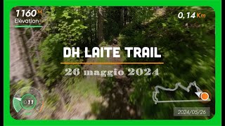
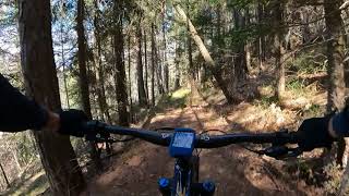
      DH LAITE TRAIL - Single track divertente e...
      ebike
      7:37 | 254 | Jun 9, 2024 , Baselga di Pine'
      Le Laite
      ebike
      2:09 | 251 | Apr 11, 2023 , Baselga di Pine'

      Trail Lists

      4.0 ★★★★★
      1 Ratings
      5 ★
      4 ★ 100%
      3 ★
      2 ★
      1 ★

      1 Review & Comments

      Mircocasa
      Bel Trail flow veloce e scorrevolissimo a parte piccoli tratti lenti x i tornanti o le parti rocciose...l'ultimo tratto il sentiero diventa ciottolato e tutto ciò lo rende variabile se asciutto o bagnato.... è l' ottima continuazione del cuc Trail

      We hope you've been enjoying Trailforks!

      Create a FREE account to view all trail reviews and much more.

      • #458191 - 830 views

      Frequently Asked Questions

      ▼ Where is Laite Trail located?
      Laite Trail is located in Sgreben Zone, Baselga di Pine', Italy. It is part of the Sgreben Zone trail network. The trailhead is located at coordinates 46.16919, 11.2961.
      ▼ How hard is Laite Trail?
      Laite Trail is rated as Blue difficulty. The average grade is 21.1%.
      ▼ What is the elevation gain for Laite Trail?
      The trail has 1,053 ft of elevation descent. The elevation ranges from 2,763 ft to 3,822 ft.
      ▼ Is Laite Trail a point to point trail?
      Laite Trail is not a point to point trail. The direction is Downhill Primary. The trail type is singletrack.
      ▼ How long is Laite Trail?
      Laite Trail is 4,990 ft long. The trail type is singletrack.
      ▼ Are dogs allowed on Laite Trail?
      There is no information about dogs being allowed on Laite Trail. Check with local trail managers or the trail page for the latest access rules.
      ▼ When is the best time of year to ride Laite Trail?
      Based on activity log data, the most popular months to ride Laite Trail are:
      • September (5 activities)
      • January (3 activities)
      • April (2 activities)
      Check the reports page for current trail conditions.
      ▼ How do I access Laite Trail? Where is the closest parking trailhead?
      The closest parking and trailhead locations to Laite Trail are: View all parking locations in the area.
      ▼ How long does it take to ride Laite Trail?
      Based on recorded activities, it takes an average of 7 minutes to ride Laite Trail. The trail is 4,990 ft long. Actual times will vary based on fitness level, conditions, and pace. View recent activity logs for more details.
      ▼ How busy is Laite Trail?
      Laite Trail is a moderately popular trail. There have been 45 recorded activities on this trail. The trail has received 45 check-ins. View recent activity on this trail.

      Hit the Trail

      Open in App

      Get this trail on your phone instantly.

      open trail in app

      Download Trail

      Save to wishlist, Garmin & download.
      save the trail

      Find Related Routes

      Find routes and users activities that include this trail.
      find routes for this trail

      You must enter a description before submitting.

