
La Civetta Trail Area è un’area dedicata alla mountain bike gravity nel cuore delle Dolomiti, collegata da impianti di risalita moderni che permettono di spostarsi con facilità tra Val Fiorentina, Alleghe e Val di Zoldo.
I percorsi sono naturali, poco o per nulla lavorati, adatti a chi pratica MTB enduro e all-mountain e cerca itinerari tecnici, vari e immersi nella natura. I trail si sviluppano tra boschi, creste panoramiche e versanti selvaggi, con viste spettacolari sul gruppo del Civetta, Pelmo e altre cime dolomitiche.
A differenza dei bike park più frequentati, qui si pedala (e si scende) in un ambiente più isolato, senza folle e con un'atmosfera più autentica. Un’area ideale per chi apprezza la montagna nella sua forma più vera.
Civetta Trail Area is a gravity-focused MTB zone in the heart of the Dolomites, served by modern lift systems that connect Val Fiorentina, Alleghe, and Val di Zoldo.
The trails are mostly natural and unshaped, suitable for enduro and all-mountain riders looking for technical terrain and a more remote, alpine riding experience. The routes traverse forests, ridgelines, and wild slopes, offering spectacular views of Mt. Civetta, Pelmo, and other Dolomite peaks.
Unlike busy bike parks, this area offers a quieter, more authentic mountain environment, ideal for riders who value nature, solitude, and the raw essence of trail riding.
I percorsi sono naturali, poco o per nulla lavorati, adatti a chi pratica MTB enduro e all-mountain e cerca itinerari tecnici, vari e immersi nella natura. I trail si sviluppano tra boschi, creste panoramiche e versanti selvaggi, con viste spettacolari sul gruppo del Civetta, Pelmo e altre cime dolomitiche.
A differenza dei bike park più frequentati, qui si pedala (e si scende) in un ambiente più isolato, senza folle e con un'atmosfera più autentica. Un’area ideale per chi apprezza la montagna nella sua forma più vera.
Civetta Trail Area is a gravity-focused MTB zone in the heart of the Dolomites, served by modern lift systems that connect Val Fiorentina, Alleghe, and Val di Zoldo.
The trails are mostly natural and unshaped, suitable for enduro and all-mountain riders looking for technical terrain and a more remote, alpine riding experience. The routes traverse forests, ridgelines, and wild slopes, offering spectacular views of Mt. Civetta, Pelmo, and other Dolomite peaks.
Unlike busy bike parks, this area offers a quieter, more authentic mountain environment, ideal for riders who value nature, solitude, and the raw essence of trail riding.
- Mountain Bike
- E-Bike
Login to see your progress towards riding all the trails and routes in this list.
Trails
| title | riding area | rating | distance | completed | |||
|---|---|---|---|---|---|---|---|
| 1 | Alleghe - Piani di Pezzè | 5,276 ft | |||||
| 2 | Chairlift Fertazza | 2,746 ft | |||||
| 3 | Chairlift Pescul - Fertazza | 5,217 ft | |||||
| 4 | Civetta Trail I | 2,106 ft | |||||
| 5 | Civetta Trail II | 3,074 ft | |||||
| 6 | Col de la Chizza Trail | 4,941 ft | |||||
| 7 | Col dei Baldi | 1 mile | |||||
| 8 | Costazza I | 778 ft | |||||
| 9 | Costazza II | 515 ft | |||||
| 10 | Cristelin | 1 mile | |||||
| 11 | Delle Coste | 2,808 ft | |||||
| 12 | El Menadoi | 1,207 ft | |||||
| 13 | Fernazza Trail | 1 mile | |||||
| 14 | Fertazza Deer Trail | 4,134 ft | |||||
| 15 | Fertazza Trail | 2,320 ft | |||||
| 16 | Foppe | 1 mile | |||||
| 17 | Hammer Trail | 3,402 ft | |||||
| 18 | La Vizza | 627 ft | |||||
| 19 | Lagusello - Caprile | 3,960 ft | |||||
| 20 | Lagusello Trail | 2 miles | |||||
| 21 | Le Ciaune | 4,177 ft | |||||
| 22 | Le Mandrate | 1 mile | |||||
| 23 | Lendina Primo Tratto | 2,907 ft | |||||
| 24 | Lendina Secondo Tratto | 2,822 ft | |||||
| 25 | Malga Vescovà | 3,691 ft | |||||
| 26 | Pian del Crep | 3,717 ft | |||||
| 27 | Piani di Pezze - Alleghe | 1 mile | |||||
| 28 | Piani Pezze DH | 1,522 ft | |||||
| 29 | Pont de Mèz | 3,881 ft | |||||
| 30 | Possedera - Tiezza | 3,855 ft | |||||
| 31 | Redolet | 5,030 ft | |||||
| 32 | Spiz Zuel | 2 miles | |||||
| 33 | Tap de le Parole | 2 miles | |||||
| 34 | Tos Trail | 1 mile | |||||
| 35 | Triol Dei Manz | 1 mile | |||||
| 36 | Wild Trail | 4,085 ft |
Displaying 36
Videos
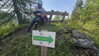
4:11 |
5 |
Aug 19, 2026 , Val di Zoldo
22:10 |
120 |
Jul 28, 2025 , Val di Zoldo
22:10 |
145 |
Jul 28, 2025 , Selva Di Cadore
Recent Trail Reports
| status | trail | date | condition | |
|---|---|---|---|---|
| Lagusello - Caprile | Aug 26, 2026 @ 3:59pm (Europe/Rome) Aug 26, 2026 | view | ||
| Wild Trail | Aug 19, 2026 @ 3:36pm (Europe/Rome) Aug 19, 2026 | view | ||
| Spiz Zuel | Aug 14, 2026 @ 12:09pm (Europe/Ljubljana) Aug 14, 2026 | view | ||
| Lagusello Trail | Aug 12, 2026 @ 10:19pm (Europe/Rome) Aug 12, 2026 | view | ||
| Fernazza Trail | Aug 12, 2026 @ 10:19pm (Europe/Rome) Aug 12, 2026 | view |
Total Trails
36
Total Distance
32 miles
Total Descent
-23,073 ft
Total Climb
1,031 ft
close
-
Layers w
- Weather Layers
- Pro
- Pro
- Pro
- Pro
- Pro
- Pro
- More Layers
- Pro
- Pro
- Pro
- Pro
-
Upgrade to

3D
Trail Conditions
- Unknown
- Snow Groomed
- Snow Packed
- Snow Covered
- Snow Cover Partial
- Freeze/thaw Cycle
- Icy
- Prevalent Mud
- Wet
- Variable
- Ideal
- Dry
- Very Dry
Trail Flow (Ridden Direction)
Trailforks scans users activity logs to determine the most popular direction each trail is ridden. A good flowing trail network will have most trails flowing in a single direction according to their intension.
The colour categories are based on what percentage of users are riding a trail in its intended direction.
The colour categories are based on what percentage of users are riding a trail in its intended direction.
- > 96%
- > 90%
- > 80%
- > 70%
- > 50%
- < 50%
- bi-directional trail
- no data
Trail Last Ridden
Trailforks scans activity logs to determine the last time a trail was ridden.
- < 2 days
- < 1 week
- < 2 weeks
- < 1 month
- < 6 months
- > 6 months
Trail Ridden Direction
The intended direction a trail should be ridden.
- Downhill Only
- Downhill Primary
- Both Directions
- Uphill Primary
- Uphill Only
- One Direction
Contribute Details
Colors indicate trail is missing specified detail.
- Description
- Photos
- Description & Photos
- Videos
Trail Popularity ?
Trailforks scans activity logs to determine which trails are ridden the most in the last 9 months.
Trails are compared with nearby trails in the same city region with a possible 25 colour shades.
Think of this as a heatmap, more activities = more kinetic energy = warmer colors.
- most popular
- popular
- less popular
- not popular
ATV/ORV/OHV Filter
Max Vehicle Width
inches
US Cell Coverage
Legend

Radar Time
Activity Recordings
Trailforks uses anonymized public activity data.
?
Activity Recordings
Trailforks uses anonymized public activity data.
?
Winter Trails
Warning
A routing network for winter maps does not exist. Selecting trails using the winter trails layer has been disabled.
Missing Trails
Most Popular
Least Popular
Trails are colored based on popularity. The more popular a trail is, the more red. Less popular trails trend towards green.
Jump Magnitude Heatmap
Heatmap of where users jump on trails. Zoom in to see individual jumps, click circles to view jump details.
BC Backroad Status
![map legend]()
Service Road Atlas is a free to use, community-driven service for viewing and creating reports on the numerous back-country service roads around B.C. and Alberta.

Slope Aspect
Direction the slope faces
Trails Deemphasized
Trails are shown in grey.
Only show trails with no bike usage.
Suggested Layers
Based on selected activity type
Save the current map location and zoom level as your default home location whenever this page is loaded.
Save
Trail transparency
Average difficulty
Trails and Routes in List - Distance by Difficulty
Trails and Routes in List - Difficulty Totals
- By enricopirollo

- #2153 - 184 views