Towns: Hampton, Eastford, Ashford
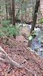
Trail Overview: The Natchaug Trail traverses the James L. Goodwin and Natchaug State Forests. Together with the Nipmuck State Forest, Yale Forest and several large private tracts, they combine to form one of the largest areas of contiguous forest in southern New England supporting a large variety of wildlife.
The trail follows a short portion of the beautiful Still River and journeys along Bigelow Brook. Meandering over relatively easy terrain, it crosses several small brooks, passes stone walls, and slips through interesting stands of trees. State foresters actively manage these forests for wildlife and timber production and the trail traverses a diverse and interesting tree mix ranging from 2 to well over 100 years old.
There are opportunities to catch sight of a variety of wildlife including turtles, beavers, and many birds along the streams and in the areas around Pine Acres Pond, Black Spruce, and Beaverdam Marshes. Active forest management has produced a variety of young, early-succession forest habitats which abound with diverse species of birds and other wildlife.
History is abundant along the trail as it passes near old CCC Camp Fernow (1933-42) and through General Nathaniel Lyon Memorial Park (first General to be killed in the Civil War). A short northern section also coincides with the Old Connecticut Path traveled in the 1630s by settlers (driving over 100 cattle) from the Boston area to the Hartford area in one of the first major inland migrations of America by European settlers.
The Natchaug Trail joins the Nipmuck Trail in Ashford and hikers can continue exploring north to Bigelow Hollow State Park and the CT/MA state line or south to Mansfield Hollow State Park.
The James L. Goodwin Conservation Education Center, on Pine Acres Pond in Hampton, offers extensive educational programming, interpretive trails and guided walks. It maintains a Native Plant Wildlife Garden and offers both Nature and History Museums. This site is jointly managed by CFPA and CT DEEP.
Allowed Uses: Hiking
- Hike
- Snowshoe
- Nordic Ski
Login to see your progress towards riding all the trails and routes in this list.
Trails
| title | riding area | rating | distance | completed | |||
|---|---|---|---|---|---|---|---|
| 1 | Natchaug (Black Spruce Pond W) CLOSED | 1,998 ft | |||||
| 2 | Pine Acres Lake Trail | 3 miles | |||||
| 3 | Air Line State Park Trail & Natchaug Trail | 955 ft | |||||
| 4 | Natchaug Trail - Southern Trailhead | 1,844 ft | |||||
| 5 | Natchaug Trail | 2,726 ft | |||||
| 6 | Goodwin Heritage Trail | 1,089 ft | |||||
| 7 | Natchaug Trail | 1 mile | |||||
| 8 | Cannon Road | 246 ft | |||||
| 9 | Natchaug (Black Spruce Pond W) | 2 miles | |||||
| 10 | Nutmeg Lane | 328 ft | |||||
| 11 | Natchaug Trail - Goodwin Br. Cascade | 1 mile | |||||
| 12 | CCC Trail | 3 miles | |||||
| 13 | Natchaug Trail | 4,770 ft | |||||
| 14 | Beaverdam Pond Road | 531 ft | |||||
| 15 | Natchaug Trail - Beaverdam Marsh | 4,610 ft | |||||
| 16 | Natchaug Trail and Yellow Diamond | 643 ft | |||||
| 17 | Natchaug Trail - Still River | 2 miles | |||||
| 18 | Pilfershire Road | 151 ft | |||||
| 19 | General Lyon Road | 715 ft | |||||
| 20 | Chaplin Road (Rt 198) | 1,427 ft | |||||
| 21 | Natchaug Trail - Bigelow Brook | 5 miles | |||||
| 22 | Moon Road | 243 ft | |||||
| 23 | Natchaug Trail - Northern Trailhead to Moon Rd | 2 miles |
Displaying 23
Videos
0:10 |
13 |
Dec 2, 2020
Recent Trail Reports
| status | trail | date | condition | |
|---|---|---|---|---|
| Pine Acres Lake Trail | Jun 2, 2025 @ 4:35pm Jun 2, 2025 | view | ||
| Goodwin Heritage Trail | Nov 27, 2024 @ 3:11pm Nov 27, 2024 | view | ||
| Natchaug Trail | Sep 25, 2024 @ 4:12pm Sep 25, 2024 | view | ||
| Cannon Road | Sep 25, 2024 @ 4:12pm Sep 25, 2024 | view | ||
| Air Line State Park Trail & Natchaug Trail | Apr 21, 2024 @ 5:55am Apr 21, 2024 | view |
Total Trails
23
Total Distance
24 miles
Total Descent
-2,227 ft
Total Climb
2,272 ft
close
-
Layers w
- Weather Layers
- Pro
- Pro
- Pro
- Pro
- Pro
- Pro
- More Layers
- Pro
- Pro
- Pro
- Pro
-
Upgrade to

3D
Trail Conditions
- Unknown
- Snow Groomed
- Snow Packed
- Snow Covered
- Snow Cover Partial
- Freeze/thaw Cycle
- Icy
- Prevalent Mud
- Wet
- Variable
- Ideal
- Dry
- Very Dry
Trail Flow (Ridden Direction)
Trailforks scans users ridelogs to determine the most popular direction each trail is ridden. A good flowing trail network will have most trails flowing in a single direction according to their intension.
The colour categories are based on what percentage of riders are riding a trail in its intended direction.
The colour categories are based on what percentage of riders are riding a trail in its intended direction.
- > 96%
- > 90%
- > 80%
- > 70%
- > 50%
- < 50%
- bi-directional trail
- no data
Trail Last Ridden
Trailforks scans ridelogs to determine the last time a trail was ridden.
- < 2 days
- < 1 week
- < 2 weeks
- < 1 month
- < 6 months
- > 6 months
Trail Ridden Direction
The intended direction a trail should be ridden.
- Downhill Only
- Downhill Primary
- Both Directions
- Uphill Primary
- Uphill Only
- One Direction
Contribute Details
Colors indicate trail is missing specified detail.
- Description
- Photos
- Description & Photos
- Videos
Trail Popularity ?
Trailforks scans ridelogs to determine which trails are ridden the most in the last 9 months.
Trails are compared with nearby trails in the same city region with a possible 25 colour shades.
Think of this as a heatmap, more rides = more kinetic energy = warmer colors.
- most popular
- popular
- less popular
- not popular
ATV/ORV/OHV Filter
Max Vehicle Width
inches
US Cell Coverage
Legend

Radar Time
Activity Recordings
Trailforks uses anonymized public activity data.
?
Activity Recordings
Trailforks uses anonymized public activity data.
?
Personal Heatmap
▶
Activity Types
all
/
none
▶
Options
2
Date range
month
–
Winter Trails
Warning
A routing network for winter maps does not exist. Selecting trails using the winter trails layer has been disabled.
Missing Trails
Most Popular
Least Popular
Trails are colored based on popularity. The more popular a trail is, the more red. Less popular trails trend towards green.
Jump Magnitude Heatmap
Heatmap of where riders jump on trails. Zoom in to see individual jumps, click circles to view jump details.
BC Backroad Status
![map legend]()
Service Road Atlas is a free to use, community-driven service for viewing and creating reports on the numerous back-country service roads around B.C. and Alberta.

Slope Aspect
Direction the slope faces
Trails Deemphasized
Trails are shown in grey.
Only show trails with no bike usage.
Suggested Layers
Based on selected activity type
Save the current map location and zoom level as your default home location whenever this page is loaded.
Save
Trail transparency
This official route list of trails is not complete
Average difficulty
Associated Route
Mountain Bike is not supported on all trail sections, see trails for more details.
Trails and Routes in List - Distance by Difficulty
Trails and Routes in List - Difficulty Totals
- By PlumbBobM
 TRAILFORKS HCH
 - #653 - 741 views