close
-
Layers w
- Weather Layers
- Pro
- Pro
- Pro
- Pro
- Pro
- Pro
- More Layers
- Pro
- Pro
- Pro
- Pro
-
Upgrade to

3D
Trail Conditions
- Unknown
- Snow Groomed
- Snow Packed
- Snow Covered
- Snow Cover Partial
- Freeze/thaw Cycle
- Icy
- Prevalent Mud
- Wet
- Variable
- Ideal
- Dry
- Very Dry
Trail Flow (Ridden Direction)
Trailforks scans users ridelogs to determine the most popular direction each trail is ridden. A good flowing trail network will have most trails flowing in a single direction according to their intension.
The colour categories are based on what percentage of riders are riding a trail in its intended direction.
The colour categories are based on what percentage of riders are riding a trail in its intended direction.
- > 96%
- > 90%
- > 80%
- > 70%
- > 50%
- < 50%
- bi-directional trail
- no data
Trail Last Ridden
Trailforks scans ridelogs to determine the last time a trail was ridden.
- < 2 days
- < 1 week
- < 2 weeks
- < 1 month
- < 6 months
- > 6 months
Trail Ridden Direction
The intended direction a trail should be ridden.
- Downhill Only
- Downhill Primary
- Both Directions
- Uphill Primary
- Uphill Only
- One Direction
Contribute Details
Colors indicate trail is missing specified detail.
- Description
- Photos
- Description & Photos
- Videos
Trail Popularity ?
Trailforks scans ridelogs to determine which trails are ridden the most in the last 9 months.
Trails are compared with nearby trails in the same city region with a possible 25 colour shades.
Think of this as a heatmap, more rides = more kinetic energy = warmer colors.
- most popular
- popular
- less popular
- not popular
ATV/ORV/OHV Filter
Max Vehicle Width
inches
US Cell Coverage
Legend

Radar Time
Activity Recordings
Trailforks uses anonymized public activity data.
?
Activity Recordings
Trailforks uses anonymized public activity data.
?
Personal Heatmap
▶
Activity Types
all
/
none
▶
Options
2
Date range
month
–
Winter Trails
Warning
A routing network for winter maps does not exist. Selecting trails using the winter trails layer has been disabled.
Missing Trails
Most Popular
Least Popular
Trails are colored based on popularity. The more popular a trail is, the more red. Less popular trails trend towards green.
Jump Magnitude Heatmap
Heatmap of where riders jump on trails. Zoom in to see individual jumps, click circles to view jump details.
BC Backroad Status
![map legend]()
Service Road Atlas is a free to use, community-driven service for viewing and creating reports on the numerous back-country service roads around B.C. and Alberta.

Slope Aspect
Direction the slope faces
Trails Deemphasized
Trails are shown in grey.
Only show trails with no bike usage.
Suggested Layers
Based on selected activity type
Save the current map location and zoom level as your default home location whenever this page is loaded.
Save
No description for Hampton has been added yet!
Login or register to submit one.
Activities Click to view
- Mountain Bike
63 trails
- E-Bike
5 trails
- Adaptive Bike
0 trails
- Horse
18 trails
- Hike
75 trails
- Trail Running
71 trails
- Snowshoe
63 trails
- Nordic Ski
7 trails
Region Details
- 11
- 1
- 12
- 34
Region Status
Open as of Jun 10, 2026Stats
- Avg Trail Rating
- Trails (view details)
- 70
- Trails Mountain Bike
- 63
- Trails E-Bike
- 5
- Trails Gravel Bike
- 3
- Trails Horse
- 18
- Trails Hike
- 75
- Trails Trail Running
- 71
- Trails Snowshoe
- 63
- Trails Nordic Ski
- 7
- Total Distance
- 52 miles
- Total Descent Distance
- 23 miles
- Total Descent
- 3,183 ft
- Total Vertical
- 505 ft
- Highest Trailhead
- 758 ft
- Reports
- 660
- Photos
- 50
- Ridden Counter
- 5,128
Sub Regions
-
Goodwin State Forest
- 1
- 11
- 34
Popular Hampton Mountain Biking Trails
• 100 ★ 0.0 • 1,089 ft • 0 ft • 202 •
Popular green difficulty singletrack. This multi-use trail can be used both directions. On average it takes minutes to complete this trail.
• 100 ★ 0.0 • 1,385 ft • 3 ft • 176 •
Popular green difficulty singletrack. This multi-use trail can be used both directions and has a easy overall physical rating with a 3 ft green climb. On average it takes 2 minutes to complete this trail.
• 90 ★ 0.0 • 3,314 ft • 70 ft • 108 •
Popular blue difficulty singletrack. This multi-use trail can be used both directions. On average it takes 5 minutes to complete this trail.
• 85 ★ 0.0 • 1,788 ft • 67 ft • 107 •
Short singletrack trail cutting up the hill to connect with the Natchaug Trail. Upper half of the Goodwin Heritage Trail, marked with blue and yellow blazes.
• 90 ★ 0.0 • 2,100 ft • 78 ft • 107 •
Lower half of the Goodwin Heritage Trail, marked with blue and yellow blazes. Short hill connecting from the Airline Trail to Eleventh Section Road. Be careful as this is a popular path for hiking and horseback riding.
• 30 ★ 0.0 • 3,517 ft • 50 ft • 107 •
Less popular blue difficulty singletrack. This multi-use trail can be used both directions. On average it takes 7 minutes to complete this trail.
Hampton Mountain Bike Routes
★ 4.0 • 12 miles • 1,096 ft • 17 • Loop •
An Intermediate loop that covers most of Goodwin's trails
8 miles • 485 ft • 6 • Loop •
A great loop for Novice riders. This is something we would typically ride if you came to a QCNEMBA Mellow...
7 miles • 483 ft • 8 • Loop •
Donnie, yeah you know him, short ‘ol double dee. The bro behind DAS. Say it! Danielson Adventure Sports!...
10 miles • 518 ft • 7 •
Glen's back country ride. Trails a bit hard to find but using this will keep you on the trail.
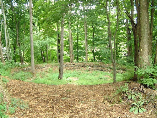
Photos of Hampton Mountain Bike


Recent Trail Reports
National Scenic Trails & Official Routes
-
East Coast Greenway
- Mountain Bike
- E-Bike
- Hike
- Trail Running
Activity Feed
| username | action | type | title | date |
|---|---|---|---|---|
| jamesEdefbd | add | report | activity #96681509 | Jun 10, 2026 @ 10:17am Jun 10, 2026 |
| Heethr | add | report | activity #96569249 | Jun 8, 2026 @ 4:02pm Jun 8, 2026 |
| Heethr | add | report | activity #93651293 | Apr 29, 2026 @ 8:58am Apr 29, 2026 |
| Foxedup401 | wishlist | route | activity #91256321 | Mar 25, 2026 @ 5:00am Mar 25, 2026 |
| dirtrider2 | wishlist | region | activity #87303171 | Jan 16, 2026 @ 2:49pm Jan 16, 2026 |
Recent Comments
| username | type | title | comment | date |
|---|---|---|---|---|
| trail | Blue eblazoned trail, no wheeled vehicles... | Mar 30, 2024 @ 12:14pm Mar 30, 2024 | ||
| report | Thanks a ton! | Dec 7, 2023 @ 4:54am Dec 7, 2023 | ||
| report | Trail cleared. | Nov 26, 2023 @ 12:12pm Nov 26, 2023 | ||
| report | You're welcome! | Nov 24, 2023 @ 8:46am Nov 24, 2023 |
Local Badges
-

10 Blue Trails93 awarded -

Epic Ride Climb 2k3 awarded -

Climbing 10k Badge18 awarded -

Climbing 100k Badge0 awarded -

Epic Ride Descent 2k3 awarded -

Descent 10k Badge18 awarded
Activity Type Stats
| activitytype | trails | distance | descent | descent distance | total vertical | rating | global rank | state rank | photos | reports | routes | ridelogs |
|---|---|---|---|---|---|---|---|---|---|---|---|---|
| Mountain Bike | 63 | 46 miles | 2,566 ft | 20 miles | 505 ft | #2,920 | #1,032 | 33 | 659 | 4 | 3,493 | |
| E-Bike | 5 | 16 miles | 499 ft | 10 miles | 397 ft | #6,811 | #2,049 | 619 | 77 | |||
| Gravel Bike | 3 | #5,274 | #1,729 | 1 | 86 | |||||||
| Horse | 18 | 24 miles | 1,027 ft | 12 miles | 505 ft | #1,719 | #978 | 18 | 3 | |||
| Hike | 75 | 52 miles | 3,182 ft | 23 miles | 505 ft | #2,486 | #988 | 17 | 660 | 1 | 215 | |
| Trail Running | 71 | 51 miles | 3,081 ft | 22 miles | 505 ft | #4,208 | #1,283 | 660 | 1 | 84 | ||
| Snowshoe | 63 | 50 miles | 3,140 ft | 22 miles | 505 ft | #502 | #176 | 34 | 7 | |||
| Nordic Ski | 7 | 15 miles | 482 ft | 9 miles | 397 ft | #1,363 | #631 | 1 | 1 |
Frequently Asked Questions About Hampton
▼
What are the best places to ride in Hampton?
Hampton has 7 areas to explore for mountain biking. The top rated areas are:
▼
What are the highest rated mountain biking trails in Hampton?
The highest rated mountain biking trails in Hampton are:
- Open Forest (4.1/5)
- Goodwin Heritage Trail (0/5)
- 11 Section (0/5)
- Cody's Trail (0/5)
- Trooper Trail (0/5)
▼
What is the best time of the year to ride in Hampton?
Based on ride log data, the most popular months to ride in Hampton are:
- August (89 activities)
- June (75 activities)
- May (74 activities)
▼
Where can I park to ride in Hampton?
There are 12 parking locations listed in Hampton. The most popular parking spots are:
- Krazy Lane
- Route 44 Parking
- Air Line Parking (Lynch Rd)
- James L. Goodwin State Forest
- Parking - Pomfret Station - Railroad St
Activities
Trails
Points of Interest
- By markholloway
 Trailforks Map Team & contributors
 - Admins: HCH, NEMBAEXEC, QC NEMBA
- #24016 - 1,690 views
- hampton activity log | embed map of Hampton mountain bike trails | hampton mountain biking points of interest polygons
Downloading of trail gps tracks in kml & gpx formats is enabled for Hampton.
You must login to download files.