The North Country National Scenic Trail is the longest in the National Trails System, stretching 4,700 miles across eight states from North Dakota to Vermont.
The Trail traverses through more than 160 federal, state and local public lands, including 10 National Forests, four areas of the National Park Service, and over 100 state parks, forests and game areas. It winds along three of the Great Lakes, past countless farmlands, through large cityscapes and vast prairies, over many rivers and streams, and through the famed Adirondacks. The North Country Trail also shares routes with the Superior Hiking Trail in Minnesota, the Buckeye Trail in Ohio, the Finger Lakes Trail in New York, and the Iron Belle Trail in Michigan.
Whether you’re looking to hike just a few miles or plan a longer backpacking trip, the North Country Trail offers diverse landscapes and flexible hiking opportunities.
- Hike
- Trail Running
- Snowshoe
- Backcountry Ski
Login to see your progress towards riding all the trails and routes in this list.
Trails
| title | riding area | rating | distance | completed | |||
|---|---|---|---|---|---|---|---|
| 1 | 120th Avenue Southeast Southeastern North Dakota (ND Maps 050 -081) | 1 mile | |||||
| 2 | 13th Street North Central North Dakota Map (ND Maps 025-049) | 2,241 ft | |||||
| 3 | 13th Street Northeast Central North Dakota Map (ND Maps 025-049) | 3 miles | |||||
| 4 | 18th Street Northeast Central North Dakota Map (ND Maps 025-049) | 2,461 ft | |||||
| 5 | 1st Avenue North Central North Dakota Map (ND Maps 025-049) | 2,523 ft | |||||
| 6 | 20th Street Northeast West Central North Dakota (ND Maps 001 – 024) | 2 miles | |||||
| 7 | 471st Ave NE North Central Minnesota (MN Maps 020 – 052) | 2 miles | |||||
| 8 | 4th Street | 3,698 ft | |||||
| 9 | 4th Street Southeast Central North Dakota Map (ND Maps 025-049) | 2,743 ft | |||||
| 10 | 50th St SE Southeastern North Dakota (ND Maps 050 -081) | 1,378 ft | |||||
| 11 | 76th St Trailhead | 249 ft | |||||
| 12 | 7th Ave Southwest West Central North Dakota (ND Maps 001 – 024) | 1 mile | |||||
| 13 | 8th Street Northeast Central North Dakota Map (ND Maps 025-049) | 1 mile | |||||
| 14 | 9 Bell Trail- BT/NCT | 3 miles | |||||
| 15 | Access Road | 492 ft | |||||
| 16 | Access Road Central North Dakota Map (ND Maps 025-049) | 4,232 ft | |||||
| 17 | Accessible Section of Big Carp River Trail (NCT) | 509 ft | |||||
| 18 | Antle Orchard Road | 4,619 ft | |||||
| 19 | ASP3 Parking Spur | 722 ft | |||||
| 20 | Big Carp River Trail (NCT) | 8 miles | |||||
| 21 | Blue Trail | 886 ft | |||||
| 22 | Bossard's Path | 354 ft | |||||
| 23 | Brook Street | 499 ft | |||||
| 24 | Brooks Rd Section | 4 miles | |||||
| 25 | Buckeye Trail | 535 ft | |||||
| 26 | Campsite Path | 184 ft | |||||
| 27 | Canton Rd NW | 2,999 ft | |||||
| 28 | Caywood Road | 3 miles | |||||
| 29 | CB 17 Southeastern North Dakota (ND Maps 050 -081) | 1,985 ft | |||||
| 30 | Chippewa Falls Trail | 1 mile | |||||
| 31 | City Multi Use Path | 3 miles | |||||
| 32 | CLST \ NCT - Fergus Falls Section 2 Northwest Minnesota (MN Maps 001 – 019) | 1 mile | |||||
| 33 | Coldwater Trail | 1,073 ft | |||||
| 34 | COral Rd NW | 2,090 ft | |||||
| 35 | County Highway 21 Southeastern North Dakota (ND Maps 050 -081) | 1,640 ft | |||||
| 36 | County Road B Section: Minnesota/Wisconsin state line to Bayfield County Road A | 3 miles | |||||
| 37 | County Road Baa | 3 miles | |||||
| 38 | County Road M Section: Minnesota/Wisconsin state line to Bayfield County Road A | 1 mile | |||||
| 39 | County Road S | 2,589 ft | |||||
| 40 | Court Street | 889 ft | |||||
| 41 | Craig Lake Trail (NCT) | 906 ft | |||||
| 42 | Croy Lake Road Northeast | 2 miles | |||||
| 43 | DeLagoon Park Access Northwest Minnesota (MN Maps 001 – 019) | 699 ft | |||||
| 44 | Denver Road | 4,170 ft | |||||
| 45 | Drybone Road | 184 ft | |||||
| 46 | East Milchesky Road Section: Minnesota/Wisconsin state line to Bayfield County Road A | 5 miles | |||||
| 47 | East Riverside Drive | 1,424 ft | |||||
| 48 | Escarpment Trail (NCT) | 4 miles | |||||
| 49 | Fairview Road | 1 mile | |||||
| 50 | Faust Park Access Southeastern North Dakota (ND Maps 050 -081) | 331 ft | |||||
| 51 | Finger Lakes / North Country Trail | 2 miles | |||||
| 52 | Finger Lakes / North Country Trail | 2 miles | |||||
| 53 | Finger Lakes / North Country Trail | 3,625 ft | |||||
| 54 | Fitzgerald Spur | 4,961 ft | |||||
| 55 | Goose Drop Drive Northwest Minnesota (MN Maps 001 – 019) | 909 ft | |||||
| 56 | Government Peak Trail (NCT) | 2 miles | |||||
| 57 | Greenwater Lake TH Link North Central Minnesota (MN Maps 020 – 052) | 164 ft | |||||
| 58 | Harvey Chappel Rd | 1 mile | |||||
| 59 | Horseshoe Lake Campsite North Central Minnesota (MN Maps 020 – 052) | 538 ft | |||||
| 60 | Howard Street | 1,230 ft | |||||
| 61 | Irish Hollow Trail | 2,320 ft | |||||
| 62 | Johnstown Rd NE | 2,546 ft | |||||
| 63 | Kanakadea Lean-to Trail | 364 ft | |||||
| 64 | Kimmie Shelter Trail | 584 ft | |||||
| 65 | Kimmie Tent Site Trail | 354 ft | |||||
| 66 | Lake Superior Trail (NCT) | 545 ft | |||||
| 67 | Lake Superior Trail (NCT) | 6 miles | |||||
| 68 | Lake Superior Trail (NCT) | 1 mile | |||||
| 69 | Leonard Road | 1,352 ft | |||||
| 70 | Little Garlic Falls Trail | 1 mile | |||||
| 71 | Little Manitou Falls Trail Section: Minnesota/Wisconsin state line to Bayfield County Road A | 3,159 ft | |||||
| 72 | Lost Lake Trail (NCT) | 3 miles | |||||
| 73 | McClusky Canal Turtle Lake Section West Central North Dakota (ND Maps 001 – 024) | 4 miles | |||||
| 74 | McDougal Road | 764 ft | |||||
| 75 | Minster Traverse Trail | 1 mile | |||||
| 76 | Mohawk River Trail | 1 mile | |||||
| 77 | Mohawk River Trail | 3,471 ft | |||||
| 78 | Mullen Road | 2 miles | |||||
| 79 | N Peets Rd | 1 mile | |||||
| 80 | NCR - Deer Park Road | 1,745 ft | |||||
| 81 | NCT - 18 Mile Road | 1 mile | |||||
| 82 | NCT - Alooma Ave Northeast | 2,628 ft | |||||
| 83 | NCT - Dillings to Marilla Section Billings Rd to Beers Rd | 15 miles | |||||
| 84 | NCT - Section3 | 2 miles | |||||
| 85 | NCT - Sherwin St Northeast to 22 Mile Rd (Kent / Newaygo Line) | 8 miles | |||||
| 86 | NCT - Tahquamenon Sp | 14 miles | |||||
| 87 | NCT - Wiersma St Northeast | 2 miles | |||||
| 88 | NCT - (Penn 1 - SGL 285) | 7 miles | |||||
| 89 | NCT - 96th St tp West 11 Mile Rd | 9 miles | |||||
| 90 | NCT - 1 Mile Road | 3,517 ft | |||||
| 91 | NCT - 1 To 11 | 1,247 ft | |||||
| 92 | NCT - 1 to 2 (Giant Pines Loop) | 1 mile | |||||
| 93 | NCT - 100th Street Southeast | 2,618 ft | |||||
| 94 | NCT - 107th Avenue Northeast Central North Dakota Map (ND Maps 025-049) | 2,329 ft | |||||
| 95 | NCT - 108th Avenue Northeast Central North Dakota Map (ND Maps 025-049) | 4,954 ft | |||||
| 96 | NCT - 108th Street | 2 miles | |||||
| 97 | NCT - 109th Avenue Northeast Central North Dakota Map (ND Maps 025-049) | 1 mile | |||||
| 98 | NCT - 10th Street Southeast Southeastern North Dakota (ND Maps 050 -081) | 289 ft | |||||
| 99 | NCT - 110 Starvation Lke Rd to Sunset Tr Rd | 8 miles | |||||
| 100 | NCT - 110th Avenue Northeast Central North Dakota Map (ND Maps 025-049) | 5,236 ft | |||||
| 101 | NCT - 112th Avenue Northeast Central North Dakota Map (ND Maps 025-049) | 2 miles | |||||
| 102 | NCT - 113th Avenue Southeast Central North Dakota Map (ND Maps 025-049) | 2 miles | |||||
| 103 | NCT - 115th Ave SE Southeastern North Dakota (ND Maps 050 -081) | 3 miles | |||||
| 104 | NCT - 115th Avenue Southeast Southeastern North Dakota (ND Maps 050 -081) | 3,747 ft | |||||
| 105 | NCT - 116th Avenue Northeast Central North Dakota Map (ND Maps 025-049) | 2 miles | |||||
| 106 | NCT - 117th Ave SE Southeastern North Dakota (ND Maps 050 -081) | 5 miles | |||||
| 107 | NCT - 117th Avenue Southeast Southeastern North Dakota (ND Maps 050 -081) | 2 miles | |||||
| 108 | NCT - 117th Avenue Southeast Southeastern North Dakota (ND Maps 050 -081) | 2 miles | |||||
| 109 | NCT - 118th Avenue Southeast Southeastern North Dakota (ND Maps 050 -081) | 1,434 ft | |||||
| 110 | NCT - 118th Avenue Southeast Southeastern North Dakota (ND Maps 050 -081) | 197 ft | |||||
| 111 | NCT - 119th Avenue Southeast Southeastern North Dakota (ND Maps 050 -081) | 2,690 ft | |||||
| 112 | NCT - 119th Avenue Southeast 2 Southeastern North Dakota (ND Maps 050 -081) | 1 mile | |||||
| 113 | NCT - 11th Street Northeast Central North Dakota Map (ND Maps 025-049) | 13 miles | |||||
| 114 | NCT - 11th Street Northeast 2 Central North Dakota Map (ND Maps 025-049) | 9 miles | |||||
| 115 | NCT - 12 To 13 (River Trail) | 2 miles | |||||
| 116 | NCT - 120 1/2 Ave SE Southeastern North Dakota (ND Maps 050 -081) | 1 mile | |||||
| 117 | NCT - 120th Ave SE Link Southeastern North Dakota (ND Maps 050 -081) | 1 mile | |||||
| 118 | NCT - 122nd Avenue Southeast Southeastern North Dakota (ND Maps 050 -081) | 2,533 ft | |||||
| 119 | NCT - 13 Mile Road | 705 ft | |||||
| 120 | NCT - 13 To 14 | 1,407 ft | |||||
| 121 | NCT - 132nd Ave SE Southeastern North Dakota (ND Maps 050 -081) | 2,674 ft | |||||
| 122 | NCT - 133rd Avenue Southeast Southeastern North Dakota (ND Maps 050 -081) | 2 miles | |||||
| 123 | NCT - 134th Avenue Southeast Southeastern North Dakota (ND Maps 050 -081) | 1 mile | |||||
| 124 | NCT - 136th Avenue Southeast Southeastern North Dakota (ND Maps 050 -081) | 2 miles | |||||
| 125 | NCT - 140th Avenue Southeast Southeastern North Dakota (ND Maps 050 -081) | 2 miles | |||||
| 126 | NCT - 14th Ave SW NCT - North Dakota Map Series 5/24 West Canal | 738 ft | |||||
| 127 | NCT - 15 Mile Road | 1 mile | |||||
| 128 | NCT - 15th Avenue Northeast West Central North Dakota (ND Maps 001 – 024) | 2,559 ft | |||||
| 129 | NCT - 161st Avenue Southeast Southeastern North Dakota (ND Maps 050 -081) | 121 ft | |||||
| 130 | NCT - 16th Street Northeast West Central North Dakota (ND Maps 001 – 024) | 1,667 ft | |||||
| 131 | NCT - 16th Street Southeast Southeastern North Dakota (ND Maps 050 -081) | 2 miles | |||||
| 132 | NCT - 172nd Ave Southeast Southeastern North Dakota (ND Maps 050 -081) | 5,276 ft | |||||
| 133 | NCT - 17th Avenue Northwest West Central North Dakota (ND Maps 001 – 024) | 2 miles | |||||
| 134 | NCT - 17th Avenue Southeast Central North Dakota Map (ND Maps 025-049) | 3 miles | |||||
| 135 | NCT - 17th Street Northeast Central North Dakota Map (ND Maps 025-049) | 696 ft | |||||
| 136 | NCT - 18th Ave Northeast West Central North Dakota (ND Maps 001 – 024) | 3,839 ft | |||||
| 137 | NCT - 19th Street Northeast Central North Dakota Map (ND Maps 025-049) | 1 mile | |||||
| 138 | NCT - 1st Avenue Southeastern North Dakota (ND Maps 050 -081) | 174 ft | |||||
| 139 | NCT - 1st Street | 1,831 ft | |||||
| 140 | NCT - 1st Street Central North Dakota Map (ND Maps 025-049) | 1,112 ft | |||||
| 141 | NCT - 1st Street | 1,010 ft | |||||
| 142 | NCT - 1st Street Southwest West Central North Dakota (ND Maps 001 – 024) | 3 miles | |||||
| 143 | NCT - 2 to 3 (Wilderness Loop) | 1 mile | |||||
| 144 | NCT - 22 Mile Road | 82 ft | |||||
| 145 | NCT - 23rd Avenue Northeast Central North Dakota Map (ND Maps 025-049) | 1,444 ft | |||||
| 146 | NCT - 24 1/2 Mile Road | 2,516 ft | |||||
| 147 | NCT - 25 1/2 Mile Road | 1 mile | |||||
| 148 | NCT - 25 1/2 Mile Road | 2,021 ft | |||||
| 149 | NCT - 25 1/2 Mile Road | 2 miles | |||||
| 150 | NCT - 25th Avenue Northeast West Central North Dakota (ND Maps 001 – 024) | 699 ft | |||||
| 151 | NCT - 25th St Southeastern North Dakota (ND Maps 050 -081) | 1,614 ft | |||||
| 152 | NCT - 26 Mile Road | 1 mile | |||||
| 153 | NCT - 26 Mile Road | 3 miles | |||||
| 154 | NCT - 260th Avenue Northwest Minnesota (MN Maps 001 – 019) | 2,753 ft | |||||
| 155 | NCT - 260th Avenue Northwest Minnesota (MN Maps 001 – 019) | 1,545 ft | |||||
| 156 | NCT - 268th Avenue Northwest Minnesota (MN Maps 001 – 019) | 2,740 ft | |||||
| 157 | NCT - 28 Mile Road | 830 ft | |||||
| 158 | NCT - 2nd Avenue Southeastern North Dakota (ND Maps 050 -081) | 381 ft | |||||
| 159 | NCT - 32nd Avenue Northwest Traverse West Central North Dakota (ND Maps 001 – 024) | 5,276 ft | |||||
| 160 | NCT - 33rd Avenue Northwest Traverse West Central North Dakota (ND Maps 001 – 024) | 1 mile | |||||
| 161 | NCT - 360 Avenue North Central Minnesota (MN Maps 020 – 052) | 2,815 ft | |||||
| 162 | NCT - 370th Avenue Northwest Minnesota (MN Maps 001 – 019) | 1 mile | |||||
| 163 | NCT - 37th Avenue Northwest Traverse West Central North Dakota (ND Maps 001 – 024) | 1 mile | |||||
| 164 | NCT - 3rd Avenue South Central North Dakota Map (ND Maps 025-049) | 105 ft | |||||
| 165 | NCT - 3rd Street | 623 ft | |||||
| 166 | NCT - 3rd Street Southeast Central North Dakota Map (ND Maps 025-049) | 2 miles | |||||
| 167 | NCT - 40M St SE Southeastern North Dakota (ND Maps 050 -081) | 1,296 ft | |||||
| 168 | NCT - 410th Street Northwest Minnesota (MN Maps 001 – 019) | 3,163 ft | |||||
| 169 | NCT - 415th Street Northwest Minnesota (MN Maps 001 – 019) | 3 miles | |||||
| 170 | NCT - 45th St to 47th St Southeastern North Dakota (ND Maps 050 -081) | 2 miles | |||||
| 171 | NCT - 45th Street Southeast Southeastern North Dakota (ND Maps 050 -081) | 2 miles | |||||
| 172 | NCT - 47th St SW Southeastern North Dakota (ND Maps 050 -081) | 1 mile | |||||
| 173 | NCT - 4th St SW NCT - North Dakota Map Series 5/24 West Canal | 1 mile | |||||
| 174 | NCT - 4th Street | 417 ft | |||||
| 175 | NCT - 4th Street | 308 ft | |||||
| 176 | NCT - 4th Street Southeastern North Dakota (ND Maps 050 -081) | 148 ft | |||||
| 177 | NCT - 4th Street East | 1,332 ft | |||||
| 178 | NCT - 4th Street Northeast Central North Dakota Map (ND Maps 025-049) | 5,259 ft | |||||
| 179 | NCT - 5 1/2 St NW Traverse NCT - North Dakota Map Series 5/24 West Canal | 1 mile | |||||
| 180 | NCT - 5 Mile to 8 Mile Roads) | 4 miles | |||||
| 181 | NCT - 51st St SE Southeastern North Dakota (ND Maps 050 -081) | 1,125 ft | |||||
| 182 | NCT - 56th Street Southeast Southeastern North Dakota (ND Maps 050 -081) | 2 miles | |||||
| 183 | NCT - 57 St SE Southeastern North Dakota (ND Maps 050 -081) | 5,246 ft | |||||
| 184 | NCT - 58th St SE Trail Southeastern North Dakota (ND Maps 050 -081) | 3 miles | |||||
| 185 | NCT - 58th Street Southeast 2 Southeastern North Dakota (ND Maps 050 -081) | 2 miles | |||||
| 186 | NCT - 59th Street Southeast Southeastern North Dakota (ND Maps 050 -081) | 2 miles | |||||
| 187 | NCT - 60th Avenue Southeast Southeastern North Dakota (ND Maps 050 -081) | 3,173 ft | |||||
| 188 | NCT - 60th Street Southeast | 1,253 ft | |||||
| 189 | NCT - 61st Street Southeast Southeastern North Dakota (ND Maps 050 -081) | 56 ft | |||||
| 190 | NCT - 62nd Street Southeast Southeastern North Dakota (ND Maps 050 -081) | 3,724 ft | |||||
| 191 | NCT - 62nd Street Southeast Southeastern North Dakota (ND Maps 050 -081) | 79 ft | |||||
| 192 | NCT - 63rd Street Southeast Southeastern North Dakota (ND Maps 050 -081) | 154 ft | |||||
| 193 | NCT - 66th Str Southeast Southeastern North Dakota (ND Maps 050 -081) | 4 miles | |||||
| 194 | NCT - 67th Avenue Northeast Central North Dakota Map (ND Maps 025-049) | 2 miles | |||||
| 195 | NCT - 69 1/2 Street Southeast Southeastern North Dakota (ND Maps 050 -081) | 3,645 ft | |||||
| 196 | NCT - 6th Lake Rd Northwesr | 341 ft | |||||
| 197 | NCT - 6th Street Northeast Central North Dakota Map (ND Maps 025-049) | 2 miles | |||||
| 198 | NCT - 70th Street Southeast Southeastern North Dakota (ND Maps 050 -081) | 2 miles | |||||
| 199 | NCT - 70th Street Southeast Southeastern North Dakota (ND Maps 050 -081) | 2,621 ft | |||||
| 200 | NCT - 71st Avenue Northeast Central North Dakota Map (ND Maps 025-049) | 4 miles | |||||
| 201 | NCT - 71st Street Southeast Southeastern North Dakota (ND Maps 050 -081) | 2 miles | |||||
| 202 | NCT - 72nd Str SE Southeastern North Dakota (ND Maps 050 -081) | 3,891 ft | |||||
| 203 | NCT - 72nd Street Southeast Southeastern North Dakota (ND Maps 050 -081) | 5,269 ft | |||||
| 204 | NCT - 74th Avenue Northeast Central North Dakota Map (ND Maps 025-049) | 2 miles | |||||
| 205 | NCT - 7th Street Central North Dakota Map (ND Maps 025-049) | 371 ft | |||||
| 206 | NCT - 7th Street Northeast Central North Dakota Map (ND Maps 025-049) | 1 mile | |||||
| 207 | NCT - 7th Street Northwest Traverse NCT - North Dakota Map Series 5/24 West Canal | 2 miles | |||||
| 208 | NCT - 7th Street Southeast Southeastern North Dakota (ND Maps 050 -081) | 1,155 ft | |||||
| 209 | NCT - 8th Avenue East Southeastern North Dakota (ND Maps 050 -081) | 230 ft | |||||
| 210 | NCT - 8th Avenue East Southeastern North Dakota (ND Maps 050 -081) | 390 ft | |||||
| 211 | NCT - 8th Street Northwest Traverse West Central North Dakota (ND Maps 001 – 024) | 2 miles | |||||
| 212 | NCT - 9th Street Northeast Central North Dakota Map (ND Maps 025-049) | 4,816 ft | |||||
| 213 | NCT - 9th Street Northeast Central North Dakota Map (ND Maps 025-049) | 1,535 ft | |||||
| 214 | NCT - 9th Street Northwest Traverse West Central North Dakota (ND Maps 001 – 024) | 4 miles | |||||
| 215 | NCT - A Drive North | 1 mile | |||||
| 216 | NCT - Abercrombie Street Southeastern North Dakota (ND Maps 050 -081) | 1,870 ft | |||||
| 217 | NCT - Access Road | 4,708 ft | |||||
| 218 | NCT - Access Road | 1,555 ft | |||||
| 219 | NCT - Airport Road (Roadwalk) | 3 miles | |||||
| 220 | NCT - Albion River Trail | 3 miles | |||||
| 221 | NCT - Allegheny River (Emlenton) | 17 miles | |||||
| 222 | NCT - Allegheny River (Franklin) | 10 miles | |||||
| 223 | NCT - Allegheny River Trail | 3 miles | |||||
| 224 | NCT - Alpha Pass Parking Connector | 322 ft | |||||
| 225 | NCT - Alpha Pass Trail | 1 mile | |||||
| 226 | NCT - Anderson Road | 1 mile | |||||
| 227 | NCT - Andora Road Northeast | 518 ft | |||||
| 228 | NCT - Arbor Road Northeast | 2,139 ft | |||||
| 229 | NCT - Armstrong Road | 3,648 ft | |||||
| 230 | NCT - Arrow Road Northwest | 4,167 ft | |||||
| 231 | NCT - Ashtabula Trail 01 Southeastern North Dakota (ND Maps 050 -081) | 2 miles | |||||
| 232 | NCT - Ashtabula Trail 02 Southeastern North Dakota (ND Maps 050 -081) | 4 miles | |||||
| 233 | NCT - Ashtabula Trail 03 Southeastern North Dakota (ND Maps 050 -081) | 4 miles | |||||
| 234 | NCT - Ashtabula Trail 04 Southeastern North Dakota (ND Maps 050 -081) | 3 miles | |||||
| 235 | NCT - Ashtabula Trail 05 Southeastern North Dakota (ND Maps 050 -081) | 4 miles | |||||
| 236 | NCT - Ashtabula Trail 06 Southeastern North Dakota (ND Maps 050 -081) | 4 miles | |||||
| 237 | NCT - Ashtabula Trail 07 Southeastern North Dakota (ND Maps 050 -081) | 2,808 ft | |||||
| 238 | NCT - Ashtabula Trail 08 Southeastern North Dakota (ND Maps 050 -081) | 2,792 ft | |||||
| 239 | NCT - Ashtabula Trail 09 Southeastern North Dakota (ND Maps 050 -081) | 2 miles | |||||
| 240 | NCT - Ashtabula Trail 10 Southeastern North Dakota (ND Maps 050 -081) | 4,396 ft | |||||
| 241 | NCT - Ashtabula Trail 12 Southeastern North Dakota (ND Maps 050 -081) | 2 miles | |||||
| 242 | NCT - Audubon Link West Central North Dakota (ND Maps 001 – 024) | 1,109 ft | |||||
| 243 | NCT - Audubon Trail West Central North Dakota (ND Maps 001 – 024) | 1,762 ft | |||||
| 244 | NCT - Audubon Wildlife Refuge Access Road Traverse West Central North Dakota (ND Maps 001 – 024) | 1,611 ft | |||||
| 245 | NCT - Audubon Wildlife Trail 01 West Central North Dakota (ND Maps 001 – 024) | 7 miles | |||||
| 246 | NCT - Audubon Wildlife Trail 02 West Central North Dakota (ND Maps 001 – 024) | 5 miles | |||||
| 247 | NCT - B Drive North | 7 miles | |||||
| 248 | NCT - Backcountry Campsite Trail Southeastern North Dakota (ND Maps 050 -081) | 518 ft | |||||
| 249 | NCT - Baker Avenue Southeast | 5,249 ft | |||||
| 250 | NCT - Baker Rd | 2,717 ft | |||||
| 251 | NCT - Baker Trail | 10 miles | |||||
| 252 | NCT - Baltimore River Bridge to Middle Branch Ontonagon River Bridge | 3 miles | |||||
| 253 | NCT - Battle Creek Linear Path | 4 miles | |||||
| 254 | NCT - Battle Creek Linear Path | 1 mile | |||||
| 255 | NCT - Battle Creek Traverse | 4 miles | |||||
| 256 | NCT - Baw Beese Trail | 1,854 ft | |||||
| 257 | NCT - Baw Beese Trail | 3 miles | |||||
| 258 | NCT - Baw Beese Trail | 1 mile | |||||
| 259 | NCT - Baw Beese Trail | 3 miles | |||||
| 260 | NCT - Baxter Bridge to US-131 | 9 miles | |||||
| 261 | NCT - Bear Head State Park Road | 1 mile | |||||
| 262 | NCT - Bear River Trail | 2 miles | |||||
| 263 | NCT - Beaver Trail Section: Minnesota/Wisconsin state line to Bayfield County Road A | 4,469 ft | |||||
| 264 | NCT - Beckon Road | 2,697 ft | |||||
| 265 | NCT - Beecher Road | 4,701 ft | |||||
| 266 | NCT - Beers Road | 1,834 ft | |||||
| 267 | NCT - Bennet Street | 948 ft | |||||
| 268 | NCT - Berg Segment Southeastern North Dakota (ND Maps 050 -081) | 3 miles | |||||
| 269 | NCT - Berg TH to 58th St SE Southeastern North Dakota (ND Maps 050 -081) | 1 mile | |||||
| 270 | NCT - Berridge Road | 3,734 ft | |||||
| 271 | NCT - Biesterfeldt Link Southeastern North Dakota (ND Maps 050 -081) | 3,100 ft | |||||
| 272 | NCT - Big Bay Road (Roadwalk) | 597 ft | |||||
| 273 | NCT - Big Lake Road (Roadwalk) | 3,399 ft | |||||
| 274 | NCT - Big Lake Road to Unnamed Two-Track | 5 miles | |||||
| 275 | NCT - Big M Section | 6 miles | |||||
| 276 | NCT - Birch Avenue West Northwest Minnesota (MN Maps 001 – 019) | 722 ft | |||||
| 277 | NCT - Black River Canal Towpath | 9 miles | |||||
| 278 | NCT - Black River Canal Trail | 7 miles | |||||
| 279 | NCT - Black River Harbor to Black River Road | 3,507 ft | |||||
| 280 | NCT - Black River Recreation Area (Roadwalk) | 436 ft | |||||
| 281 | NCT - Black River Road (Roadwalk) | 5 miles | |||||
| 282 | NCT - Black River Road to Copper Peak | 6 miles | |||||
| 283 | NCT - Blackey Dr NE | 2,657 ft | |||||
| 284 | NCT - Blann Road | 2,103 ft | |||||
| 285 | NCT - Blann Road 2 | 3,862 ft | |||||
| 286 | NCT - Blann Road to Blann Rd Trail | 3 miles | |||||
| 287 | NCT - Bluff Street Southeastern North Dakota (ND Maps 050 -081) | 1,637 ft | |||||
| 288 | NCT - Boardman River Section | 4,528 ft | |||||
| 289 | NCT - Boardman River to Supply Rd | 2 miles | |||||
| 290 | NCT - Bowens Mill Road | 2,343 ft | |||||
| 291 | NCT - Bowens Rd Section | 3,474 ft | |||||
| 292 | NCT - Boyd School Road | 1,388 ft | |||||
| 293 | NCT - Branchton Road | 2 miles | |||||
| 294 | NCT - Braziel Street | 2,346 ft | |||||
| 295 | NCT - Brevoort Lake Section | 11 miles | |||||
| 296 | NCT - Brevoort Lake Section | 5 miles | |||||
| 297 | NCT - Bridge to Ott | 3 miles | |||||
| 298 | NCT - Britton School Road | 4,751 ft | |||||
| 299 | NCT - Broad Street | 318 ft | |||||
| 300 | NCT - Broadway Southeastern North Dakota (ND Maps 050 -081) | 509 ft | |||||
| 301 | NCT - Brown Bridge Rd - Scharmen Rd | 5,233 ft | |||||
| 302 | NCT - BRT (Border Route Trail) Border Route Trail Section | 5 miles | |||||
| 303 | NCT - Brubaker Road | 3,268 ft | |||||
| 304 | NCT - Brule Bog Boardwalk Section: Minnesota/Wisconsin state line to Bayfield County Road A | 1 mile | |||||
| 305 | NCT - Brush Road Northeast | 2,841 ft | |||||
| 306 | NCT - Bryners Mill Road | 3,402 ft | |||||
| 307 | NCT - Buck Bay Road | 2,507 ft | |||||
| 308 | NCT - Buckeye Trail | 3 miles | |||||
| 309 | NCT - Buckeye Trail | 4 miles | |||||
| 310 | NCT - Buckeye Trail | 3,691 ft | |||||
| 311 | NCT - Buckeye Trail | 1 mile | |||||
| 312 | NCT - Buckeye Trail | 4,239 ft | |||||
| 313 | NCT - Buckeye Trail | 1 mile | |||||
| 314 | NCT - Buffalo Road | 3 miles | |||||
| 315 | NCT - Burnside Road | 1 mile | |||||
| 316 | NCT - Bypass Trail | 269 ft | |||||
| 317 | NCT - C-Drive North | 3,825 ft | |||||
| 318 | NCT - C-Drive North | 2 miles | |||||
| 319 | NCT - Cadillac Highway | 197 ft | |||||
| 320 | NCT - Camp Road (Roadwalk) | 315 ft | |||||
| 321 | NCT - Camp Road to Herman-Nestoria Road | 6 miles | |||||
| 322 | NCT - Camp Ten Rd | 5,033 ft | |||||
| 323 | NCT - Campground Connector Trail to Dogwood | 1,621 ft | |||||
| 324 | NCT - Campsite Trail Southeastern North Dakota (ND Maps 050 -081) | 115 ft | |||||
| 325 | NCT - Canal Rd Trail | 253 ft | |||||
| 326 | NCT - Canal Rd Trail | 3,612 ft | |||||
| 327 | NCT - Canal Road | 1,401 ft | |||||
| 328 | NCT - Canal Road | 3,209 ft | |||||
| 329 | NCT - Canal Road | 2,188 ft | |||||
| 330 | NCT - Canal Road | 1 mile | |||||
| 331 | NCT - Canal Road | 2,674 ft | |||||
| 332 | NCT - Canal Street | 2,014 ft | |||||
| 333 | NCT - Canal Street | 203 ft | |||||
| 334 | NCT - Cannon Trail | 5 miles | |||||
| 335 | NCT - Canton Road | 1,171 ft | |||||
| 336 | NCT - Canyon Falls Roadside Park to Old US-41 | 2 miles | |||||
| 337 | NCT - Canyon Falls Roadside Park to Plumbago Creek Canyon Falls Trail | 2 miles | |||||
| 338 | NCT - Carleton Road East | 495 ft | |||||
| 339 | NCT - Carmel Achor Road | 4,734 ft | |||||
| 340 | NCT - Carncross Road | 3,983 ft | |||||
| 341 | NCT - Cass County Forest Section Co Rd 125 NE to MN *$ | 3 miles | |||||
| 342 | NCT - Castle Rock Road | 528 ft | |||||
| 343 | NCT - Cecil Bay Rd Section | 2 miles | |||||
| 344 | NCT - Cedar Creek Rd Section | 3,350 ft | |||||
| 345 | NCT - Cedar Creek Road | 1,099 ft | |||||
| 346 | NCT - Cedar Creek Road | 699 ft | |||||
| 347 | NCT - Cedar Springs Link | 4,075 ft | |||||
| 348 | NCT - Cedar Valley Road | 3,970 ft | |||||
| 349 | NCT - Celotex Road (Roadwalk) | 5,253 ft | |||||
| 350 | NCT - Cemetery Lane Northwest Minnesota (MN Maps 001 – 019) | 1,207 ft | |||||
| 351 | NCT - Center Street | 272 ft | |||||
| 352 | NCT - Central Avenue Central North Dakota Map (ND Maps 025-049) | 2,720 ft | |||||
| 353 | NCT - Chandler Hill Rd to Springvale Rd | 5 miles | |||||
| 354 | NCT - Chase Road | 1,683 ft | |||||
| 355 | NCT - Chequamegon - Nicolet NF Section (County Rd D to Old Grade Rd P) County Rd D to Old Grade Rd P | 6 miles | |||||
| 356 | NCT - Chequamegon - Nicolet NF Section (Delta Drummond Rd P to US 63 P) Delta Drummond Rd P to US 63 P | 5 miles | |||||
| 357 | NCT - Chequamegon - Nicolet NF Section (FR 188 to Quarry Rd) FR188 P tp Quarry Rd P | 4 miles | |||||
| 358 | NCT - Chequamegon - Nicolet NF Section (Lake Ruth TH to West Delta Rd/FR 288 Parking) Lake Ruth TH to West Delta Rd Parking (FR 228) | 7 miles | |||||
| 359 | NCT - Chequamegon - Nicolet NF Section (Lake three TH to Hanson Rd/FR188) Lake three TH to Hanson Rd (FR188) | 3 miles | |||||
| 360 | NCT - Chequamegon - Nicolet NF Section (Old Grade Rd TH to Lake Three TH) Old Grade Rd TH to Lake Three TH | 10 miles | |||||
| 361 | NCT - Chequamegon - Nicolet NF Section (Penokee Ski Area to Kornstead Rd) Penokee Ski Area to Kornstead Rd | 2 miles | |||||
| 362 | NCT - Chequamegon - Nicolet NF Section (Porcupine Rd P to County Rd D P) Porcupine Rd P to County Rd D P | 7 miles | |||||
| 363 | NCT - Chequamegon - Nicolet NF Section (Reynard Lake Rd P to Delta Drummond Rd Parking) Reynard Lake Rd P to Delta Drummond Rd Parking | 1 mile | |||||
| 364 | NCT - Chequamegon - Nicolet NF Section (US63 P to Porcupine Lake Rd P) US63 P to Porcupine Lake Rd P | 8 miles | |||||
| 365 | NCT - Chequamegon - Nicolet NF Section (West Delta Rd to Reynard Lake Rd) West Delta Rd to Reynard Lake Rd | 6 miles | |||||
| 366 | NCT - Cherry Valley Overlook Loop | 4,124 ft | |||||
| 367 | NCT - Chicago Ave to N Highbridge Rd | 2 miles | |||||
| 368 | NCT - Chicago Avenue | 1,588 ft | |||||
| 369 | NCT - Chippewa National Forest Section Shingobee to Lake Erin Trailhead | 7 miles | |||||
| 370 | NCT - Chippewa National Forest Section FR 2321 to State 6NE | 4 miles | |||||
| 371 | NCT - Chippewa National Forest Section Milton Lake TH to FR 2324 Parking | 2 miles | |||||
| 372 | NCT - Chippewa National Forest Section Co Rd 52 to Milton Lake Drive TH | 4,606 ft | |||||
| 373 | NCT - Chippewa National Forest Section Tobique Rd to County Rd 4 NW | 6 miles | |||||
| 374 | NCT - Chippewa National Forest Section State Hwy 200 W to Tobique Rd NE (CR53) | 4 miles | |||||
| 375 | NCT - Chippewa National Forest Section Macemon Rd to Hwy 200 W Parking | 3 miles | |||||
| 376 | NCT - Chippewa National Forest Section Co Rd 4 to Co Rd 52 | 2 miles | |||||
| 377 | NCT - Chippewa National Forest Section MN 84 to Macemon Rd NE | 4 miles | |||||
| 378 | NCT - Chippewa National Forest Section Woodtick Trail to Co Rd 125 NE Parking | 4 miles | |||||
| 379 | NCT - Chippewa National Forest Section Whipholt Parking to FR2825 Spur | 4 miles | |||||
| 380 | NCT - Chippewa National Forest Section 30th Ave NW Parking to Whipholt Tower Spur F | 4 miles | |||||
| 381 | NCT - Chippewa National Forest Section Woodtick TH to 30th Ave TH | 3 miles | |||||
| 382 | NCT - Chippewa National Forest Section Woodtick Trail | 2 miles | |||||
| 383 | NCT - Chippewa National Forest Section Lake Erin TH to FR2107 (Woodtick Trail) | 2 miles | |||||
| 384 | NCT - Citrus Road Northwest | 4 miles | |||||
| 385 | NCT - City Beach Northwest Minnesota (MN Maps 001 – 019) | 764 ft | |||||
| 386 | NCT - City Park Section Southeastern North Dakota (ND Maps 050 -081) | 653 ft | |||||
| 387 | NCT - Clarion Highlands | 7 miles | |||||
| 388 | NCT - Clausen Spring Section Southeastern North Dakota (ND Maps 050 -081) | 5 miles | |||||
| 389 | NCT - Clear Creek SF | 8 miles | |||||
| 390 | NCT - Clearwater CF Section 2 North Central Minnesota (MN Maps 020 – 052) | 7 miles | |||||
| 391 | NCT - Click Rd Soccer Complex | 3,970 ft | |||||
| 392 | NCT - Click Road | 1,325 ft | |||||
| 393 | NCT - Click to McDougal Rd- | 1,686 ft | |||||
| 394 | NCT - Clinton Street | 1,798 ft | |||||
| 395 | NCT - Co Rd 26 P to Greenwater Trailhead C Hwy 35 North Central Minnesota (MN Maps 020 – 052) | 2 miles | |||||
| 396 | NCT - Co Rd 76 | 2 miles | |||||
| 397 | NCT - Co Road 63 | 7 miles | |||||
| 398 | NCT - Coast Guard Line Road | 1,503 ft | |||||
| 399 | NCT - Coast Guard Line Road | 2,113 ft | |||||
| 400 | NCT - Coast Guard Line Road | 840 ft | |||||
| 401 | NCT - Cohasset Traverse | 2 miles | |||||
| 402 | NCT - Coldwater Trail | 4,347 ft | |||||
| 403 | NCT - Colfax Avenue Southeastern North Dakota (ND Maps 050 -081) | 3 miles | |||||
| 404 | NCT - Colfax Section North Southeastern North Dakota (ND Maps 050 -081) | 2 miles | |||||
| 405 | NCT - Colfax Section North Southeastern North Dakota (ND Maps 050 -081) | 1 mile | |||||
| 406 | NCT - Condit Road | 5 miles | |||||
| 407 | NCT - Connector | 2,375 ft | |||||
| 408 | NCT - Connector | 1 mile | |||||
| 409 | NCT - Conservation Street | 2 miles | |||||
| 410 | NCT - Cook Forest SP | 5 miles | |||||
| 411 | NCT - Copper Falls/Heritage Section (Mellen to Tyler Forks Bridge) | 4 miles | |||||
| 412 | NCT - Copper Falls/Heritage Section (Northern Copper Falls to Hwy 169 Parking) | 7 miles | |||||
| 413 | NCT - Copper Falls/Heritage Section (Sandstone Ledges section) | 1 mile | |||||
| 414 | NCT - Copper Falls/Heritage Section (Tyler Forks Bridge to Little Creek Bridge) | 2,575 ft | |||||
| 415 | NCT - Copper Peak Road (Roadwalk) | 2 miles | |||||
| 416 | NCT - Corey Road | 2 miles | |||||
| 417 | NCT - Country Road A Section: Minnesota/Wisconsin state line to Bayfield County Road A | 11 miles | |||||
| 418 | NCT - County Highway 1 Northwest Minnesota (MN Maps 001 – 019) | 4 miles | |||||
| 419 | NCT - County Highway 10 Northwest Minnesota (MN Maps 001 – 019) | 699 ft | |||||
| 420 | NCT - County Highway 11 Northwest Minnesota (MN Maps 001 – 019) | 2 miles | |||||
| 421 | NCT - County Highway 111 | 912 ft | |||||
| 422 | NCT - County Highway 22 Southeastern North Dakota (ND Maps 050 -081) | 3,937 ft | |||||
| 423 | NCT - County Highway 22 Northwest Minnesota (MN Maps 001 – 019) | 2 miles | |||||
| 424 | NCT - County Highway 24 Northwest Minnesota (MN Maps 001 – 019) | 991 ft | |||||
| 425 | NCT - County Highway 24 Northwest Minnesota (MN Maps 001 – 019) | 1 mile | |||||
| 426 | NCT - County Highway 25 | 1,532 ft | |||||
| 427 | NCT - County Highway 29 North Central Minnesota (MN Maps 020 – 052) | 6 miles | |||||
| 428 | NCT - County Highway 3 Northwest Minnesota (MN Maps 001 – 019) | 8 miles | |||||
| 429 | NCT - County Highway 4 Southeastern North Dakota (ND Maps 050 -081) | 1,693 ft | |||||
| 430 | NCT - County Highway 4 | 3 miles | |||||
| 431 | NCT - County Highway 41 Northwest Minnesota (MN Maps 001 – 019) | 5 miles | |||||
| 432 | NCT - County Highway 86 | 486 ft | |||||
| 433 | NCT - County Highway 88 Northwest Minnesota (MN Maps 001 – 019) | 8 miles | |||||
| 434 | NCT - County Line Road | 1 mile | |||||
| 435 | NCT - County Line Road | 5,220 ft | |||||
| 436 | NCT - County Line to Lake Head Rd 2 | 19 miles | |||||
| 437 | NCT - County Rd 120 North Central Minnesota (MN Maps 020 – 052) | 2 miles | |||||
| 438 | NCT - County Rd West Section: Minnesota/Wisconsin state line to Bayfield County Road A | 906 ft | |||||
| 439 | NCT - County Road 138 | 2,671 ft | |||||
| 440 | NCT - County Road 163 | 4 miles | |||||
| 441 | NCT - County Road 171 | 3 miles | |||||
| 442 | NCT - County road 172 Northwest Minnesota (MN Maps 001 – 019) | 6 miles | |||||
| 443 | NCT - County Road 20 | 6 miles | |||||
| 444 | NCT - County Road 20 | 1 mile | |||||
| 445 | NCT - County Road 20.50 | 3,701 ft | |||||
| 446 | NCT - County Road 21 Southeastern North Dakota (ND Maps 050 -081) | 2 miles | |||||
| 447 | NCT - County Road 21 Southeastern North Dakota (ND Maps 050 -081) | 2 miles | |||||
| 448 | NCT - County Road 26 Northwest Minnesota (MN Maps 001 – 019) | 13 miles | |||||
| 449 | NCT - County Road 339 | 1 mile | |||||
| 450 | NCT - County Road 66A | 2 miles | |||||
| 451 | NCT - County Road 8 Central North Dakota Map (ND Maps 025-049) | 8 miles | |||||
| 452 | NCT - County Road 88 Northwest Minnesota (MN Maps 001 – 019) | 8 miles | |||||
| 453 | NCT - County Road A | 1 mile | |||||
| 454 | NCT - County Road A Section: Minnesota/Wisconsin state line to Bayfield County Road A | 1,312 ft | |||||
| 455 | NCT - County Road A Section: Minnesota/Wisconsin state line to Bayfield County Road A | 545 ft | |||||
| 456 | NCT - County Road B Section: Minnesota/Wisconsin state line to Bayfield County Road A | 2 miles | |||||
| 457 | NCT - County Road C Section: Minnesota/Wisconsin state line to Bayfield County Road A | 1 mile | |||||
| 458 | NCT - Courtland Drive Northeast | 3,438 ft | |||||
| 459 | NCT - Covert Road Northeast | 3 miles | |||||
| 460 | NCT - CR510 to Roadwalk (Partial Roadwalk) | 3 miles | |||||
| 461 | NCT - CR519 to Black River Harbor | 6 miles | |||||
| 462 | NCT - Craig Lake State Park | 6 miles | |||||
| 463 | NCT - Crane Road | 1 mile | |||||
| 464 | NCT - Crescentdale Rd | 272 ft | |||||
| 465 | NCT - Crisp Point Road | 679 ft | |||||
| 466 | NCT - Cronk Road | 1 mile | |||||
| 467 | NCT - Crosser Road | 633 ft | |||||
| 468 | NCT - Croton Dr Link | 1,263 ft | |||||
| 469 | NCT - Croton Hardy Drive | 295 ft | |||||
| 470 | NCT - Croton Hardy Drive 2 | 367 ft | |||||
| 471 | NCT - Crotte Brook Road Section: Minnesota/Wisconsin state line to Bayfield County Road A | 3,950 ft | |||||
| 472 | NCT - Culhane Lake SF Section | 5 miles | |||||
| 473 | NCT - Culhane Lke to Little Crisp Rd | 2 miles | |||||
| 474 | NCT - Culver Avenue | 23 ft | |||||
| 475 | NCT - Darlington Road | 807 ft | |||||
| 476 | NCT - Darlington Road | 627 ft | |||||
| 477 | NCT - Deatrick Street | 604 ft | |||||
| 478 | NCT - Deer Park Road | 3,497 ft | |||||
| 479 | NCT - Defiance-Paulding County Line Road | 2 miles | |||||
| 480 | NCT - Delagoon Park Northwest Minnesota (MN Maps 001 – 019) | 1 mile | |||||
| 481 | NCT - Delta Lookout Spur | 1,017 ft | |||||
| 482 | NCT - Depot Street | 302 ft | |||||
| 483 | NCT - Dickman Road | 2,648 ft | |||||
| 484 | NCT - Division Road | 1 mile | |||||
| 485 | NCT - Doerr Rd to Scholl Rd | 5 miles | |||||
| 486 | NCT - Doerr Road | 2,972 ft | |||||
| 487 | NCT - Dogwood Trail | 2 miles | |||||
| 488 | NCT - Doubleski Rd | 1 mile | |||||
| 489 | NCT - Doubleski Rd to M32 | 4 miles | |||||
| 490 | NCT - Dover Zoar Road Northeast | 2,034 ft | |||||
| 491 | NCT - Dover Zoar Road Northeast | 4 miles | |||||
| 492 | NCT - Downes St NE | 3,930 ft | |||||
| 493 | NCT - Downs Street | 2,369 ft | |||||
| 494 | NCT - Dursum Ave NE | 1 mile | |||||
| 495 | NCT - Dutch Hill Road | 1,109 ft | |||||
| 496 | NCT - E 58th St | 958 ft | |||||
| 497 | NCT - E 58th St to Croton Dam | 8 miles | |||||
| 498 | NCT - E Drive North | 1 mile | |||||
| 499 | NCT - E Ef Ave to E Augusta Dr | 1 mile | |||||
| 500 | NCT - East 120th Str | 2,641 ft |
Displaying 500
Videos
34:32 |
177 |
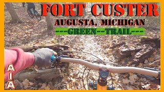
Nov 19, 2023 , Augusta
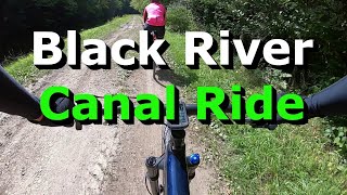
3:17 |
290 |
Aug 27, 2021 , Marcy

2:47 |
239 |
Aug 27, 2021 , Marcy
Recent Trail Reports
| status | trail | date | condition | |
|---|---|---|---|---|
| NCT - East Leigh Street | Jun 19, 2026 @ 5:36pm (America/Detroit) 11 hours | view | ||
| NCT - Jordan Valley To Pinney Bridge Cg | Jun 6, 2026 @ 6:30pm (America/Menominee) Jun 6, 2026 | view | ||
| NCT - Jordan Valley Pathway | Jun 6, 2026 @ 6:30pm (America/Menominee) Jun 6, 2026 | view | ||
| NCT - Cherry Valley Overlook Loop | Jun 1, 2026 @ 6:49pm (America/Detroit) Jun 1, 2026 | view | ||
| NCT - Section3 | May 26, 2026 @ 7:26pm (America/Detroit) May 26, 2026 | view |
Total Trails
500
Total Distance
995 miles
Total Descent
-34,671 ft
Total Climb
33,259 ft
close
-
Layers w
- Weather Layers
- Pro
- Pro
- Pro
- Pro
- Pro
- Pro
- More Layers
- Pro
- Pro
- Pro
- Pro
-
Upgrade to

3D
Trail Conditions
- Unknown
- Snow Groomed
- Snow Packed
- Snow Covered
- Snow Cover Partial
- Freeze/thaw Cycle
- Icy
- Prevalent Mud
- Wet
- Variable
- Ideal
- Dry
- Very Dry
Trail Flow (Ridden Direction)
Trailforks scans users ridelogs to determine the most popular direction each trail is ridden. A good flowing trail network will have most trails flowing in a single direction according to their intension.
The colour categories are based on what percentage of riders are riding a trail in its intended direction.
The colour categories are based on what percentage of riders are riding a trail in its intended direction.
- > 96%
- > 90%
- > 80%
- > 70%
- > 50%
- < 50%
- bi-directional trail
- no data
Trail Last Ridden
Trailforks scans ridelogs to determine the last time a trail was ridden.
- < 2 days
- < 1 week
- < 2 weeks
- < 1 month
- < 6 months
- > 6 months
Trail Ridden Direction
The intended direction a trail should be ridden.
- Downhill Only
- Downhill Primary
- Both Directions
- Uphill Primary
- Uphill Only
- One Direction
Contribute Details
Colors indicate trail is missing specified detail.
- Description
- Photos
- Description & Photos
- Videos
Trail Popularity ?
Trailforks scans ridelogs to determine which trails are ridden the most in the last 9 months.
Trails are compared with nearby trails in the same city region with a possible 25 colour shades.
Think of this as a heatmap, more rides = more kinetic energy = warmer colors.
- most popular
- popular
- less popular
- not popular
ATV/ORV/OHV Filter
Max Vehicle Width
inches
US Cell Coverage
Legend

Radar Time
Activity Recordings
Trailforks uses anonymized public activity data.
?
Activity Recordings
Trailforks uses anonymized public activity data.
?
Personal Heatmap
▶
Activity Types
all
/
none
▶
Options
2
Date range
month
–
Winter Trails
Warning
A routing network for winter maps does not exist. Selecting trails using the winter trails layer has been disabled.
Missing Trails
Most Popular
Least Popular
Trails are colored based on popularity. The more popular a trail is, the more red. Less popular trails trend towards green.
Jump Magnitude Heatmap
Heatmap of where riders jump on trails. Zoom in to see individual jumps, click circles to view jump details.
BC Backroad Status
![map legend]()
Service Road Atlas is a free to use, community-driven service for viewing and creating reports on the numerous back-country service roads around B.C. and Alberta.

Slope Aspect
Direction the slope faces
Trails Deemphasized
Trails are shown in grey.
Only show trails with no bike usage.
Suggested Layers
Based on selected activity type
Save the current map location and zoom level as your default home location whenever this page is loaded.
Save
Trail transparency
This official route list of trails is not complete
Average difficulty
Mountain Bike is not supported on all trail sections, see trails for more details.
Trails and Routes in List - Distance by Difficulty
Trails and Routes in List - Difficulty Totals
- By WillieJacobsz
 Trailforks SBP SWW
 - #799 - 6,558 views