San Úrbez vivió en tierras altoaragonesas en el siglo VIII. Desarrolló el oficio de pastor pero acabó sus días como hombre de fe. Tras su muerte fue muy venerado por los pueblos y gentes de todo el Alto Aragón, y surgieron romerías y veneraciones a lo largo del año o en momentos de fuerte sequía para pedir agua por la intercesión del santo pastor. Esta fuerte y arraigada veneración a San Úrbez es el origen y fundamento de esta ruta.
Además de su componente histórico-religioso, esta ruta senderista homologada como GR 268 sirve de comunicación entre el Pirineo, Pre-Pirineo y la Hoya de Huesca. Recorre bellos, valiosos y variados paisajes, conecta el Parque Nacional de Ordesa y Monte Perdido con el Parque Natural de la Sierra y Cañones de Guara, así como muchos pueblos y despoblados de la Huesca más desconocida.
Además de su componente histórico-religioso, esta ruta senderista homologada como GR 268 sirve de comunicación entre el Pirineo, Pre-Pirineo y la Hoya de Huesca. Recorre bellos, valiosos y variados paisajes, conecta el Parque Nacional de Ordesa y Monte Perdido con el Parque Natural de la Sierra y Cañones de Guara, así como muchos pueblos y despoblados de la Huesca más desconocida.
- Mountain Bike
- E-Bike
- Hike
- Trail Running
Login to see your progress towards riding all the trails and routes in this list.
Trails
Displaying 35
Videos
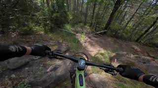
16:13 |
40 |
Jul 7, 2025 , Huesca
youtuber
![San Urbez]()
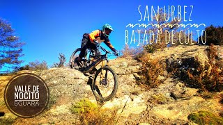
13:45 |
182 |
Jan 7, 2023 , Huesca
Recent Trail Reports
| status | trail | date | condition | |
|---|---|---|---|---|
| Las Mallatas de Albella | Jun 1, 2026 @ 10:26pm (Europe/Madrid) Jun 1, 2026 | view | ||
| Pardina Latorre | Feb 22, 2026 @ 10:37am (Europe/Madrid) Feb 22, 2026 | view | ||
| San Urbez | Feb 21, 2026 @ 12:35pm (Europe/Madrid) Feb 21, 2026 | view | ||
| San Urbez-Nocito | Jun 24, 2025 @ 7:11am Jun 24, 2025 | view | ||
| Campol-Villamana | Feb 6, 2025 @ 1:53pm Feb 6, 2025 | view |
Total Trails
35
Total Distance
41 miles
Total Descent
-13,447 ft
Total Climb
7,901 ft
close
-
Layers w
- Weather Layers
- Pro
- Pro
- Pro
- Pro
- Pro
- Pro
- More Layers
- Pro
- Pro
- Pro
- Pro
-
Upgrade to

3D
Trail Conditions
- Unknown
- Snow Groomed
- Snow Packed
- Snow Covered
- Snow Cover Partial
- Freeze/thaw Cycle
- Icy
- Prevalent Mud
- Wet
- Variable
- Ideal
- Dry
- Very Dry
Trail Flow (Ridden Direction)
Trailforks scans users ridelogs to determine the most popular direction each trail is ridden. A good flowing trail network will have most trails flowing in a single direction according to their intension.
The colour categories are based on what percentage of riders are riding a trail in its intended direction.
The colour categories are based on what percentage of riders are riding a trail in its intended direction.
- > 96%
- > 90%
- > 80%
- > 70%
- > 50%
- < 50%
- bi-directional trail
- no data
Trail Last Ridden
Trailforks scans ridelogs to determine the last time a trail was ridden.
- < 2 days
- < 1 week
- < 2 weeks
- < 1 month
- < 6 months
- > 6 months
Trail Ridden Direction
The intended direction a trail should be ridden.
- Downhill Only
- Downhill Primary
- Both Directions
- Uphill Primary
- Uphill Only
- One Direction
Contribute Details
Colors indicate trail is missing specified detail.
- Description
- Photos
- Description & Photos
- Videos
Trail Popularity ?
Trailforks scans ridelogs to determine which trails are ridden the most in the last 9 months.
Trails are compared with nearby trails in the same city region with a possible 25 colour shades.
Think of this as a heatmap, more rides = more kinetic energy = warmer colors.
- most popular
- popular
- less popular
- not popular
ATV/ORV/OHV Filter
Max Vehicle Width
inches
US Cell Coverage
Legend

Radar Time
Activity Recordings
Trailforks uses anonymized public activity data.
?
Activity Recordings
Trailforks uses anonymized public activity data.
?
Personal Heatmap
▶
Activity Types
all
/
none
▶
Options
2
Date range
month
–
Winter Trails
Warning
A routing network for winter maps does not exist. Selecting trails using the winter trails layer has been disabled.
Missing Trails
Most Popular
Least Popular
Trails are colored based on popularity. The more popular a trail is, the more red. Less popular trails trend towards green.
Jump Magnitude Heatmap
Heatmap of where riders jump on trails. Zoom in to see individual jumps, click circles to view jump details.
BC Backroad Status
![map legend]()
Service Road Atlas is a free to use, community-driven service for viewing and creating reports on the numerous back-country service roads around B.C. and Alberta.

Slope Aspect
Direction the slope faces
Trails Deemphasized
Trails are shown in grey.
Only show trails with no bike usage.
Suggested Layers
Based on selected activity type
Save the current map location and zoom level as your default home location whenever this page is loaded.
Save
Trail transparency
This official route list of trails is not complete
Average difficulty
Associated Route
Mountain Bike is not supported on all trail sections, see trails for more details.
Trails and Routes in List - Distance by Difficulty
Trails and Routes in List - Difficulty Totals
- By Crisjaca

- #838 - 572 views