close
-
Layers w
- Weather Layers
- Pro
- Pro
- Pro
- Pro
- Pro
- Pro
- More Layers
- Pro
- Pro
- Pro
- Pro
-
Upgrade to

3D
Trail Conditions
- Unknown
- Snow Groomed
- Snow Packed
- Snow Covered
- Snow Cover Partial
- Freeze/thaw Cycle
- Icy
- Prevalent Mud
- Wet
- Variable
- Ideal
- Dry
- Very Dry
Trail Flow (Ridden Direction)
Trailforks scans users ridelogs to determine the most popular direction each trail is ridden. A good flowing trail network will have most trails flowing in a single direction according to their intension.
The colour categories are based on what percentage of riders are riding a trail in its intended direction.
The colour categories are based on what percentage of riders are riding a trail in its intended direction.
- > 96%
- > 90%
- > 80%
- > 70%
- > 50%
- < 50%
- bi-directional trail
- no data
Trail Last Ridden
Trailforks scans ridelogs to determine the last time a trail was ridden.
- < 2 days
- < 1 week
- < 2 weeks
- < 1 month
- < 6 months
- > 6 months
Trail Ridden Direction
The intended direction a trail should be ridden.
- Downhill Only
- Downhill Primary
- Both Directions
- Uphill Primary
- Uphill Only
- One Direction
Contribute Details
Colors indicate trail is missing specified detail.
- Description
- Photos
- Description & Photos
- Videos
Trail Popularity ?
Trailforks scans ridelogs to determine which trails are ridden the most in the last 9 months.
Trails are compared with nearby trails in the same city region with a possible 25 colour shades.
Think of this as a heatmap, more rides = more kinetic energy = warmer colors.
- most popular
- popular
- less popular
- not popular
ATV/ORV/OHV Filter
Max Vehicle Width
inches
US Cell Coverage
Legend

Radar Time
Activity Recordings
Trailforks uses anonymized public activity data.
?
Activity Recordings
Trailforks uses anonymized public activity data.
?
Personal Heatmap
▶
Activity Types
all
/
none
▶
Options
2
Date range
month
–
Winter Trails
Warning
A routing network for winter maps does not exist. Selecting trails using the winter trails layer has been disabled.
Missing Trails
Most Popular
Least Popular
Trails are colored based on popularity. The more popular a trail is, the more red. Less popular trails trend towards green.
Jump Magnitude Heatmap
Heatmap of where riders jump on trails. Zoom in to see individual jumps, click circles to view jump details.
BC Backroad Status
![map legend]()
Service Road Atlas is a free to use, community-driven service for viewing and creating reports on the numerous back-country service roads around B.C. and Alberta.

Slope Aspect
Direction the slope faces
Trails Deemphasized
Trails are shown in grey.
Only show trails with no bike usage.
Suggested Layers
Based on selected activity type
Save the current map location and zoom level as your default home location whenever this page is loaded.
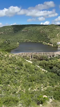
SaveAguascalientes, officially the Free and Sovereign State of Aguascalientes, is one of the 32 states which comprise the Federal Entities of Mexico. At 22°N and with an average altitude of 1,950 m (6,400 ft) above sea level[8] it is predominantly of semi-arid climate (Bhs and Bhk). The state is located in west-central Mexico and is located in the northern part of the Bajío region, which is in the north-central part of the country, bordered by Zacatecas to the north, east and west, and by Jalisco to the south.
source: Aguascalientes - Wikipedia
Links
Region Details
- 13
- 1
- 62
- 26
- 21
- 5
Stats
- Avg Trail Rating
- Trails (view details)
- 130
- Trails Mountain Bike
- 128
- Trails E-Bike
- 127
- Trails Horse
- 6
- Trails Hike
- 27
- Trails Trail Running
- 28
- Trails Dirtbike/Moto
- 3
- Trails ATV/ORV/OHV
- 3
- Total Distance
- 169 miles
- Total Descent Distance
- 72 miles
- Total Descent
- 26,533 ft
- Total Vertical
- 4,243 ft
- Highest Trailhead
- 9,751 ft
- Reports
- 400
- Photos
- 60
- Ridden Counter
- 1,605
Popular Trail Networks
view all areas »Sub Regions
- Aguascalientes (Municipality) (128)
- Aguascalientes (128)
- Aguascalientes Trail Network (29)
- Arkytox Bike Park (44)
- Cerro de La Memoria (0)
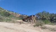
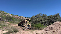
- Chichimeco Bike Park (43)
- Rio Sonora (0)
- Sierra. Norte (0)
- Yuca Xtreme Bike Park (12)
- Aguascalientes (128)
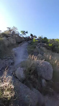
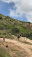
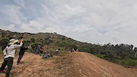
Popular Aguascalientes (State) Mountain Biking Trails
• 90 ★ 1.0 • 1 mile • 317 ft • 40 •
Este sendero te lleva al arrancador de las principales pistas de Arkitox Bike Park
• 100 ★ 5.0 • 1,765 ft • 207 ft • 37 •
Popular green difficulty machine groomed. This mountain bike primary trail can be used both directions and has a moderate overall physical rating with a 207 ft blue climb. Trail visibility is always easy to follow.
• 95 ★ 5.0 • 3,422 ft • 0 ft • 35 •
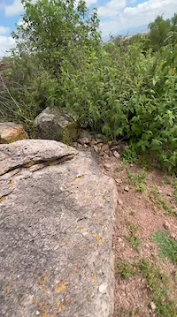
Popular black diamond difficulty singletrack. This mountain bike primary trail can be used downhill only and has a hard overall physical rating. It features bridge, rock face and rock garden. Trail visibility is always easy to follow.
• 90 ★ 5.0 • 774 ft • 31 ft • 33 •
Popular green difficulty machine groomed. This mountain bike primary trail and has a easy overall physical rating with a 31 ft green climb. Trail visibility is always easy to follow.
• 60 ★ 0.0 • 4,583 ft • 0 ft • 32 •
Moderately popular black diamond difficulty singletrack. This mountain bike primary trail and has a hard overall physical rating. It features rock face and rock garden. Trail visibility is always easy to follow.
• 95 ★ 5.0 • 3,983 ft • 15 ft • 31 •
Popular black diamond difficulty singletrack. This mountain bike primary trail can be used downhill only and has a hard overall physical rating. It features drop, jump, rock face and rock garden. Trail visibility is sometimes hard to follow.
• 70 ★ 2.0 • 4,669 ft • 10 ft • 31 •
Popular black diamond difficulty singletrack. This mountain bike primary trail and has a moderate overall physical rating with a 10 ft blue climb. Adaptive MTB rating: amtb blue. Trail visibility is always easy to follow.
Aguascalientes (State) Mountain Bike Routes
14 miles • 2,173 ft • 12 • Loop •
Ruta al puma iniciando desde el estacionamiento de Chichimeco Bike Park subiendo por las Zetas y Gemelas...
21 miles • 1,537 ft • 0 • Loop •
La Ruta de la Guayaba (o Rodada de la Guayaba) es uno de los eventos y recorridos de ciclismo de montaña...
★ 5.0 • 5 miles • 1,231 ft • 9 • Loop • Race •
Pistas para la carrera de enduro categoría mayores: PE 1: PE 2: PE 3:
3 miles • 34 ft • 5 • Point to Point • Race •
Bajada por el cerro arriba de Piedras Negras en el Ejido Chichimeco, Aguascalientes, más de 2,275 metros...
10 miles • 1,964 ft • 19 • Loop • Race •
PE1: 1.07 km. PE2: 1.37 km. PE3: 0.98 km. PE4: 1.17 km.
4 miles • 844 ft • 7 • Loop • Race •
Pistas para el evento Yuca Fest categoría Juvenil PE 1: PE 2:
Videos of Aguascalientes (State) Mountain Bike
Recent Trail Reports
Activity Feed
| username | action | type | title | date |
|---|---|---|---|---|
| Paranoid006 | add | trail | activity #98536489 | Jul 5, 2026 @ 2:16pm 2 hours |
| Paranoid006 | add | report | activity #98023154 and 7 more | Jun 28, 2026 @ 2:04pm Jun 28, 2026 |
| twvWcY | ridden | trail | activity #97632626 | Jun 23, 2026 @ 9:26am Jun 23, 2026 |
| Paranoid006 | add | badge | activity #97008227 | Jun 14, 2026 @ 3:17pm Jun 14, 2026 |
| Paranoid006 | add | trail | activity #97003241 and 1 more | Jun 14, 2026 @ 2:03pm Jun 14, 2026 |
Recent Comments
| username | type | title | comment | date |
|---|---|---|---|---|
| report | Race finish | Sep 21, 2025 @ 11:11am Sep 21, 2025 | ||
| trail | 👏🏽👏🏽👏🏽 | Aug 17, 2025 @ 1:09pm Aug 17, 2025 |
Local Badges
-

YUCA FEST 20250 awarded -

YUCA FEST 20250 awarded -

YUCA FEST 20250 awarded -

Serial Altiplano XTREME 2025 Final14 awarded -
Avalanchichi 20260 awarded -

Epic Mountain Bike Climb 2k0 awarded
Bike & Skill Parks
| name | type | city | rating |
|---|---|---|---|
| Arkytox Bike Park | bike park | Aguascalientes | |
| Chichimeco Bike Park | bike park | Aguascalientes | |
| Yuca Xtreme Bike Park | bike park | Aguascalientes |
Upcoming Local Events
Activity Type Stats
| activitytype | trails | distance | descent | descent distance | total vertical | rating | global rank | state rank | photos | reports | routes | ridelogs |
|---|---|---|---|---|---|---|---|---|---|---|---|---|
| Mountain Bike | 128 | 167 miles | 25,551 ft | 71 miles | 4,242 ft | 32 | 400 | 14 | 4,562 | |||
| E-Bike | 127 | 167 miles | 25,551 ft | 71 miles | 4,242 ft | 375 | 8 | 30 | ||||
| Horse | 6 | 2 miles | 338 ft | 3,845 ft | 358 ft | 8 | ||||||
| Hike | 27 | 27 miles | 3,071 ft | 10 miles | 1,706 ft | 393 | 114 | |||||
| Trail Running | 28 | 27 miles | 3,071 ft | 10 miles | 1,706 ft | 393 | 25 | |||||
| Dirtbike/Moto | 3 | 3 miles | 10 ft | 804 ft | 207 ft | 8 | 12 | |||||
| ATV/ORV/OHV | 3 | 3 miles | 10 ft | 804 ft | 207 ft | 8 |
Activities
Trails
- Hard trails in Aguascalientes (State)
- Easy trails in Aguascalientes (State)
- Favorite trails in Aguascalientes (State)
- Most ridden trails in Aguascalientes (State)
- Singletrack in Aguascalientes (State)
- Viewpoint trails in Aguascalientes (State)
- Trails with technical features in Aguascalientes (State)
- Race routes in Aguascalientes (State)
Points of Interest
- By DreyMX
 TRAILFORKS MAG & contributors
 - Admins: MAG, ASAG
- #64921 - 904 views
- aguascalientes (state) activity log | embed map of Aguascalientes (State) mountain bike trails | aguascalientes (state) mountain biking points of interest
Downloading of trail gps tracks in kml & gpx formats is enabled for Aguascalientes (State).
You must login to download files.