
close
3D
Trail Conditions
- Unknown
- Snow Groomed
- Snow Packed
- Snow Covered
- Snow Cover Partial
- Freeze/thaw Cycle
- Icy
- Prevalent Mud
- Wet
- Variable
- Ideal
- Dry
- Very Dry
Trail Flow (Ridden Direction)
Trailforks scans users activity logs to determine the most popular direction each trail is ridden. A good flowing trail network will have most trails flowing in a single direction according to their intension.
The colour categories are based on what percentage of users are riding a trail in its intended direction.
The colour categories are based on what percentage of users are riding a trail in its intended direction.
- > 96%
- > 90%
- > 80%
- > 70%
- > 50%
- < 50%
- bi-directional trail
- no data
Trail Last Used
Trailforks scans activity logs to determine the last time a trail was ridden.
- < 2 days
- < 1 week
- < 2 weeks
- < 1 month
- < 6 months
- > 6 months
Trail Ridden Direction
The intended direction a trail should be ridden.
- Downhill Only
- Downhill Primary
- Both Directions
- Uphill Primary
- Uphill Only
- One Direction
Contribute Details
Colors indicate trail is missing specified detail.
- Description
- Photos
- Description & Photos
- Videos
Trail Popularity ?
Trailforks scans activity logs to determine which trails are ridden the most in the last 9 months.
Trails are compared with nearby trails in the same city region with a possible 25 colour shades.
Think of this as a heatmap, more activities = more kinetic energy = warmer colors.
- most popular
- popular
- less popular
- not popular
ATV/ORV/OHV Filter
Max Vehicle Width
inches
US Cell Coverage
Legend

Radar Time
Activity Recordings
Trailforks uses anonymized public activity data.
?
Activity Recordings
Trailforks uses anonymized public activity data.
?
Winter Trails
Warning
A routing network for winter maps does not exist. Selecting trails using the winter trails layer has been disabled.
Missing Trails
Most Popular
Least Popular
Trails are colored based on popularity. The more popular a trail is, the more red. Less popular trails trend towards green.
Jump Magnitude Heatmap
Heatmap of where users jump on trails. Zoom in to see individual jumps, click circles to view jump details.
BC Backroad Status
![map legend]()
Service Road Atlas is a free to use, community-driven service for viewing and creating reports on the numerous back-country service roads around B.C. and Alberta.

Slope Aspect
Direction the slope faces
Trails Deemphasized
Trails are shown in grey.
Only show trails with no bike usage.
Suggested Layers
Based on selected activity type
Save the current map location and zoom level as your default home location whenever this page is loaded.
SaveNorsk:
I åssiden sør for Hallingdalselva, bak Ål stasjon, finner du de lekne sykkelstiene Hallingspretten og Bråtabakkjin, henholdsvis blå- og rødgradert. Begge byr på doserte svinger, hopp og andre morsomme utfordringer som gjør dem vel verdt et besøk. Stiene kan shuttles, men det er også enkelt å sykle opp via asfaltert bilvei fra Ål stasjon.
På sentrumssiden av elven finner du Hallingdal sykkelpark, med hopplinjer i ulike størrelser, og midt i sentrum ligger Ørneparken pump track – et morsomt lekeområde for syklister i alle aldre.
English:
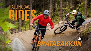
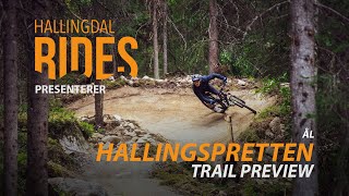
On the hillside south of the Hallingdal River, just behind Ål Station, you’ll find the playful mountain bike trails Hallingspretten and Bråtabakkjin, rated blue and red, respectively. Both trails feature berms, jumps, and fun technical elements, making them well worth a visit. You can shuttle to the top, but it's also easy to ride up via the paved road from Ål Station.
On the town side of the river, you’ll find Hallingdal Bike Park, featuring jump lines in various sizes, and right in the town center is Ørneparken Pump Track – a fun playground for riders of all ages.
I åssiden sør for Hallingdalselva, bak Ål stasjon, finner du de lekne sykkelstiene Hallingspretten og Bråtabakkjin, henholdsvis blå- og rødgradert. Begge byr på doserte svinger, hopp og andre morsomme utfordringer som gjør dem vel verdt et besøk. Stiene kan shuttles, men det er også enkelt å sykle opp via asfaltert bilvei fra Ål stasjon.
På sentrumssiden av elven finner du Hallingdal sykkelpark, med hopplinjer i ulike størrelser, og midt i sentrum ligger Ørneparken pump track – et morsomt lekeområde for syklister i alle aldre.
English:
On the hillside south of the Hallingdal River, just behind Ål Station, you’ll find the playful mountain bike trails Hallingspretten and Bråtabakkjin, rated blue and red, respectively. Both trails feature berms, jumps, and fun technical elements, making them well worth a visit. You can shuttle to the top, but it's also easy to ride up via the paved road from Ål Station.
On the town side of the river, you’ll find Hallingdal Bike Park, featuring jump lines in various sizes, and right in the town center is Ørneparken Pump Track – a fun playground for riders of all ages.
Primary Trail Type: All-Mountain & Downhill
eBikes Allowed:
Yes
Shuttleable: YES
Access Info:
Norsk:
Sykkelbutikken Trø Te, like ved Ål stasjon, er et perfekt utgangspunkt for sykling i området.
English:
The bike shop Trø Te, located near Ål Station, is a great starting point for exploring the trails in this area.
Sykkelbutikken Trø Te, like ved Ål stasjon, er et perfekt utgangspunkt for sykling i området.
English:
The bike shop Trø Te, located near Ål Station, is a great starting point for exploring the trails in this area.
Links
This region uses the Uk/Euro style trail grading system.
Trail info last updated
Activities Click to view
- Mountain Bike
2 trails
- E-Bike
2 trails
- Hike
2 trails
- Trail Running
2 trails
Region Details
- 1
- 1
Region Status
Open as of Jul 29, 2025
Stats
- Trails (view details)
- 2
- Trails Mountain Bike
- 2
- Trails E-Bike
- 2
- Trails Adaptive Bike
- 1
- Trails Winter Fat Bike
- 1
- Trails Hike
- 2
- Trails Trail Running
- 2
- Total Distance
- 2 miles
- Total Descent Distance
- 4,787 ft
- Total Descent
- 1,027 ft
- Total Vertical
- 535 ft
- Highest Trailhead
- 1,988 ft
- Reports
- 2
- Photos
- 8
- Completed Counter
- 45
Popular Ål sentrum Mountain Biking Trails
• 50 ★ 0.0 • 4,757 ft • 47 ft • 17 •
Norsk (English below): Hallingspretten er en blågradert, maskinbygd sti laget med naturlige materialer, og byr på en flott kombinasjon av flyt, lekenhet og utfordringer. Stien ligger rett ved Ål sentrum, og det er kort vei å sykle...
• 100 ★ 0.0 • 5,036 ft • 305 ft • 16 •
Norsk (English below): BråtaBakkjin – luftig moro rett ved Ål sentrum BråtaBakkjin byr på 1,7 km med rødgradert "air flow", med store doseringer, alternative linjer og masse luft under hjulene – bare et steinkast fra Ål...
Photos of Ål sentrum Mountain Bike
Videos of Ål sentrum Mountain Bike
Recent Trail Reports
| status | trail | date | condition | info | user |
|---|---|---|---|---|---|
| Bråtabakkjin | Jul 29, 2025 @ 1:03pm Jul 29, 2025 | Dry | Rakikaya | ||
| Hallingspretten | Jul 18, 2025 @ 1:15pm Jul 18, 2025 | Ideal | kimaamaas |
Activity Feed
| username | action | type | title | date |
|---|---|---|---|---|
| WilliamjU6yqr | wishlist | trail | activity #103432761 and 1 more | Sep 9, 2026 @ 1:33pm Sep 9, 2026 |
| WilliamjU6yqr | wishlist | skillpark | activity #103432757 | Sep 9, 2026 @ 1:33pm Sep 9, 2026 |
| Stortuvan | wishlist | trail | activity #95193037 and 1 more | May 21, 2026 @ 12:12pm May 21, 2026 |
| Manniger | vote | skillpark | activity #78916153 | Aug 25, 2025 @ 8:45am Aug 25, 2025 |
| Manniger | ridden | skillpark | activity #78916148 | Aug 25, 2025 @ 8:45am Aug 25, 2025 |
Nearby Areas
| name | distance | ||||
|---|---|---|---|---|---|
| Hillbilly Bike Park | 2.8 km | ||||
| Liatoppen Skisenter | 3.7 km | ||||
| Ål-fjella | 1 | 2 | 4.6 km | ||
| Torpo | 6.6 km | ||||
| Skarslia Ski Og Akesenter | 10.3 km |
Bike & Skill Parks
| name | type | city | rating |
|---|---|---|---|
| Hallingdal sykkelpark | skill park | ||
| Ørneparken Pump Track | skill park |

Activity Type Stats
| activitytype | trails | distance | descent | descent distance | total vertical | rating | global rank | state rank | photos | reports | routes | activity logs |
|---|---|---|---|---|---|---|---|---|---|---|---|---|
| Mountain Bike | 2 | 2 miles | 1,027 ft | 4,787 ft | 535 ft | #14,872 | #195 | 6 | 2 | 52 | ||
| E-Bike | 2 | 2 miles | 1,027 ft | 4,787 ft | 535 ft | #5,174 | #114 | 2 | 17 | |||
| Adaptive Bike | 1 | 4,757 ft | 266 ft | 2,290 ft | 240 ft | 1 | ||||||
| Winter Fat Bike | 1 | 5,036 ft | 761 ft | 2,497 ft | 522 ft | |||||||
| Hike | 2 | 2 miles | 1,027 ft | 4,787 ft | 535 ft | #8,713 | #128 | 2 | 3 | |||
| Trail Running | 2 | 2 miles | 1,027 ft | 4,787 ft | 535 ft | #7,850 | #125 | 2 | 1 |
- By WillieJacobsz
 Trailforks SBP SWW & contributors
- Admins: apply
- #70268 - 927 views
- Ål sentrum activity log | embed map of Ål sentrum mountain bike trails |
Downloading of trail gps tracks in kml & gpx formats is enabled for Ål sentrum.
You must login to download files.
