close
-
Layers w
- Weather Layers
- Pro
- Pro
- Pro
- Pro
- Pro
- Pro
- More Layers
- Pro
- Pro
- Pro
- Pro
-
Upgrade to

3D
Trail Conditions
- Unknown
- Snow Groomed
- Snow Packed
- Snow Covered
- Snow Cover Partial
- Freeze/thaw Cycle
- Icy
- Prevalent Mud
- Wet
- Variable
- Ideal
- Dry
- Very Dry
Trail Flow (Ridden Direction)
Trailforks scans users activity logs to determine the most popular direction each trail is ridden. A good flowing trail network will have most trails flowing in a single direction according to their intension.
The colour categories are based on what percentage of users are riding a trail in its intended direction.
The colour categories are based on what percentage of users are riding a trail in its intended direction.
- > 96%
- > 90%
- > 80%
- > 70%
- > 50%
- < 50%
- bi-directional trail
- no data
Trail Last Ridden
Trailforks scans activity logs to determine the last time a trail was ridden.
- < 2 days
- < 1 week
- < 2 weeks
- < 1 month
- < 6 months
- > 6 months
Trail Ridden Direction
The intended direction a trail should be ridden.
- Downhill Only
- Downhill Primary
- Both Directions
- Uphill Primary
- Uphill Only
- One Direction
Contribute Details
Colors indicate trail is missing specified detail.
- Description
- Photos
- Description & Photos
- Videos
Trail Popularity ?
Trailforks scans activity logs to determine which trails are ridden the most in the last 9 months.
Trails are compared with nearby trails in the same city region with a possible 25 colour shades.
Think of this as a heatmap, more activities = more kinetic energy = warmer colors.
- most popular
- popular
- less popular
- not popular
ATV/ORV/OHV Filter
Max Vehicle Width
inches
US Cell Coverage
Legend

Radar Time
Activity Recordings
Trailforks uses anonymized public activity data.
?
Activity Recordings
Trailforks uses anonymized public activity data.
?
Personal Heatmap
▶
Activity Types
all
/
none
▶
Options
2
Date range
month
–
Winter Trails
Warning
A routing network for winter maps does not exist. Selecting trails using the winter trails layer has been disabled.
Missing Trails
Most Popular
Least Popular
Trails are colored based on popularity. The more popular a trail is, the more red. Less popular trails trend towards green.
Jump Magnitude Heatmap
Heatmap of where users jump on trails. Zoom in to see individual jumps, click circles to view jump details.
BC Backroad Status
![map legend]()
Service Road Atlas is a free to use, community-driven service for viewing and creating reports on the numerous back-country service roads around B.C. and Alberta.

Slope Aspect
Direction the slope faces
Trails Deemphasized
Trails are shown in grey.
Only show trails with no bike usage.
Suggested Layers
Based on selected activity type
Save the current map location and zoom level as your default home location whenever this page is loaded.
SaveThe Bike Park is a small trail centre just outside Alyth, East Perthshire, Scotland. It was built in the summer of 2014 by Cycletherapy.
This region uses the Uk/Euro style trail grading system.
Activities Click to view
- Mountain Bike
33 trails
- E-Bike
31 trails
- Gravel Bike
0 trails
- Adaptive Bike
0 trails
- Winter Fat Bike
0 trails
- Horse
6 trails
- Hike
22 trails
- Trail Running
22 trails
Region Details
- 5
- 16
- 12
Region Status
Open as of Oct 28, 2024Stats
- Avg Trail Rating
- Trails (view details)
- 33
- Trails Mountain Bike
- 33
- Trails E-Bike
- 31
- Trails Horse
- 6
- Trails Hike
- 22
- Trails Trail Running
- 22
- Total Distance
- 21 miles
- Total Descent
- 3,532 ft
- Total Vertical
- 1,763 ft
- Highest Trailhead
- 2,188 ft
- Reports
- 46
- Photos
- 32
- Completed Counter
- 918
Sub Regions
-
Alyth Hill
- 15
- 11
Popular Alyth Mountain Biking Trails
• 100 ★ 3.7 • 2,497 ft • 0 ft • 126 •
great for beginners but different lines are challenging enough to keep anyone entertained
• 85 ★ 2.8 • 1,050 ft • 0 ft • 70 •
Natural trail winding its way down a strip of mixed woodland. Expect flat turns, muddy turns , off camber turns and a couple of wee berms. Watch out for roots. Trail start changed after storm damage.
• 75 ★ 4.0 • 1,273 ft • 118 ft • 32 • • hike
Popular green difficulty singletrack. This hike primary trail can be used both directions. On average it takes 3 minutes to complete this trail.
• 70 ★ 3.4 • 1,900 ft • 0 ft • 32 •
Singletrack, bench cut trail following the contours of the hill down.
• 80 ★ 4.5 • 1,352 ft • 0 ft • 30 •
Alternative to the back woods main descent to take you down to the road
• 100 ★ 0.0 • 1,624 ft • 74 ft • 27 • • hike
Popular green difficulty singletrack. This hike primary trail can be used both directions. On average it takes 4 minutes to complete this trail.
• 85 ★ 0.0 • 2,972 ft • 121 ft • 27 • • hike
Popular green difficulty singletrack. This hike primary trail can be used both directions. On average it takes 6 minutes to complete this trail.
• 60 ★ 0.0 • 2,156 ft • 4 ft • 24 • • hike
Moderately popular green difficulty singletrack. This hike primary trail can be used both directions. On average it takes 1 minutes to complete this trail.
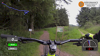
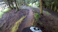
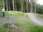
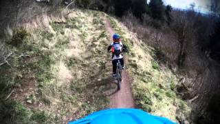
Photos of Alyth Mountain Bike
Videos of Alyth Mountain Bike
trail: Alyth bike park
0:06 |
400 |
Jul 19, 2016

trail: Hard Work
3:55 |
4509 |
Nov 26, 2014
trail: Alyth bike park
2:12 |
529 |
Jul 7, 2014

0:17 |
407 |
Jan 11, 2019

0:21 |
1164 |
Jan 11, 2019
trail: Hard Work
0:24 |
815 |
Jun 9, 2008
trail: Alyth bike park
680 |
Oct 27, 2017 , Alyth
Recent Trail Reports
| status | trail | date | condition | info | user |
|---|---|---|---|---|---|
| Rowdy Rhubarb | Oct 28, 2024 @ 3:28pm Oct 28, 2024 | Ideal | Jackbrown95 | ||
| Trail | Sep 22, 2022 @ 11:06am Sep 22, 2022 | Ideal | Steelytail | ||
| Hard Work | Sep 18, 2022 @ 2:23pm Sep 18, 2022 | Dry | cook973 TTA | ||
| Alyth bike park | Aug 29, 2022 @ 1:49pm Aug 29, 2022 | Ideal | Lewismurray | ||
| Yoohoo | May 30, 2022 @ 8:14am May 30, 2022 | Ideal | Jackbrown95 | ||
| Back Woods | May 30, 2022 @ 8:14am May 30, 2022 | Ideal | Jackbrown95 | ||
| Blinded by the light | Oct 31, 2021 @ 2:37am Oct 31, 2021 | Variable | Steelytail | ||
| Path | Jul 26, 2021 @ 4:57am Jul 26, 2021 | Dry | mikejdavie | ||
| Old Drove Road | Jul 26, 2021 @ 4:57am Jul 26, 2021 | Dry | mikejdavie | ||
| Path | Jul 26, 2021 @ 4:57am Jul 26, 2021 | Dry | mikejdavie |
Activity Feed
| username | action | type | title | date |
|---|---|---|---|---|
| Neilpaterson1969 | vote | trail | activity #94810904 | May 16, 2026 @ 6:56am May 16, 2026 |
| Neilpaterson1969 | vote | trail | activity #94810895 and 1 more | May 16, 2026 @ 6:56am May 16, 2026 |
| Peterd6ufYr | wishlist | region | activity #94491628 | May 11, 2026 @ 6:42am May 11, 2026 |
| Mill0491 | wishlist | region | activity #94270466 | May 8, 2026 @ 2:06am May 8, 2026 |
| Neilpaterson1969 | ridden | trail | activity #93880516 | May 2, 2026 @ 11:27am May 2, 2026 |
Recent Comments
| username | type | title | comment | date |
|---|---|---|---|---|
| trail | Lots of trees covering the trail, also not... | Jan 2, 2025 @ 8:30am Jan 2, 2025 | ||
| trail | Now clear of trees on the top half of the trail | May 24, 2022 @ 11:49pm May 24, 2022 | ||
| trail | Very loose ground pirime condition in damp weather | Sep 6, 2021 @ 4:53am Sep 6, 2021 |
Local Badges
-

Epic Ride Climb 2k10 awarded -

Climbing 10k Badge8 awarded -

Climbing 100k Badge0 awarded -

Epic Ride Descent 2k10 awarded -

Descent 10k Badge9 awarded -

Descent 100k Badge0 awarded
Activity Type Stats
| activitytype | trails | distance | descent | descent distance | total vertical | rating | global rank | state rank | photos | reports | routes | activity logs |
|---|---|---|---|---|---|---|---|---|---|---|---|---|
| Mountain Bike | 33 | 21 miles | 3,530 ft | 8 miles | 1,762 ft | #6,017 | #212 | 32 | 46 | 1,600 | ||
| E-Bike | 31 | 19 miles | 3,330 ft | 8 miles | 1,762 ft | #4,077 | #157 | 43 | 204 | |||
| Horse | 6 | 3 miles | 138 ft | 3,340 ft | 538 ft | #1,864 | #95 | 7 | ||||
| Hike | 22 | 17 miles | 1,722 ft | 5 miles | 1,762 ft | #6,490 | #166 | 35 | 104 | |||
| Trail Running | 22 | 17 miles | 1,722 ft | 5 miles | 1,762 ft | #6,544 | #183 | 35 | 395 |
Frequently Asked Questions About Alyth
▼
What are the best places to ride in Alyth?
Alyth has 1 areas to explore for mountain biking. The top rated areas are:
▼
What are the highest rated mountain biking trails in Alyth?
The highest rated mountain biking trails in Alyth are:
- Yoohoo (4.1/5)
- Rowdy Rhubarb (4/5)
- The Cateran Trail (4/5)
- Back Woods (4/5)
- off the beaten track (4/5)
▼
What is the best time of the year to ride in Alyth?
Based on activity log data, the most popular months to ride in Alyth are:
- May (9 activities)
- June (7 activities)
- July (5 activities)
▼
Where can I park to ride in Alyth?
There are 1 parking locations listed in Alyth. The most popular parking spots are:
Activities
Trails
Points of Interest
- By londondl
 & contributors
 - Admins: DMBinS, FLS, TTA
- #17257 - 4,810 views
- alyth activity log | embed map of Alyth mountain bike trails | alyth mountain biking points of interest
Downloading of trail gps tracks in kml & gpx formats is enabled for Alyth.
You must login to download files.