close
-
Layers w
- Weather Layers
- Pro
- Pro
- Pro
- Pro
- Pro
- Pro
- More Layers
- Pro
- Pro
- Pro
- Pro
-
Upgrade to

3D
Trail Conditions
- Unknown
- Snow Groomed
- Snow Packed
- Snow Covered
- Snow Cover Partial
- Freeze/thaw Cycle
- Icy
- Prevalent Mud
- Wet
- Variable
- Ideal
- Dry
- Very Dry
Trail Flow (Ridden Direction)
Trailforks scans users activity logs to determine the most popular direction each trail is ridden. A good flowing trail network will have most trails flowing in a single direction according to their intension.
The colour categories are based on what percentage of users are riding a trail in its intended direction.
The colour categories are based on what percentage of users are riding a trail in its intended direction.
- > 96%
- > 90%
- > 80%
- > 70%
- > 50%
- < 50%
- bi-directional trail
- no data
Trail Last Ridden
Trailforks scans activity logs to determine the last time a trail was ridden.
- < 2 days
- < 1 week
- < 2 weeks
- < 1 month
- < 6 months
- > 6 months
Trail Ridden Direction
The intended direction a trail should be ridden.
- Downhill Only
- Downhill Primary
- Both Directions
- Uphill Primary
- Uphill Only
- One Direction
Contribute Details
Colors indicate trail is missing specified detail.
- Description
- Photos
- Description & Photos
- Videos
Trail Popularity ?
Trailforks scans activity logs to determine which trails are ridden the most in the last 9 months.
Trails are compared with nearby trails in the same city region with a possible 25 colour shades.
Think of this as a heatmap, more activities = more kinetic energy = warmer colors.
- most popular
- popular
- less popular
- not popular
ATV/ORV/OHV Filter
Max Vehicle Width
inches
US Cell Coverage
Legend

Radar Time
Activity Recordings
Trailforks uses anonymized public activity data.
?
Activity Recordings
Trailforks uses anonymized public activity data.
?
Personal Heatmap
▶
Activity Types
all
/
none
▶
Options
2
Date range
month
–
Winter Trails
Warning
A routing network for winter maps does not exist. Selecting trails using the winter trails layer has been disabled.
Missing Trails
Most Popular
Least Popular
Trails are colored based on popularity. The more popular a trail is, the more red. Less popular trails trend towards green.
Jump Magnitude Heatmap
Heatmap of where users jump on trails. Zoom in to see individual jumps, click circles to view jump details.
BC Backroad Status
![map legend]()
Service Road Atlas is a free to use, community-driven service for viewing and creating reports on the numerous back-country service roads around B.C. and Alberta.

Slope Aspect
Direction the slope faces
Trails Deemphasized
Trails are shown in grey.
Only show trails with no bike usage.
Suggested Layers
Based on selected activity type
Save the current map location and zoom level as your default home location whenever this page is loaded.
Save
No description for Bansko has been added yet!
Login or register to submit one.
Activities Click to view
- Mountain Bike
41 trails
- E-Bike
34 trails
- Adaptive Bike
0 trails
- Winter Fat Bike
0 trails
- Hike
37 trails
- Trail Running
38 trails
Region Details
- 7
- 11
- 15
- 4
Region Status
Open as of Jul 31, 2026Stats
- Avg Trail Rating
- Trails (view details)
- 37
- Trails Mountain Bike
- 41
- Trails E-Bike
- 34
- Trails Horse
- 1
- Trails Hike
- 37
- Trails Trail Running
- 38
- Trails Dirtbike/Moto
- 1
- Trails Snowshoe
- 2
- Trails Backcountry Ski
- 4
- Total Distance
- 32 miles
- Total Descent Distance
- 22 miles
- Total Descent
- 14,672 ft
- Total Vertical
- 3,025 ft
- Highest Trailhead
- 5,965 ft
- Reports
- 1,261
- Photos
- 94
- Completed Counter
- 1,958
Popular Bansko Mountain Biking Trails
• 100 ★ 5.0 • 3,488 ft • 0 ft • 105 •
Mostly flowy trail with small berms. Some rooty sections, and one (optional) small jump. Follow the at the end to bring you back into the town ready for another lap.
• 100 ★ 5.0 • 1 mile • 0 ft • 100 •
Highly rated popular black diamond difficulty singletrack. This mountain bike primary trail can be used downhill primary and has a hard overall physical rating. It features berm, drop, log ride, rock garden and roller coaster. On average it takes 9 minutes to complete this trail.
• 80 ★ 4.3 • 1 mile • 9 ft • 97 •
Popular blue difficulty singletrack. This mountain bike primary trail can be used downhill primary and has a hard overall physical rating. It features log ride. Trail visibility is always easy to follow. On average it takes 12 minutes to complete this trail.
• 70 ★ 4.4 • 1 mile • 0 ft • 94 •
Highly rated popular blue difficulty singletrack. This mountain bike primary trail can be used downhill primary. On average it takes 13 minutes to complete this trail.
• 95 ★ 4.0 • 2,408 ft • 0 ft • 77 •
Popular blue difficulty singletrack. This mountain bike primary trail can be used downhill primary. On average it takes 3 minutes to complete this trail.
• 70 ★ 5.0 • 1,850 ft • 0 ft • 67 •
Popular blue difficulty singletrack. This mountain bike primary trail can be used downhill primary. On average it takes 1 minutes to complete this trail.
• 60 ★ 4.5 • 1 mile • 25 ft • 45 •
Moderately popular blue difficulty singletrack. This mountain bike primary trail can be used downhill primary and has a moderate overall physical rating. It features berm and log ride. Trail visibility is always easy to follow. On average it takes 10 minutes to complete this trail.
Bansko Mountain Bike Routes
25 miles • 2,785 ft • 0 •
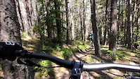
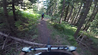
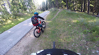
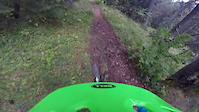
Photos of Bansko Mountain Bike
Videos of Bansko Mountain Bike
trail: #ТЕГАТА
0:35 |
68 |
Jun 2, 2024

trail: Particle Accelerator
3:51 |
89 |
Aug 11, 2022

trail: #ТЕГАТА
3:09 |
188 |
Sep 16, 2019
trail: Chalin
5:43 |
204 |
Sep 16, 2019
trail: Who Dares (upper part)
5:40 |
253 |
Sep 16, 2019
trail: Bunderitsa hut
4:32 |
224 |
Sep 16, 2019

trail: Chalin
5:07 |
92 |
Aug 23, 2017
trail: Bear Pines
7:01 |
159 |
Mar 5, 2017
Recent Trail Reports
| status | trail | date | condition | info | user |
|---|---|---|---|---|---|
| Chalin | Jul 31, 2026 @ 4:02pm (Europe/Sofia) Jul 31, 2026 | Ideal | 1stamenov | ||
| The Flows | Jul 31, 2026 @ 4:02pm (Europe/Sofia) Jul 31, 2026 | Ideal | 1stamenov | ||
| Enduro Access | Jul 31, 2026 @ 4:02pm (Europe/Sofia) Jul 31, 2026 | Ideal | 1stamenov | ||
| Bear Pines | Jul 31, 2026 @ 4:02pm (Europe/Sofia) Jul 31, 2026 | Ideal | 1stamenov | ||
| Trails Access | Jul 31, 2026 @ 4:02pm (Europe/Sofia) Jul 31, 2026 | Ideal | 1stamenov | ||
| #ТЕГАТА | Jul 31, 2026 @ 4:02pm (Europe/Sofia) Jul 31, 2026 | Dry | 1stamenov | ||
| Sweepy `n Steepy | Jul 31, 2026 @ 4:02pm (Europe/Sofia) Jul 31, 2026 | Ideal | 1stamenov | ||
| Zig Zag | Jul 31, 2026 @ 4:02pm (Europe/Sofia) Jul 31, 2026 | Ideal | 1stamenov | ||
| Ski Slope Climb | Aug 1, 2026 @ 9:01am (Europe/Sofia) 2 days | Ideal | 1stamenov | ||
| La Cresta | Aug 1, 2026 @ 9:01am (Europe/Sofia) 2 days | Ideal | 1stamenov |
Activity Feed
| username | action | type | title | date |
|---|---|---|---|---|
| HighCycleBG | difficultyvote | trail | activity #100636725 | Aug 3, 2026 @ 2:10am 6 hours |
| itanev24 | wishlist | trail | activity #100562768 | Aug 2, 2026 @ 4:47am 1 day |
| 1stamenov | add | report | activity #100560742 and 39 more | Aug 2, 2026 @ 4:14am 1 day |
| VASI9pCukk | vote | trail | activity #99514444 | Jul 19, 2026 @ 3:30am Jul 19, 2026 |
| BatNik | add | report | activity #99155345 and 1 more | Jul 14, 2026 @ 3:20am Jul 14, 2026 |
Recent Comments
| username | type | title | comment | date |
|---|---|---|---|---|
| trail | Мястото на пропадането е... | Jul 13, 2026 @ 12:46pm Jul 13, 2026 | ||
| trail | интересно разнообразие... | Jul 13, 2026 @ 12:45pm Jul 13, 2026 | ||
| trail | the obvious reason this trail is not so... | Sep 8, 2025 @ 9:37am Sep 8, 2025 | ||
| trail | short steep and tricky enter, but after that... | Jul 10, 2025 @ 6:30am Jul 10, 2025 | ||
| trail | interesting one ... slower then who dares with... | Jul 6, 2025 @ 2:30am Jul 6, 2025 |
Local Badges
-

Epic Ride Climb 2k70 awarded -

Climbing 10k Badge19 awarded -

Climbing 100k Badge2 awarded -

Epic Ride Descent 2k70 awarded -

Descent 10k Badge26 awarded -

Descent 100k Badge3 awarded
Activity Type Stats
| activitytype | trails | distance | descent | descent distance | total vertical | rating | global rank | state rank | photos | reports | routes | activity logs |
|---|---|---|---|---|---|---|---|---|---|---|---|---|
| Mountain Bike | 41 | 32 miles | 14,672 ft | 22 miles | 3,025 ft | #1,632 | #4 | 78 | 1,261 | 1 | 2,305 | |
| E-Bike | 34 | 28 miles | 12,087 ft | 18 miles | 3,025 ft | #772 | #9 | 16 | 1,232 | 618 | ||
| Horse | 1 | 16 | ||||||||||
| Hike | 37 | 29 miles | 12,779 ft | 19 miles | 3,025 ft | #1,898 | #6 | 1,242 | 882 | |||
| Trail Running | 38 | 29 miles | 12,694 ft | 19 miles | 3,025 ft | #1,444 | #5 | 1,236 | 139 | |||
| Dirtbike/Moto | 1 | 16 | 5 | |||||||||
| Snowshoe | 2 | 1 mile | 915 ft | 1 mile | 889 ft | 1 | 2 | |||||
| Backcountry Ski | 4 | 1 mile | 1,145 ft | 1 mile | 906 ft | 5 | 181 |
Frequently Asked Questions About Bansko
▼
What are the highest rated mountain biking trails in Bansko?
The highest rated mountain biking trails in Bansko are:
- #ТЕГАТА (4.5/5)
- Water Chute (4.4/5)
- Devil's Marbles (4.4/5)
- Secret XCO (4.2/5)
- Picnica (4.2/5)
▼
What is the best time of the year to ride in Bansko?
Based on activity log data, the most popular months to ride in Bansko are:
- May (27 activities)
- June (12 activities)
- August (11 activities)
▼
Where can I park to ride in Bansko?
Check the Bansko trail map for trailhead and parking information. Community members regularly update access and parking details for trails in the area.
▼
What is the longest trail in Bansko?
The longest trail in Bansko is La Cresta at 3.4 km. View all trails sorted by distance.
Activities
Trails
Points of Interest
- By slashervet
 & contributors
 - Admins: pufalot, BTBG
- #21250 - 17,559 views
- bansko activity log | embed map of Bansko mountain bike trails | bansko mountain biking points of interest
Downloading of trail gps tracks in kml & gpx formats is enabled for Bansko.
You must login to download files.