close
-
Layers w
- Weather Layers
- Pro
- Pro
- Pro
- Pro
- Pro
- Pro
- More Layers
- Pro
- Pro
- Pro
- Pro
-
Upgrade to

3D
Trail Conditions
- Unknown
- Snow Groomed
- Snow Packed
- Snow Covered
- Snow Cover Partial
- Freeze/thaw Cycle
- Icy
- Prevalent Mud
- Wet
- Variable
- Ideal
- Dry
- Very Dry
Trail Flow (Ridden Direction)
Trailforks scans users activity logs to determine the most popular direction each trail is ridden. A good flowing trail network will have most trails flowing in a single direction according to their intension.
The colour categories are based on what percentage of users are riding a trail in its intended direction.
The colour categories are based on what percentage of users are riding a trail in its intended direction.
- > 96%
- > 90%
- > 80%
- > 70%
- > 50%
- < 50%
- bi-directional trail
- no data
Trail Last Ridden
Trailforks scans activity logs to determine the last time a trail was ridden.
- < 2 days
- < 1 week
- < 2 weeks
- < 1 month
- < 6 months
- > 6 months
Trail Ridden Direction
The intended direction a trail should be ridden.
- Downhill Only
- Downhill Primary
- Both Directions
- Uphill Primary
- Uphill Only
- One Direction
Contribute Details
Colors indicate trail is missing specified detail.
- Description
- Photos
- Description & Photos
- Videos
Trail Popularity ?
Trailforks scans activity logs to determine which trails are ridden the most in the last 9 months.
Trails are compared with nearby trails in the same city region with a possible 25 colour shades.
Think of this as a heatmap, more activities = more kinetic energy = warmer colors.
- most popular
- popular
- less popular
- not popular
ATV/ORV/OHV Filter
Max Vehicle Width
inches
US Cell Coverage
Legend

Radar Time
Activity Recordings
Trailforks uses anonymized public activity data.
?
Activity Recordings
Trailforks uses anonymized public activity data.
?
Personal Heatmap
▶
Activity Types
all
/
none
▶
Options
2
Date range
month
–
Winter Trails
Warning
A routing network for winter maps does not exist. Selecting trails using the winter trails layer has been disabled.
Missing Trails
Most Popular
Least Popular
Trails are colored based on popularity. The more popular a trail is, the more red. Less popular trails trend towards green.
Jump Magnitude Heatmap
Heatmap of where users jump on trails. Zoom in to see individual jumps, click circles to view jump details.
BC Backroad Status
![map legend]()
Service Road Atlas is a free to use, community-driven service for viewing and creating reports on the numerous back-country service roads around B.C. and Alberta.

Slope Aspect
Direction the slope faces
Trails Deemphasized
Trails are shown in grey.
Only show trails with no bike usage.
Suggested Layers
Based on selected activity type
Save the current map location and zoom level as your default home location whenever this page is loaded.
Save | § 10 Kantonales Waldgesetz Radfahren und Reiten 1 Radfahren und Reiten sind auf Waldstrassen erlaubt und im übrigen Waldareal verboten. 2 Der Gemeinderat kann das Radfahren und das Reiten a. auf einzelnen Waldstrassen aus wichtigen Gründen verbieten, oder b. im übrigen Waldareal zur Schliessung von Rad- oder Reitwegnetzen örtlich begrenzt erlauben. 3 Vor Erlass von Verfügungen gemäss Absatz 2 ist das Einverständnis der betroffenen Waldeigentümerinnen und Waldeigentümer einzuholen sowie die Revierförsterin oder der Revierförster anzuhören. |
Willkommen im Baselbiet
Die weiten Wälder sind wie geschaffen fürs Biken, die Topografie ist anspruchsvoller, als man auf den ersten Blick zu meinen scheint und der Spass ist mehr oder weniger ganzjährig.
Auf «BikeBaselland» sind 13 (legale) Touren, 3 Trails und alle Pumptracks und Bikeparks vereint. Sie bildet damit das gesamte Spektrum an Schwierigkeitsgraden und Möglichkeiten ab.
Auch Einsteigerinnen und Einsteiger finden sich auf fast allen Routen zurecht, ohne Kopf und Kragen zu riskieren - natürlich auch mit dem E-Mountainbike! Für E-MTB-s gibt es in der Region 20 Ladestationen, die ein sicheres und schnelles Aufladen des Akkus bei jedem Wetter garantieren (kostenlos). Die gängigsten Ladekabel sind bei der Ladestation vorhanden - Standorte und weitere Details: www.e-bike-land.ch
Links
This region uses the Uk/Euro style trail grading system.
Region Details
- 17
- 38
- 71
- 24
Local Trail Association
Stats
- Avg Trail Rating
- Trails (view details)
- 156
- Trails Mountain Bike
- 150
- Trails E-Bike
- 37
- Trails Gravel Bike
- 2
- Trails Adaptive Bike
- 3
- Trails Hike
- 140
- Trails Trail Running
- 140
- Total Distance
- 102 miles
- Total Descent
- 39,719 ft
- Total Vertical
- 3,003 ft
- Highest Trailhead
- 3,904 ft
- Reports
- 1,639
- Photos
- 507
- Completed Counter
- 8,243
Sub Regions
- Bezirk Arlesheim (17)
- Bezirk Laufen (52)
- Bezirk Liestal (5)
- Liestal (5)
- Liestal (5)
- Bezirk Sissach (20)
- Läufelfingen (3)
- Oltingen (1)
- Sissach (15)
- Läufelfingen (3)
- Bezirk Waldenburg (56)
- Bennwil (7)
- Langenbruck (26)
- Oberdorf BL (7)
- Reigoldswil (15)
- Wasserfallen (11)
- Waldenburg (1)
- Bennwil (7)
Popular Basel-Landschaft Mountain Biking Trails
• 100 ★ 4.2 • 2 miles • 20 ft • 612 •
Enduro Flowtrail mit einigen Sprüngen, Rollern und Berms. Alles ist rollbar!
• 100 ★ 4.8 • 1,703 ft • 0 ft • 393 •
Schwierigkeiten Blau Rot Abfahrtsstrecke mit Anlegerkurven und Tables, Wellen und Sprüngen die gesamte Strecke ist rollbar ausgeführt die Sprünge können je nach Fahrlevel genutzt werden. Am Bahnhof Münchenstein hat es eine...
• 100 ★ 4.4 • 3,012 ft • 5 ft • 341 •
Dieser Flowtrail ist die erste offiziell bewillgte Bikestrecke in der Region Nordwestschweiz. Davon sind zwei Abschnitte von je etwa 1000m ausgebaut für Biker, der Rest besteht aus bewillgten Trails und wenig Forstwegen. Der GNT ist...
• 65 ★ 4.7 • 1,519 ft • 3 ft • 290 •
Dieser Flowtrail ist die erste offiziell bewillgte Bikestrecke in der Region Nordwestschweiz. Davon sind zwei Abschnitte von je etwa 1000m ausgebaut für Biker, der Rest besteht aus bewillgten Trails und wenig Forstwegen. Der GNT ist...
• 50 ★ 3.3 • 4,423 ft • 62 ft • 282 •
Dieser Flowtrail ist die erste offiziell bewillgte Bikestrecke in der Region Nordwestschweiz. Davon sind zwei Abschnitte von je etwa 1000m ausgebaut für Biker, der Rest besteht aus bewillgten Trails und wenig Forstwegen. Der GNT ist...
• 80 ★ 4.6 • 1,903 ft • 6 ft • 251 •
Schwierigkeiten Blau Rot Abfahrtsstrecke mit Anlegerkurven und Tables, Wellen und Sprüngen die gesamte Strecke ist rollbar ausgeführt die Sprünge können je nach Fahrlevel genutzt werden. Am Bahnhof Münchenstein hat es eine...
• 40 ★ 0.0 • 3,681 ft • 0 ft • 178 • • hike
Moderately popular blue difficulty singletrack. This hike primary trail can be used downhill primary. Trail visibility is always easy to follow. On average it takes 4 minutes to complete this trail.
• 90 ★ 5.0 • 797 ft • 0 ft • 168 •
Schwierigkeiten Blau Rot Abfahrtsstrecke mit Anlegerkurven und Tables, Wellen und Sprüngen die gesamte Strecke ist rollbar ausgeführt die Sprünge können je nach Fahrlevel genutzt werden. Am Bahnhof Münchenstein hat es eine...
Basel-Landschaft Mountain Bike Routes
6 miles • 1,309 ft • 2 • Loop •
Paved: 2km Forest Track: 4km SingleTrail: 3km
7 miles • 1,186 ft • 6 • Loop •
Paved: 7km Forest Track: 3km SingleTrail: 2km
2 miles • 65 ft • 3 • Point to Point •
Der ist nicht nur der erste bewilligte Trail der Region sondern auch der meistbefahrene Trail in der...
10 miles • 2,266 ft • 4 • Loop •
Die Route führt durch schöne Waldlandschaften, vorbei an vielen Bunkern aus den beiden Weltkriegen....
★ 5.0 • 13 miles • 2,769 ft • 0 • Loop •
Schöne, technisch und körperlich anspruchsvolle Tour. Interessanter Abschnitt über den Passwang....
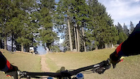
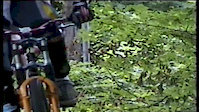
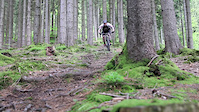
Photos of Basel-Landschaft Mountain Bike
Videos of Basel-Landschaft Mountain Bike
trail: Endless Trail Sissach
0:36 |
265 |
Dec 1, 2018
trail: Endless Trail Sissach
5:02 |
515 |
Oct 22, 2017

trail: Wilderness!
3:13 |
72 |
Sep 17, 2017
trail: Endless Trail Sissach
3:28 |
236 |
Jul 19, 2015
trail: Endless Trail Sissach
4:12 |
5952 |
Jun 8, 2015
trail: Endless Trail Sissach
8:18 |
870 |
Sep 25, 2014
trail: Gempen Nord Trail
2:11 |
835 |
Jun 16, 2014

trail: Endless Trail Sissach
0:30 |
916 |
Dec 10, 2013
Recent Trail Reports
Activity Feed
| username | action | type | title | date |
|---|---|---|---|---|
| Pgillier | add | report | activity #100258512 | Jul 29, 2026 @ 2:52am 7 hours |
| SuperMac | add | report | activity #100036600 | Jul 26, 2026 @ 2:55am Jul 26, 2026 |
| SuperMac | add | report | activity #100036599 | Jul 26, 2026 @ 2:55am Jul 26, 2026 |
| korev | add | report | activity #99993673 and 5 more | Jul 25, 2026 @ 12:10pm Jul 25, 2026 |
| SuperMac | add | report | activity #99873820 | Jul 24, 2026 @ 1:09am Jul 24, 2026 |
Recent Comments
| username | type | title | comment | date |
|---|---|---|---|---|
| trail | Danke für deine Rückmeldung, was ich gerne... | Jun 2, 2026 @ 1:37am Jun 2, 2026 | ||
| trail | Dieser Trail ist über mehrere Abschnitte... | May 26, 2026 @ 1:56am May 26, 2026 | ||
| trail | Trailnet hält den Trail in gutem Zustand.... | Dec 31, 2025 @ 9:19am Dec 31, 2025 | ||
| trail | Der Trail wäre ansich cool, der obere Teil... | Aug 8, 2025 @ 12:28pm Aug 8, 2025 | ||
| trail | Der Aufstieg ist für jene, welche den Trail... | Jul 15, 2025 @ 12:16pm Jul 15, 2025 |
Local Badges
-

Trailnet NW Rider40 awarded -

Descent 10k Badge0 awarded -

Descent 100k Badge0 awarded -
Descent 10k Badge1 awarded -
Descent 100k Badge0 awarded -
Descent 100k Badge0 awarded
Bike & Skill Parks
| name | type | city | rating |
|---|---|---|---|
| BMX Track Reinach | skill park | Arlesheim | |
| Trailcenter Aesch | skill park | Aesch | |
| Pumptrack Arlesheim | skill park | Arlesheim | |
| Roggenburg motocross muligvis | skill park | Laufen | |
| Bikepark Hölstein | skill park | Hölstein |
Local Products
Activity Type Stats
| activitytype | trails | distance | descent | descent distance | total vertical | rating | global rank | state rank | photos | reports | routes | activity logs |
|---|---|---|---|---|---|---|---|---|---|---|---|---|
| Mountain Bike | 150 | 99 miles | 38,120 ft | 60 miles | 3,002 ft | 503 | 1,639 | 5 | 23,022 | |||
| E-Bike | 37 | 37 miles | 4,593 ft | 11 miles | 2,749 ft | 4 | 1,535 | 5 | 3,537 | |||
| Gravel Bike | 2 | 2 miles | 167 ft | 2,310 ft | 354 ft | 33 | 1 | 200 | ||||
| Adaptive Bike | 3 | 5 miles | 312 ft | 1 mile | 1,001 ft | 83 | 2 | |||||
| Hike | 140 | 96 miles | 36,654 ft | 57 miles | 2,936 ft | 1,537 | 1,187 | |||||
| Trail Running | 140 | 96 miles | 36,654 ft | 57 miles | 2,936 ft | 1,537 | 500 |
Activities
Trails
- By brenthillier
 NSMBA TRAILFORKS & contributors
 - Admins: swiss, trailpapst
- #8960 - 6,269 views
- basel-landschaft activity log | embed map of Basel-Landschaft mountain bike trails | basel-landschaft mountain biking points of interest polygons
Downloading of trail gps tracks in kml & gpx formats is enabled for Basel-Landschaft.
You must login to download files.