close
-
Layers w
- Weather Layers
- Pro
- Pro
- Pro
- Pro
- Pro
- Pro
- More Layers
- Pro
- Pro
- Pro
- Pro
-
Upgrade to

3D
Trail Conditions
- Unknown
- Snow Groomed
- Snow Packed
- Snow Covered
- Snow Cover Partial
- Freeze/thaw Cycle
- Icy
- Prevalent Mud
- Wet
- Variable
- Ideal
- Dry
- Very Dry
Trail Flow (Ridden Direction)
Trailforks scans users ridelogs to determine the most popular direction each trail is ridden. A good flowing trail network will have most trails flowing in a single direction according to their intension.
The colour categories are based on what percentage of riders are riding a trail in its intended direction.
The colour categories are based on what percentage of riders are riding a trail in its intended direction.
- > 96%
- > 90%
- > 80%
- > 70%
- > 50%
- < 50%
- bi-directional trail
- no data
Trail Last Ridden
Trailforks scans ridelogs to determine the last time a trail was ridden.
- < 2 days
- < 1 week
- < 2 weeks
- < 1 month
- < 6 months
- > 6 months
Trail Ridden Direction
The intended direction a trail should be ridden.
- Downhill Only
- Downhill Primary
- Both Directions
- Uphill Primary
- Uphill Only
- One Direction
Contribute Details
Colors indicate trail is missing specified detail.
- Description
- Photos
- Description & Photos
- Videos
Trail Popularity ?
Trailforks scans ridelogs to determine which trails are ridden the most in the last 9 months.
Trails are compared with nearby trails in the same city region with a possible 25 colour shades.
Think of this as a heatmap, more rides = more kinetic energy = warmer colors.
- most popular
- popular
- less popular
- not popular
ATV/ORV/OHV Filter
Max Vehicle Width
inches
US Cell Coverage
Legend

Radar Time
Activity Recordings
Trailforks uses anonymized public activity data.
?
Activity Recordings
Trailforks uses anonymized public activity data.
?
Personal Heatmap
▶
Activity Types
all
/
none
▶
Options
2
Date range
month
–
Winter Trails
Warning
A routing network for winter maps does not exist. Selecting trails using the winter trails layer has been disabled.
Missing Trails
Most Popular
Least Popular
Trails are colored based on popularity. The more popular a trail is, the more red. Less popular trails trend towards green.
Jump Magnitude Heatmap
Heatmap of where riders jump on trails. Zoom in to see individual jumps, click circles to view jump details.
BC Backroad Status
![map legend]()
Service Road Atlas is a free to use, community-driven service for viewing and creating reports on the numerous back-country service roads around B.C. and Alberta.

Slope Aspect
Direction the slope faces
Trails Deemphasized
Trails are shown in grey.
Only show trails with no bike usage.
Suggested Layers
Based on selected activity type
Save the current map location and zoom level as your default home location whenever this page is loaded.
SaveBath contains a huge variety of trails and riding spots for all disciplines, from dirt jumps, to downhill. Most stuff is hidden, so will require some locals knowledge to properly enjoy
Please respect hikers and horses on the bridleways/footpaths (remember this isn't a racetrack!), leave no trace, and don't build anything new at the "sneaky spots".
Please respect hikers and horses on the bridleways/footpaths (remember this isn't a racetrack!), leave no trace, and don't build anything new at the "sneaky spots".
Disclaimer:
Riding is at the landowners discretion, so be respectful.
This region uses the Uk/Euro style trail grading system.
Activities Click to view
- Mountain Bike
18 trails
- E-Bike
3 trails
- Adaptive Bike
0 trails
- Winter Fat Bike
0 trails
- Hike
13 trails
- Trail Running
13 trails
Region Details
- 2
- 3
- 7
- 3
- 2
Region Status
Caution as of May 17, 2026Stats
- Avg Trail Rating
- Trails (view details)
- 18
- Trails Mountain Bike
- 18
- Trails E-Bike
- 3
- Trails Horse
- 1
- Trails Hike
- 13
- Trails Trail Running
- 13
- Total Distance
- 13 miles
- Total Descent
- 4,254 ft
- Total Vertical
- 757 ft
- Highest Trailhead
- 808 ft
- Reports
- 94
- Photos
- 67
- Ridden Counter
- 931
Popular Bath Mountain Biking Trails
• 95 ★ 4.0 • 1 mile • 24 ft • 77 •
Takes you from Brown's Folley tower down to the A363, walking tail so mostly roots and rock gardens with some things you can jump.
• 85 ★ 0.0 • 2,854 ft • 0 ft • 58 •
Popular green difficulty machine groomed. This mountain bike primary trail can be used both directions. On average it takes 3 minutes to complete this trail.
• 70 ★ 2.8 • 3 miles • 292 ft • 53 •
Popular blue difficulty mixed. This mountain bike primary trail can be used downhill primary and has a moderate overall physical rating with a 292 ft blue climb. On average it takes 25 minutes to complete this trail.
• 45 ★ 4.2 • 3,427 ft • 65 ft • 50 •
Natural DH trail including rock garden, flat corners and doubles at the bottom
• 60 ★ 0.0 • 2 miles • 220 ft • 42 •
Singletrack bridlepath passing Kelston Round Hill.
• 75 ★ 0.0 • 1,049 ft • 0 ft • 38 •
Popular green difficulty singletrack. This mountain bike primary trail can be used downhill primary. It features rock garden. On average it takes minutes to complete this trail.
• 35 ★ 5.0 • 1,838 ft • 2 ft • 26 •
Steep singletrack trail. Hard in the dry, perilous in the wet
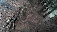
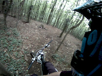
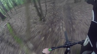
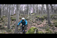
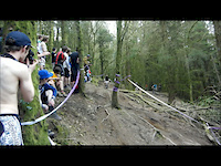
Photos of Bath Mountain Bike
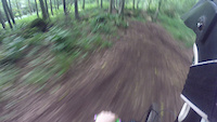
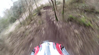
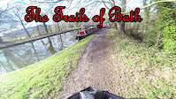
Videos of Bath Mountain Bike
trail: Conkwell
0:39 |
642 |
Dec 12, 2015
trail: Conkwell
0:44 |
647 |
Aug 23, 2015
trail: Half Moustache
0:49 |
1015 |
Apr 2, 2015
trail: Conkwell
5:01 |
512 |
Feb 14, 2015
trail: Conkwell
0:21 |
968 |
Sep 28, 2014
trail: Conkwell
0:39 |
504 |
Sep 19, 2014
trail: Conkwell
0:18 |
444 |
Apr 15, 2012
trail: Half Moustache
0:56 |
1658 |
Mar 25, 2012
Recent Trail Reports
| status | trail | date | condition | info | user |
|---|---|---|---|---|---|
| Half Moustache | May 10, 2026 @ 9:06am (Europe/London) May 10, 2026 | Unknown | Edward7gQFYV | ||
| Conkwell | Feb 10, 2026 @ 9:21pm (Europe/London) Feb 10, 2026 | Wet | Louis_slash | ||
| Rocky Road | Sep 25, 2025 @ 1:22pm (Europe/London) Sep 25, 2025 | Ideal | pablopicasso1 | ||
| Bath to Bathampton canal path | May 24, 2023 @ 8:44am May 24, 2023 | Ideal | Jaib06 | ||
| Cabin in the Woods | May 24, 2023 @ 8:44am May 24, 2023 | Ideal | Jaib06 | ||
| Barry Basic | May 3, 2023 @ 6:21am May 3, 2023 | Variable | Jaib06 | ||
| Kelston to North Stoke | Apr 3, 2023 @ 2:40am Apr 3, 2023 | Prevalent Mud | Jaib06 | ||
| Brown's Folley | Feb 3, 2023 @ 5:17pm Feb 3, 2023 | Wet | Jaib06 | ||
| Slippy McSlipface | Sep 17, 2022 @ 2:56pm Sep 17, 2022 | Dry | mtbconti | ||
| The Swan | Sep 7, 2021 @ 3:19am Sep 7, 2021 | Ideal | Jaib06 |
Activity Feed
| username | action | type | title | date |
|---|---|---|---|---|
| Edward7gQFYV | add | report | activity #94403831 | May 10, 2026 @ 1:06am May 10, 2026 |
| HansY5vho4 | vote | trail | activity #93713298 | Apr 30, 2026 @ 8:05am Apr 30, 2026 |
| Louis_slash | add | report | activity #88691287 | Feb 10, 2026 @ 1:21pm Feb 10, 2026 |
| leebostock | wishlist | region | activity #86691265 | Jan 5, 2026 @ 6:40am Jan 5, 2026 |
| MTBchapperz | add | trail | activity #86464678 | Jan 1, 2026 @ 1:30pm Jan 1, 2026 |
Recent Comments
| username | type | title | comment | date |
|---|---|---|---|---|
| trail | Completely overgrown I just about got through... | Jun 26, 2024 @ 4:41am Jun 26, 2024 | ||
| report | Dryer now and trails expanding but some trails... | Aug 30, 2023 @ 12:53am Aug 30, 2023 | ||
| trail | This has such great potential but needs some... | Sep 17, 2022 @ 2:52pm Sep 17, 2022 | ||
| trail | Needs cutting back desperately! | Sep 17, 2022 @ 2:51pm Sep 17, 2022 | ||
| trail | The whole area is mega, wet or dry, just gotta... | Aug 21, 2022 @ 3:25pm Aug 21, 2022 |
Local Badges
-

Epic Ride Climb 2k39 awarded -

Climbing 10k Badge44 awarded -

Climbing 100k Badge3 awarded -

Epic Ride Descent 2k39 awarded -

Descent 10k Badge44 awarded -

Descent 100k Badge3 awarded
Bike & Skill Parks
| name | type | city | rating |
|---|---|---|---|
| Bath BMX Track | skill park | Bath | |
| Corsham BMX Track | skill park | Bath | |
| Welshmill Park Pumptrack | skill park | Bath |
Local Mountain Biking Directory
-
Avon Valley CycleryBike Shop
-
CadenceBike Shop
-
Fresh Tripe BikesBike Shop
-
MsbmxBike Shop
-
Total Fitness BathBike Shop
Activity Type Stats
| activitytype | trails | distance | descent | descent distance | total vertical | rating | global rank | state rank | photos | reports | routes | ridelogs |
|---|---|---|---|---|---|---|---|---|---|---|---|---|
| Mountain Bike | 18 | 13 miles | 4,255 ft | 8 miles | 758 ft | #3,308 | #107 | 67 | 94 | 10,562 | ||
| E-Bike | 3 | 2 miles | 709 ft | 2 miles | 384 ft | #2,689 | #97 | 75 | 946 | |||
| Horse | 1 | 3,153 ft | 269 ft | 2,904 ft | 269 ft | 13 | ||||||
| Hike | 13 | 12 miles | 3,373 ft | 7 miles | 758 ft | #4,178 | #96 | 89 | 294 | |||
| Trail Running | 13 | 12 miles | 3,373 ft | 7 miles | 758 ft | #3,603 | #78 | 89 | 128 |
Frequently Asked Questions About Bath
▼
What are the highest rated mountain biking trails in Bath?
The highest rated mountain biking trails in Bath are:
- Cabin in the Woods (4.2/5)
- Half Moustache (4.2/5)
- Berma (4.1/5)
- Slippy McSlipface (4.1/5)
- Brown's Folley (4/5)
▼
What is the best time of the year to ride in Bath?
Based on ride log data, the most popular months to ride in Bath are:
- June (24 activities)
- May (21 activities)
- September (19 activities)
▼
Where can I park to ride in Bath?
Check the Bath trail map for trailhead and parking information. Community members regularly update access and parking details for trails in the area.
▼
What is the longest trail in Bath?
The longest trail in Bath is The Swan at 5.0 km. View all trails sorted by distance.
- By JoeBaker & contributors
- Admins: wisey, MathieuC, cemoorelife
- #5045 - 21,514 views
- bath activity log | embed map of Bath mountain bike trails |
Downloading of trail gps tracks in kml & gpx formats is enabled for Bath.
You must login to download files.