close
-
Layers w
- Weather Layers
- Pro
- Pro
- Pro
- Pro
- Pro
- Pro
- More Layers
- Pro
- Pro
- Pro
- Pro
-
Upgrade to

3D
Trail Conditions
- Unknown
- Snow Groomed
- Snow Packed
- Snow Covered
- Snow Cover Partial
- Freeze/thaw Cycle
- Icy
- Prevalent Mud
- Wet
- Variable
- Ideal
- Dry
- Very Dry
Trail Flow (Ridden Direction)
Trailforks scans users ridelogs to determine the most popular direction each trail is ridden. A good flowing trail network will have most trails flowing in a single direction according to their intension.
The colour categories are based on what percentage of riders are riding a trail in its intended direction.
The colour categories are based on what percentage of riders are riding a trail in its intended direction.
- > 96%
- > 90%
- > 80%
- > 70%
- > 50%
- < 50%
- bi-directional trail
- no data
Trail Last Ridden
Trailforks scans ridelogs to determine the last time a trail was ridden.
- < 2 days
- < 1 week
- < 2 weeks
- < 1 month
- < 6 months
- > 6 months
Trail Ridden Direction
The intended direction a trail should be ridden.
- Downhill Only
- Downhill Primary
- Both Directions
- Uphill Primary
- Uphill Only
- One Direction
Contribute Details
Colors indicate trail is missing specified detail.
- Description
- Photos
- Description & Photos
- Videos
Trail Popularity ?
Trailforks scans ridelogs to determine which trails are ridden the most in the last 9 months.
Trails are compared with nearby trails in the same city region with a possible 25 colour shades.
Think of this as a heatmap, more rides = more kinetic energy = warmer colors.
- most popular
- popular
- less popular
- not popular
ATV/ORV/OHV Filter
Max Vehicle Width
inches
US Cell Coverage
Legend

Radar Time
Activity Recordings
Trailforks uses anonymized public activity data.
?
Activity Recordings
Trailforks uses anonymized public activity data.
?
Personal Heatmap
▶
Activity Types
all
/
none
▶
Options
2
Date range
month
–
Winter Trails
Warning
A routing network for winter maps does not exist. Selecting trails using the winter trails layer has been disabled.
Missing Trails
Most Popular
Least Popular
Trails are colored based on popularity. The more popular a trail is, the more red. Less popular trails trend towards green.
Jump Magnitude Heatmap
Heatmap of where riders jump on trails. Zoom in to see individual jumps, click circles to view jump details.
BC Backroad Status
![map legend]()
Service Road Atlas is a free to use, community-driven service for viewing and creating reports on the numerous back-country service roads around B.C. and Alberta.

Slope Aspect
Direction the slope faces
Trails Deemphasized
Trails are shown in grey.
Only show trails with no bike usage.
Suggested Layers
Based on selected activity type
Save the current map location and zoom level as your default home location whenever this page is loaded.
Save
No description for Baunei has been added yet!
Login or register to submit one.
This region uses the Uk/Euro style trail grading system.
Activities Click to view
- Mountain Bike
8 trails
- Hike
11 trails
- Trail Running
11 trails
Region Details
- 3
- 1
Region Status
Open as of Jul 3, 2026Stats
- Avg Trail Rating
- Trails (view details)
- 8
- Trails Mountain Bike
- 8
- Trails E-Bike
- 3
- Trails Hike
- 11
- Trails Trail Running
- 11
- Total Distance
- 23 miles
- Total Descent Distance
- 17 miles
- Total Descent
- 10,024 ft
- Total Vertical
- 3,279 ft
- Highest Trailhead
- 3,304 ft
- Reports
- 18
- Photos
- 38
- Ridden Counter
- 353
Sub Regions
-
Supramonte di Baunei
- 1
Popular Baunei Mountain Biking Trails
• 5 ★ 4.0 • 1 mile • 138 ft • 26 • • hike
Sentiero spettacolare e panoramico, piuttosto frequentato da trekker, molto impegnativo a livello tecnico perchè ripido e con tornanti stretti, inoltre il terreno calcareo è molto insidioso; infine buone parte del sentiero è molto...
• 100 ★ 4.7 • 2 miles • 185 ft • 24 • • hike
Sentiero che parte dal passo di Genna Silana e termina direttamente nell'imbocco del canyon Gorroppu; molto bello e spettacolare, alterna sezioni fluide a tratti piuttosto tecnici con un fondo molto cedevole di sassi di calcare, sono...
• 75 ★ 2.5 • 2 miles • 0 ft • 24 •
Discesa dalla quale si gode un bellissimo panorama della piana di Arbatax, salvo l'inizio (S1-S2) è poco più di una sterrata.
• 5 ★ 4.0 • 2 miles • 9 ft • 24 • • hike
Questo sentiero fa' parte del percorso per trekking del Selvaggio Blu e a detta di molti è uno dei più sentieri naturali più belli della Sardegna, per la mountain bike risulta essere quasi totalmente pedalabile ma bisogna essere...
• 5 ★ 2.0 • 2 miles • 19 ft • 2 • • hike
Less popular red difficulty singletrack. This hike primary trail can be used downhill only.
Baunei Mountain Bike Routes
★ 5.0 • 10 miles • 2,304 ft • 3 • Loop •
Percorso che partendo da Baunei, da dove si gode un bellissimo panorama sulla piana sottostante, unisce...
Photos of Baunei Mountain Bike
Videos of Baunei Mountain Bike
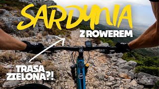
youtuber
![Walka o życie na trasie black diamond |...]()
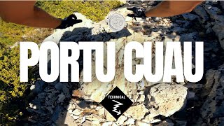
trail: Portu Cuau
15:06 |
419 |
Oct 6, 2022 , Baunei
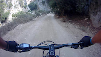
trail: Cala Sisine
0:22 |
78 |
May 24, 2024
Recent Trail Reports
| status | trail | date | condition | info | user |
|---|---|---|---|---|---|
| Costa Silana | Oct 13, 2024 @ 11:46am Oct 13, 2024 | Dry | pablitto | ||
| Bacu Dolcolce | Jul 22, 2024 @ 11:24pm Jul 22, 2024 | Dry | riccardo-penco | ||
| Scaleddas | Apr 15, 2021 @ 3:57am Apr 15, 2021 | Very Dry | Frankthaar |
Activity Feed
| username | action | type | title | date |
|---|---|---|---|---|
| davideL1Rc9t | difficultyvote | trail | activity #85364938 | Dec 11, 2025 @ 10:33am Dec 11, 2025 |
| Dame90 | ridden | trail | activity #83044276 | Oct 26, 2025 @ 5:12am Oct 26, 2025 |
| Alexandra84 | ridden | trail | activity #82393058 | Oct 15, 2025 @ 9:18am Oct 15, 2025 |
| Dame90 | ridden | trail | activity #82349505 | Oct 14, 2025 @ 1:47pm Oct 14, 2025 |
| Evidario | add | report | activity #77763924 | Aug 9, 2025 @ 12:03pm Aug 9, 2025 |
Recent Comments
| username | type | title | comment | date |
|---|---|---|---|---|
| trail | Spettacolare a tratti esposto ma fattibile... | Dec 30, 2024 @ 8:14am Dec 30, 2024 | ||
| report | Plus difficult when the rocks and slaps are... | Oct 28, 2024 @ 8:40am Oct 28, 2024 | ||
| trail | I did it on a shoestring and I was glad having... | Apr 5, 2024 @ 11:13am Apr 5, 2024 | ||
| trail | For expert rider 80% rideable, maybe bit... | Oct 19, 2023 @ 11:17am Oct 19, 2023 | ||
| trail | E' da fare con attenzione a piedi, figurarsi... | Nov 13, 2022 @ 10:38am Nov 13, 2022 |
Activity Type Stats
| activitytype | trails | distance | descent | descent distance | total vertical | rating | global rank | state rank | photos | reports | routes | ridelogs |
|---|---|---|---|---|---|---|---|---|---|---|---|---|
| Mountain Bike | 8 | 23 miles | 10,023 ft | 17 miles | 3,281 ft | #6,489 | #506 | 18 | 18 | 1 | 282 | |
| E-Bike | 3 | 14 miles | 3,169 ft | 9 miles | 1,991 ft | 20 | 15 | 31 | ||||
| Hike | 11 | 23 miles | 10,023 ft | 17 miles | 3,281 ft | #6,722 | #355 | 18 | 482 | |||
| Trail Running | 11 | 23 miles | 10,023 ft | 17 miles | 3,281 ft | #6,812 | #387 | 18 | 24 |
Frequently Asked Questions About Baunei
▼
What are the best places to ride in Baunei?
Baunei has 1 areas to explore for mountain biking. The top rated areas are:
▼
What are the highest rated mountain biking trails in Baunei?
The highest rated mountain biking trails in Baunei are:
- Costa Silana (4.2/5)
- Cengia Giradili (4/5)
- Su Irove Longu (4/5)
- Portu Cuau (3.7/5)
- Scaleddas (3.6/5)
▼
What is the best time of the year to ride in Baunei?
Based on ride log data, the most popular months to ride in Baunei are:
- September (2 activities)
- August (2 activities)
- October (1 activities)
▼
Where can I park to ride in Baunei?
There are 1 parking locations listed in Baunei. The most popular parking spots are:
Trails
- By barc74 & contributors
- Admins: gatz87
- #25200 - 1,829 views
- baunei activity log | embed map of Baunei mountain bike trails | baunei mountain biking points of interest
Downloading of trail gps tracks in kml & gpx formats is enabled for Baunei.
You must login to download files.