close
-
Layers w
- Weather Layers
- Pro
- Pro
- Pro
- Pro
- Pro
- Pro
- More Layers
- Pro
- Pro
- Pro
- Pro
-
Upgrade to

3D
Trail Conditions
- Unknown
- Snow Groomed
- Snow Packed
- Snow Covered
- Snow Cover Partial
- Freeze/thaw Cycle
- Icy
- Prevalent Mud
- Wet
- Variable
- Ideal
- Dry
- Very Dry
Trail Flow (Ridden Direction)
Trailforks scans users ridelogs to determine the most popular direction each trail is ridden. A good flowing trail network will have most trails flowing in a single direction according to their intension.
The colour categories are based on what percentage of riders are riding a trail in its intended direction.
The colour categories are based on what percentage of riders are riding a trail in its intended direction.
- > 96%
- > 90%
- > 80%
- > 70%
- > 50%
- < 50%
- bi-directional trail
- no data
Trail Last Ridden
Trailforks scans ridelogs to determine the last time a trail was ridden.
- < 2 days
- < 1 week
- < 2 weeks
- < 1 month
- < 6 months
- > 6 months
Trail Ridden Direction
The intended direction a trail should be ridden.
- Downhill Only
- Downhill Primary
- Both Directions
- Uphill Primary
- Uphill Only
- One Direction
Contribute Details
Colors indicate trail is missing specified detail.
- Description
- Photos
- Description & Photos
- Videos
Trail Popularity ?
Trailforks scans ridelogs to determine which trails are ridden the most in the last 9 months.
Trails are compared with nearby trails in the same city region with a possible 25 colour shades.
Think of this as a heatmap, more rides = more kinetic energy = warmer colors.
- most popular
- popular
- less popular
- not popular
ATV/ORV/OHV Filter
Max Vehicle Width
inches
US Cell Coverage
Legend

Radar Time
Activity Recordings
Trailforks uses anonymized public activity data.
?
Activity Recordings
Trailforks uses anonymized public activity data.
?
Personal Heatmap
▶
Activity Types
all
/
none
▶
Options
2
Date range
month
–
Winter Trails
Warning
A routing network for winter maps does not exist. Selecting trails using the winter trails layer has been disabled.
Missing Trails
Most Popular
Least Popular
Trails are colored based on popularity. The more popular a trail is, the more red. Less popular trails trend towards green.
Jump Magnitude Heatmap
Heatmap of where riders jump on trails. Zoom in to see individual jumps, click circles to view jump details.
BC Backroad Status
![map legend]()
Service Road Atlas is a free to use, community-driven service for viewing and creating reports on the numerous back-country service roads around B.C. and Alberta.

Slope Aspect
Direction the slope faces
Trails Deemphasized
Trails are shown in grey.
Only show trails with no bike usage.
Suggested Layers
Based on selected activity type
Save the current map location and zoom level as your default home location whenever this page is loaded.
SaveLarge riding area in north part of San Carlos typically near the airstrip / along the road to Nacapule Canyon. Originally consisting of Rancho Baviso and Campestres de Rancho Nacapule trails that when ridden together formed a figure eight (ocho) of approx 17 km. Recent trail construction in the area has expanded this area with more intermediate and advanced trails and trail features and can easily be ridden to include 35+ km of singletrack. More is being added each year.
Primary Trail Type: Cross-Country
 google parking directions
 Access Info:
Typcial area for beginning a ride is at the Jito tree at the south end of the airstrip.
Region Supporters & Maintainers
- SCTESponsor
trail builderSponsor
Activities Click to view
- Mountain Bike
47 trails
- E-Bike
38 trails
- Hike
42 trails
- Trail Running
41 trails
- Dirtbike/Moto
5 trails
- ATV/ORV/OHV
4 trails
Region Details
- 7
- 26
- 11
- 3
Region Status
Open as of Feb 28, 2026Stats
- Avg Trail Rating
- Trails (view details)
- 47
- Trails Mountain Bike
- 47
- Trails E-Bike
- 38
- Trails Gravel Bike
- 5
- Trails Adaptive Bike
- 5
- Trails Winter Fat Bike
- 2
- Trails Hike
- 42
- Trails Trail Running
- 41
- Trails Dirtbike/Moto
- 5
- Trails ATV/ORV/OHV
- 4
- Total Distance
- 57 miles
- Total Descent
- 3,514 ft
- Total Vertical
- 477 ft
- Highest Trailhead
- 521 ft
- Reports
- 163
- Photos
- 29
- Ridden Counter
- 670
Popular Baviso Mountain Biking Trails
• 100 ★ 3.4 • 3,894 ft • 76 ft • 42 •
The newest trail in the network. It has a lot of gently banked turns and meanders up the valley with a tiny lollypop at the top.
• 100 ★ 4.4 • 5,138 ft • 75 ft • 39 •
New singletrack alternative to dirt road to Nacapule Canyon. Enjoy!
• 100 ★ 4.5 • 1 mile • 66 ft • 39 •
Fun route along the edge of arroyo. Best ridden in the counterclockwise direction, but either direction is fairly easy.
• 80 ★ 4.5 • 1 mile • 132 ft • 39 •
Nice climbing trail in an otherwise flat riding area. Fully rideable both directions. A bit rockier and rougher than other parts of the trail system.
• 100 ★ 4.0 • 2,927 ft • 62 ft • 36 •
Fast and flowing singletrack between Las Puente and intersection. Great in both directions.
• 95 ★ 4.0 • 1 mile • 117 ft • 32 •
addition to Baviso. Twists, turns, dips, pure fun. Thanks to trail builder Mike Barry!
• 100 ★ 5.0 • 1,325 ft • 52 ft • 32 •
Singletrack to bypass riding much of the road up to Cactus Jack / Descenso Jabalí
• 95 ★ 4.5 • 2,703 ft • 59 ft • 31 •
Another new trail. Similar type of trail as the rest in the valley with a tad more vertical. A few fun whoops through arroyos. Starts at the top of .
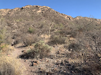
Photos of Baviso Mountain Bike
Videos of Baviso Mountain Bike
trail: Ridge View
0:15 |
|
Apr 8, 2024

trail: Graeme's Toe
0:36 |
86 |
Apr 8, 2024 , San Carlos

trail: Saddle Up
0:27 |
80 |
Apr 8, 2024 , San Carlos

trail: Graeme's Toe
0:48 |
265 |
Jul 27, 2020 , San Carlos

trail: Graeme's Toe
0:44 |
227 |
Jul 17, 2020 , San Carlos

trail: Graeme's Toe
0:54 |
318 |
Jul 5, 2020 , San Carlos

trail: Camino - Doubletrack
0:30 |
258 |
Jul 5, 2020 , San Carlos
Recent Trail Reports
| status | trail | date | condition | info | user |
|---|---|---|---|---|---|
| Baviso | Dec 3, 2025 @ 8:46am (America/Hermosillo) Dec 3, 2025 | Ideal | joeMvvRMZ | ||
| Camino - Doubletrack | Dec 3, 2025 @ 8:46am (America/Hermosillo) Dec 3, 2025 | Ideal | joeMvvRMZ | ||
| Southern Loop (Southern Cross) | Dec 3, 2025 @ 8:46am (America/Hermosillo) Dec 3, 2025 | Ideal | joeMvvRMZ | ||
| Descenso Jabalí (Cactus Jack) | Dec 3, 2025 @ 8:46am (America/Hermosillo) Dec 3, 2025 | Ideal | joeMvvRMZ | ||
| RoadRunner | Dec 3, 2025 @ 8:46am (America/Hermosillo) Dec 3, 2025 | Ideal | joeMvvRMZ | ||
| Coyote Cojo | Dec 3, 2025 @ 8:46am (America/Hermosillo) Dec 3, 2025 | Ideal | joeMvvRMZ | ||
| Vaca Vista | Feb 22, 2025 @ 7:43am Feb 22, 2025 | Dry | Diff01 | ||
| Big Boulder Basin | Feb 22, 2025 @ 7:43am Feb 22, 2025 | Dry | Diff01 | ||
| Loma del Lobo | Jul 18, 2024 @ 10:56am Jul 18, 2024 | Variable | Diff01 | ||
| Rosita | Jul 5, 2024 @ 11:13pm Jul 5, 2024 | Variable | Diff01 |
Activity Feed
| username | action | type | title | date |
|---|---|---|---|---|
| 2outsiders | add | trail | activity #92097095 | Apr 6, 2026 @ 8:39pm Apr 6, 2026 |
| stevemunro | comment | report | activity #91086040 | Mar 22, 2026 @ 9:57am Mar 22, 2026 |
| OmarBernal | ridden | trail | activity #90965113 | Mar 21, 2026 @ 12:33am Mar 21, 2026 |
| OmarBernal | wishlist | trail | activity #90964856 | Mar 21, 2026 @ 12:19am Mar 21, 2026 |
| Ncollings | comment | trail | activity #90130527 | Mar 7, 2026 @ 8:57am Mar 7, 2026 |
Recent Comments
| username | type | title | comment | date |
|---|---|---|---|---|
| report | T | Mar 22, 2026 @ 9:57am Mar 22, 2026 | ||
| trail | This area is blocked off by the landowner.... | Mar 7, 2026 @ 8:57am Mar 7, 2026 | ||
| trail | Not my favorite trail. About a quarter of it... | Apr 11, 2024 @ 11:43am Apr 11, 2024 | ||
| trail | At first I was skeptical, this whole network... | Dec 11, 2023 @ 6:54pm Dec 11, 2023 | ||
| trail | Best ridden clockwise- Rocky climb, fun and... | Feb 26, 2023 @ 6:00am Feb 26, 2023 |
Nearby Areas
| name | distance | ||||
|---|---|---|---|---|---|
| Catch 22-La Manga | 19 | 8 | 2 | 2 | 4.3 km |
| Estero del Soldado | 6 | 3 | 1 | 5.6 km | |
| Aguamalas | 7 | 3 | 8.8 km |
Local Badges
-

Completionist0 awarded
Activity Type Stats
| activitytype | trails | distance | descent | descent distance | total vertical | rating | global rank | state rank | photos | reports | routes | ridelogs |
|---|---|---|---|---|---|---|---|---|---|---|---|---|
| Mountain Bike | 47 | 57 miles | 3,514 ft | 18 miles | 476 ft | #2,132 | #18 | 29 | 163 | 1,003 | ||
| E-Bike | 38 | 53 miles | 3,215 ft | 17 miles | 476 ft | #2,013 | #37 | 161 | 131 | |||
| Gravel Bike | 5 | 23 miles | 568 ft | 5 miles | 453 ft | #6,491 | #32 | 17 | ||||
| Adaptive Bike | 5 | 13 miles | 240 ft | 3 miles | 469 ft | #6,502 | #32 | 9 | ||||
| Winter Fat Bike | 2 | 2 miles | 213 ft | 4,780 ft | 203 ft | #6,491 | #32 | 14 | ||||
| Hike | 42 | 50 miles | 2,789 ft | 15 miles | 476 ft | #3,347 | #29 | 163 | 18 | |||
| Trail Running | 41 | 49 miles | 2,789 ft | 15 miles | 476 ft | #2,589 | 163 | 3 | ||||
| Dirtbike/Moto | 5 | 8 miles | 1,161 ft | 4 miles | 387 ft | #289 | #10 | 3 | ||||
| ATV/ORV/OHV | 4 | 6 miles | 715 ft | 3 miles | 325 ft | #177 | #5 | 2 | 7 |
Frequently Asked Questions About Baviso
▼
What are the highest rated mountain biking trails in Baviso?
The highest rated mountain biking trails in Baviso are:
- Descenso Jabalí (Cactus Jack) (4.2/5)
- RoadRunner (4.1/5)
- Rosita (4.1/5)
- Yaqui (Dan's) (4.1/5)
- Jardín Secreto (4.1/5)
▼
What is the best time of the year to ride in Baviso?
Based on ride log data, the most popular months to ride in Baviso are:
- March (16 activities)
- April (12 activities)
- February (6 activities)
▼
Where can I park to ride in Baviso?
There are 3 parking locations listed in Baviso. The most popular parking spots are: View all parking and trailhead locations on the map to plan your visit.
▼
What is the longest trail in Baviso?
The longest trail in Baviso is Baviso at 5.0 miles. View all trails sorted by distance.
Activities
Trails
- By mickspring1
 SCTE & contributors
 - Admins: SCTE, MikeJBarry
- #36097 - 2,258 views
- baviso activity log | embed map of Baviso mountain bike trails | baviso mountain biking points of interest
Downloading of trail gps tracks in kml & gpx formats is enabled for Baviso.
You must login to download files.