close
-
Layers w
- Weather Layers
- Pro
- Pro
- Pro
- Pro
- Pro
- Pro
- More Layers
- Pro
- Pro
- Pro
- Pro
-
Upgrade to

3D
Trail Conditions
- Unknown
- Snow Groomed
- Snow Packed
- Snow Covered
- Snow Cover Partial
- Freeze/thaw Cycle
- Icy
- Prevalent Mud
- Wet
- Variable
- Ideal
- Dry
- Very Dry
Trail Flow (Ridden Direction)
Trailforks scans users ridelogs to determine the most popular direction each trail is ridden. A good flowing trail network will have most trails flowing in a single direction according to their intension.
The colour categories are based on what percentage of riders are riding a trail in its intended direction.
The colour categories are based on what percentage of riders are riding a trail in its intended direction.
- > 96%
- > 90%
- > 80%
- > 70%
- > 50%
- < 50%
- bi-directional trail
- no data
Trail Last Ridden
Trailforks scans ridelogs to determine the last time a trail was ridden.
- < 2 days
- < 1 week
- < 2 weeks
- < 1 month
- < 6 months
- > 6 months
Trail Ridden Direction
The intended direction a trail should be ridden.
- Downhill Only
- Downhill Primary
- Both Directions
- Uphill Primary
- Uphill Only
- One Direction
Contribute Details
Colors indicate trail is missing specified detail.
- Description
- Photos
- Description & Photos
- Videos
Trail Popularity ?
Trailforks scans ridelogs to determine which trails are ridden the most in the last 9 months.
Trails are compared with nearby trails in the same city region with a possible 25 colour shades.
Think of this as a heatmap, more rides = more kinetic energy = warmer colors.
- most popular
- popular
- less popular
- not popular
ATV/ORV/OHV Filter
Max Vehicle Width
inches
US Cell Coverage
Legend

Radar Time
Activity Recordings
Trailforks uses anonymized public activity data.
?
Activity Recordings
Trailforks uses anonymized public activity data.
?
Personal Heatmap
▶
Activity Types
all
/
none
▶
Options
2
Date range
month
–
Winter Trails
Warning
A routing network for winter maps does not exist. Selecting trails using the winter trails layer has been disabled.
Missing Trails
Most Popular
Least Popular
Trails are colored based on popularity. The more popular a trail is, the more red. Less popular trails trend towards green.
Jump Magnitude Heatmap
Heatmap of where riders jump on trails. Zoom in to see individual jumps, click circles to view jump details.
BC Backroad Status
![map legend]()
Service Road Atlas is a free to use, community-driven service for viewing and creating reports on the numerous back-country service roads around B.C. and Alberta.

Slope Aspect
Direction the slope faces
Trails Deemphasized
Trails are shown in grey.
Only show trails with no bike usage.
Suggested Layers
Based on selected activity type
Save the current map location and zoom level as your default home location whenever this page is loaded.
SaveNestled in the heart of the Central Sierra between the Mokelumne and Carson-Iceberg Wilderness areas, Bear Valley Cross Country & Adventure Company is located on all-weather Highway 4 / Ebbetts Pass, a designated National Scenic Byway.
Bear Valley Adventure Company (BVAC) rents, sells, and services bikes, flatwater kayaks, and stand-up paddleboards. BVAC also has clothing and accessories, mini-mart, fishing, and camping supplies, a variety of special events and races, and is your connection to all of Bear Valley's summer adventures.
Bear Valley Adventure Company (BVAC) rents, sells, and services bikes, flatwater kayaks, and stand-up paddleboards. BVAC also has clothing and accessories, mini-mart, fishing, and camping supplies, a variety of special events and races, and is your connection to all of Bear Valley's summer adventures.
source: Bear Valley Adventure Company
Links
Activities Click to view
- Mountain Bike
86 trails
- E-Bike
34 trails
- Gravel Bike
6 trails
- Adaptive Bike
1 trails
- Winter Fat Bike
1 trails
- Horse
50 trails
- Hike
119 trails
- Trail Running
114 trails
- Dirtbike/Moto
27 trails
- ATV/ORV/OHV
12 trails
- Snowmobile
4 trails
- Snowshoe
38 trails
- Downhill Ski
79 trails
- Backcountry Ski
4 trails
- Nordic Ski
37 trails
Region Details
- 29
- 8
- 37
- 12
Region Status
Caution as of Jun 28, 2026Local Trail Association
Stats
- Avg Trail Rating
- Trails (view details)
- 264
- Trails Mountain Bike
- 86
- Trails E-Bike
- 34
- Trails Gravel Bike
- 6
- Trails Adaptive Bike
- 1
- Trails Winter Fat Bike
- 1
- Trails Horse
- 50
- Trails Hike
- 119
- Trails Trail Running
- 114
- Trails Dirtbike/Moto
- 27
- Trails ATV/ORV/OHV
- 12
- Trails Snowmobile
- 4
- Trails Snowshoe
- 38
- Trails Downhill Ski
- 79
- Trails Backcountry Ski
- 4
- Trails Nordic Ski
- 37
- Total Distance
- 435 miles
- Total Descent
- 96,445 ft
- Total Vertical
- 7,277 ft
- Highest Trailhead
- 10,525 ft
- Reports
- 395
- Photos
- 456
- Ridden Counter
- 7,925
Sub Regions
-
Bear Valley Resort
- 3
- 3
- 2
-
Ebbetts Pass
-
Village Trails
- 1
- 19
- 1
Popular Bear Valley Mountain Biking Trails
• 100 ★ 4.9 • 2 miles • 110 ft • 179 •
Short and sweet downhill from Mt.Reba Road to the "Overflow Campground" Area on Highway 4. Includes many technical rock sections, and a great section at the end.
• 100 ★ 4.5 • 2,933 ft • 3 ft • 168 •
This is a wide , between and the Bear Valley parking lot. It is a short slow-speed trail with excellent traction on granite. It is a fun challenge to see if one can ride down it to the parking lot without putting a foot down.
• 95 ★ 4.0 • 2 miles • 158 ft • 150 •
Even though this is listed as an intermediate ride, there are sections that require some technical skills. You must be willing to walk your bike through sections that you cannot ride without sliding. There is also a difficult creek...
• 100 ★ 5.0 • 3,566 ft • 39 ft • 148 •
Popular blue difficulty singletrack. This multi-use trail can be used both directions. On average it takes 3 minutes to complete this trail.
• 100 ★ 3.0 • 2 miles • 517 ft • 148 •
This is Bear Valley's newest multi-use trail that has a nice flow and grade from bottom to top, or top to bottom, whichever direction you choose to ride it. Due to the fact that this is a multi-use trail with moderate traffic please be...
• 90 ★ 2.2 • 2 miles • 94 ft • 123 •
Trail along the south shore of Lake Alpine. The west end of the trail navigates some rock spines and rock gardens that will be difficult for many riders. Along the lake shore the trail is flat and easy.
• 85 ★ 4.7 • 1 mile • 337 ft • 122 •
This trail branches off the Bear Valley-Lake Alpine trail and climbs steeply to the south of Osborn ridge then descends to Slickrock Road. Rideable in both directions.
• 95 ★ 4.0 • 4,331 ft • 139 ft • 110 •
This is a newly built segment of the . It was recently re-claimed after dissapearing from older topo maps and fading from use. BVTS trail volunteers re-built it in October 2018 so it is still a little soft with several portions that...
Bear Valley Mountain Bike Routes
★ 4.0 • 43 miles • 3,046 ft • 9 •
A crazy suggestion to ride from Bear Valley to Arnold... Any takers?
11 miles • 1,326 ft • 5 •
Intermediate ride starting and ending at Bear Valley resort.
3 miles • 577 ft • 1 •
8 miles • 1,430 ft • 6 •
Rough outline of race course used in the past. Start and finish area is flexible.
5 miles • 93 ft • 3 • Shuttled •
Great option from the Top of Bear Valley ski area down to the Adventure Center in town. and
Photos of Bear Valley Mountain Bike
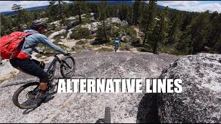
Videos of Bear Valley Mountain Bike
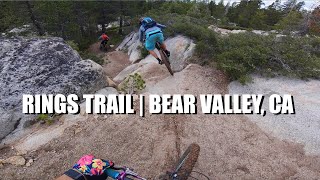
20:39 |
282 |
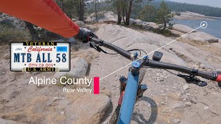
Oct 8, 2021 , Bear Valley

trail: Lower Rings
3:52 |
607 |
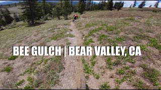
Dec 19, 2020 , Bear Valley
trail: Bee Gulch Trail
3:52 |
717 |
Dec 19, 2020 , Bear Valley
trail: Bee Gulch Trail
2:36 |
929 |
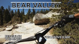
Jun 12, 2020 , Bear Valley
trail: Lower Rings
2:33 |
1104 |
Jun 10, 2020 , Bear Valley
trail: Granite Slab
2:32 |
578 |
Jun 9, 2020 , Bear Valley

12:18 |
809 |
Jun 30, 2019 , Bear Valley

trail: Cape Horn
8:35 |
1048 |
Jun 23, 2019 , Bear Valley
Current Trail Warnings
| status | trail | date | condition | user | info |
|---|---|---|---|---|---|
| Horn Wood Trail | Jun 7, 2026 @ 2:38pm (America/Los_Angeles) Jun 7, 2026 | Variable | JohnDube | Five trees down |
Recent Trail Reports
| status | trail | date | condition | info | user |
|---|---|---|---|---|---|
| Obvious | Jun 28, 2026 @ 4:58pm (America/Los_Angeles) Jun 28, 2026 | Ideal | JohnDube | ||
| Oddenn Trail (Upper Rings) | Jun 28, 2026 @ 4:40pm (America/Los_Angeles) Jun 28, 2026 | Ideal | JohnDube | ||
| Cape Horn | Jun 25, 2026 @ 11:54am (America/Los_Angeles) Jun 25, 2026 | Unknown | sierrabackcountry | ||
| Lower Woodchuck Basin | Jun 24, 2026 @ 2:48pm (America/Los_Angeles) Jun 24, 2026 | Ideal | JohnDube | ||
| Power Line Trail | Jun 24, 2026 @ 2:46pm (America/Los_Angeles) Jun 24, 2026 | Ideal | JohnDube | ||
| Upper Tamarack Trail | Jun 24, 2026 @ 2:45pm (America/Los_Angeles) Jun 24, 2026 | Variable | JohnDube | ||
| Lake Alpine Loop (Southwest Segment) | Jun 24, 2026 @ 2:43pm (America/Los_Angeles) Jun 24, 2026 | Ideal | JohnDube | ||
| Lower Rings | Jun 24, 2026 @ 2:39pm (America/Los_Angeles) Jun 24, 2026 | Ideal | JohnDube | ||
| Lake Alpine Loop (Bypass Section) | Jun 14, 2026 @ 8:45am (America/Los_Angeles) Jun 14, 2026 | Ideal | JohnDube | ||
| Koala Access | May 15, 2026 @ 4:59pm (America/Los_Angeles) May 15, 2026 | Variable | sierrabackcountry |
Activity Feed
| username | action | type | title | date |
|---|---|---|---|---|
| JohnDube | add | report | activity #98034622 | Jun 28, 2026 @ 4:58pm Jun 28, 2026 |
| JohnDube | add | report | activity #98033664 | Jun 28, 2026 @ 4:40pm Jun 28, 2026 |
| JohnDube | like | report | activity #97842167 | Jun 26, 2026 @ 10:07am Jun 26, 2026 |
| sierrabackcountry | add | report | activity #97783758 | Jun 25, 2026 @ 11:54am Jun 25, 2026 |
| JohnDube | add | report | activity #97725183 and 1 more | Jun 24, 2026 @ 2:43pm Jun 24, 2026 |
Recent Comments
| username | type | title | comment | date |
|---|---|---|---|---|
| trail | No longer accessible from the Bear Valley side... | Jun 24, 2026 @ 10:02am Jun 24, 2026 | ||
| trail | There is a locked gate across the trail on the... | Jun 12, 2026 @ 1:30pm Jun 12, 2026 | ||
| trail | We did this from Ebbett's Pass on Gravel... | Jun 3, 2026 @ 7:56am Jun 3, 2026 | ||
| report | Trail is in great shape except for one downed... | Sep 20, 2025 @ 11:30am Sep 20, 2025 | ||
| trail | I read recently that Bear Valley Trails has... | Sep 16, 2025 @ 10:05pm Sep 16, 2025 |
Local Badges
-

10 Blue Trails40 awarded -

10 Black Trails18 awarded -

Epic Ride Climb 2k68 awarded -

Climbing 10k Badge9 awarded -

Climbing 100k Badge0 awarded -

Epic Ride Descent 2k74 awarded
Bike & Skill Parks
| name | type | city | rating |
|---|---|---|---|
| Sun Deck Skillpark | skill park | Bear Valley |
Upcoming Local Events
-
-
-
-
Activity Type Stats
| activitytype | trails | distance | descent | descent distance | total vertical | rating | global rank | state rank | photos | reports | routes | ridelogs |
|---|---|---|---|---|---|---|---|---|---|---|---|---|
| Mountain Bike | 86 | 139 miles | 25,105 ft | 71 miles | 5,341 ft | #1,575 | #593 | 452 | 363 | 12 | 2,026 | |
| E-Bike | 34 | 58 miles | 9,111 ft | 29 miles | 3,064 ft | #2,469 | #1,004 | 261 | 4 | 242 | ||
| Gravel Bike | 6 | 7 miles | 1,362 ft | 3 miles | 1,493 ft | #429 | #991 | 55 | 1 | 1 | ||
| Adaptive Bike | 1 | #426 | #1,739 | |||||||||
| Winter Fat Bike | 1 | #276 | #1,037 | 2 | ||||||||
| Horse | 50 | 164 miles | 26,562 ft | 75 miles | 7,277 ft | #172 | #405 | 89 | ||||
| Hike | 119 | 350 miles | 60,935 ft | 162 miles | 7,277 ft | #417 | #194 | 2 | 359 | 9 | 633 | |
| Trail Running | 114 | 336 miles | 59,560 ft | 158 miles | 7,277 ft | #365 | #141 | 359 | 9 | 70 | ||
| Dirtbike/Moto | 27 | 87 miles | 16,063 ft | 43 miles | 3,802 ft | #311 | #142 | 78 | 8 | |||
| ATV/ORV/OHV | 12 | 23 miles | 3,990 ft | 13 miles | 3,802 ft | #518 | #181 | 79 | 1 | |||
| Snowmobile | 4 | 3 miles | 154 ft | 4,347 ft | 1,539 ft | #193 | #88 | 31 | 2 | |||
| Snowshoe | 38 | 22 miles | 1,430 ft | 9 miles | 1,752 ft | #468 | #156 | 2 | 32 | 71 | ||
| Downhill Ski | 79 | 24 miles | 22,283 ft | 22 miles | 1,978 ft | #92 | #40 | 32 | 1,392 | |||
| Backcountry Ski | 4 | 3 miles | 154 ft | 4,347 ft | 1,539 ft | #425 | #97 | 31 | 167 | |||
| Nordic Ski | 37 | 19 miles | 1,414 ft | 8 miles | 1,037 ft | #432 | #124 | 1 | 32 | 398 |
Frequently Asked Questions About Bear Valley
▼
What are the best places to ride in Bear Valley?
Bear Valley has 5 areas to explore for mountain biking. The top rated areas are:
▼
What are the highest rated mountain biking trails in Bear Valley?
The highest rated mountain biking trails in Bear Valley are:
- Lower Rings (4.4/5)
- Cape Horn (4.4/5)
- Bear Valley to Alpine Lake Trail (4.3/5)
- Upper Tamarack Trail (4.2/5)
- Emigrant Trail (4.2/5)
▼
What is the best time of the year to ride in Bear Valley?
Based on ride log data, the most popular months to ride in Bear Valley are:
- July (76 activities)
- October (41 activities)
- September (29 activities)
▼
Where can I park to ride in Bear Valley?
There are 20 parking locations listed in Bear Valley. The most popular parking spots are:
- Chickadee Day Use Area Parking
- Chickadee Day Use Area Parking
- Parking
- Parking
- Skyline Bear Valley Main Parking Area
Activities
- Bear Valley Mountain Biking Trails
- Bear Valley E-Biking Trails
- Bear Valley Gravel Biking Trails
- Bear Valley Horseback Trails
- Bear Valley Hiking Trails
- Bear Valley Trail Running Trails
- Bear Valley Dirtbiking Trails
- Bear Valley ATVing/Offroading Trails
- Bear Valley Snowshoeing Trails
- Bear Valley Skiing Trails
- Bear Valley Nordic Skiing Trails
Trails
Points of Interest
- By dhtahoe2010
 & contributors
 - Admins: TheAngryTomato, BVAC, GWiz, JohnDube, sierrabackcountry
- #19052 - 26,302 views
- bear valley activity log | embed map of Bear Valley mountain bike trails | bear valley mountain biking points of interest
Downloading of trail gps tracks in kml & gpx formats is enabled for Bear Valley.
You must login to download files.