close
-
Layers w
- Map Content
- More Layers
- Pro
- Pro
- Pro
- Pro
- Pro
- Pro
- Pro
- Pro
-
Upgrade to

3D
Trail Conditions
- Unknown
- Snow Groomed
- Snow Packed
- Snow Covered
- Snow Cover Partial
- Freeze/thaw Cycle
- Icy
- Prevalent Mud
- Wet
- Variable
- Ideal
- Dry
- Very Dry
Trail Flow (Ridden Direction)
Trailforks scans users ridelogs to determine the most popular direction each trail is ridden. A good flowing trail network will have most trails flowing in a single direction according to their intension.
The colour categories are based on what percentage of riders are riding a trail in its intended direction.
The colour categories are based on what percentage of riders are riding a trail in its intended direction.
- > 96%
- > 90%
- > 80%
- > 70%
- > 50%
- < 50%
- bi-directional trail
- no data
Trail Last Ridden
Trailforks scans ridelogs to determine the last time a trail was ridden.
- < 2 days
- < 1 week
- < 2 weeks
- < 1 month
- < 6 months
- > 6 months
Trail Ridden Direction
The intended direction a trail should be ridden.
- Downhill Only
- Downhill Primary
- Both Directions
- Uphill Primary
- Uphill Only
- One Direction
Contribute Details
Colors indicate trail is missing specified detail.
- Description
- Photos
- Description & Photos
- Videos
Trail Popularity ?
Trailforks scans ridelogs to determine which trails are ridden the most in the last 9 months.
Trails are compared with nearby trails in the same city region with a possible 25 colour shades.
Think of this as a heatmap, more rides = more kinetic energy = warmer colors.
- most popular
- popular
- less popular
- not popular
ATV/ORV/OHV Filter
Max Vehicle Width
inches
US Cell Coverage
Legend

Radar Time
x
Activity Recordings
Trailforks users anonymized public ridelogs from the past 6 months.
- mountain biking recent
- mountain biking (>6 month)
- hiking (1 year)
- moto (1 year)
Activity Recordings
Trailforks users anonymized public skilogs from the past 12 months.
- Downhill Ski
- Backcountry Ski
- Nordic Ski
- Snowmobile
Winter Trails
Warning
A routing network for winter maps does not exist. Selecting trails using the winter trails layer has been disabled.
x
Missing Trails
Most Popular
Least Popular
Trails are colored based on popularity. The more popular a trail is, the more red. Less popular trails trend towards green.
Jump Magnitude Heatmap
Heatmap of where riders jump on trails. Zoom in to see individual jumps, click circles to view jump details.
Trails Deemphasized
Trails are shown in grey.
Only show trails with NO bikes.
Save the current map location and zoom level as your default home location whenever this page is loaded.
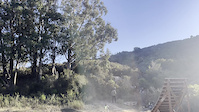
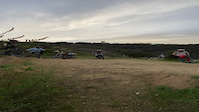
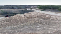
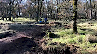
SaveBelmont is a small, mostly residential city in San Mateo county. Its notability for mountain biking lies in a little gem of a park called Waterdog Lake Park (often also referring to the adjoining Hidden Valley Open Space Preserve). Many of the trails in this park have been built and maintained by mountain bikers, lending to a surprisingly dense and interesting trail network for such a small area.
Activities Click to view
- Mountain Bike
74 trails
- E-Bike
22 trails
- Hike
72 trails
- Trail Running
72 trails
Region Details
- 19
- 16
- 24
- 8
- 4
- 1
Region Status
Open as of May 9, 2024Stats
- Avg Trail Rating
- Trails (view details)
- 83
- Trails Mountain Bike
- 74
- Trails E-Bike
- 22
- Trails Horse
- 2
- Trails Hike
- 72
- Trails Trail Running
- 72
- Trails Observed Trials
- 2
- Total Distance
- 48 miles
- Total Descent Distance
- 22 miles
- Total Descent
- 9,999 ft
- Total Vertical
- 1,254 ft
- Highest Trailhead
- 1,388 ft
- Reports
- 2,554
- Photos
- 617
- Ridden Counter
- 18,164
Sub Regions
-
Carlmont Hills
- 1
- 2
- 3
- 4
- 1
-
Sugarloaf Mountain
- 7
- 7
- 5
-
Waterdog Lake Park
- 7
- 12
Popular Belmont Mountain Biking Trails
Belmont Mountain Bike Routes
| title | rating | distance |
|---|---|---|
| Waterdog Complete Loop | 7 miles | |
| The Waterdog Tour | 10 miles | |
| Full loop from the very top | 8 miles | |
| Waterdog with LoL Trail | 7 miles | |
| Hidden Canyon (own) | 2 miles | |
| Water Dog to Jack Daniels Loop | 6 miles | |
| Water Dog Tour de Force | 9 miles | |
| Sugarloaf All Trail Loop | 12 miles | |
| Creek Trail Access | 568 ft | |
| 8 mile Waterdog Lake Park All-Mountain Ride | popular ridelog | 8 miles |
Photos of Belmont Mountain Bike
trail: Utter Delight
32 |
Mar 17, 2024 @ 7:47pm
Mar 17, 2024
trail: Belmont Edge Trail
30 |
Dec 3, 2023 @ 11:57pm
Dec 3, 2023
trail: Carlmont Main Trail
27 |
Nov 30, 2023 @ 10:47am
Nov 30, 2023
trail: Belmont Edge Trail
27 |
Nov 26, 2023 @ 8:08pm
Nov 26, 2023
trail: Carlmont Main Trail
364 |
Dec 27, 2017 @ 2:21pm
Dec 27, 2017
trail: Carlmont Main Trail
729 |
Feb 14, 2016 @ 8:02pm
Feb 14, 2016
trail: DMC
1,134 | | 5 comments
Dec 27, 2010 @ 2:06am
Dec 27, 2010
trail: DMC
674 | | 4 comments
Oct 25, 2009 @ 9:36am
Oct 25, 2009Videos of Belmont Mountain Bike
trail: Carlmont Main Trail
49 |
Jan 17, 2024

trail: Keiths's Creative Line
907 |
Jan 2, 2022
trail: Keiths's Creative Line
|
Jan 2, 2022

trail: Keiths's Creative Line
|
Jan 2, 2022

trail: Keiths's Creative Line
|
Nov 28, 2021
trail: Jack Daniels
|
Oct 17, 2021
trail: Carlmont Main Trail
215 |
Jun 28, 2021
trail: Gravity
0:17 |
251 |
Dec 22, 2019
Recent Trail Reports
| status | trail | date | condition | info | user |
|---|---|---|---|---|---|
| Ensatina Trail | May 9, 2024 @ 1:59pm May 9, 2024 | Variable | asdghhh | ||
| Labor of Love | May 9, 2024 @ 1:59pm May 9, 2024 | Variable | asdghhh | ||
| Lake Road Trail | May 9, 2024 @ 1:59pm May 9, 2024 | Variable | asdghhh | ||
| John Brooks Trail | May 9, 2024 @ 1:59pm May 9, 2024 | Variable | asdghhh | ||
| Upper Lake Road Trail | May 5, 2024 @ 9:38am May 5, 2024 | Ideal | OTBhotdog | ||
| Carlmont Connector | May 5, 2024 @ 3:39pm May 5, 2024 | Ideal | shill WDOSS | ||
| Rambler Trail | May 5, 2024 @ 3:39pm May 5, 2024 | Ideal | shill WDOSS | ||
| Ohlone Trail | May 5, 2024 @ 3:39pm May 5, 2024 | Ideal | shill WDOSS | ||
| Chaparral Trail | May 5, 2024 @ 3:39pm May 5, 2024 | Ideal | shill WDOSS | ||
| Fox School Trail | May 5, 2024 @ 3:39pm May 5, 2024 | Variable | shill WDOSS |
Activity Feed
| username | action | type | title | date |
|---|---|---|---|---|
| amirh1 | add | video | activity #52617245 and 1 more | May 14, 2024 @ 7:40pm May 14, 2024 |
| FzYzOG | wishlist | region | activity #52395591 | May 10, 2024 @ 8:45pm May 10, 2024 |
| asdghhh | add | report | activity #52331985 and 3 more | May 9, 2024 @ 2:00pm May 9, 2024 |
| Vv2O9hvM | wishlist | route | activity #52299990 | May 8, 2024 @ 10:22pm May 8, 2024 |
| OTBhotdog | add | report | activity #52176536 and 1 more | May 6, 2024 @ 9:24am May 6, 2024 |
Recent Comments
| username | type | title | comment | date |
|---|---|---|---|---|
| trail | Not really a ‘double black’, in my... | Apr 7, 2024 @ 1:50am Apr 7, 2024 | ||
| trail | This trail is one of the last to dry out in... | Apr 3, 2024 @ 4:36pm Apr 3, 2024 | ||
| trail | Many trails in WD benefit from having a bell... | Apr 3, 2024 @ 4:30pm Apr 3, 2024 | ||
| trail | Trail is open | Mar 10, 2024 @ 4:51pm Mar 10, 2024 | ||
| trail | Open again! | Nov 25, 2023 @ 2:14pm Nov 25, 2023 |
Local Badges
-

Climbing 10k Badge174 awarded -

Big Ride 30k2,449 awarded -

Top 10 Trails17 awarded -

Climbing 100k Badge5 awarded -

Epic Ride Climb 2k34 awarded -

Epic Ride Descent 2k33 awarded
Activity Type Stats
| activitytype | trails | distance | descent | descent distance | total vertical | rating | global rank | state rank | photos | reports | routes | ridelogs |
|---|---|---|---|---|---|---|---|---|---|---|---|---|
| Mountain Bike | 74 | 42 miles | 9,222 ft | 20 miles | 1,240 ft | #350 | #188 | 616 | 2,554 | 9 | 23,112 | |
| E-Bike | 22 | 16 miles | 3,307 ft | 8 miles | 1,148 ft | #202 | #69 | 2,233 | 3 | 1,306 | ||
| Horse | 2 | 2 miles | 98 ft | 4,524 ft | 95 ft | #371 | #215 | 193 | ||||
| Hike | 72 | 43 miles | 7,595 ft | 18 miles | 1,253 ft | #292 | #178 | 1 | 2,472 | 915 | ||
| Trail Running | 72 | 43 miles | 7,595 ft | 18 miles | 1,253 ft | #293 | #178 | 2,471 | 440 | |||
| Observed Trials | 2 | 2 miles | 272 ft | 3,862 ft | 262 ft | 2 |
- By canadaka
 Trailforks & contributors
 - Admins: CTC, shill, spokesmanmtb, CMB
- #7225 - 8,632 views
- belmont activity log | embed map of Belmont mountain bike trails | belmont mountain biking points of interest
Downloading of trail gps tracks in kml & gpx formats is enabled for Belmont.
You must login to download files.