
close
3D
Trail Conditions
- Unknown
- Snow Groomed
- Snow Packed
- Snow Covered
- Snow Cover Partial
- Freeze/thaw Cycle
- Icy
- Prevalent Mud
- Wet
- Variable
- Ideal
- Dry
- Very Dry
Trail Flow (Ridden Direction)
Trailforks scans users activity logs to determine the most popular direction each trail is ridden. A good flowing trail network will have most trails flowing in a single direction according to their intension.
The colour categories are based on what percentage of users are riding a trail in its intended direction.
The colour categories are based on what percentage of users are riding a trail in its intended direction.
- > 96%
- > 90%
- > 80%
- > 70%
- > 50%
- < 50%
- bi-directional trail
- no data
Trail Last Used
Trailforks scans activity logs to determine the last time a trail was ridden.
- < 2 days
- < 1 week
- < 2 weeks
- < 1 month
- < 6 months
- > 6 months
Trail Ridden Direction
The intended direction a trail should be ridden.
- Downhill Only
- Downhill Primary
- Both Directions
- Uphill Primary
- Uphill Only
- One Direction
Contribute Details
Colors indicate trail is missing specified detail.
- Description
- Photos
- Description & Photos
- Videos
Trail Popularity ?
Trailforks scans activity logs to determine which trails are ridden the most in the last 9 months.
Trails are compared with nearby trails in the same city region with a possible 25 colour shades.
Think of this as a heatmap, more activities = more kinetic energy = warmer colors.
- most popular
- popular
- less popular
- not popular
ATV/ORV/OHV Filter
Max Vehicle Width
inches
US Cell Coverage
Legend

Radar Time
Activity Recordings
Trailforks uses anonymized public activity data.
?
Activity Recordings
Trailforks uses anonymized public activity data.
?
Winter Trails
Warning
A routing network for winter maps does not exist. Selecting trails using the winter trails layer has been disabled.
Missing Trails
Most Popular
Least Popular
Trails are colored based on popularity. The more popular a trail is, the more red. Less popular trails trend towards green.
Jump Magnitude Heatmap
Heatmap of where users jump on trails. Zoom in to see individual jumps, click circles to view jump details.
BC Backroad Status
![map legend]()
Service Road Atlas is a free to use, community-driven service for viewing and creating reports on the numerous back-country service roads around B.C. and Alberta.

Slope Aspect
Direction the slope faces
Trails Deemphasized
Trails are shown in grey.
Only show trails with no bike usage.
Suggested Layers
Based on selected activity type
Save the current map location and zoom level as your default home location whenever this page is loaded.
SaveBrezno trails and routes are listed on Trailforks with interactive trail maps, difficulty ratings, photos, and user-reported trail conditions. The Trailforks community has shared hundreds of photos from this region. Supported activity types include Mountain Biking, E-Biking, Hiking, Trail Running, Gravel Biking, Adaptive Biking and Winter Fat Biking. Scenery includes alpine terrain. Common trail features include jumps, berms and drops. Popular destinations include Jasna Low Tatras, Mýto pod Ďumbierom Bikepark and Ski Čierny Balog.
This is an auto-generated description of Brezno.
Login or register to submit a custom description.
Trail info last updated
Activities Click to view
- Mountain Bike
25 trails
- E-Bike
25 trails
- Gravel Bike
9 trails
- Adaptive Bike
8 trails
- Winter Fat Bike
6 trails
- Hike
23 trails
- Trail Running
21 trails
Region Details
- 8
- 4
- 8
- 4
- 1
Region Status
Caution as of Jul 17, 2026Stats
- Avg Trail Rating
- Trails (view details)
- 86
- Trails Mountain Bike
- 25
- Trails E-Bike
- 25
- Trails Gravel Bike
- 9
- Trails Adaptive Bike
- 8
- Trails Winter Fat Bike
- 6
- Trails Horse
- 1
- Trails Hike
- 23
- Trails Trail Running
- 21
- Trails Dirtbike/Moto
- 1
- Trails Downhill Ski
- 48
- Total Distance
- 91 miles
- Total Descent
- 51,074 ft
- Total Vertical
- 5,280 ft
- Highest Trailhead
- 6,610 ft
- Reports
- 80
- Photos
- 133
- Completed Counter
- 1,813
Sub Regions
-
Čertovica
- 1
-
Kráľova Hoľa
-
Mýto pod Ďumbierom Bikepark
- 2
- 2
Popular Brezno Mountain Biking Trails
• 70 ★ 5.0 • 1,821 ft • 4 ft • 72 •
Popular blue difficulty singletrack. This mountain bike primary trail can be used downhill only. It features berm and jump. On average it takes 2 minutes to complete this trail.
• 90 ★ 4.0 • 3,268 ft • 16 ft • 54 •
Popular black diamond difficulty singletrack. This mountain bike primary trail can be used downhill only. On average it takes 11 minutes to complete this trail.
• 100 ★ 4.0 • 2 miles • 32 ft • 44 •
Popular red difficulty singletrack. This mountain bike primary trail. It features berm, bridge, drop, jump, rock garden, roller coaster and skinny. Exposure: High Risk of Serious Injury. Trail visibility is always easy to follow. On average it takes 9 minutes to complete this trail.
• 80 ★ 0.0 • 4,161 ft • 0 ft • 32 •
Popular blue difficulty singletrack. This mountain bike primary trail can be used downhill primary. It features berm, jump and gap jump. On average it takes 2 minutes to complete this trail.
• 5 ★ 4.5 • 2 miles • 80 ft • 22 •
Less popular blue difficulty singletrack. This mountain bike primary trail can be used downhill only. On average it takes 23 minutes to complete this trail.
• 5 ★ 0.0 • 1 mile • 4 ft • 13 •
Less popular green difficulty singletrack. This mountain bike primary trail can be used both directions. It features berm. On average it takes 9 minutes to complete this trail.
• 55 ★ 4.0 • 2 miles • 7 ft • 6 •
Moderately popular blue difficulty singletrack. This multi-use trail can be used both directions and has a moderate overall physical rating with a 7 ft blue climb. It features jump. Trail visibility is always easy to follow. On average it takes 10 minutes to complete this trail.
Brezno Mountain Bike Routes
26 miles • 2,858 ft • 0 • Loop •
Neopakovateľné výhľady na blízke a ďaleké okolie Veporských vrchov a Horehronia, nespočetné...
★ 5.0 • 23 miles • 4,318 ft • 7 • Race •
Trasa 4. kola Slovenskeho Pohara v Endure 2019 pre kategórie Hobby Občerstvovacia stanica sa bude...
19 miles • 3,377 ft • 8 • Race •
Trasa 4. kola Slovenskeho Pohara v Endure 2019 pre kategórie Hobby Občerstvovacia stanica sa bude...
19 miles • 6,069 ft • 10 • Race •
MSR Enduro + EWS Gold Qualifier Mýto pod Ďumbierom 2021
20 miles • 6,148 ft • 10 • Race •
MSR Enduro + EWS Gold Qualifier Mýto pod Ďumbierom 2021 Kategória Race
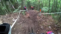
Photos of Brezno Mountain Bike
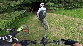
Videos of Brezno Mountain Bike

Recent Trail Reports
| status | trail | date | condition | info | user |
|---|---|---|---|---|---|
| RS 2 Kota - Rit 2018 | Apr 23, 2026 @ 12:35am (Europe/Bratislava) Apr 22, 2026 | Variable | KuraciaBageta | ||
| RS 3 Bernardin - Valaska 2018 | Apr 23, 2026 @ 12:34am (Europe/Bratislava) Apr 22, 2026 | Dry | KuraciaBageta | ||
| RS 1 Hnusne - Svaty Jan 2018 | Mar 7, 2026 @ 8:35pm (Europe/Bratislava) Mar 7, 2026 | Ideal | KuraciaBageta | ||
| Kralova Hola | Jul 16, 2025 @ 7:38am Jul 16, 2025 | Dry | Deafman | ||
| RS1 Myto21 Enduro | Jul 6, 2025 @ 6:34am Jul 6, 2025 | Very Dry | Deafman | ||
| FREERIDE 2 TRAIL MYTO vrch | Jul 6, 2025 @ 10:42am Jul 6, 2025 | Very Dry | Deafman | ||
| Lift | Jul 6, 2025 @ 10:42am Jul 6, 2025 | Ideal | Deafman | ||
| Transfer 5 Race | Oct 12, 2024 @ 9:16am Oct 12, 2024 | Prevalent Mud | katko | ||
| RS3 Rampage | Oct 12, 2024 @ 11:48am Oct 12, 2024 | Variable | katko | ||
| Transfer 1 Myto21 | Oct 12, 2024 @ 11:48am Oct 12, 2024 | Ideal | katko |
Activity Feed
| username | action | type | title | date |
|---|---|---|---|---|
| JaromirYfDUSx | wishlist | trail | activity #103931493 | Sep 16, 2026 @ 11:29am Sep 16, 2026 |
| pekko | add | report | activity #99533484 and 1 more | Jul 19, 2026 @ 8:11am Jul 19, 2026 |
| Batovetraily | ridden | trail | activity #99438425 and 2 more | Jul 18, 2026 @ 5:57am Jul 18, 2026 |
| MichalgV1q0m | ridden | trail | activity #93945905 | May 3, 2026 @ 7:39am May 3, 2026 |
| KuraciaBageta | add | report | activity #93176416 and 1 more | Apr 22, 2026 @ 3:34pm Apr 22, 2026 |
Recent Comments
| username | type | title | comment | date |
|---|---|---|---|---|
| trail | nesedí značenie na Tralforks-modrá???... | Jul 7, 2023 @ 9:31am Jul 7, 2023 | ||
| trail | mega nadherny singlac | Jul 29, 2021 @ 12:51pm Jul 29, 2021 | ||
| trail | Tusi niekto v akom stave su momentalne tieto... | Jul 27, 2021 @ 12:51pm Jul 27, 2021 | ||
| report | Určite nie Červená ... toto je ledva Modrá :D | Apr 5, 2019 @ 11:49pm Apr 5, 2019 |
Local Badges
-

Epic Ride Climb 2k204 awarded -

Climbing 10k Badge33 awarded -

Climbing 100k Badge3 awarded -

Epic Ride Descent 2k204 awarded -

Descent 10k Badge37 awarded -

Descent 100k Badge4 awarded
Bike & Skill Parks
| name | type | city | rating |
|---|---|---|---|
| Mýto pod Ďumbierom Bikepark | bike park | Brezno |
Activity Type Stats
| activitytype | trails | distance | descent | descent distance | total vertical | rating | global rank | state rank | photos | reports | routes | activity logs |
|---|---|---|---|---|---|---|---|---|---|---|---|---|
| Mountain Bike | 25 | 40 miles | 12,746 ft | 18 miles | 5,003 ft | #2,058 | #24 | 132 | 80 | 7 | 3,086 | |
| E-Bike | 25 | 44 miles | 13,442 ft | 19 miles | 5,279 ft | #1,412 | #13 | 79 | 2 | 388 | ||
| Gravel Bike | 9 | 26 miles | 2,421 ft | 5 miles | 5,003 ft | #587 | #18 | 9 | 3 | |||
| Adaptive Bike | 8 | 21 miles | 2,408 ft | 5 miles | 4,695 ft | #744 | #22 | 17 | ||||
| Winter Fat Bike | 6 | 13 miles | 4,728 ft | 6 miles | 3,301 ft | #419 | #17 | 3 | ||||
| Horse | 1 | 5 miles | 13 ft | 1,283 ft | 1,040 ft | 2 | ||||||
| Hike | 23 | 45 miles | 19,478 ft | 26 miles | 5,279 ft | #2,004 | #23 | 67 | 832 | |||
| Trail Running | 21 | 42 miles | 17,805 ft | 24 miles | 5,279 ft | #1,709 | #21 | 63 | 38 | |||
| Dirtbike/Moto | 1 | 2,874 ft | 456 ft | 2,746 ft | 456 ft | 2 | ||||||
| Downhill Ski | 48 | 25 miles | 23,281 ft | 24 miles | 4,711 ft | 416 |
Frequently Asked Questions
▼
What are the best places to ride in Brezno?
Brezno has 12 areas to explore for mountain biking. The top rated areas are:
▼
What are the highest rated mountain biking trails in Brezno?
The highest rated mountain biking trails in Brezno are:
- FREERIDE 2 TRAIL MYTO vrch (4.1/5)
- Tri mosty (4.1/5)
- RS2 Myto21 Skalka (4.1/5)
- Lazná Trail (4.1/5)
- RS 1 Hnusne - Svaty Jan 2018 (4.1/5)
▼
What is the best time of the year to ride in Brezno?
Based on activity log data, the most popular months to ride in Brezno are:
- July (32 activities)
- September (30 activities)
- August (28 activities)
▼
Where can I park to ride in Brezno?
There are 2 parking locations listed in Brezno. The most popular parking spots are:
▼
What is the longest trail in Brezno?
The longest trail in Brezno is Zjazd spod Králičky do Jarabej at 2.4 miles. View all trails sorted by distance.
▼
What are the best & highest rated hiking trails in Brezno?
The best hiking trails in Brezno are: View all hiking trails sorted by popularity score.
▼
What are the best & highest rated trail running trails in Brezno?
The best trail running trails in Brezno are: View all trail running trails sorted by popularity score.
▼
How many trails are in Brezno?
Brezno has a total of 86 trails. Of those, 25 are designated for mountain biking. Browse top mountain biking trails in Brezno to find detailed information including difficulty ratings, distances, and trail conditions.
▼
Which trail has the most elevation gain in Brezno?
The trail with the most elevation gain in Brezno is Zjazd spod Králičky do Jarabej with 313 ft of elevation gain. View all trails sorted by elevation gain.
▼
Which trail has the most elevation descent in Brezno?
The trail with the most elevation descent in Brezno is RS2 Myto21 Skalka with 1,436 ft of elevation descent. View all trails sorted by elevation descent.
▼
What activities are most popular in Brezno?
Brezno supports the following activities: Mountain Biking, E-Biking, Gravel Biking, Adaptive Biking, Winter Fat Biking, Hiking, Trail Running.
▼
Are the trails open in Brezno?
The overall region status for Brezno is Minor Issue / Yellow. Out of 30 trails:
- Clear / Green: 24
- Minor Issue / Yellow: 3
- Closed: 3
▼
Can I ride an ebike in Brezno?
Yes, Brezno supports e-bike riding. There are 32 trails in Brezno that allow e-bikes. Check the e-bike trails listing for specific trail access details and any local regulations.
▼
What are the most popular mountain biking routes in Brezno?
The most popular mountain biking routes in Brezno are: View all mountain biking routes in Brezno.
▼
What type of bike is most common in Brezno?
Based on activity log data, the most common bike types used in Brezno are:
- AM (6 activities)
▼
What is the highest summit in Brezno?
The highest summit in Brezno is Ďumbier at 6,637 ft elevation.
▼
What are the most popular Strava Segments in Brezno?
The most popular Strava segments in Brezno are:
- krizovatka P.pole - chata (7,258 athletes)
- posledne kilometre po hribik (6,982 athletes)
- KH asfalt Horal 2016 (6,855 athletes)
▼
What trails are closed in Brezno?
There are currently 3 closed trails in Brezno. The breakdown of all trail statuses is:
- Clear / Green: 24
- Minor Issue / Yellow: 3
- Closed: 3
▼
Are there accessible or adaptive trails in Brezno?
Yes, there are 12 accessible/adaptive trails in Brezno. View all adaptive trails in Brezno for specific accessibility information.
▼
What are the most popular mountain biking trails in Brezno?
The most popular mountain biking trails in Brezno are: View all mountain biking trails sorted by popularity.
▼
What are the best beginner ride trails in Brezno?
The best beginner mountain biking trails in Brezno are:
- Tri mosty (5/5)
- Zjazd spod Králičky do Jarabej (0/5)
- FAMILY TRAIL MYTO (0/5)
Activities
Trails
Points of Interest
- By jxxw
 TRAILFORKS & contributors
- Admins: jxxw
- #25673 - 4,903 views
- brezno activity log | embed map of Brezno mountain bike trails | brezno mountain biking points of interest
Downloading of trail gps tracks in kml & gpx formats is enabled for Brezno.
You must login to download files.
