
close
3D
Trail Conditions
- Unknown
- Snow Groomed
- Snow Packed
- Snow Covered
- Snow Cover Partial
- Freeze/thaw Cycle
- Icy
- Prevalent Mud
- Wet
- Variable
- Ideal
- Dry
- Very Dry
Trail Flow (Ridden Direction)
Trailforks scans users activity logs to determine the most popular direction each trail is ridden. A good flowing trail network will have most trails flowing in a single direction according to their intension.
The colour categories are based on what percentage of users are riding a trail in its intended direction.
The colour categories are based on what percentage of users are riding a trail in its intended direction.
- > 96%
- > 90%
- > 80%
- > 70%
- > 50%
- < 50%
- bi-directional trail
- no data
Trail Last Used
Trailforks scans activity logs to determine the last time a trail was ridden.
- < 2 days
- < 1 week
- < 2 weeks
- < 1 month
- < 6 months
- > 6 months
Trail Ridden Direction
The intended direction a trail should be ridden.
- Downhill Only
- Downhill Primary
- Both Directions
- Uphill Primary
- Uphill Only
- One Direction
Contribute Details
Colors indicate trail is missing specified detail.
- Description
- Photos
- Description & Photos
- Videos
Trail Popularity ?
Trailforks scans activity logs to determine which trails are ridden the most in the last 9 months.
Trails are compared with nearby trails in the same city region with a possible 25 colour shades.
Think of this as a heatmap, more activities = more kinetic energy = warmer colors.
- most popular
- popular
- less popular
- not popular
ATV/ORV/OHV Filter
Max Vehicle Width
inches
US Cell Coverage
Legend

Radar Time
Activity Recordings
Trailforks uses anonymized public activity data.
?
Activity Recordings
Trailforks uses anonymized public activity data.
?
Winter Trails
Warning
A routing network for winter maps does not exist. Selecting trails using the winter trails layer has been disabled.
Missing Trails
Most Popular
Least Popular
Trails are colored based on popularity. The more popular a trail is, the more red. Less popular trails trend towards green.
Jump Magnitude Heatmap
Heatmap of where users jump on trails. Zoom in to see individual jumps, click circles to view jump details.
BC Backroad Status
![map legend]()
Service Road Atlas is a free to use, community-driven service for viewing and creating reports on the numerous back-country service roads around B.C. and Alberta.

Slope Aspect
Direction the slope faces
Trails Deemphasized
Trails are shown in grey.
Only show trails with no bike usage.
Suggested Layers
Based on selected activity type
Save the current map location and zoom level as your default home location whenever this page is loaded.
SaveBronchales es una localidad y municipio situado en la Sierra de Albarracín al suroeste de la provincia de Teruel, en la Comunidad Autónoma de Aragón (España). Tiene un área de 59,60 km² con una población de 417 habitantes (INE 2016) y una densidad de 6,99 hab/km².
Es conocido por su masa de pinares (uno de los mejores conservados del país), lo que hace que se erija como centro vacacional para numerosas familias, tanto de la propia comunidad de Aragón, como de la vecina Valencia. También es conocido por tener en sus cercanías un singular acuífero de cuarcitas rosas.
Se encuentra a 1.569 metros de altura sobre el nivel del mar, siendo uno de los pueblos más altos de España. En sus parajes podemos encontrar gran cantidad de fuentes naturales, cuyas aguas son de reconocida calidad y extraordinarias propiedades.
Es conocido por su masa de pinares (uno de los mejores conservados del país), lo que hace que se erija como centro vacacional para numerosas familias, tanto de la propia comunidad de Aragón, como de la vecina Valencia. También es conocido por tener en sus cercanías un singular acuífero de cuarcitas rosas.
Se encuentra a 1.569 metros de altura sobre el nivel del mar, siendo uno de los pueblos más altos de España. En sus parajes podemos encontrar gran cantidad de fuentes naturales, cuyas aguas son de reconocida calidad y extraordinarias propiedades.
source: Bronchales
This region uses the Uk/Euro style trail grading system.
Trail info last updated
Activities Click to view
- Mountain Bike
249 trails
- E-Bike
249 trails
- Gravel Bike
98 trails
- Adaptive Bike
5 trails
- Horse
17 trails
- Hike
253 trails
- Trail Running
253 trails
Region Details
- 123
- 34
- 80
- 12
Region Status
Open as of Nov 2, 2026Stats
- Avg Trail Rating
- Trails (view details)
- 253
- Trails Mountain Bike
- 249
- Trails E-Bike
- 249
- Trails Gravel Bike
- 98
- Trails Adaptive Bike
- 5
- Trails Winter Fat Bike
- 10
- Trails Horse
- 17
- Trails Hike
- 253
- Trails Trail Running
- 253
- Total Distance
- 287 miles
- Total Descent Distance
- 132 miles
- Total Descent
- 47,045 ft
- Total Vertical
- 2,957 ft
- Highest Trailhead
- 6,345 ft
- Reports
- 315
- Photos
- 51
- Completed Counter
- 4,005
Popular Bronchales Mountain Biking Trails
• 95 ★ 4.0 • 1 mile • 376 ft • 46 •
Popular blue difficulty singletrack. This multi-use trail can be used both directions. On average it takes 13 minutes to complete this trail.
• 100 ★ 5.0 • 2,411 ft • 0 ft • 43 •
Popular blue difficulty singletrack. This multi-use trail can be used downhill primary. On average it takes 3 minutes to complete this trail.
• 95 ★ 4.0 • 4,951 ft • 16 ft • 41 •
Popular red difficulty singletrack. This multi-use trail can be used both directions. On average it takes 9 minutes to complete this trail.
• 100 ★ 4.5 • 2,969 ft • 0 ft • 41 •
Popular blue difficulty singletrack. This multi-use trail can be used downhill primary. On average it takes 2 minutes to complete this trail.
• 95 ★ 4.0 • 2,733 ft • 0 ft • 41 •
Popular green difficulty singletrack. This multi-use trail can be used downhill primary. Trail visibility is always easy to follow. On average it takes 4 minutes to complete this trail.
• 90 ★ 4.4 • 1,781 ft • 2 ft • 37 •
Sendero de bajada flow, con tramo de raices en escalón, divertido. De subida muy duro
• 100 ★ 0.0 • 1,716 ft • 66 ft • 36 •
Popular green difficulty singletrack. This multi-use trail can be used both directions. On average it takes 3 minutes to complete this trail.
• 95 ★ 5.0 • 2,185 ft • 3 ft • 35 •
Popular blue difficulty singletrack. This multi-use trail can be used both directions. On average it takes 1 minutes to complete this trail.
Bronchales Mountain Bike Routes
★ 5.0 • 27 miles • 5,100 ft • 19 • Loop •
Ruta con las mejores bajadas de Bronchales, tirando a All Mountain/Enduro. Fisicamente exigente. Hay...
46 miles • 7,518 ft • 13 •
Segunda etapa de la carrera por etapas Berrea Bike Race, edición año 2021. Esta carrera se disputa en...
43 miles • 8,165 ft • 26 •
Ruta para ciclistas expertos, muy larga, en terreno despoblado y técnicamente algo difícil.
12 miles • 2,176 ft • 5 •
Primera etapa de la carrera por etapas Berrea Bike Race, edición año 2021. Esta carrera se disputa en...
43 miles • 6,946 ft • 5 • Loop •
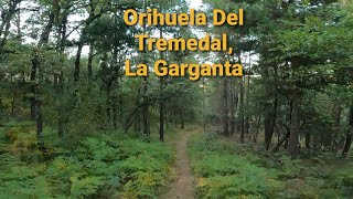
Etapa 2 de la Berrea Bike Race de 2022, con salida y llegada en Orihuela Del Tremedal.
31 miles • 4,849 ft • 8 • Loop •
Etapa 3 de la Berrea Bike Race (BBR) de 2022. Salida y llegada en Griegos.
Photos of Bronchales Mountain Bike
Videos of Bronchales Mountain Bike
Recent Trail Reports
National Scenic Trails & Official Routes
-
Montañas Vacías
- Mountain Bike
- Hike
Activity Feed
| username | action | type | title | date |
|---|---|---|---|---|
| Kalamarrrrrdo | update | trail | activity #107478412 | Nov 9, 2026 @ 1:49am Nov 9, 2026 |
| Kalamarrrrrdo | update | trail | activity #107331671 and 1 more | Nov 7, 2026 @ 2:41am Nov 7, 2026 |
| JorgeCI | add | report | activity #107068990 and 5 more | Nov 2, 2026 @ 7:28am Nov 2, 2026 |
| JorgeCI | add | photo | activity #106596378 | Oct 25, 2026 @ 1:59pm Oct 25, 2026 |
| JorgeCI | comment | trail | activity #106546993 | Oct 25, 2026 @ 2:34am Oct 25, 2026 |
Recent Comments
| username | type | title | comment | date |
|---|---|---|---|---|
| trail | La senda sí es ciclable... bajada endurera y... | Oct 25, 2026 @ 2:34am Oct 25, 2026 | ||
| trail | hecho de subida, de bajada tiene que ser una... | May 30, 2026 @ 10:42am May 30, 2026 | ||
| trail | una gozada de sendero de flow | May 30, 2026 @ 10:40am May 30, 2026 | ||
| trail | muy flow y muy rápida hasta casi el final | May 30, 2026 @ 7:04am May 30, 2026 | ||
| trail | salvo el principio desde la caseta del guarda... | May 30, 2026 @ 6:59am May 30, 2026 |
Local Badges
-

Epic Mountain Bike Climb 2k71 awarded -

Climbing 10k Badge8 awarded -

Mountain Biking 100k Badge0 awarded -

Epic Ride Descent 2k71 awarded -

Descent 10k Badge8 awarded -

Descent 100k Badge0 awarded
Activity Type Stats
| activitytype | trails | distance | descent | descent distance | total vertical | rating | global rank | state rank | photos | reports | routes | activity logs |
|---|---|---|---|---|---|---|---|---|---|---|---|---|
| Mountain Bike | 249 | 283 miles | 46,634 ft | 131 miles | 2,956 ft | #893 | #109 | 49 | 315 | 12 | 1,131 | |
| E-Bike | 249 | 283 miles | 46,634 ft | 131 miles | 2,956 ft | #392 | #149 | 315 | 11 | 93 | ||
| Gravel Bike | 98 | 159 miles | 14,298 ft | 61 miles | 2,690 ft | #379 | #73 | 20 | 1 | 31 | ||
| Adaptive Bike | 5 | 3 miles | 482 ft | 1 mile | 1,211 ft | #4,378 | #253 | |||||
| Winter Fat Bike | 10 | 10 miles | 1,125 ft | 3 miles | 1,512 ft | #7,569 | #337 | |||||
| Horse | 17 | 45 miles | 3,438 ft | 15 miles | 1,385 ft | #1,238 | #93 | 20 | ||||
| Hike | 253 | 287 miles | 47,044 ft | 132 miles | 2,956 ft | #351 | #83 | 1 | 315 | 11 | 174 | |
| Trail Running | 253 | 287 miles | 47,044 ft | 132 miles | 2,956 ft | #432 | #99 | 315 | 55 |
Frequently Asked Questions
▼
What are the highest rated mountain biking trails in Bronchales?
The highest rated mountain biking trails in Bronchales are:
- Loma Negradela (4.2/5)
- La Garganta (4.2/5)
- La Umbría (4.1/5)
- Fuente del Cura (4.1/5)
- Senda Santuario Sup. (4.1/5)
▼
Where can I park to ride in Bronchales?
There are 1 parking locations listed in Bronchales. The most popular parking spots are:
▼
What is the longest trail in Bronchales?
The longest trail in Bronchales is Orea - Campamento Escolapios at 4.3 miles. View all trails sorted by distance.
▼
What are the best & highest rated hiking trails in Bronchales?
The best hiking trails in Bronchales are:
- Peña Del Cervero
- Era Carrasco - Fuente del Canto Inferior
- La Garganta
- Senda Santuario Inf.
- Era Carrasco - Fuente del Canto Superior
▼
What are the best & highest rated trail running trails in Bronchales?
The best trail running trails in Bronchales are: View all trail running trails sorted by popularity score.
▼
How many trails are in Bronchales?
Bronchales has a total of 253 trails. Of those, 249 are designated for mountain biking. Browse top mountain biking trails in Bronchales to find detailed information including difficulty ratings, distances, and trail conditions.
▼
Which trail has the most elevation gain in Bronchales?
The trail with the most elevation gain in Bronchales is Orea - Campamento Escolapios with 524 ft of elevation gain. View all trails sorted by elevation gain.
▼
Which trail has the most elevation descent in Bronchales?
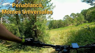
The trail with the most elevation descent in Bronchales is Peñablanca with 1,107 ft of elevation descent. View all trails sorted by elevation descent.
▼
What activities are most popular in Bronchales?
Bronchales supports the following activities: Mountain Biking, E-Biking, Gravel Biking, Adaptive Biking, Horseback, Hiking, Trail Running.
▼
What are the steepest mountain biking trails in Bronchales?
The steepest mountain biking trail in Bronchales is Campamento Juvenil - Senda Santuario with an average grade of 11.6%. View all trails sorted by grade.
▼
Are there any trails with scenic viewpoints in Bronchales?
Yes, there are 2 scenic viewpoints marked along trails in Bronchales. Some popular viewpoints include: Explore more points of interest to find trails with the best views.
▼
Are the trails open in Bronchales?
The overall region status for Bronchales is Clear / Green. Out of 124 trails:
- Clear / Green: 104
- Minor Issue / Yellow: 14
- Significant Issue / Amber: 4
- Closed: 2
▼
Can I ride an ebike in Bronchales?
Yes, Bronchales supports e-bike riding. There are 252 trails in Bronchales that allow e-bikes. Check the e-bike trails listing for specific trail access details and any local regulations.
▼
What are the most popular mountain biking routes in Bronchales?
The most popular mountain biking routes in Bronchales are: View all mountain biking routes in Bronchales.
▼
What is the highest summit in Bronchales?
The highest summit in Bronchales is Caimodorro at 6,342 ft elevation.
▼
What are the most popular Strava Segments in Bronchales?
The most popular Strava segments in Bronchales are:
- Subida Miradador Portera desde Río Gallo (2,376 athletes)
- Pista mirador de La Portera (2,130 athletes)
- Senda Peña Aguda (1,844 athletes)
▼
What trails are closed in Bronchales?
There are currently 2 closed trails in Bronchales. The breakdown of all trail statuses is:
- Clear / Green: 104
- Minor Issue / Yellow: 14
- Significant Issue / Amber: 4
- Closed: 2
▼
Are there accessible or adaptive trails in Bronchales?
Yes, there are 5 accessible/adaptive trails in Bronchales. View all adaptive trails in Bronchales for specific accessibility information.
▼
What are the most popular mountain biking trails in Bronchales?
The most popular mountain biking trails in Bronchales are: View all mountain biking trails sorted by popularity.
▼
What are the best beginner ride trails in Bronchales?
The best beginner mountain biking trails in Bronchales are:
- El Canto (3/5)
- Atalaya Sur (3/5)
- La Salobreja - Las Hoyas (3/5)
Activities
Trails
Points of Interest
- Caseta/Refugio Cabin
- Caimodorro (1.936 m) Summit
- Sierra Alta (1.854 m) Summit
- Peñablanca (1.857 m) Summit
- Alto del Tremedal (1.853 m) Summit
- Muela de San Juan (1.841 m) Summit
- Loma Negradela (1.811 m) Summit
- Refugio de Matapán Cabin
- Santuario Virgen del Tremedal Viewpoint
- Camping Las Corralizas
- Caimodorro (6,342 ft)
- Caimodorro (6,342 ft)
- Alto del Tremedal (6,211 ft)
- By arlegui & contributors
- Admins: juanx, Kalamarrrrrdo, not-really
- #29144 - 2,592 views
- bronchales activity log | embed map of Bronchales mountain bike trails | bronchales mountain biking points of interest
Downloading of trail gps tracks in kml & gpx formats is enabled for Bronchales.
You must login to download files.
