
more stats
1.2 miles
Distance
9 ft
Climb
-1,107 ft
Descent
00:17:53
Avg time
-1,098 ft
Altitude change
4,978 ft
Altitude min
6,086 ft
Altitude max
6,085 ft
Altitude start
4,987 ft
Altitude end
-16.9%
Grade
-59.8%
Grade max
3.3%
Grade min
561 ft
Distance climb
1 mile
Distance down
00:17:53
Avg time

Peñablanca Details

  • Activities
    • Mountain Bike
    • E-Bike
    • Hike
    • Trail Running
  • Riding Area
  • Difficulty Rating
  • Local Popularity
    40 in Mountain Biking heatmap [+]
    • 75 in E-Biking
    • 5 in Trail Running
    • 5 in Hiking
  • Global Ranking
    #119132 in Mountain Biking [+]
    • #84011 in E-Biking
    • #306257 in Trail Running
    • #75689 in Hiking
  • National Ranking
    #9,669 in Mountain Biking · Spain [+]
    • #16,020 in E-Biking
    • #32,341 in Trail Running
    • #4,470 in Hiking
  • Trail Type
    Singletrack
  • Direction
    Downhill Only
    Popular Direction Shown
  • Dogs Allowed
    Yes
  • eBike Allowed
    Yes up to Class 1

No community description for Peñablanca trail has been added yet!

AI Generated Description

Peñablanca is a 2 km moderately popular red difficulty singletrack trail located near Bronchales. Highlights include a summit. This multi-use trail can be used downhill only. On average it takes 17 minutes to complete this trail.

Tags
Summit

Recent Activity on Trail

Past Week
  • 0 rides
  •  
6 Months
  • 0 rides
  •  
All
  • 2 rides
  • Last: Aug 15, 2026
update trails status or condition

Peñablanca Trail Reports

statusdatedescription
Aug 23, 2026 @ 10:54am (Europe/Madrid)
Aug 23, 2026
reporter Está prácticamente perfecta, con troncos colocados indicando el paso a seguir, el único punto "conflictivo" es el humedal que hay a media...
Aug 23, 2025 @ 12:07pm
Aug 23, 2025
Sí, sigue perdiéndose en la parte inferior. Es una senda muy
Jul 30, 2023 @ 2:29am
Jul 30, 2023
reporter En la parte inferior se pierde un poco la senda.
Aug 30, 2022 @ 12:20am
Aug 30, 2022
En Marzo de 2022 había trabajos de saca de madera en la zona y en un tramo intermedio se perdía el sendero debido al camino que ha creado la...
more »
Status:
on Aug 23, 2026
Ideal
Avg: 4.11 (2 votes)
Your vote: 0

view (8)
close
      Directions to penablanca trailhead (40.463210, -1.668720)

      Photos

      No photos have been added for Peñablanca yet, add a photo.

      Videos

      1 more »
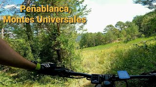
      Peñablanca, Montes Universales
      mtb
      2:57 | 255 | Jul 21, 2022 , Bronchales

      Routes with this trail

      more »
      ★ 5.0 • 27 miles • 5,100 ft • 19 • Loop •
      Ruta con las mejores bajadas de Bronchales, tirando a All Mountain/Enduro. Fisicamente exigente. Hay...
      4.5 ★★★★★
      2 Ratings
      5 ★ 50%
      4 ★ 50%
      3 ★
      2 ★
      1 ★

      1 Review & Comments

      juanx
      Cuesta seguir la traza en algún punto pero tiene tramos realmente espectaculares. Algún tramo con mucha pendiente que en seco cuesta bajar velocidad

      We hope you've been enjoying Trailforks!

      Create a FREE account to view all trail reviews and much more.

      • By KalamarrrrrdoTF Pro TFSPAIN & contributors
      • #332603 - 473 views

      Frequently Asked Questions

      ▼ Where is Peñablanca located?
      Peñablanca is located in Bronchales, Spain. It is part of the Bronchales trail network. The trailhead is located at coordinates 40.46321, -1.66872.
      ▼ How hard is Peñablanca?
      Peñablanca is rated as Red difficulty. The average grade is 16.9%.
      ▼ What is the elevation gain for Peñablanca?
      Peñablanca has 9 ft of elevation gain. The trail has 1,107 ft of elevation descent. The elevation ranges from 4,978 ft to 6,086 ft.
      ▼ Is Peñablanca a point to point trail?
      Yes, Peñablanca is a point to point trail. The direction is Downhill Only. The trail type is singletrack.
      ▼ How long is Peñablanca?
      Peñablanca is 1.2 miles long. The trail type is singletrack.
      ▼ Are dogs allowed on Peñablanca?
      Yes, dogs are allowed on Peñablanca. Please keep dogs on a leash where required and clean up after them.
      ▼ How do I access Peñablanca? Where is the closest parking trailhead?
      The closest parking and trailhead locations to Peñablanca are: View all parking locations in the area.
      ▼ How long does it take to ride Peñablanca?
      Based on recorded activities, it takes an average of 18 minutes to ride Peñablanca. The trail is 1.2 miles long. Actual times will vary based on fitness level, conditions, and pace. View recent activity logs for more details.
      ▼ How busy is Peñablanca?
      Peñablanca is a moderately popular trail. There have been 7 recorded activities on this trail. The trail has received 8 check-ins. View recent activity on this trail.

      Hit the Trail

      Open in App

      Get this trail on your phone instantly.

      open trail in app

      Download Trail

      Save to wishlist, Garmin & download.
      save the trail

      Find Related Routes

      Find routes and users activities that include this trail.
      find routes for this trail

      You must enter a description before submitting.

