close
-
Layers w
- Weather Layers
- Pro
- Pro
- Pro
- Pro
- Pro
- Pro
- More Layers
- Pro
- Pro
- Pro
- Pro
-
Upgrade to

3D
Trail Conditions
- Unknown
- Snow Groomed
- Snow Packed
- Snow Covered
- Snow Cover Partial
- Freeze/thaw Cycle
- Icy
- Prevalent Mud
- Wet
- Variable
- Ideal
- Dry
- Very Dry
Trail Flow (Ridden Direction)
Trailforks scans users ridelogs to determine the most popular direction each trail is ridden. A good flowing trail network will have most trails flowing in a single direction according to their intension.
The colour categories are based on what percentage of riders are riding a trail in its intended direction.
The colour categories are based on what percentage of riders are riding a trail in its intended direction.
- > 96%
- > 90%
- > 80%
- > 70%
- > 50%
- < 50%
- bi-directional trail
- no data
Trail Last Ridden
Trailforks scans ridelogs to determine the last time a trail was ridden.
- < 2 days
- < 1 week
- < 2 weeks
- < 1 month
- < 6 months
- > 6 months
Trail Ridden Direction
The intended direction a trail should be ridden.
- Downhill Only
- Downhill Primary
- Both Directions
- Uphill Primary
- Uphill Only
- One Direction
Contribute Details
Colors indicate trail is missing specified detail.
- Description
- Photos
- Description & Photos
- Videos
Trail Popularity ?
Trailforks scans ridelogs to determine which trails are ridden the most in the last 9 months.
Trails are compared with nearby trails in the same city region with a possible 25 colour shades.
Think of this as a heatmap, more rides = more kinetic energy = warmer colors.
- most popular
- popular
- less popular
- not popular
ATV/ORV/OHV Filter
Max Vehicle Width
inches
US Cell Coverage
Legend

Radar Time
Activity Recordings
Trailforks uses anonymized public activity data.
?
Activity Recordings
Trailforks uses anonymized public activity data.
?
Personal Heatmap
▶
Activity Types
all
/
none
▶
Options
2
Date range
month
–
Winter Trails
Warning
A routing network for winter maps does not exist. Selecting trails using the winter trails layer has been disabled.
Missing Trails
Most Popular
Least Popular
Trails are colored based on popularity. The more popular a trail is, the more red. Less popular trails trend towards green.
Jump Magnitude Heatmap
Heatmap of where riders jump on trails. Zoom in to see individual jumps, click circles to view jump details.
BC Backroad Status
![map legend]()
Service Road Atlas is a free to use, community-driven service for viewing and creating reports on the numerous back-country service roads around B.C. and Alberta.

Slope Aspect
Direction the slope faces
Trails Deemphasized
Trails are shown in grey.
Only show trails with no bike usage.
Suggested Layers
Based on selected activity type
Save the current map location and zoom level as your default home location whenever this page is loaded.
Save
No description for Campan has been added yet!
Login or register to submit one.
This region uses the Uk/Euro style trail grading system.
Activities Click to view
- Mountain Bike
59 trails
- E-Bike
59 trails
- Gravel Bike
18 trails
- Adaptive Bike
12 trails
- Hike
38 trails
- Trail Running
38 trails
Region Details
- 19
- 4
- 9
- 19
- 8
Region Status
Open as of 2 daysStats
- Avg Trail Rating
- Trails (view details)
- 59
- Trails Mountain Bike
- 59
- Trails E-Bike
- 59
- Trails Gravel Bike
- 18
- Trails Adaptive Bike
- 12
- Trails Hike
- 38
- Trails Trail Running
- 38
- Total Distance
- 57 miles
- Total Descent Distance
- 29 miles
- Total Descent
- 25,060 ft
- Total Vertical
- 3,202 ft
- Highest Trailhead
- 5,379 ft
- Reports
- 962
- Photos
- 209
- Ridden Counter
- 7
Sub Regions
-
Payolle bici d'aqui
- 2
- 4
Popular Campan Mountain Biking Trails
• 100 ★ 4.9 • 5,138 ft • 0 ft • 130 •
Premier sentier "historique" dédiée à la pratique de l'enduro en Haute Bigorre. Vous découvrirez un itinéraire où le plaisir de pilotage est à la hauteur de l'ambiance de cette magnifique forêt. Un sentier qui serpente entre les...
• 100 ★ 4.5 • 2 miles • 0 ft • 121 •
Highly rated popular blue difficulty singletrack. This mountain bike primary trail and has a easy overall physical rating. It features berm and jump. Trail visibility is always easy to follow. On average it takes 10 minutes to complete this trail.
• 95 ★ 4.8 • 3,340 ft • 0 ft • 85 •
Un ancien goulet réaménagé pour l'occasion.
• 95 ★ 5.0 • 1,217 ft • 0 ft • 80 •
Popular red difficulty singletrack. This mountain bike primary trail. On average it takes 7 minutes to complete this trail.
• 95 ★ 4.0 • 1,073 ft • 0 ft • 68 •
Popular red difficulty singletrack. This multi-use trail can be used downhill only. On average it takes 1 minutes to complete this trail.
• 90 ★ 4.2 • 1 mile • 0 ft • 66 •
Long, physique et technique, cet itinéraire enduro se découpe en 2 parties. Sur le haut de la piste, c’est le royaume des racines.
• 70 ★ 3.5 • 2,201 ft • 6 ft • 36 •
Sentier assez raide et technique avec un beau passage sur un rocher...
• 55 ★ 5.0 • 1,463 ft • 0 ft • 31 •
Moderately popular black difficulty singletrack. This mountain bike primary trail can be used downhill only. On average it takes 3 minutes to complete this trail.
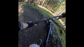
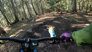
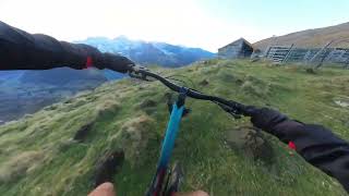
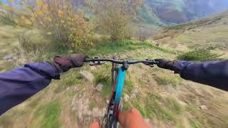
Photos of Campan Mountain Bike
Videos of Campan Mountain Bike
trail: Mirkwood
3:07 |
81 |
Mar 26, 2026 , Campan
trail: L'Amanite
11:28 |
24 |
Mar 9, 2026 , Campan
trail: Ordincèdes
8:33 |
42 |
Jan 6, 2026 , Campan
trail: Ordincèdes
8:33 |
25 |
Nov 6, 2025 , Campan
trail: Mirkwood
13:53 |
97 |
May 24, 2025 , Campan
trail: Racines-land haut
7:07 |
83 |
Mar 10, 2025 , Campan
trail: Mirkwood
4:55 |
67 |
Mar 10, 2025 , Campan
trail: Racines land milieu
3:27 |
61 |
Feb 27, 2025 , Campan
Recent Trail Reports
| status | trail | date | condition | info | user |
|---|---|---|---|---|---|
| Bowl party Upper | Jun 24, 2026 @ 6:34pm (Europe/Paris) 2 days | Ideal | Gus64 | ||
| Mirkwooldy | Jun 21, 2026 @ 10:25pm (Europe/Paris) Jun 21, 2026 | Very Dry | lcoadik | ||
| Racines land milieu | Jun 21, 2026 @ 10:24pm (Europe/Paris) Jun 21, 2026 | Very Dry | lcoadik | ||
| L'amanite partie basse | Jun 21, 2026 @ 10:24pm (Europe/Paris) Jun 21, 2026 | Very Dry | lcoadik | ||
| Mirkwood | Jun 21, 2026 @ 10:23pm (Europe/Paris) Jun 21, 2026 | Very Dry | lcoadik | ||
| liaison Mirkwood 1 moyen | Jun 13, 2026 @ 11:23am (Europe/Andorra) Jun 13, 2026 | Ideal | northernbraaap Eremua | ||
| Liaison Secteur Mirkwood E10-11-12-13 | Jun 13, 2026 @ 11:23am (Europe/Andorra) Jun 13, 2026 | Ideal | northernbraaap Eremua | ||
| L'Amanite | May 25, 2026 @ 9:01am (Europe/Andorra) May 25, 2026 | Variable | Danialus | ||
| Mirkwood 5 | May 24, 2026 @ 1:56pm (Europe/Andorra) May 24, 2026 | Ideal | Danialus | ||
| Liaison départ racines-land | May 24, 2026 @ 1:56pm (Europe/Andorra) May 24, 2026 | Ideal | Danialus |
Activity Feed
| username | action | type | title | date |
|---|---|---|---|---|
| Gus64 | add | report | activity #97704150 | Jun 24, 2026 @ 9:34am 2 days |
| lcoadik | update | trail | activity #97545957 | Jun 21, 2026 @ 11:52pm Jun 21, 2026 |
| provencemb | add | trail | activity #97312955 and 3 more | Jun 19, 2026 @ 6:37am Jun 19, 2026 |
| provencemb | update | trail | activity #97303629 and 9 more | Jun 19, 2026 @ 2:11am Jun 19, 2026 |
| lcoadik | update | region | activity #97303307 | Jun 19, 2026 @ 1:57am Jun 19, 2026 |
Recent Comments
| username | type | title | comment | date |
|---|---|---|---|---|
| trail | Great and easy red. Pine trees. Roots and loam | May 23, 2026 @ 5:42am May 23, 2026 | ||
| trail | May be because it’s not shaped, but for me... | May 23, 2026 @ 5:41am May 23, 2026 | ||
| trail | Me gustó mucho este sendero, es "natural" no... | Aug 15, 2025 @ 10:50am Aug 15, 2025 | ||
| trail | Subida muy cómoda por pista asfaltada y... | Aug 6, 2025 @ 11:29am Aug 6, 2025 | ||
| trail | Baixada molt divertida. | Aug 4, 2025 @ 12:21am Aug 4, 2025 |
Activity Type Stats
| activitytype | trails | distance | descent | descent distance | total vertical | rating | global rank | state rank | photos | reports | routes | ridelogs |
|---|---|---|---|---|---|---|---|---|---|---|---|---|
| Mountain Bike | 59 | 57 miles | 25,059 ft | 29 miles | 3,202 ft | #4,099 | #131 | 206 | 961 | 7 | ||
| E-Bike | 59 | 57 miles | 25,059 ft | 29 miles | 3,202 ft | #2,679 | #151 | 3 | 903 | 2 | ||
| Gravel Bike | 18 | 28 miles | 1,972 ft | 6 miles | 3,100 ft | #442 | #77 | 17 | ||||
| Adaptive Bike | 12 | 20 miles | 1,043 ft | 3 miles | 3,022 ft | #467 | #226 | 123 | ||||
| Hike | 38 | 33 miles | 13,960 ft | 17 miles | 3,202 ft | #5,668 | #190 | 796 | 1 | |||
| Trail Running | 38 | 33 miles | 13,960 ft | 17 miles | 3,202 ft | #5,447 | #193 | 796 |
Frequently Asked Questions About Campan
▼
What are the best places to ride in Campan?
Campan has 1 areas to explore for mountain biking. The top rated areas are:
▼
What are the highest rated mountain biking trails in Campan?
The highest rated mountain biking trails in Campan are:
- Mirkwood (4.5/5)
- Bowl party (4.4/5)
- L'Amanite (4.3/5)
- Racines land milieu (4.3/5)
- Racines-land haut (4.3/5)
▼
Where can I park to ride in Campan?
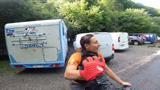
There are 7 parking locations listed in Campan. The most popular parking spots are: View all parking and trailhead locations on the map to plan your visit.
▼
What is the longest trail in Campan?
The longest trail in Campan is Chemin de Ramy at 3.9 km. View all trails sorted by distance.
Activities
Trails
- By lcoadik
 & contributors
 - Admins: JackyStyleTom, lcoadik
- #74188 - 68 views
- campan activity log | embed map of Campan mountain bike trails | campan mountain biking points of interest
Downloading of trail gps tracks in kml & gpx formats is enabled for Campan.
You must login to download files.