close
-
Layers w
- Weather Layers
- Pro
- Pro
- Pro
- Pro
- Pro
- Pro
- More Layers
- Pro
- Pro
- Pro
- Pro
-
Upgrade to

3D
Trail Conditions
- Unknown
- Snow Groomed
- Snow Packed
- Snow Covered
- Snow Cover Partial
- Freeze/thaw Cycle
- Icy
- Prevalent Mud
- Wet
- Variable
- Ideal
- Dry
- Very Dry
Trail Flow (Ridden Direction)
Trailforks scans users ridelogs to determine the most popular direction each trail is ridden. A good flowing trail network will have most trails flowing in a single direction according to their intension.
The colour categories are based on what percentage of riders are riding a trail in its intended direction.
The colour categories are based on what percentage of riders are riding a trail in its intended direction.
- > 96%
- > 90%
- > 80%
- > 70%
- > 50%
- < 50%
- bi-directional trail
- no data
Trail Last Ridden
Trailforks scans ridelogs to determine the last time a trail was ridden.
- < 2 days
- < 1 week
- < 2 weeks
- < 1 month
- < 6 months
- > 6 months
Trail Ridden Direction
The intended direction a trail should be ridden.
- Downhill Only
- Downhill Primary
- Both Directions
- Uphill Primary
- Uphill Only
- One Direction
Contribute Details
Colors indicate trail is missing specified detail.
- Description
- Photos
- Description & Photos
- Videos
Trail Popularity ?
Trailforks scans ridelogs to determine which trails are ridden the most in the last 9 months.
Trails are compared with nearby trails in the same city region with a possible 25 colour shades.
Think of this as a heatmap, more rides = more kinetic energy = warmer colors.
- most popular
- popular
- less popular
- not popular
ATV/ORV/OHV Filter
Max Vehicle Width
inches
US Cell Coverage
Legend

Radar Time
Activity Recordings
Trailforks uses anonymized public activity data.
?
Activity Recordings
Trailforks uses anonymized public activity data.
?
Personal Heatmap
▶
Activity Types
all
/
none
▶
Options
2
Date range
month
–
Winter Trails
Warning
A routing network for winter maps does not exist. Selecting trails using the winter trails layer has been disabled.
Missing Trails
Most Popular
Least Popular
Trails are colored based on popularity. The more popular a trail is, the more red. Less popular trails trend towards green.
Jump Magnitude Heatmap
Heatmap of where riders jump on trails. Zoom in to see individual jumps, click circles to view jump details.
BC Backroad Status
![map legend]()
Service Road Atlas is a free to use, community-driven service for viewing and creating reports on the numerous back-country service roads around B.C. and Alberta.

Slope Aspect
Direction the slope faces
Trails Deemphasized
Trails are shown in grey.
Only show trails with no bike usage.
Suggested Layers
Based on selected activity type
Save the current map location and zoom level as your default home location whenever this page is loaded.
Save
No description for Chaska has been added yet!
Login or register to submit one.
Activities Click to view
- Mountain Bike
34 trails
- E-Bike
30 trails
- Winter Fat Bike
0 trails
- Horse
0 trails
- Hike
34 trails
- Trail Running
34 trails
- Dirtbike/Moto
0 trails
- Observed Trials
0 trails
- ATV/ORV/OHV
0 trails
- Snowmobile
0 trails
- Snowshoe
14 trails
- Downhill Ski
0 trails
- Backcountry Ski
0 trails
- Nordic Ski
14 trails
Region Details
- 4
- 16
- 13
- 1
Region Status
Caution as of Sep 15, 2025Stats
- Avg Trail Rating
- Trails (view details)
- 35
- Trails Mountain Bike
- 34
- Trails E-Bike
- 30
- Trails Hike
- 34
- Trails Trail Running
- 34
- Trails Snowshoe
- 14
- Trails Nordic Ski
- 14
- Total Distance
- 57 miles
- Total Descent Distance
- 15 miles
- Total Descent
- 1,939 ft
- Total Vertical
- 331 ft
- Highest Trailhead
- 1,026 ft
- Reports
- 23
- Photos
- 8
- Ridden Counter
- 1,968
Sub Regions
-
Hawks Ridge
- 2
- 4
- 1
-
Mcknight Lake
- 1
- 9
-
Minnesota Valley State Recreation Area
- 14
Popular Chaska Mountain Biking Trails
• 90 ★ 3.4 • 3 miles • 139 ft • 136 •
Popular green difficulty family friendly singletrack. This mountain bike primary trail can be used one direction and has a easy overall physical rating with a 139 ft green climb. Trail visibility is always easy to follow. On average it takes 21 minutes to complete this trail.
• 95 ★ 1.8 • 3,547 ft • 36 ft • 135 •
Popular blue difficulty singletrack. This mountain bike primary trail can be used one direction and has a moderate overall physical rating with a 36 ft green climb. Trail visibility is always easy to follow. On average it takes 4 minutes to complete this trail.
• 90 ★ 2.0 • 925 ft • 15 ft • 133 •
Popular black diamond difficulty singletrack. This mountain bike primary trail can be used one direction and has a moderate overall physical rating with a 15 ft blue climb. Trail visibility is always easy to follow. On average it takes 1 minutes to complete this trail.
• 60 ★ 2.5 • 1,371 ft • 12 ft • 101 •
Moderately popular blue difficulty singletrack. This mountain bike primary trail can be used one direction and has a moderate overall physical rating with a 12 ft blue climb. Trail visibility is always easy to follow. On average it takes 2 minutes to complete this trail.
• 85 ★ 2.4 • 974 ft • 13 ft • 98 •
Popular blue difficulty singletrack. This mountain bike primary trail can be used one direction and has a moderate overall physical rating with a 13 ft green climb. Trail visibility is always easy to follow. On average it takes 1 minutes to complete this trail.
• 100 ★ 0.0 • 587 ft • 0 ft • 84 •
Popular blue difficulty singletrack. This multi-use trail can be used one direction. On average it takes minutes to complete this trail.
• 65 ★ 0.0 • 577 ft • 3 ft • 84 •
Moderately popular green difficulty singletrack. This mountain bike primary trail can be used one direction and has a easy overall physical rating with a 3 ft green climb. Trail visibility is always easy to follow. On average it takes 1 minutes to complete this trail.
• 70 ★ 0.0 • 2 miles • 26 ft • 82 • • hike
Popular white difficulty paved path. This hike primary trail can be used both directions and has a easy overall physical rating with a 26 ft green climb. On average it takes 17 minutes to complete this trail.
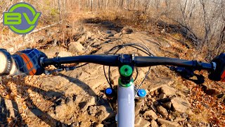
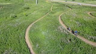
Photos of Chaska Mountain Bike
Videos of Chaska Mountain Bike
youtuber
![Chunky blue trails in Duluth | Hawk Ridge...]()
2:30 |
452 |
Mar 10, 2021
0:02 |
502 |
Jul 9, 2020
Recent Trail Reports
| status | trail | date | condition | info | user |
|---|---|---|---|---|---|
| Levy Trail | Mar 14, 2025 @ 12:54pm Mar 14, 2025 | Ideal | elkribk | ||
| Bowl | Jun 9, 2024 @ 10:16am Jun 9, 2024 | Ideal | qnD8qIRA | ||
| Two Ridges | Jun 9, 2024 @ 10:16am Jun 9, 2024 | Ideal | qnD8qIRA | ||
| Main Loop | Jun 9, 2024 @ 10:16am Jun 9, 2024 | Ideal | qnD8qIRA | ||
| Woods | Apr 6, 2024 @ 7:05am Apr 6, 2024 | Wet | TheDy1an | ||
| Oakridge Loop Out | May 29, 2023 @ 3:43am May 29, 2023 | Ideal | EYawkYetiDude CLMTBC | ||
| Skull Loop | May 29, 2023 @ 3:43am May 29, 2023 | Ideal | EYawkYetiDude CLMTBC | ||
| McKnight Lake West Connector | May 29, 2023 @ 3:43am May 29, 2023 | Ideal | EYawkYetiDude CLMTBC | ||
| Connector | May 29, 2023 @ 3:43am May 29, 2023 | Ideal | EYawkYetiDude CLMTBC | ||
| Tom Thumb Loop | May 29, 2023 @ 3:43am May 29, 2023 | Ideal | EYawkYetiDude CLMTBC |
Activity Feed
| username | action | type | title | date |
|---|---|---|---|---|
| aarontheroaddog | wishlist | region | activity #94060993 | May 4, 2026 @ 5:32pm May 4, 2026 |
| p3i73T5h | wishlist | trail | activity #93434369 | Apr 26, 2026 @ 5:59am Apr 26, 2026 |
| fl0wstate | ridden | trail | activity #90740996 and 1 more | Mar 17, 2026 @ 8:00am Mar 17, 2026 |
| RochelleAndPar | wishlist | region | activity #84983914 | Nov 30, 2025 @ 12:46pm Nov 30, 2025 |
| dahlg055 | wishlist | region | activity #80045750 | Sep 10, 2025 @ 7:21am Sep 10, 2025 |
Recent Comments
| username | type | title | comment | date |
|---|---|---|---|---|
| trail | Last part of this loop is now closed and on... | Sep 2, 2024 @ 6:27pm Sep 2, 2024 | ||
| trail | Fun, non-technical and easy trail. Good for a... | Jan 26, 2021 @ 11:00am Jan 26, 2021 | ||
| trail | More of the same, some moderate climbs.... | Aug 16, 2020 @ 9:35am Aug 16, 2020 | ||
| trail | Fun trail, very smooth considering it's not... | Aug 16, 2020 @ 9:34am Aug 16, 2020 |
Local Badges
-

Epic Mountain Bike Climb 2k0 awarded -

Climbing 10k Badge10 awarded -

Mountain Biking 100k Badge0 awarded -

Epic Ride Descent 2k0 awarded -

Descent 10k Badge10 awarded -

Descent 100k Badge0 awarded
Activity Type Stats
| activitytype | trails | distance | descent | descent distance | total vertical | rating | global rank | state rank | photos | reports | routes | ridelogs |
|---|---|---|---|---|---|---|---|---|---|---|---|---|
| Mountain Bike | 34 | 56 miles | 1,906 ft | 15 miles | 302 ft | #8,918 | #2,837 | 8 | 23 | 4,635 | ||
| E-Bike | 30 | 49 miles | 1,621 ft | 12 miles | 302 ft | #3,507 | #1,229 | 22 | 98 | |||
| Hike | 34 | 55 miles | 1,801 ft | 14 miles | 331 ft | #5,104 | #1,796 | 21 | 140 | |||
| Trail Running | 34 | 55 miles | 1,801 ft | 14 miles | 331 ft | #4,603 | #1,422 | 21 | 34 | |||
| Snowshoe | 14 | 31 miles | 620 ft | 7 miles | 85 ft | #858 | #401 | 17 | ||||
| Nordic Ski | 14 | 31 miles | 620 ft | 7 miles | 85 ft | #937 | #381 | 7 |
Frequently Asked Questions About Chaska
▼
What are the best places to ride in Chaska?
Chaska has 3 areas to explore for mountain biking. The top rated areas are:
▼
What are the highest rated mountain biking trails in Chaska?
The highest rated mountain biking trails in Chaska are:
- Mazomani Trail (3.8/5)
- Main Loop (3.7/5)
- Woods (3.4/5)
- Halfpipe (3.4/5)
- Bowl (3.3/5)
▼
What is the best time of the year to ride in Chaska?
Based on ride log data, the most popular months to ride in Chaska are:
- September (45 activities)
- October (38 activities)
- August (36 activities)
▼
Where can I park to ride in Chaska?
There are 8 parking locations listed in Chaska. The most popular parking spots are: View all parking and trailhead locations on the map to plan your visit.
Activities
Trails
Points of Interest
- By pbouffleur & contributors
- Admins: apply
- #32487 - 2,990 views
- chaska activity log | embed map of Chaska mountain bike trails | chaska mountain biking points of interest
Downloading of trail gps tracks in kml & gpx formats is enabled for Chaska.
You must login to download files.