close
-
Layers w
- Weather Layers
- Pro
- Pro
- Pro
- Pro
- Pro
- Pro
- More Layers
- Pro
- Pro
- Pro
- Pro
-
Upgrade to

3D
Trail Conditions
- Unknown
- Snow Groomed
- Snow Packed
- Snow Covered
- Snow Cover Partial
- Freeze/thaw Cycle
- Icy
- Prevalent Mud
- Wet
- Variable
- Ideal
- Dry
- Very Dry
Trail Flow (Ridden Direction)
Trailforks scans users ridelogs to determine the most popular direction each trail is ridden. A good flowing trail network will have most trails flowing in a single direction according to their intension.
The colour categories are based on what percentage of riders are riding a trail in its intended direction.
The colour categories are based on what percentage of riders are riding a trail in its intended direction.
- > 96%
- > 90%
- > 80%
- > 70%
- > 50%
- < 50%
- bi-directional trail
- no data
Trail Last Ridden
Trailforks scans ridelogs to determine the last time a trail was ridden.
- < 2 days
- < 1 week
- < 2 weeks
- < 1 month
- < 6 months
- > 6 months
Trail Ridden Direction
The intended direction a trail should be ridden.
- Downhill Only
- Downhill Primary
- Both Directions
- Uphill Primary
- Uphill Only
- One Direction
Contribute Details
Colors indicate trail is missing specified detail.
- Description
- Photos
- Description & Photos
- Videos
Trail Popularity ?
Trailforks scans ridelogs to determine which trails are ridden the most in the last 9 months.
Trails are compared with nearby trails in the same city region with a possible 25 colour shades.
Think of this as a heatmap, more rides = more kinetic energy = warmer colors.
- most popular
- popular
- less popular
- not popular
ATV/ORV/OHV Filter
Max Vehicle Width
inches
US Cell Coverage
Legend

Radar Time
Activity Recordings
Trailforks uses anonymized public activity data.
?
Activity Recordings
Trailforks uses anonymized public activity data.
?
Personal Heatmap
▶
Activity Types
all
/
none
▶
Options
2
Date range
month
–
Winter Trails
Warning
A routing network for winter maps does not exist. Selecting trails using the winter trails layer has been disabled.
Missing Trails
Most Popular
Least Popular
Trails are colored based on popularity. The more popular a trail is, the more red. Less popular trails trend towards green.
Jump Magnitude Heatmap
Heatmap of where riders jump on trails. Zoom in to see individual jumps, click circles to view jump details.
BC Backroad Status
![map legend]()
Service Road Atlas is a free to use, community-driven service for viewing and creating reports on the numerous back-country service roads around B.C. and Alberta.

Slope Aspect
Direction the slope faces
Trails Deemphasized
Trails are shown in grey.
Only show trails with no bike usage.
Suggested Layers
Based on selected activity type
Save the current map location and zoom level as your default home location whenever this page is loaded.
Save
No description for Chatel has been added yet!
Login or register to submit one.
This region uses the Uk/Euro style trail grading system.
Activities Click to view
- Mountain Bike
60 trails
- E-Bike
39 trails
- Adaptive Bike
0 trails
- Hike
37 trails
- Trail Running
37 trails
- Downhill Ski
53 trails
Region Details
- 7
- 4
- 11
- 19
- 12
- 3
Region Status
Open as of May 7, 2026Stats
- Avg Trail Rating
- Trails (view details)
- 106
- Trails Mountain Bike
- 60
- Trails E-Bike
- 39
- Trails Hike
- 37
- Trails Trail Running
- 37
- Trails Snowmobile
- 1
- Trails Snowshoe
- 1
- Trails Downhill Ski
- 53
- Trails Backcountry Ski
- 1
- Trails Nordic Ski
- 1
- Total Distance
- 63 miles
- Total Descent
- 51,753 ft
- Total Vertical
- 3,195 ft
- Highest Trailhead
- 6,857 ft
- Reports
- 328
- Photos
- 734
- Ridden Counter
- 34,731
Articles
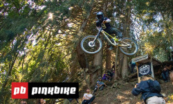
Video: Freeride Madness in Châtel at the Second Annual 'Tour des Niares' 2025
Aug 26, 2025 from pinkbike.com
So many rowdy attempts in one video.
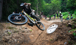
Video: Unlocking Bikepark Châtel's Gnarliest Hits in 'Tour Des Niares'
Aug 2, 2025 from pinkbike.com
Getting a bunch of friends together and hitting the biggest/sketchiest hits around the Bikepark. How good?
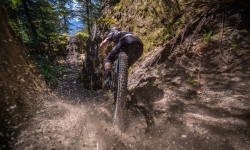
Video: Something Different with Antoine Buffart
May 15, 2023 from pinkbike.com
Constantly creating new and interesting ways to ride is what Antoine is all about.
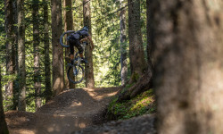
Video: Airtime on the Nico Vink Line in Châtel Bike Park
Aug 26, 2021 from pinkbike.com
Local riders Mateo Verdier and Antoine Buffart hit up the Lower Vink Line trail showing off their seriously creative, fun, and skillful level of...
Sub Regions
-
Chatel Bike Park
- 2
- 4
- 7
- 8
- 3
-
Chatel ski
- 1
- 1
- 1
Popular Chatel Mountain Biking Trails
• 90 ★ 4.5 • 4,482 ft • 0 ft • 1,907 •
A machine groomed trail that is Nico Vink's smaller playground, with lots and lots of opportunities to get airtime, rail the berms and generally just sit back and enjoy the flow. Everything is rollable, there are no gaps but do not be...
• 95 ★ 3.7 • 2,231 ft • 3 ft • 1,824 •
Popular blue difficulty singletrack. This mountain bike primary trail can be used one direction. On average it takes 1 minutes to complete this trail.
• 90 ★ 4.1 • 5,135 ft • 3 ft • 1,823 •
Highly rated popular blue difficulty singletrack. This mountain bike primary trail can be used one direction. Trail visibility is always easy to follow. On average it takes 3 minutes to complete this trail.
• 100 ★ 4.3 • 2 miles • 11 ft • 1,755 •
Large flow trail with lots of features: tables, doubles, step down, step up, gap jumps and 65 berms! Rebuilt in autumn 2016. It is now a blue level flow trail.
• 85 ★ 4.2 • 3,330 ft • 0 ft • 1,644 •
Good flowing trail with berms, gap jumps and tables . Beware, this trail has some large optional features that would be considered as black difficulty such as a large gap step up and a large wooden drop
• 100 ★ 4.3 • 2 miles • 27 ft • 1,233 •
An alternative route down to Chatel Bike Park to the well used blue run. Much smoother with spectacular views, a few table top jumps with optional bigger lips and big berms. Only a short climb at the start.
• 70 ★ 4.5 • 4,596 ft • 0 ft • 1,121 •
Super fast flow trail built by none other than Nico Vink. The top section was finished for the summer 2017. Massive berms that will have you bottoming out your suspension and your tires!!! Huge jumps with a bunch of little hidden...
• 75 ★ 4.4 • 3,373 ft • 7 ft • 941 •
vorachatek is graded a red by France standards, although It is a particularly narrow and tight trail in places with large drops and gaps. Lots of smiles though as it’s a very fast and steep in places too.
Chatel Mountain Bike Routes
60 miles • 20,680 ft • 22 •
40 miles • 14,209 ft • 23 • Loop • Race •
Official Route of the Chatel EDR Race, final of the 2023 season. The two little loop above the end of the...
• 23 miles • 8,806 ft • 23 •
Photos of Chatel Mountain Bike
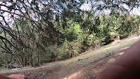
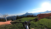
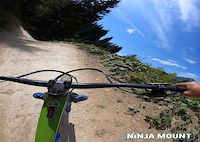
Videos of Chatel Mountain Bike
trail: Flash
0:13 |
28 |
Aug 17, 2025
trail: Vorachatak
0:09 |
202 |
Jul 16, 2024
trail: People
0:11 |
70 |
Jul 8, 2024
trail: Shade
3:28 |
72 |
Feb 1, 2024
trail: Shade
0:53 |
49 |
Feb 1, 2024
trail: Barbossine Ridgeline S1
0:54 |
20 |
Jan 2, 2024

trail: Vorachatak
0:09 |
45 |
Aug 25, 2023
trail: Serpentine
0:08 |
91 |
Aug 7, 2023
Recent Trail Reports
| status | trail | date | condition | info | user |
|---|---|---|---|---|---|
| Shortcut | May 7, 2026 @ 1:36pm (Europe/Paris) May 7, 2026 | Wet | SintraFreeride | ||
| Drive | May 7, 2026 @ 1:25pm (Europe/Paris) May 7, 2026 | Wet | SintraFreeride | ||
| La Verte Pré La Joux | Aug 18, 2025 @ 1:28am Aug 18, 2025 | Dry | gurgulec | ||
| La Reboul | Aug 18, 2025 @ 1:26am Aug 18, 2025 | Ideal | gurgulec | ||
| Fluid | Aug 18, 2025 @ 1:24am Aug 18, 2025 | Ideal | gurgulec | ||
| Vinkline - Lower | Aug 18, 2025 @ 1:23am Aug 18, 2025 | Variable | gurgulec | ||
| Vink Line (Middle) | Aug 18, 2025 @ 1:22am Aug 18, 2025 | Dry | gurgulec | ||
| Flash | Aug 18, 2025 @ 1:21am Aug 18, 2025 | Variable | gurgulec | ||
| Vorachatak | Aug 18, 2025 @ 1:19am Aug 18, 2025 | Very Dry | gurgulec | ||
| Vinkline - Upper | Aug 18, 2025 @ 12:52am Aug 18, 2025 | Dry | gurgulec |
Activity Feed
| username | action | type | title | date |
|---|---|---|---|---|
| trailforks | add | video | activity #96573034 | Jun 8, 2026 @ 5:00pm Jun 8, 2026 |
| Christine2mUq6I | add | photo | activity #96542108 and 1 more | Jun 8, 2026 @ 8:41am Jun 8, 2026 |
| trailforks | add | video | activity #96316493 | Jun 5, 2026 @ 1:00pm Jun 5, 2026 |
| minimusprime | wishlist | route | activity #96037779 | Jun 1, 2026 @ 1:28pm Jun 1, 2026 |
| cyclodicted-detcidolcyc | wishlist | route | activity #96032973 | Jun 1, 2026 @ 12:03pm Jun 1, 2026 |
Recent Comments
| username | type | title | comment | date |
|---|---|---|---|---|
| trail | All good! Lovely track | Aug 7, 2025 @ 10:30am Aug 7, 2025 | ||
| trail | Gem! | Aug 7, 2025 @ 10:28am Aug 7, 2025 | ||
| trail | Huge logs blocked the entrance and it wasn't... | Aug 8, 2024 @ 7:27am Aug 8, 2024 | ||
| trail | Flowy forest trail, with fun semi steep... | Aug 8, 2024 @ 7:25am Aug 8, 2024 | ||
| trail | It's rideable except the lower part where... | Aug 8, 2024 @ 7:22am Aug 8, 2024 |
Local Badges
-

Epic Ride Climb 2k988 awarded -

Climbing 10k Badge99 awarded -

Climbing 100k Badge2 awarded -

Epic Ride Descent 2k1,483 awarded -

Descent 10k Badge170 awarded -

Descent 100k Badge3 awarded
Bike & Skill Parks
| name | type | city | rating |
|---|---|---|---|
| Chatel Bike Park | bike park | Chatel |
Activity Type Stats
| activitytype | trails | distance | descent | descent distance | total vertical | rating | global rank | state rank | photos | reports | routes | ridelogs |
|---|---|---|---|---|---|---|---|---|---|---|---|---|
| Mountain Bike | 60 | 31 miles | 23,215 ft | 27 miles | 2,841 ft | #1,005 | #15 | 730 | 328 | 5 | 8,415 | |
| E-Bike | 39 | 16 miles | 12,428 ft | 13 miles | 2,841 ft | #2,403 | #134 | 285 | 2 | 370 | ||
| Hike | 37 | 17 miles | 11,490 ft | 14 miles | 2,841 ft | #4,116 | #117 | 4 | 281 | 244 | ||
| Trail Running | 37 | 17 miles | 11,490 ft | 14 miles | 2,841 ft | #3,624 | #118 | 281 | 49 | |||
| Snowmobile | 1 | 666 ft | 62 ft | 666 ft | 66 ft | 1 | ||||||
| Snowshoe | 1 | 666 ft | 62 ft | 666 ft | 66 ft | 1 | 6 | |||||
| Downhill Ski | 53 | 32 miles | 28,743 ft | 27 miles | 3,136 ft | #90 | #15 | 2 | 506 | |||
| Backcountry Ski | 1 | 666 ft | 62 ft | 666 ft | 66 ft | 1 | 74 | |||||
| Nordic Ski | 1 | 666 ft | 62 ft | 666 ft | 66 ft | 1 | 4 |
Frequently Asked Questions About Chatel
▼
What are the best places to ride in Chatel?
Chatel has 2 areas to explore for mountain biking. The top rated areas are:
▼
What are the highest rated mountain biking trails in Chatel?
The highest rated mountain biking trails in Chatel are:
- Black Shore (4.7/5)
- Cha-Nada (4.5/5)
- Air Voltage (4.5/5)
- Komatrautrail (4.5/5)
- Bike Patrol (4.5/5)
▼
What is the best time of the year to ride in Chatel?
Based on ride log data, the most popular months to ride in Chatel are:
- July (106 activities)
- August (91 activities)
- June (23 activities)
▼
Where can I park to ride in Chatel?
Check the Chatel trail map for trailhead and parking information. Community members regularly update access and parking details for trails in the area.
Activities
Trails
- By brenthillier
 NSMBA TRAILFORKS & contributors
 - Admins: alltta, freerider48, maxlatourte, Charliedp, Whipperman
- #4497 - 12,054 views
- chatel activity log | embed map of Chatel mountain bike trails | chatel mountain biking points of interest
Downloading of trail gps tracks in kml & gpx formats is enabled for Chatel.
You must login to download files.