
close
3D
Trail Conditions
- Unknown
- Snow Groomed
- Snow Packed
- Snow Covered
- Snow Cover Partial
- Freeze/thaw Cycle
- Icy
- Prevalent Mud
- Wet
- Variable
- Ideal
- Dry
- Very Dry
Trail Flow (Ridden Direction)
Trailforks scans users activity logs to determine the most popular direction each trail is ridden. A good flowing trail network will have most trails flowing in a single direction according to their intension.
The colour categories are based on what percentage of users are riding a trail in its intended direction.
The colour categories are based on what percentage of users are riding a trail in its intended direction.
- > 96%
- > 90%
- > 80%
- > 70%
- > 50%
- < 50%
- bi-directional trail
- no data
Trail Last Used
Trailforks scans activity logs to determine the last time a trail was ridden.
- < 2 days
- < 1 week
- < 2 weeks
- < 1 month
- < 6 months
- > 6 months
Trail Ridden Direction
The intended direction a trail should be ridden.
- Downhill Only
- Downhill Primary
- Both Directions
- Uphill Primary
- Uphill Only
- One Direction
Contribute Details
Colors indicate trail is missing specified detail.
- Description
- Photos
- Description & Photos
- Videos
Trail Popularity ?
Trailforks scans activity logs to determine which trails are ridden the most in the last 9 months.
Trails are compared with nearby trails in the same city region with a possible 25 colour shades.
Think of this as a heatmap, more activities = more kinetic energy = warmer colors.
- most popular
- popular
- less popular
- not popular
ATV/ORV/OHV Filter
Max Vehicle Width
inches
US Cell Coverage
Legend

Radar Time
Activity Recordings
Trailforks uses anonymized public activity data.
?
Activity Recordings
Trailforks uses anonymized public activity data.
?
Winter Trails
Warning
A routing network for winter maps does not exist. Selecting trails using the winter trails layer has been disabled.
Missing Trails
Most Popular
Least Popular
Trails are colored based on popularity. The more popular a trail is, the more red. Less popular trails trend towards green.
Jump Magnitude Heatmap
Heatmap of where users jump on trails. Zoom in to see individual jumps, click circles to view jump details.
BC Backroad Status
![map legend]()
Service Road Atlas is a free to use, community-driven service for viewing and creating reports on the numerous back-country service roads around B.C. and Alberta.

Slope Aspect
Direction the slope faces
Trails Deemphasized
Trails are shown in grey.
Only show trails with no bike usage.
Suggested Layers
Based on selected activity type
Save the current map location and zoom level as your default home location whenever this page is loaded.
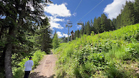
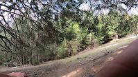
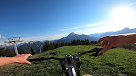
SaveChatel trails and routes are listed on Trailforks with interactive trail maps, difficulty ratings, photos, and user-reported trail conditions. The Trailforks community has shared hundreds of photos from this region. Supported activity types include Mountain Biking, Skiing, E-Biking, Hiking, Trail Running and Adaptive Biking. Trails here are often rooty, flowy and faint trail. Scenery includes alpine terrain, ridgelines and views. Common trail features include berms, jumps and drops. Many trails are family friendly. Popular destinations include Chatel ski and Chatel Bike Park.
This is an auto-generated description of Chatel.
Login or register to submit a custom description.
This region uses the Uk/Euro style trail grading system.
Trail info last updated
Activities Click to view
- Mountain Bike
51 trails
- E-Bike
45 trails
- Adaptive Bike
1 trails
- Hike
28 trails
- Trail Running
28 trails
- Downhill Ski
50 trails
Region Details
- 6
- 1
- 5
- 12
- 3
- 1
Region Status
Open as of Aug 25, 2026Trail Running Stats
- Global Ranking
- #3,741
- State Ranking
- #119
- Trails (view details)
- 28
- Trails Mountain Bike
- 51
- Trails E-Bike
- 45
- Trails Gravel Bike
- 15
- Trails Adaptive Bike
- 1
- Trails Hike
- 28
- Trails Trail Running
- 28
- Trails Snowmobile
- 1
- Trails Snowshoe
- 1
- Trails Downhill Ski
- 50
- Trails Backcountry Ski
- 1
- Trails Nordic Ski
- 1
- Lifts
- 2
- Total Distance
- 16 miles
- Total Descent Distance
- 14 miles
- Total Descent
- 11,959 ft
- Total Vertical
- 2,740 ft
- Reports
- 308
- Photos
- 2
- Completed Counter
- 96
Articles
Video: Absolutely Throwing Down at the 2026 Tour des Niares in the Châtel Bike Park
Aug 17, 2026 from pinkbike.com
20 of the best freeriders threw down and Charlie Coquillard was there to capture it.
Video: Freeride Madness in Châtel at the Second Annual 'Tour des Niares' 2025
Aug 26, 2025 from pinkbike.com
So many rowdy attempts in one video.
Video: Unlocking Bikepark Châtel's Gnarliest Hits in 'Tour Des Niares'
Aug 2, 2025 from pinkbike.com
Getting a bunch of friends together and hitting the biggest/sketchiest hits around the Bikepark. How good?
Video: Something Different with Antoine Buffart
May 15, 2023 from pinkbike.com
Constantly creating new and interesting ways to ride is what Antoine is all about.
Sub Regions
-
Chatel Bike Park
- 1
- 5
- 7
- 10
- 1
-
Chatel ski
- 1
- 1
Popular Chatel Trail Running Trails
• 100 ★ 0.0 • 1,119 ft • 0 ft • 11 •
Narrow singletrack very close to an electrified fence, care should be taken.
• 80 ★ 0.0 • 1,099 ft • 0 ft • 10 •
Part of the hiking trail that joins the top of the Barbossine chairlift to junction between Torgon and Chatel. Once you see the wood stake turn left into the space in the forest over the tall grass thus avoiding the rest of the hiking...
• 100 ★ 0.0 • 666 ft • 0 ft • 5 •
Shortcut to avoid climbing the fireroad or small descent before joining Petit Chatel singletrack
• 75 ★ 0.0 • 4,222 ft • 51 ft • 4 •
Starts at the first fire road left turn after getting off the top of Super Chatel Gondola. Fast traversing singletrack. A few roots and rocks are present.
• 95 ★ 5.0 • 1,007 ft • 0 ft • 2 •
Technical singletrack with steep entrance and exit. Some tight berm turns and two small jumps in the middle. Joins into super Châtel footpath at the end.
• 5 ★ 5.0 • 951 ft • 0 ft • 1 •
After the Cheval Blanc footpath turn right into the forest. Small gap jump in the middle which can be ridden around. Take care at the end when joining the fire road.
• 5 ★ 4.0 • 3,570 ft • 41 ft • 1 •
Technical singletrack half in the forest and half in open field. Uphill it is ebike only due to gradient. Gives access the top of Barbossine/Tour de Don area. Trail starts at the Barbossine farm in the Barbossine bowl, which can be...
• 5 ★ 0.0 • 3,314 ft • 5 ft • 1 •
Tight switchback filled hiking trail. Great to practice those nose turns. When you reach the sign turn right to join the bottom section. Left will take you down the old double track. Epingles serrés sur un sentier piéton. Idéal pour...
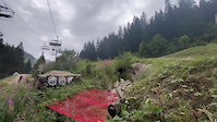
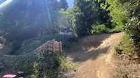
Photos of Chatel
Videos of Chatel
Recent Trail Reports
| status | trail | date | condition | info | user |
|---|---|---|---|---|---|
| Eterlou | Aug 2, 2026 @ 9:05am (Europe/Zurich) Aug 2, 2026 | Dry | arthurit | ||
| Shortcut | May 7, 2026 @ 1:36pm (Europe/Paris) May 7, 2026 | Wet | SintraFreeride | ||
| Drive | May 7, 2026 @ 1:25pm (Europe/Paris) May 7, 2026 | Wet | SintraFreeride | ||
| La Reboul | Aug 18, 2025 @ 1:26am Aug 18, 2025 | Ideal | gurgulec | ||
| Barbossine | Aug 7, 2025 @ 10:30am Aug 7, 2025 | Ideal | treedodgercharles | ||
| Inbloom | Aug 7, 2025 @ 10:30am Aug 7, 2025 | Ideal | treedodgercharles | ||
| Shade | Aug 7, 2025 @ 10:29am Aug 7, 2025 | Ideal | treedodgercharles | ||
| Boude | Jul 6, 2024 @ 12:19pm Jul 6, 2024 | Wet | MariopQPsV5 | ||
| Switchbacks | Feb 16, 2024 @ 4:11am Feb 16, 2024 | Ideal | Last2FXuHZ | ||
| Liaison Super Chatel | Sep 5, 2023 @ 3:39am Sep 5, 2023 | Dry | Neekens |
Activity Feed
| username | action | type | title | date |
|---|---|---|---|---|
| Octo0o | wishlist | region | activity #106546730 | Oct 25, 2026 @ 2:27am Oct 25, 2026 |
| terrdferguson | wishlist | region | activity #106320146 | Oct 21, 2026 @ 5:12am Oct 21, 2026 |
| micheleg86 | wishlist | region | activity #103435324 | Sep 9, 2026 @ 2:27pm Sep 9, 2026 |
| mandreasen | wishlist | region | activity #103171685 | Sep 6, 2026 @ 5:20am Sep 6, 2026 |
| kardi13 | add | report | activity #102680589 and 9 more | Aug 30, 2026 @ 8:09am Aug 30, 2026 |
Recent Comments
| username | type | title | comment | date |
|---|---|---|---|---|
| trail | access is blocked by vegetation, no way to access | Jul 2, 2026 @ 3:35am Jul 2, 2026 | ||
| trail | All good! Lovely track | Aug 7, 2025 @ 10:30am Aug 7, 2025 | ||
| trail | Gem! | Aug 7, 2025 @ 10:28am Aug 7, 2025 | ||
| trail | Huge logs blocked the entrance and it wasn't... | Aug 8, 2024 @ 7:27am Aug 8, 2024 | ||
| trail | Flowy forest trail, with fun semi steep... | Aug 8, 2024 @ 7:25am Aug 8, 2024 |
Local Badges
-

Epic Trail Running Climb 2k1 awarded -

Climbing 10k Badge0 awarded -

Trail Running 100k Badge0 awarded -

Big Trail Run 30k1 awarded -

Epic Trail Run 50k0 awarded
Activity Type Stats
| activitytype | trails | distance | descent | descent distance | total vertical | rating | global rank | state rank | photos | reports | routes | activity logs |
|---|---|---|---|---|---|---|---|---|---|---|---|---|
| Mountain Bike | 51 | 31 miles | 23,094 ft | 27 miles | 2,740 ft | #990 | #11 | 723 | 355 | 5 | 9,681 | |
| E-Bike | 45 | 26 miles | 21,312 ft | 23 miles | 2,740 ft | #2,279 | #136 | 317 | 2 | 542 | ||
| Gravel Bike | 15 | 15 miles | 8,287 ft | 13 miles | 2,812 ft | #641 | #3 | 6 | ||||
| Adaptive Bike | 1 | 4,642 ft | 384 ft | 4,360 ft | 384 ft | #1,702 | #48 | 4 | 1 | |||
| Hike | 28 | 16 miles | 11,959 ft | 14 miles | 2,740 ft | #4,292 | #128 | 4 | 308 | 277 | ||
| Trail Running | 28 | 16 miles | 11,959 ft | 14 miles | 2,740 ft | #3,741 | #119 | 2 | 308 | 43 | ||
| Snowmobile | 1 | 666 ft | 62 ft | 666 ft | 66 ft | 1 | ||||||
| Snowshoe | 1 | 666 ft | 62 ft | 666 ft | 66 ft | 1 | 7 | |||||
| Downhill Ski | 50 | 31 miles | 28,232 ft | 26 miles | 3,136 ft | #100 | #15 | 2 | 541 | |||
| Backcountry Ski | 1 | 666 ft | 62 ft | 666 ft | 66 ft | 1 | 77 | |||||
| Nordic Ski | 1 | 666 ft | 62 ft | 666 ft | 66 ft | 1 | 2 |
Frequently Asked Questions
▼
What are the best places to run in Chatel?
Chatel has 2 areas to explore for trail running. The top rated areas are:
▼
What are the highest rated trail running trails in Chatel?
The highest rated trail running trails in Chatel are:
- Barbossine Ridgeline S1 (0/5)
- Shortcut (0/5)
- Morclan Ridgeline (0/5)
- Totem-bottom (0/5)
- Ortaz (0/5)
▼
Where can I park to run in Chatel?
Check the Chatel trail map for trailhead and parking information. Community members regularly update access and parking details for trails in the area.
▼
What is the longest trail in Chatel?
The longest trail in Chatel is Inbloom at 1.0 mile. View all trails sorted by distance.
▼
What are the best & highest rated hiking trails in Chatel?
The best hiking trails in Chatel are: View all hiking trails sorted by popularity score.
▼
How many trails are in Chatel?
Chatel has a total of 99 trails. Of those, 28 are designated for trail running. Browse top trail running trails in Chatel to find detailed information including difficulty ratings, distances, and trail conditions.
▼
Which trail has the most elevation gain in Chatel?
The trail with the most elevation gain in Chatel is Everlong with 206 ft of elevation gain. View all trails sorted by elevation gain.
▼
Which trail has the most elevation descent in Chatel?
The trail with the most elevation descent in Chatel is Inbloom with 1,282 ft of elevation descent. View all trails sorted by elevation descent.
▼
What activities are most popular in Chatel?
Chatel supports the following activities: Mountain Biking, E-Biking, Adaptive Biking, Hiking, Trail Running, Skiing.
▼
What are the steepest trail running trails in Chatel?
The steepest trail running trail in Chatel is Switchbacks with an average grade of 33.5%. View all trails sorted by grade.
▼
Are the trails open in Chatel?
The overall region status for Chatel is Clear / Green. Out of 36 trails:
- Clear / Green: 28
- Minor Issue / Yellow: 5
- Closed: 3
▼
What is the highest summit in Chatel?
The highest summit in Chatel is Pointe de Vorlaz at 7,618 ft elevation.
▼
What trails are closed in Chatel?
There are currently 3 closed trails in Chatel. The breakdown of all trail statuses is:
- Clear / Green: 28
- Minor Issue / Yellow: 5
- Closed: 3
▼
Are there accessible or adaptive trails in Chatel?
Yes, there are 1 accessible/adaptive trails in Chatel. View all adaptive trails in Chatel for specific accessibility information.
▼
Are there local clubs or events in Chatel?
There are 1 local clubs or associations listed in the Chatel directory. Browse the local directory for details.
▼
What are the most popular trail running trails in Chatel?
The most popular trail running trails in Chatel are: View all trail running trails sorted by popularity.
▼
What are the best beginner trail run trails in Chatel?
The best beginner trail running trails in Chatel are:
- Shortcut (0/5)
Activities
Trails
- By brenthillier
 NSMBA TRAILFORKS & contributors
- Admins: alltta, freerider48, maxlatourte, Charliedp, Whipperman
- #4497 - 12,975 views
- chatel activity log | embed map of Chatel mountain bike trails | chatel mountain biking points of interest
Downloading of trail gps tracks in kml & gpx formats is enabled for Chatel.
You must login to download files.
