close
-
Layers w
- Weather Layers
- Pro
- Pro
- Pro
- Pro
- Pro
- Pro
- More Layers
- Pro
- Pro
- Pro
- Pro
-
Upgrade to

3D
Trail Conditions
- Unknown
- Snow Groomed
- Snow Packed
- Snow Covered
- Snow Cover Partial
- Freeze/thaw Cycle
- Icy
- Prevalent Mud
- Wet
- Variable
- Ideal
- Dry
- Very Dry
Trail Flow (Ridden Direction)
Trailforks scans users ridelogs to determine the most popular direction each trail is ridden. A good flowing trail network will have most trails flowing in a single direction according to their intension.
The colour categories are based on what percentage of riders are riding a trail in its intended direction.
The colour categories are based on what percentage of riders are riding a trail in its intended direction.
- > 96%
- > 90%
- > 80%
- > 70%
- > 50%
- < 50%
- bi-directional trail
- no data
Trail Last Ridden
Trailforks scans ridelogs to determine the last time a trail was ridden.
- < 2 days
- < 1 week
- < 2 weeks
- < 1 month
- < 6 months
- > 6 months
Trail Ridden Direction
The intended direction a trail should be ridden.
- Downhill Only
- Downhill Primary
- Both Directions
- Uphill Primary
- Uphill Only
- One Direction
Contribute Details
Colors indicate trail is missing specified detail.
- Description
- Photos
- Description & Photos
- Videos
Trail Popularity ?
Trailforks scans ridelogs to determine which trails are ridden the most in the last 9 months.
Trails are compared with nearby trails in the same city region with a possible 25 colour shades.
Think of this as a heatmap, more rides = more kinetic energy = warmer colors.
- most popular
- popular
- less popular
- not popular
ATV/ORV/OHV Filter
Max Vehicle Width
inches
US Cell Coverage
Legend

Radar Time
Activity Recordings
Trailforks uses anonymized public activity data.
?
Activity Recordings
Trailforks uses anonymized public activity data.
?
Personal Heatmap
▶
Activity Types
all
/
none
▶
Options
2
Date range
month
–
Winter Trails
Warning
A routing network for winter maps does not exist. Selecting trails using the winter trails layer has been disabled.
Missing Trails
Most Popular
Least Popular
Trails are colored based on popularity. The more popular a trail is, the more red. Less popular trails trend towards green.
Jump Magnitude Heatmap
Heatmap of where riders jump on trails. Zoom in to see individual jumps, click circles to view jump details.
BC Backroad Status
![map legend]()
Service Road Atlas is a free to use, community-driven service for viewing and creating reports on the numerous back-country service roads around B.C. and Alberta.

Slope Aspect
Direction the slope faces
Trails Deemphasized
Trails are shown in grey.
Only show trails with no bike usage.
Suggested Layers
Based on selected activity type
Save the current map location and zoom level as your default home location whenever this page is loaded.
Save
No description for Chelan has been added yet!
Login or register to submit one.
Activities Click to view
- Mountain Bike
54 trails
- E-Bike
8 trails
- Gravel Bike
5 trails
- Adaptive Bike
5 trails
- Winter Fat Bike
3 trails
- Hike
57 trails
- Trail Running
56 trails
- Snowshoe
14 trails
- Downhill Ski
12 trails
- Backcountry Ski
2 trails
- Nordic Ski
29 trails
Region Details
- 8
- 16
- 27
- 3
Region Status
Open as of 1 dayStats
- Avg Trail Rating
- Trails (view details)
- 69
- Trails Mountain Bike
- 54
- Trails E-Bike
- 8
- Trails Gravel Bike
- 5
- Trails Adaptive Bike
- 5
- Trails Winter Fat Bike
- 3
- Trails Horse
- 3
- Trails Hike
- 57
- Trails Trail Running
- 56
- Trails Dirtbike/Moto
- 1
- Trails ATV/ORV/OHV
- 2
- Trails Snowmobile
- 3
- Trails Snowshoe
- 14
- Trails Downhill Ski
- 12
- Trails Backcountry Ski
- 2
- Trails Nordic Ski
- 29
- Total Distance
- 73 miles
- Total Descent
- 14,333 ft
- Total Vertical
- 3,357 ft
- Highest Trailhead
- 4,330 ft
- Reports
- 1,462
- Photos
- 309
- Ridden Counter
- 9,665
Sub Regions
-
Echo Ridge
- 16
- 24
- 2
-
Lake Chelan State Park
Popular Chelan Mountain Biking Trails
• 100 ★ 4.9 • 5 miles • 529 ft • 508 •
Must ride at Echo Ridge. Trail built in 2018-2020. Rides very well in both directions but preferred direction is "clockwise" to get the most downhill. If ridden "counterclockwise" there are some small but fun features on the first 1.5...
• 100 ★ 4.5 • 2 miles • 193 ft • 448 •
Fun and flowy XC trail. Rides well in both directions.
• 95 ★ 4.2 • 4,426 ft • 30 ft • 443 •
Fun descent north to south but easily ridden in both directions.
• 95 ★ 3.8 • 1,611 ft • 0 ft • 345 •
This is a one of kind trail at Echo Ridge.....Fun swoopy "bike only" ride down a short drainage that is the start to one of the longer continuous downhills. The exit is the cruz for those only comfortable on blue squares. Gets dusty in...
• 100 ★ 3.0 • 1,362 ft • 6 ft • 338 •
Connector from Upper Lot to Lower Lot or the other way around so you can skip the gravel road
• 95 ★ 2.8 • 3,885 ft • 133 ft • 333 •
Popular blue difficulty singletrack. This multi-use trail can be used both directions and has a moderate overall physical rating with a 133 ft blue climb. On average it takes 6 minutes to complete this trail.
• 85 ★ 2.7 • 1,867 ft • 88 ft • 333 •
Popular blue difficulty singletrack. This multi-use trail can be used downhill primary and has a moderate overall physical rating with a 88 ft black diamond climb. Winter use: Classic / Skating snow grooming. On average it takes 3 minutes to complete this trail.
• 90 ★ 4.6 • 4,288 ft • 9 ft • 308 •
Awesome little singletrack finish to the ski hill ... combine with and or from the Lower Echo Parking Lot lot for a flowy and fast 2 mile descent!
Chelan Mountain Bike Routes
★ 4.5 • 19 miles • 2,386 ft • 15 • Loop •
The Echo Super Loop is a combination of the best trails at Echo Ridge. Loop can be ridden in either...
★ 5.0 • 3 miles • 25 ft • 4 • Shuttled •
Another one of the best descents at Echo, and super easy to shuttle if you are so inclined. After a short...
★ 5.0 • 6 miles • 31 ft • 4 • Point to Point •
This is the longest descent at Echo Ridge @ 5+ miles. It's a combo of new school flow and old school...
★ 5.0 • 2 miles • 5 • Shuttled •
Great descent that starts with our only Black Diamond trail, , then uses north half Trail and . Popular...
14 miles • 2,060 ft • 4 •
Echo Ridge 14.2 mile loop ride starting and ending at the parking area.
13 miles • 1,517 ft • 12 • Loop •
In the area and need a quick lap? Or just off work and need to spin? Check out this quick loop to get some...
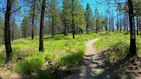
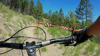
Photos of Chelan Mountain Bike
Videos of Chelan Mountain Bike
trail: Switchback Alley
3:15 |
15 |
May 27, 2026
trail: Outback
2:21 |
50 |
Nov 12, 2025
trail: Mallory's Trail
2:36 |
26 |
Nov 11, 2025

trail: Chelan Butte Downhill
13:03 |
125 |
May 2, 2025
trail: Chelan Butte Downhill
10:59 |
178 |
Nov 2, 2024
trail: Bob's Trail
18:07 |
736 |
Jun 6, 2019
trail: Far East
7:13 |
258 |
Jun 5, 2019

trail: Chelan Butte Downhill
11:32 |
575 |
May 31, 2022 , Chelan
Current Trail Warnings
| status | trail | date | condition | user | info |
|---|---|---|---|---|---|
| Chelan Butte Minor | Jun 6, 2026 @ 3:45pm (America/Los_Angeles) Jun 6, 2026 | Dry | kb7rsk | Access to the Butte is closed due to... | |
| Downie Canyon Road | Jun 6, 2026 @ 3:45pm (America/Los_Angeles) Jun 6, 2026 | Dry | kb7rsk | Access to the Butte is closed due to... | |
| Butte Lookout Road | Jun 6, 2026 @ 3:45pm (America/Los_Angeles) Jun 6, 2026 | Dry | kb7rsk | Access to the Butte is closed due to... |
Recent Trail Reports
Activity Feed
| username | action | type | title | date |
|---|---|---|---|---|
| jlejle | wishlist | route | activity #97249882 | Jun 18, 2026 @ 7:13am 6 hours |
| kb7rsk | add | report | activity #97208201 and 1 more | Jun 17, 2026 @ 1:59pm 23 hours |
| Stevemartinsen | wishlist | region | activity #97022056 | Jun 14, 2026 @ 9:13pm Jun 14, 2026 |
| Codycarter | difficultyvote | trail | activity #96968390 | Jun 14, 2026 @ 7:51am Jun 14, 2026 |
| Codycarter | vote | trail | activity #96773344 | Jun 11, 2026 @ 5:48pm Jun 11, 2026 |
Recent Comments
| username | type | title | comment | date |
|---|---|---|---|---|
| trail | Here is a story and route to reference when... | May 1, 2026 @ 12:53pm May 1, 2026 | ||
| trail | This is a downhill! Almost 4 miles of... | Apr 28, 2026 @ 2:17pm Apr 28, 2026 | ||
| report | Same here Brian. See you on the trails.👍 | Feb 14, 2026 @ 7:29am Feb 14, 2026 | ||
| report | Good to meet you guys. Glad you got it! Brian | Feb 13, 2026 @ 8:52am Feb 13, 2026 | ||
| trail | Sand and gravel single-track on old road. Nice... | Oct 19, 2025 @ 7:51pm Oct 19, 2025 |
Local Badges
-

10 Blue Trails172 awarded -

Epic Ride Climb 2k36 awarded -

Climbing 10k Badge17 awarded -

Climbing 100k Badge0 awarded -

Epic Ride Descent 2k37 awarded -

Descent 10k Badge17 awarded
Activity Type Stats
| activitytype | trails | distance | descent | descent distance | total vertical | rating | global rank | state rank | photos | reports | routes | ridelogs |
|---|---|---|---|---|---|---|---|---|---|---|---|---|
| Mountain Bike | 54 | 69 miles | 12,858 ft | 30 miles | 3,353 ft | #2,659 | #951 | 305 | 1,456 | 12 | 3,846 | |
| E-Bike | 8 | 13 miles | 3,376 ft | 6 miles | 2,835 ft | #5,605 | #1,730 | 1,037 | 247 | |||
| Gravel Bike | 5 | 16 miles | 2,428 ft | 4 miles | 2,707 ft | #438 | #1,018 | 176 | 10 | |||
| Adaptive Bike | 5 | 16 miles | 2,428 ft | 4 miles | 2,707 ft | #392 | #1,737 | 40 | ||||
| Winter Fat Bike | 3 | 4 miles | 26 ft | 761 ft | 1,283 ft | #301 | #1,088 | 27 | 1 | |||
| Horse | 3 | 5 miles | 59 ft | 1,125 ft | 1,191 ft | 534 | ||||||
| Hike | 57 | 71 miles | 13,081 ft | 30 miles | 3,356 ft | #3,656 | #1,287 | 2 | 1,418 | 4 | 568 | |
| Trail Running | 56 | 71 miles | 12,946 ft | 30 miles | 3,356 ft | #3,162 | 1,418 | 4 | 290 | |||
| Dirtbike/Moto | 1 | 1 mile | 23 ft | 653 ft | 456 ft | 522 | 13 | |||||
| ATV/ORV/OHV | 2 | 4 miles | 23 ft | 705 ft | 827 ft | 523 | 1 | |||||
| Snowmobile | 3 | 5 miles | 325 ft | 1 mile | 906 ft | 2 | 6 | 2 | ||||
| Snowshoe | 14 | 21 miles | 3,018 ft | 9 miles | 2,365 ft | #752 | #333 | 170 | 25 | |||
| Downhill Ski | 12 | 2 miles | 1,253 ft | 2 miles | 430 ft | #579 | #260 | 5 | ||||
| Backcountry Ski | 2 | 5 miles | 200 ft | 4,190 ft | 1,864 ft | #512 | #140 | 36 | 637 | |||
| Nordic Ski | 29 | 31 miles | 4,272 ft | 13 miles | 1,368 ft | #620 | #210 | 1 | 211 | 267 |
Frequently Asked Questions About Chelan
▼
What are the best places to ride in Chelan?
Chelan has 4 areas to explore for mountain biking. The top rated areas are:
▼
What are the highest rated mountain biking trails in Chelan?
The highest rated mountain biking trails in Chelan are:
- Bob's Trail (4.6/5)
- Switchback Alley (4.3/5)
- Dust to Glory (4.3/5)
- Mallory's Trail (4.2/5)
- Waterbar Heaven (4.2/5)
▼
What is the best time of the year to ride in Chelan?
Based on ride log data, the most popular months to ride in Chelan are:
- July (149 activities)
- June (127 activities)
- August (120 activities)
▼
Where can I park to ride in Chelan?
There are 9 parking locations listed in Chelan. The most popular parking spots are:
- Parking
- Parking OK at bottom of Waterbar Trail, not at cabin rental office or Echo Valley Ski Area
- North Junction Trailhead
- Lower Echo Trailhead
- Switchback Alley TH
Activities
Trails
Points of Interest
- Daroga State Park Camping
- Lake Chelan State Park Camping
- High Five Junction Information
- Ridge View Spur Viewpoint
- Elephant Head Viewpoint
- Fourth of July Mountain Summit
- Quickstep Crossing Information
- North Junction Information
- Grand Junction Information
- Chaos Corner Information
- Three Way Peak (6,703 ft)
- Crown Point (6,444 ft)
- Pickhandle Point (6,358 ft)
- By pwillard
 LCTA & contributors
 - Admins: LCTA, CDLT, EMBA-CC
- #13543 - 17,458 views
- chelan activity log | embed map of Chelan mountain bike trails | chelan mountain biking points of interest polygons
Downloading of trail gps tracks in kml & gpx formats is enabled for Chelan.
You must login to download files.