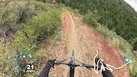
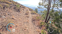
The Echo Super Loop is a combination of the best trails at Echo Ridge. Loop can be ridden in either direction, so its really like two totally different rides. If you're pressed for time or not up for the whole 19 miles just check out the routes section for other sweet loops.
The Super Loop now includes the newest section of Bob's Trail that was opened in Oct. 2020 which has eliminated the nasty climb up Somewhere to Ride Trail.
Trail Issues on Route
- Minor Issue / Yellow: 2 trails (newest: Nov 11, 2025)
Local Trail Association
Evergreen - Central Chapter (cwevergreenmtb.org)Trail Products
Stats
-
Distance19 miles
-
Avg time2 hr 20 min
-
Altitude min2,621 ft
-
Altitude start2,706 ft
-
Altitude end2,651 ft
-
Climb2,386 ft
-
Descent-2,444 ft
-
Grade-0.1%
-
Grade max-42.4%
-
Grade min42.9%
-
Distance climb10 miles
-
Distance down9 miles
-
Distance flat3,789 ft
28 Reviews & Comments
We hope you've been enjoying Trailforks!
Create a FREE account to view route comments and much more.
Trails in Route
| 10 miles | |||||
| 4 miles | |||||
| 4 miles | |||||
| 8 miles | |||||
| 5 miles | |||||
| 3 miles | |||||
| 3 miles | |||||
| 3 miles | |||||
| 3,694 ft | |||||
| 3,606 ft | |||||
| 3 miles | |||||
| 3 miles |
Details
-
Riding area
-
Primary ActivityMountain Bike
-
Difficulty ratingBlue
-
Route TypeLoop
-
eBike Allowed
-
DirectionBoth Directions
-
Physical ratingModerate
-
Ridelogs
- Unknown
- Snow Groomed
- Snow Packed
- Snow Covered
- Snow Cover Partial
- Freeze/thaw Cycle
- Icy
- Prevalent Mud
- Wet
- Variable
- Ideal
- Dry
- Very Dry
The colour categories are based on what percentage of riders are riding a trail in its intended direction.
- > 96%
- > 90%
- > 80%
- > 70%
- > 50%
- < 50%
- bi-directional trail
- no data
- < 2 days
- < 1 week
- < 2 weeks
- < 1 month
- < 6 months
- > 6 months
- Downhill Only
- Downhill Primary
- Both Directions
- Uphill Primary
- Uphill Only
- One Direction
- Description
- Photos
- Description & Photos
- Videos
- most popular
- popular
- less popular
- not popular
Service Road Atlas is a free to use, community-driven service for viewing and creating reports on the numerous back-country service roads around B.C. and Alberta.
Save the current map location and zoom level as your default home location whenever this page is loaded.
Save- Singletrack
- Unpaved
Photos
Videos
Recent Trail Reports Along Route
- By pwillard
LCTA & contributors - #2908 - 7,224 views
