close
-
Layers w
- Weather Layers
- Pro
- Pro
- Pro
- Pro
- Pro
- Pro
- More Layers
- Pro
- Pro
- Pro
- Pro
-
Upgrade to

3D
Trail Conditions
- Unknown
- Snow Groomed
- Snow Packed
- Snow Covered
- Snow Cover Partial
- Freeze/thaw Cycle
- Icy
- Prevalent Mud
- Wet
- Variable
- Ideal
- Dry
- Very Dry
Trail Flow (Ridden Direction)
Trailforks scans users ridelogs to determine the most popular direction each trail is ridden. A good flowing trail network will have most trails flowing in a single direction according to their intension.
The colour categories are based on what percentage of riders are riding a trail in its intended direction.
The colour categories are based on what percentage of riders are riding a trail in its intended direction.
- > 96%
- > 90%
- > 80%
- > 70%
- > 50%
- < 50%
- bi-directional trail
- no data
Trail Last Ridden
Trailforks scans ridelogs to determine the last time a trail was ridden.
- < 2 days
- < 1 week
- < 2 weeks
- < 1 month
- < 6 months
- > 6 months
Trail Ridden Direction
The intended direction a trail should be ridden.
- Downhill Only
- Downhill Primary
- Both Directions
- Uphill Primary
- Uphill Only
- One Direction
Contribute Details
Colors indicate trail is missing specified detail.
- Description
- Photos
- Description & Photos
- Videos
Trail Popularity ?
Trailforks scans ridelogs to determine which trails are ridden the most in the last 9 months.
Trails are compared with nearby trails in the same city region with a possible 25 colour shades.
Think of this as a heatmap, more rides = more kinetic energy = warmer colors.
- most popular
- popular
- less popular
- not popular
ATV/ORV/OHV Filter
Max Vehicle Width
inches
US Cell Coverage
Legend

Radar Time
Activity Recordings
Trailforks uses anonymized public activity data.
?
Activity Recordings
Trailforks uses anonymized public activity data.
?
Personal Heatmap
▶
Activity Types
all
/
none
▶
Options
2
Date range
month
–
Winter Trails
Warning
A routing network for winter maps does not exist. Selecting trails using the winter trails layer has been disabled.
Missing Trails
Most Popular
Least Popular
Trails are colored based on popularity. The more popular a trail is, the more red. Less popular trails trend towards green.
Jump Magnitude Heatmap
Heatmap of where riders jump on trails. Zoom in to see individual jumps, click circles to view jump details.
BC Backroad Status
![map legend]()
Service Road Atlas is a free to use, community-driven service for viewing and creating reports on the numerous back-country service roads around B.C. and Alberta.

Slope Aspect
Direction the slope faces
Trails Deemphasized
Trails are shown in grey.
Only show trails with no bike usage.
Suggested Layers
Based on selected activity type
Save the current map location and zoom level as your default home location whenever this page is loaded.
SaveThe principal town of Chios island and seat of the municipality is Chios town. Locals refer to Chios town as "Chora" ("Χώρα" literally means land or country, but usually refers to the capital or a settlement at the highest point of a Greek island).
Activities Click to view
- Mountain Bike
12 trails
- Adaptive Bike
0 trails
- Hike
4 trails
- Trail Running
4 trails
Region Details
- 1
- 9
- 2
Region Status
Caution as of Jun 12, 2026Stats
- Avg Trail Rating
- Trails (view details)
- 12
- Trails Mountain Bike
- 12
- Trails Hike
- 4
- Trails Trail Running
- 4
- Total Distance
- 8 miles
- Total Descent
- 4,397 ft
- Total Vertical
- 1,571 ft
- Highest Trailhead
- 1,602 ft
- Reports
- 103
- Photos
- 47
- Ridden Counter
- 118
Popular Chios Mountain Biking Trails
• 70 ★ 5.0 • 2,036 ft • 0 ft • 15 •
Popular blue difficulty singletrack. This mountain bike primary trail can be used downhill only and has a hard overall physical rating with a 0 ft blue climb. It features berm, drop and gap jump. On average it takes 2 minutes to complete this trail.
• 95 ★ 5.0 • 5,184 ft • 63 ft • 14 •
Popular blue difficulty singletrack. This mountain bike primary trail can be used downhill primary and has a moderate overall physical rating with a 63 ft blue climb. It features berm and drop. On average it takes 30 minutes to complete this trail.
• 75 ★ 5.0 • 2,784 ft • 0 ft • 6 •
Popular blue difficulty singletrack. This mountain bike primary trail can be used downhill primary and has a moderate overall physical rating with a 0 ft blue climb. It features berm and drop. On average it takes 3 minutes to complete this trail.
• 45 ★ 5.0 • 2,959 ft • 0 ft • 4 •
Moderately popular blue difficulty singletrack. This mountain bike primary trail can be used downhill only and has a moderate overall physical rating with a 0 ft blue climb. It features berm, drop and jump. On average it takes 3 minutes to complete this trail.
• 5 ★ 4.7 • 3,028 ft • 26 ft • 4 •
Less popular blue difficulty singletrack. This mountain bike primary trail can be used downhill primary and has a moderate overall physical rating with a 26 ft blue climb. It features drop. On average it takes 7 minutes to complete this trail.
• 60 ★ 5.0 • 3,618 ft • 3 ft • 3 •
Moderately popular blue difficulty singletrack. This mountain bike primary trail can be used downhill primary and has a hard overall physical rating with a 3 ft black diamond climb. On average it takes 2 minutes to complete this trail.
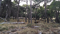
Photos of Chios Mountain Bike
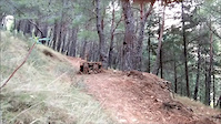
Videos of Chios Mountain Bike
trail: New Monodentri Enduro Trail
0:22 |
79 |
Dec 20, 2016
trail: New Monodentri Enduro Trail
0:14 |
71 |
Mar 23, 2016
Recent Trail Reports
| status | trail | date | condition | info | user |
|---|---|---|---|---|---|
| Nomad Trail | Sep 23, 2024 @ 12:19pm Sep 23, 2024 | Dry | titiviteza | ||
| Slave Trail | Sep 23, 2024 @ 12:19pm Sep 23, 2024 | Dry | titiviteza | ||
| Lizard | Sep 23, 2024 @ 12:19pm Sep 23, 2024 | Dry | titiviteza | ||
| Louki Trail | Feb 5, 2022 @ 5:10am Feb 5, 2022 | Wet | verginas | ||
| Kona Trail | Apr 1, 2018 @ 1:43am Apr 1, 2018 | Variable | xenofonboubaris | ||
| Skull Trail | Apr 1, 2018 @ 1:43am Apr 1, 2018 | Dry | xenofonboubaris | ||
| I Hi Trail | Mar 24, 2018 @ 6:35am Mar 24, 2018 | Wet | xenofonboubaris | ||
| New Monodentri Enduro Trail | Mar 24, 2018 @ 6:35am Mar 24, 2018 | Wet | xenofonboubaris | ||
| Kastromina | Nov 19, 2017 @ 1:02am Nov 19, 2017 | Wet | xenofonboubaris | ||
| Scramble Trail | May 28, 2017 @ 11:08pm May 28, 2017 | Dry | xenofonboubaris |
Activity Feed
| username | action | type | title | date |
|---|---|---|---|---|
| Jirirejnek | ridden | trail | activity #69964140 and 5 more | Apr 19, 2025 @ 1:44pm Apr 19, 2025 |
| titiviteza | add | report | activity #59372970 and 2 more | Sep 23, 2024 @ 10:23am Sep 23, 2024 |
| tanzucycles | wishlist | region | activity #47194310 | Dec 12, 2023 @ 7:51am Dec 12, 2023 |
| verginas | add | report | activity #26614200 and 2 more | Feb 5, 2022 @ 10:15am Feb 5, 2022 |
| Faniskit | wishlist | trail | activity #23647621 | Sep 30, 2021 @ 12:08pm Sep 30, 2021 |
Local Badges
-

Epic Ride Climb 2k15 awarded -

Climbing 10k Badge9 awarded -

Climbing 100k Badge1 awarded -

Epic Ride Descent 2k15 awarded -

Descent 10k Badge9 awarded -

Descent 100k Badge2 awarded
Local Trail Supporters
- Chios MTB
Activity Type Stats
| activitytype | trails | distance | descent | descent distance | total vertical | rating | global rank | state rank | photos | reports | routes | ridelogs |
|---|---|---|---|---|---|---|---|---|---|---|---|---|
| Mountain Bike | 12 | 8 miles | 4,396 ft | 7 miles | 1,572 ft | #2,057 | #11 | 47 | 103 | 1,336 | ||
| Hike | 4 | 2 miles | 1,125 ft | 2 miles | 778 ft | #3,062 | #22 | 103 | 27 | |||
| Trail Running | 4 | 2 miles | 1,125 ft | 2 miles | 778 ft | #2,566 | #23 | 103 |
Frequently Asked Questions About Chios
▼
What are the highest rated mountain biking trails in Chios?
The highest rated mountain biking trails in Chios are:
- Slave Trail (4.2/5)
- Skull Trail (4.2/5)
- Louki Trail (4.2/5)
- Scramble Trail (4.2/5)
- Kastromina (4.2/5)
▼
What is the best time of the year to ride in Chios?
Based on ride log data, the most popular months to ride in Chios are:
- February (9 activities)
- May (7 activities)
- December (5 activities)
▼
Where can I park to ride in Chios?
Check the Chios trail map for trailhead and parking information. Community members regularly update access and parking details for trails in the area.
▼
What is the longest trail in Chios?
The longest trail in Chios is Slave Trail at 1.6 km. View all trails sorted by distance.
- By xenofonboubaris & contributors
- Admins: apply
- #13537 - 3,875 views
- chios activity log | embed map of Chios mountain bike trails |
Downloading of trail gps tracks in kml & gpx formats is enabled for Chios.
You must login to download files.