close
-
Layers w
- Weather Layers
- Pro
- Pro
- Pro
- Pro
- Pro
- Pro
- More Layers
- Pro
- Pro
- Pro
- Pro
-
Upgrade to

3D
Trail Conditions
- Unknown
- Snow Groomed
- Snow Packed
- Snow Covered
- Snow Cover Partial
- Freeze/thaw Cycle
- Icy
- Prevalent Mud
- Wet
- Variable
- Ideal
- Dry
- Very Dry
Trail Flow (Ridden Direction)
Trailforks scans users ridelogs to determine the most popular direction each trail is ridden. A good flowing trail network will have most trails flowing in a single direction according to their intension.
The colour categories are based on what percentage of riders are riding a trail in its intended direction.
The colour categories are based on what percentage of riders are riding a trail in its intended direction.
- > 96%
- > 90%
- > 80%
- > 70%
- > 50%
- < 50%
- bi-directional trail
- no data
Trail Last Ridden
Trailforks scans ridelogs to determine the last time a trail was ridden.
- < 2 days
- < 1 week
- < 2 weeks
- < 1 month
- < 6 months
- > 6 months
Trail Ridden Direction
The intended direction a trail should be ridden.
- Downhill Only
- Downhill Primary
- Both Directions
- Uphill Primary
- Uphill Only
- One Direction
Contribute Details
Colors indicate trail is missing specified detail.
- Description
- Photos
- Description & Photos
- Videos
Trail Popularity ?
Trailforks scans ridelogs to determine which trails are ridden the most in the last 9 months.
Trails are compared with nearby trails in the same city region with a possible 25 colour shades.
Think of this as a heatmap, more rides = more kinetic energy = warmer colors.
- most popular
- popular
- less popular
- not popular
ATV/ORV/OHV Filter
Max Vehicle Width
inches
US Cell Coverage
Legend

Radar Time
Activity Recordings
Trailforks uses anonymized public activity data.
?
Activity Recordings
Trailforks uses anonymized public activity data.
?
Personal Heatmap
▶
Activity Types
all
/
none
▶
Options
2
Date range
month
–
Winter Trails
Warning
A routing network for winter maps does not exist. Selecting trails using the winter trails layer has been disabled.
Missing Trails
Most Popular
Least Popular
Trails are colored based on popularity. The more popular a trail is, the more red. Less popular trails trend towards green.
Jump Magnitude Heatmap
Heatmap of where riders jump on trails. Zoom in to see individual jumps, click circles to view jump details.
BC Backroad Status
![map legend]()
Service Road Atlas is a free to use, community-driven service for viewing and creating reports on the numerous back-country service roads around B.C. and Alberta.

Slope Aspect
Direction the slope faces
Trails Deemphasized
Trails are shown in grey.
Only show trails with no bike usage.
Suggested Layers
Based on selected activity type
Save the current map location and zoom level as your default home location whenever this page is loaded.
Save
No description for Cisna has been added yet!
Login or register to submit one.
This region uses the Uk/Euro style trail grading system.
Activities Click to view
- Mountain Bike
23 trails
- E-Bike
3 trails
- Gravel Bike
0 trails
- Adaptive Bike
0 trails
- Horse
0 trails
- Hike
22 trails
- Trail Running
22 trails
- Observed Trials
0 trails
- Snowshoe
0 trails
- Downhill Ski
0 trails
- Backcountry Ski
0 trails
- Nordic Ski
0 trails
Region Details
- 7
- 1
- 7
- 6
- 2
Region Status
Caution as of Oct 28, 2025Stats
- Avg Trail Rating
- Trails (view details)
- 23
- Trails Mountain Bike
- 23
- Trails E-Bike
- 3
- Trails Hike
- 22
- Trails Trail Running
- 22
- Total Distance
- 53 miles
- Total Descent
- 15,519 ft
- Total Vertical
- 2,165 ft
- Highest Trailhead
- 3,747 ft
- Reports
- 81
- Photos
- 98
- Ridden Counter
- 1,073
Popular Cisna Mountain Biking Trails
• 95 ★ 5.0 • 2 miles • 144 ft • 48 • • hike
Popular blue difficulty singletrack. This hike primary trail can be used downhill primary and has a moderate overall physical rating with a 144 ft green climb. On average it takes 21 minutes to complete this trail.
• 5 ★ 5.0 • 1 mile • 213 ft • 45 • • hike
Less popular red difficulty singletrack. This hike primary trail can be used downhill primary. On average it takes 15 minutes to complete this trail.
• 70 ★ 4.8 • 1 mile • 14 ft • 38 • • hike
Popular red difficulty singletrack. This hike primary trail can be used downhill primary. On average it takes 5 minutes to complete this trail.
• 5 ★ 4.8 • 1 mile • 171 ft • 36 • • hike
Less popular blue difficulty singletrack. This hike primary trail can be used downhill primary. On average it takes 23 minutes to complete this trail.
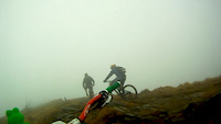
Cisna Mountain Bike Routes
★ 5.0 • 37 miles • 5,197 ft • 8 • Loop •
Pętla której główna część to Pasmo Jasła, a opcjonalna szutry dokoła Fałowej, bądź atak na...
★ 5.0 • 28 miles • 5,087 ft • 11 • Loop •
Pętla po dwóch pasmach między Cisną i Baligrodem. Pasmo Łopiennika jest dość ciężką...
43 miles • 4,665 ft • 0 • Loop •
Second day of Trailseekers.pl trip to Bieszczady. Loop starting and ending in Bukowiec, leading through...
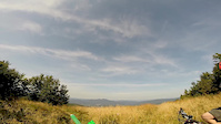
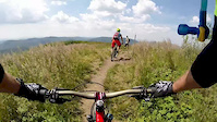
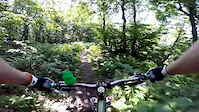
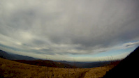
Photos of Cisna Mountain Bike
Videos of Cisna Mountain Bike
![Legalne Bieszczady [18.06.2016]](https://ev1.pinkbike.org/vt/1/svt-449802-1.jpg)
trail: Okrąglik
4:35 |
250 |
Jul 10, 2016
trail: Jasło
0:44 |
473 |
Sep 11, 2014
trail: Jasło
13:23 |
296 |
Jul 25, 2014
trail: Jasło
12:43 |
84 |
Jul 22, 2014
trail: Jasło
10:17 |
78 |
Feb 22, 2013
trail: Smerek
8:29 |
243 |
Feb 22, 2013

trail: Smerek
10:29 |
496 |
Nov 26, 2012

trail: Jasło
13:06 |
335 |
Nov 12, 2012
Recent Trail Reports
| status | trail | date | condition | info | user |
|---|---|---|---|---|---|
| Singletrack Pod Honem | Oct 28, 2025 @ 3:08pm (America/Los_Angeles) Oct 28, 2025 | Unknown | wilazek | ||
| Smerek | Aug 10, 2025 @ 10:21am Aug 10, 2025 | Ideal | Marcinwojtczak | ||
| Przez Sine Wiry | Sep 15, 2024 @ 11:15am Sep 15, 2024 | Very Dry | JurajKEYrhI | ||
| Szczycisko | Aug 20, 2022 @ 1:59am Aug 20, 2022 | Ideal | arso82 | ||
| Czerenina | Aug 20, 2022 @ 1:59am Aug 20, 2022 | Wet | arso82 | ||
| Fałowa | Aug 20, 2022 @ 1:59am Aug 20, 2022 | Wet | arso82 | ||
| Worwosoka | Jul 3, 2022 @ 12:51am Jul 3, 2022 | Wet | xCf98 | ||
| Berest | Jun 17, 2022 @ 4:04am Jun 17, 2022 | Ideal | PaPaweu | ||
| Sasów | Jun 17, 2022 @ 4:04am Jun 17, 2022 | Ideal | PaPaweu | ||
| Łopiennik Access | May 28, 2022 @ 1:38am May 28, 2022 | Prevalent Mud | mardro1 |
Activity Feed
| username | action | type | title | date |
|---|---|---|---|---|
| wilazek | add | report | activity #83185070 | Oct 28, 2025 @ 3:10pm Oct 28, 2025 |
| wilazek | wishlist | trail | activity #83184966 | Oct 28, 2025 @ 3:08pm Oct 28, 2025 |
| krzychumalina | add | trail | activity #78669029 | Aug 22, 2025 @ 6:00am Aug 22, 2025 |
| krzychumalina | add | trail | activity #78308763 | Aug 16, 2025 @ 11:34pm Aug 16, 2025 |
| Marcinwojtczak | add | report | activity #77817244 | Aug 10, 2025 @ 5:38am Aug 10, 2025 |
Recent Comments
| username | type | title | comment | date |
|---|---|---|---|---|
| trail | Okoliczności przyrody to w zasadzie jedyna... | Aug 9, 2022 @ 9:26am Aug 9, 2022 | ||
| trail | Singiel zupełnie zaniedbany, mnóstwo... | Jun 17, 2022 @ 12:10pm Jun 17, 2022 | ||
| trail | Cały czas czerwonym szlakiem do Cisnej | May 27, 2022 @ 12:31pm May 27, 2022 | ||
| trail | Czerwony szlak pieszy w kierunku Cisnej przez... | May 27, 2022 @ 12:28pm May 27, 2022 | ||
| trail | Świetny, graniowy singiel. Prawdziwa górska... | May 27, 2022 @ 12:17pm May 27, 2022 |
Local Badges
-

Epic Ride Climb 2k42 awarded -

Climbing 10k Badge2 awarded -

Climbing 100k Badge0 awarded -

Epic Ride Descent 2k42 awarded -

Descent 10k Badge2 awarded -

Descent 100k Badge0 awarded
Activity Type Stats
| activitytype | trails | distance | descent | descent distance | total vertical | rating | global rank | state rank | photos | reports | routes | ridelogs |
|---|---|---|---|---|---|---|---|---|---|---|---|---|
| Mountain Bike | 23 | 53 miles | 15,518 ft | 30 miles | 2,165 ft | #3,494 | #68 | 98 | 81 | 3 | 414 | |
| E-Bike | 3 | 7 miles | 1,204 ft | 3 miles | 978 ft | #4,500 | #352 | 71 | 76 | |||
| Hike | 22 | 46 miles | 14,318 ft | 27 miles | 2,165 ft | #3,969 | #71 | 77 | 202 | |||
| Trail Running | 22 | 46 miles | 14,318 ft | 27 miles | 2,165 ft | #3,714 | #62 | 77 | 34 |
Frequently Asked Questions About Cisna
▼
What are the highest rated mountain biking trails in Cisna?
▼
What is the best time of the year to ride in Cisna?
Based on ride log data, the most popular months to ride in Cisna are:
- June (13 activities)
- August (11 activities)
- July (2 activities)
▼
Where can I park to ride in Cisna?
▼
What is the longest trail in Cisna?
The longest trail in Cisna is Singletrack Pod Honem at 11.6 km. View all trails sorted by distance.
Trails
Points of Interest
- By micolai
 TRAILFORKS Poland & contributors
 - Admins: apply
- #15211 - 4,442 views
- cisna activity log | embed map of Cisna mountain bike trails | cisna mountain biking points of interest
Downloading of trail gps tracks in kml & gpx formats is enabled for Cisna.
You must login to download files.