close
-
Layers w
- Weather Layers
- Pro
- Pro
- Pro
- Pro
- Pro
- Pro
- More Layers
- Pro
- Pro
- Pro
- Pro
-
Upgrade to

3D
Trail Conditions
- Unknown
- Snow Groomed
- Snow Packed
- Snow Covered
- Snow Cover Partial
- Freeze/thaw Cycle
- Icy
- Prevalent Mud
- Wet
- Variable
- Ideal
- Dry
- Very Dry
Trail Flow (Ridden Direction)
Trailforks scans users ridelogs to determine the most popular direction each trail is ridden. A good flowing trail network will have most trails flowing in a single direction according to their intension.
The colour categories are based on what percentage of riders are riding a trail in its intended direction.
The colour categories are based on what percentage of riders are riding a trail in its intended direction.
- > 96%
- > 90%
- > 80%
- > 70%
- > 50%
- < 50%
- bi-directional trail
- no data
Trail Last Ridden
Trailforks scans ridelogs to determine the last time a trail was ridden.
- < 2 days
- < 1 week
- < 2 weeks
- < 1 month
- < 6 months
- > 6 months
Trail Ridden Direction
The intended direction a trail should be ridden.
- Downhill Only
- Downhill Primary
- Both Directions
- Uphill Primary
- Uphill Only
- One Direction
Contribute Details
Colors indicate trail is missing specified detail.
- Description
- Photos
- Description & Photos
- Videos
Trail Popularity ?
Trailforks scans ridelogs to determine which trails are ridden the most in the last 9 months.
Trails are compared with nearby trails in the same city region with a possible 25 colour shades.
Think of this as a heatmap, more rides = more kinetic energy = warmer colors.
- most popular
- popular
- less popular
- not popular
ATV/ORV/OHV Filter
Max Vehicle Width
inches
US Cell Coverage
Legend

Radar Time
Activity Recordings
Trailforks uses anonymized public activity data.
?
Activity Recordings
Trailforks uses anonymized public activity data.
?
Personal Heatmap
▶
Activity Types
all
/
none
▶
Options
2
Date range
month
–
Winter Trails
Warning
A routing network for winter maps does not exist. Selecting trails using the winter trails layer has been disabled.
Missing Trails
Most Popular
Least Popular
Trails are colored based on popularity. The more popular a trail is, the more red. Less popular trails trend towards green.
Jump Magnitude Heatmap
Heatmap of where riders jump on trails. Zoom in to see individual jumps, click circles to view jump details.
BC Backroad Status
![map legend]()
Service Road Atlas is a free to use, community-driven service for viewing and creating reports on the numerous back-country service roads around B.C. and Alberta.

Slope Aspect
Direction the slope faces
Trails Deemphasized
Trails are shown in grey.
Only show trails with no bike usage.
Suggested Layers
Based on selected activity type
Save the current map location and zoom level as your default home location whenever this page is loaded.
Save
No description for Clemson has been added yet!
Login or register to submit one.
Activities Click to view
- Mountain Bike
77 trails
- E-Bike
76 trails
- Gravel Bike
0 trails
- Adaptive Bike
0 trails
- Horse
77 trails
- Hike
76 trails
- Trail Running
76 trails
Region Details
- 20
- 21
- 26
- 5
Region Status
Caution as of Jun 18, 2026Stats
- Avg Trail Rating
- Trails (view details)
- 71
- Trails Mountain Bike
- 77
- Trails E-Bike
- 76
- Trails Horse
- 77
- Trails Hike
- 76
- Trails Trail Running
- 76
- Total Distance
- 63 miles
- Total Descent
- 7,118 ft
- Total Vertical
- 319 ft
- Highest Trailhead
- 983 ft
- Reports
- 979
- Photos
- 107
- Ridden Counter
- 10,305
Sub Regions
-
Issaqueena Trail System @ Clemson Experimental Forest
- 21
- 26
- 5
Popular Clemson Mountain Biking Trails
• 90 ★ 3.0 • 2 miles • 99 ft • 440 •
Classic singletrack that defines this area. Trail climbs from the Dam area to the main parking area. Remember to take, right, right left at the first three intersections to stay on this trail.nTrails is as BLUE as any other blue trail...
• 95 ★ 4.3 • 2 miles • 45 ft • 410 •
The system offers approximately 40 miles of diverse single-track and fire roads for mountain biking, /running, and horseback riding. The trails on the southern section offer a more demanding riding experience with punchy climbs and...
• 75 ★ 3.5 • 3,415 ft • 12 ft • 314 •
Popular blue difficulty singletrack. This multi-use trail can be used downhill primary and has a easy overall physical rating. On average it takes 3 minutes to complete this trail.
• 90 ★ 4.7 • 2,549 ft • 0 ft • 273 •
Popular blue difficulty singletrack. This multi-use trail can be used downhill primary and has a moderate overall physical rating with a 0 ft blue climb. Trail visibility is always easy to follow. On average it takes 3 minutes to complete this trail.
• 80 ★ 3.0 • 2 miles • 109 ft • 269 •
Popular blue difficulty singletrack. This multi-use trail. On average it takes 14 minutes to complete this trail.
• 85 ★ 0.0 • 2,822 ft • 4 ft • 245 •
Popular blue difficulty singletrack. This multi-use trail. On average it takes 3 minutes to complete this trail.
• 75 ★ 3.7 • 3,668 ft • 0 ft • 231 •
Popular blue difficulty singletrack. This multi-use trail can be used downhill primary and has a moderate overall physical rating. Trail visibility is always easy to follow. On average it takes 4 minutes to complete this trail.
• 80 ★ 0.0 • 2,736 ft • 17 ft • 228 •
Popular green difficulty singletrack. This multi-use trail can be used both directions and has a easy overall physical rating with a 17 ft green climb. On average it takes 2 minutes to complete this trail.
Clemson Mountain Bike Routes
★ 4.4 • 20 miles • 2,165 ft • 22 • Loop •
This is a route for exploring middle and upper (Clemson Experimental Forest).
8 miles • 1,002 ft • 7 • Loop •
8 Mile Loop in holly springs area
9 miles • 829 ft • 0 •
• 13 miles • 1,395 ft • 13 •
• 5 miles • 544 ft • 1 •
• 5 miles • 562 ft • 3 •
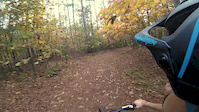
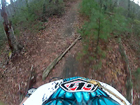
Photos of Clemson Mountain Bike
Videos of Clemson Mountain Bike

trail: Loopty Connector
6:55 |
148 |
Dec 30, 2017

trail: Fast
4:21 |
384 |
Dec 30, 2017
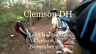
trail: Clemson Freeride DH
5:10 |
521 |
Dec 29, 2017
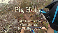
trail: Pig Horse
8:37 |
575 |
Dec 27, 2017
trail: Rapids Trail
6:34 |
110 |
Dec 27, 2017

trail: Family
14:36 |
37 |
Dec 6, 2016
trail: Fast
0:49 |
178 |
Mar 28, 2014

trail: Fast
0:23 |
209 |
Feb 21, 2014
Recent Trail Reports
Activity Feed
| username | action | type | title | date |
|---|---|---|---|---|
| micawood | add | report | activity #97252962 and 6 more | Jun 18, 2026 @ 8:09am Jun 18, 2026 |
| BriannarPFfE6 | wishlist | trail | activity #96504995 | Jun 7, 2026 @ 4:05pm Jun 7, 2026 |
| VTKarl | add | report | activity #92474299 | Apr 12, 2026 @ 8:09am Apr 12, 2026 |
| skwisssgar | ridden | trail | activity #92333523 and 3 more | Apr 10, 2026 @ 11:28am Apr 10, 2026 |
| Ccouch5859 | wishlist | route | activity #92051956 | Apr 6, 2026 @ 7:38am Apr 6, 2026 |
Recent Comments
| username | type | title | comment | date |
|---|---|---|---|---|
| trail | Now they had a rake party. Or really a rape... | Mar 24, 2026 @ 6:39am Mar 24, 2026 | ||
| trail | Please please please dont put inexperienced... | Mar 24, 2026 @ 6:32am Mar 24, 2026 | ||
| trail | This trail isn’t really rideable very little... | Nov 23, 2025 @ 2:43pm Nov 23, 2025 | ||
| trail | PLEASE DO NOT BLOW THE TRAILS, EVER!!!! Huge... | Oct 26, 2025 @ 10:28am Oct 26, 2025 | ||
| trail | All trees cleared. SADLY, someone blew the... | Oct 26, 2025 @ 9:55am Oct 26, 2025 |
Local Badges
-

10 Green Trails102 awarded -

10 Blue Trails156 awarded -

Epic Ride Climb 2k13 awarded -

Climbing 10k Badge29 awarded -

Climbing 100k Badge0 awarded -

Epic Ride Descent 2k13 awarded
Activity Type Stats
| activitytype | trails | distance | descent | descent distance | total vertical | rating | global rank | state rank | photos | reports | routes | ridelogs |
|---|---|---|---|---|---|---|---|---|---|---|---|---|
| Mountain Bike | 77 | 63 miles | 7,119 ft | 26 miles | 318 ft | #2,429 | #864 | 106 | 983 | 3 | 7,332 | |
| E-Bike | 76 | 63 miles | 7,119 ft | 26 miles | 318 ft | #2,444 | #996 | 781 | 2 | 338 | ||
| Horse | 77 | 63 miles | 7,119 ft | 26 miles | 318 ft | #875 | #610 | 172 | 1 | 13 | ||
| Hike | 76 | 63 miles | 7,067 ft | 26 miles | 318 ft | #4,096 | #1,447 | 982 | 1 | 187 | ||
| Trail Running | 76 | 63 miles | 7,067 ft | 26 miles | 318 ft | #3,558 | #1,064 | 982 | 1 | 166 |
Frequently Asked Questions About Clemson
▼
What are the best places to ride in Clemson?
Clemson has 1 areas to explore for mountain biking. The top rated areas are:
▼
What are the highest rated mountain biking trails in Clemson?
The highest rated mountain biking trails in Clemson are:
- Ungrinder (4.3/5)
- Wounded Knee (4.2/5)
- Weedeater (4.2/5)
- Issaqueena (4.1/5)
- Holly Springs Road (4.1/5)
▼
What is the best time of the year to ride in Clemson?
Based on ride log data, the most popular months to ride in Clemson are:
- October (92 activities)
- June (80 activities)
- September (66 activities)
▼
Where can I park to ride in Clemson?
There are 8 parking locations listed in Clemson. The most popular parking spots are:
- Main Parking Lot
- Holly Spring Parking Area
- Indian Springs Parking Area
- Doyle Bottom Rd Parking
- Vic's Trailhead Parking (roadside)
Activities
Trails
- By brenthillier
 NSMBA TRAILFORKS & contributors
 - Admins: apply
- #3560 - 8,398 views
- clemson activity log | embed map of Clemson mountain bike trails | clemson mountain biking points of interest
Downloading of trail gps tracks in kml & gpx formats is enabled for Clemson.
You must login to download files.