close
-
Layers w
- Weather Layers
- Pro
- Pro
- Pro
- Pro
- Pro
- Pro
- More Layers
- Pro
- Pro
- Pro
- Pro
-
Upgrade to

3D
Trail Conditions
- Unknown
- Snow Groomed
- Snow Packed
- Snow Covered
- Snow Cover Partial
- Freeze/thaw Cycle
- Icy
- Prevalent Mud
- Wet
- Variable
- Ideal
- Dry
- Very Dry
Trail Flow (Ridden Direction)
Trailforks scans users ridelogs to determine the most popular direction each trail is ridden. A good flowing trail network will have most trails flowing in a single direction according to their intension.
The colour categories are based on what percentage of riders are riding a trail in its intended direction.
The colour categories are based on what percentage of riders are riding a trail in its intended direction.
- > 96%
- > 90%
- > 80%
- > 70%
- > 50%
- < 50%
- bi-directional trail
- no data
Trail Last Ridden
Trailforks scans ridelogs to determine the last time a trail was ridden.
- < 2 days
- < 1 week
- < 2 weeks
- < 1 month
- < 6 months
- > 6 months
Trail Ridden Direction
The intended direction a trail should be ridden.
- Downhill Only
- Downhill Primary
- Both Directions
- Uphill Primary
- Uphill Only
- One Direction
Contribute Details
Colors indicate trail is missing specified detail.
- Description
- Photos
- Description & Photos
- Videos
Trail Popularity ?
Trailforks scans ridelogs to determine which trails are ridden the most in the last 9 months.
Trails are compared with nearby trails in the same city region with a possible 25 colour shades.
Think of this as a heatmap, more rides = more kinetic energy = warmer colors.
- most popular
- popular
- less popular
- not popular
ATV/ORV/OHV Filter
Max Vehicle Width
inches
US Cell Coverage
Legend

Radar Time
Activity Recordings
Trailforks uses anonymized public activity data.
?
Activity Recordings
Trailforks uses anonymized public activity data.
?
Personal Heatmap
▶
Activity Types
all
/
none
▶
Options
2
Date range
month
–
Winter Trails
Warning
A routing network for winter maps does not exist. Selecting trails using the winter trails layer has been disabled.
Missing Trails
Most Popular
Least Popular
Trails are colored based on popularity. The more popular a trail is, the more red. Less popular trails trend towards green.
Jump Magnitude Heatmap
Heatmap of where riders jump on trails. Zoom in to see individual jumps, click circles to view jump details.
BC Backroad Status
![map legend]()
Service Road Atlas is a free to use, community-driven service for viewing and creating reports on the numerous back-country service roads around B.C. and Alberta.

Slope Aspect
Direction the slope faces
Trails Deemphasized
Trails are shown in grey.
Only show trails with no bike usage.
Suggested Layers
Based on selected activity type
Save the current map location and zoom level as your default home location whenever this page is loaded.
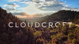
SaveHigh elevation, mix conifer and aspen with lots of steep and rocky trails leading out of and around the mountain Village of Cloudcroft NM. Big Elevation change down to the desert of the Tularosa Basin is possible, 4000ft Large views of White Sands National Monument along the Rim Trail. Home of the High Altitude Classic!
Activities Click to view
- Mountain Bike
63 trails
- E-Bike
45 trails
- Gravel Bike
13 trails
- Adaptive Bike
15 trails
- Winter Fat Bike
2 trails
- Horse
47 trails
- Hike
67 trails
- Trail Running
67 trails
- Dirtbike/Moto
31 trails
- Observed Trials
20 trails
- ATV/ORV/OHV
27 trails
- Downhill Ski
28 trails
Region Details
- 14
- 8
- 32
- 9
Region Status
Caution as of Mar 16, 2026Stats
- Avg Trail Rating
- Trails (view details)
- 95
- Trails Mountain Bike
- 63
- Trails E-Bike
- 45
- Trails Gravel Bike
- 13
- Trails Adaptive Bike
- 15
- Trails Winter Fat Bike
- 2
- Trails Horse
- 47
- Trails Hike
- 67
- Trails Trail Running
- 67
- Trails Dirtbike/Moto
- 31
- Trails Observed Trials
- 20
- Trails ATV/ORV/OHV
- 27
- Trails Downhill Ski
- 28
- Total Distance
- 218 miles
- Total Descent
- 38,385 ft
- Total Vertical
- 3,798 ft
- Highest Trailhead
- 9,550 ft
- Reports
- 18
- Photos
- 22
- Ridden Counter
- 1,384
Sub Regions
-
Bluff Springs
- 3
- 15
- 5
-
Lincoln National Forest
- 6
- 4
Popular Cloudcroft Mountain Biking Trails
• 100 ★ 4.0 • 1 mile • 174 ft • 131 •
Steep rocky single track with a fast flowing decent in the middle.
• 100 ★ 4.0 • 3,182 ft • 197 ft • 128 •
Connects to the trialhead of the Race Course at the ball field. The "official" way to complete the Race Course Loop.
• 90 ★ 5.0 • 2 miles • 0 ft • 118 •
Fun flowy singletrack through open meows off the start, then transitions to a fast singletrack decent though the canyon.
• 95 ★ 3.8 • 2 miles • 291 ft • 88 •
High Altitude Classic Race Course is a fun Loop that starts and finishes in downtown Cloudcroft. The trail is a mix of steepish rocky singletrack climbs and descents, some fire road, and flowy old school forest single track.
• 95 ★ 0.0 • 1 mile • 21 ft • 55 •
Popular blue difficulty singletrack. This multi-use trail can be used both directions. On average it takes 4 minutes to complete this trail.
• 100 ★ 0.0 • 3 miles • 416 ft • 47 •
Popular blue difficulty singletrack. This multi-use trail can be used both directions. On average it takes 24 minutes to complete this trail.
• 95 ★ 0.0 • 1 mile • 17 ft • 40 • • hike
Popular green difficulty singletrack. This hike primary trail can be used downhill primary.
• 65 ★ 0.0 • 3 miles • 274 ft • 19 •
Moderately popular blue difficulty singletrack. This multi-use trail can be used both directions. On average it takes 16 minutes to complete this trail.
Cloudcroft Mountain Bike Routes
8 miles • 1,308 ft • 2 • Loop •
High Altitude Classic XC Mountain Bike Race (Short Loop) More information:...
8 miles • 1,280 ft • 4 • Loop •
Simple loop in Cloudcroft, NM that is a 1:1 for climbing to descending
73 miles • 9,397 ft • 0 • Point to Point •
Long Course for the Cloudcoft Gravel Fondo ride
Photos of Cloudcroft Mountain Bike
Videos of Cloudcroft Mountain Bike
7:45 |
225 |
Oct 3, 2022

9:55 |
228 |
Jul 9, 2022
Recent Trail Reports
| status | trail | date | condition | info | user |
|---|---|---|---|---|---|
| Rim Trail NRT | Mar 16, 2026 @ 10:07am (America/Denver) Mar 16, 2026 | Ideal | Timyzh91r | ||
| Overlook South | Nov 9, 2025 @ 10:43am (America/Ciudad_Juarez) Nov 9, 2025 | Ideal | ingothomas BMBA | ||
| Bailey Canyon | Jun 18, 2025 @ 1:23pm Jun 18, 2025 | Ideal | bluetrailbimbo | ||
| Coats Peak | Mar 30, 2025 @ 11:15am Mar 30, 2025 | Dry | Roadwarriorxo | ||
| Last Chance Canyon | Mar 29, 2025 @ 10:57am Mar 29, 2025 | Dry | Roadwarriorxo | ||
| Trail 5510 | Mar 29, 2025 @ 10:57am Mar 29, 2025 | Dry | Roadwarriorxo | ||
| Pines N. Trail | Sep 16, 2024 @ 11:43am Sep 16, 2024 | Ideal | angelhernandez | ||
| Race Course Connector | Apr 10, 2024 @ 4:44pm Apr 10, 2024 | Ideal | matthewsfur SFUR | ||
| High Altitude Race Course | Apr 10, 2024 @ 4:41pm Apr 10, 2024 | Variable | matthewsfur SFUR | ||
| Crooked Canyon | Apr 23, 2018 @ 4:18pm Apr 23, 2018 | Dry | Honda1262 |
Activity Feed
| username | action | type | title | date |
|---|---|---|---|---|
| ReaperBeast | wishlist | trail | activity #97311069 | Jun 19, 2026 @ 5:58am 9 hours |
| znTzEU84 | vote | trail | activity #94554452 | May 12, 2026 @ 6:27am May 12, 2026 |
| CKinder | wishlist | trail | activity #92462543 | Apr 12, 2026 @ 5:03am Apr 12, 2026 |
| vdzsno | ridden | route | activity #90757048 | Mar 17, 2026 @ 12:34pm Mar 17, 2026 |
| Timyzh91r | add | report | activity #90693480 | Mar 16, 2026 @ 9:07am Mar 16, 2026 |
Recent Comments
| username | type | title | comment | date |
|---|---|---|---|---|
| trail | you must not be a real rider, wow what a jerk.... | Feb 3, 2026 @ 9:31am Feb 3, 2026 | ||
| trail | Yes and you’re a gigantic pussy | Feb 3, 2026 @ 9:02am Feb 3, 2026 | ||
| trail | are the scattered rocks due to moto traffic? ... | Feb 2, 2026 @ 11:02am Feb 2, 2026 | ||
| trail | Oldest trail in NF land in Nm and it shows. So... | Aug 11, 2025 @ 5:47pm Aug 11, 2025 | ||
| trail | First half of the trail has a ton of softball... | Jul 19, 2025 @ 12:07pm Jul 19, 2025 |
Local Badges
-

10 Blue Trails20 awarded -

Epic Ride Climb 2k17 awarded -

Climbing 10k Badge6 awarded -

Climbing 100k Badge0 awarded -

Epic Ride Descent 2k21 awarded -

Descent 10k Badge6 awarded
Local Mountain Biking Directory
-
High AltitudeBike Shop
Activity Type Stats
| activitytype | trails | distance | descent | descent distance | total vertical | rating | global rank | state rank | photos | reports | routes | ridelogs |
|---|---|---|---|---|---|---|---|---|---|---|---|---|
| Mountain Bike | 63 | 208 miles | 33,875 ft | 113 miles | 3,799 ft | #1,339 | #509 | 16 | 18 | 9 | 963 | |
| E-Bike | 45 | 187 miles | 28,822 ft | 99 miles | 3,799 ft | #901 | #776 | 13 | 24 | |||
| Gravel Bike | 13 | 81 miles | 8,635 ft | 40 miles | 3,074 ft | #264 | #890 | 4 | 8 | |||
| Adaptive Bike | 15 | 84 miles | 8,658 ft | 40 miles | 3,074 ft | #244 | #1,545 | 6 | ||||
| Winter Fat Bike | 2 | 2 miles | 646 ft | 2 miles | 689 ft | #388 | #1,161 | 4 | ||||
| Horse | 47 | 147 miles | 26,594 ft | 79 miles | 2,513 ft | #278 | #450 | 5 | ||||
| Hike | 67 | 213 miles | 35,023 ft | 116 miles | 3,799 ft | #1,082 | #497 | 2 | 18 | 287 | ||
| Trail Running | 67 | 213 miles | 35,023 ft | 116 miles | 3,799 ft | #843 | #319 | 4 | 18 | 56 | ||
| Dirtbike/Moto | 31 | 103 miles | 19,656 ft | 57 miles | 2,326 ft | #466 | #161 | 4 | 7 | |||
| Observed Trials | 20 | 80 miles | 11,601 ft | 41 miles | 2,513 ft | #178 | #30 | |||||
| ATV/ORV/OHV | 27 | 93 miles | 16,289 ft | 50 miles | 2,513 ft | #370 | #107 | 4 | ||||
| Downhill Ski | 28 | 5 miles | 3,363 ft | 5 miles | 591 ft | #622 | #287 | 2 |
Frequently Asked Questions About Cloudcroft
▼
What are the best places to ride in Cloudcroft?
Cloudcroft has 3 areas to explore for mountain biking. The top rated areas are:
▼
What are the highest rated mountain biking trails in Cloudcroft?
The highest rated mountain biking trails in Cloudcroft are:
- Bailey Canyon (4.1/5)
- Trail 5510 (4.1/5)
- Last Chance Canyon (4.1/5)
- Coats Peak (4.1/5)
- Wills Canyon (4.1/5)
▼
What is the best time of the year to ride in Cloudcroft?
Based on ride log data, the most popular months to ride in Cloudcroft are:
- June (14 activities)
- August (10 activities)
- July (9 activities)
▼
Where can I park to ride in Cloudcroft?
There are 4 parking locations listed in Cloudcroft. The most popular parking spots are: View all parking and trailhead locations on the map to plan your visit.
Activities
- Cloudcroft Mountain Biking Trails
- Cloudcroft E-Biking Trails
- Cloudcroft Gravel Biking Trails
- Cloudcroft Adaptive Biking Trails
- Cloudcroft Horseback Trails
- Cloudcroft Hiking Trails
- Cloudcroft Trail Running Trails
- Cloudcroft Dirtbiking Trails
- Cloudcroft Observed Trials Trails
- Cloudcroft ATVing/Offroading Trails
- Cloudcroft Skiing Trails
Trails
Points of Interest
- Bluff Springs Campground Camping
- Mexico Canyon Railroad Trestle Sight
- Trestle Observation Deck Viewpoint
- Pines Campground Camping
- Tularosa Basin Overlook Viewpoint
- Silver Campground Camping
- Saddle Campground Camping
- Apache Campground Camping
- L Lodge
- Cathey Peak (9,652 ft)
- Sacramento Peak (9,249 ft)
- Prestridge Hill (8,655 ft)
- By Geochemistry & contributors
- Admins: apply
- #20572 - 6,001 views
- cloudcroft activity log | embed map of Cloudcroft mountain bike trails | cloudcroft mountain biking points of interest
Downloading of trail gps tracks in kml & gpx formats is enabled for Cloudcroft.
You must login to download files.