close
-
Layers w
- Weather Layers
- Pro
- Pro
- Pro
- Pro
- Pro
- Pro
- More Layers
- Pro
- Pro
- Pro
- Pro
-
Upgrade to

3D
Trail Conditions
- Unknown
- Snow Groomed
- Snow Packed
- Snow Covered
- Snow Cover Partial
- Freeze/thaw Cycle
- Icy
- Prevalent Mud
- Wet
- Variable
- Ideal
- Dry
- Very Dry
Trail Flow (Ridden Direction)
Trailforks scans users ridelogs to determine the most popular direction each trail is ridden. A good flowing trail network will have most trails flowing in a single direction according to their intension.
The colour categories are based on what percentage of riders are riding a trail in its intended direction.
The colour categories are based on what percentage of riders are riding a trail in its intended direction.
- > 96%
- > 90%
- > 80%
- > 70%
- > 50%
- < 50%
- bi-directional trail
- no data
Trail Last Ridden
Trailforks scans ridelogs to determine the last time a trail was ridden.
- < 2 days
- < 1 week
- < 2 weeks
- < 1 month
- < 6 months
- > 6 months
Trail Ridden Direction
The intended direction a trail should be ridden.
- Downhill Only
- Downhill Primary
- Both Directions
- Uphill Primary
- Uphill Only
- One Direction
Contribute Details
Colors indicate trail is missing specified detail.
- Description
- Photos
- Description & Photos
- Videos
Trail Popularity ?
Trailforks scans ridelogs to determine which trails are ridden the most in the last 9 months.
Trails are compared with nearby trails in the same city region with a possible 25 colour shades.
Think of this as a heatmap, more rides = more kinetic energy = warmer colors.
- most popular
- popular
- less popular
- not popular
ATV/ORV/OHV Filter
Max Vehicle Width
inches
US Cell Coverage
Legend

Radar Time
Activity Recordings
Trailforks uses anonymized public activity data.
?
Activity Recordings
Trailforks uses anonymized public activity data.
?
Personal Heatmap
▶
Activity Types
all
/
none
▶
Options
2
Date range
month
–
Winter Trails
Warning
A routing network for winter maps does not exist. Selecting trails using the winter trails layer has been disabled.
Missing Trails
Most Popular
Least Popular
Trails are colored based on popularity. The more popular a trail is, the more red. Less popular trails trend towards green.
Jump Magnitude Heatmap
Heatmap of where riders jump on trails. Zoom in to see individual jumps, click circles to view jump details.
BC Backroad Status
![map legend]()
Service Road Atlas is a free to use, community-driven service for viewing and creating reports on the numerous back-country service roads around B.C. and Alberta.

Slope Aspect
Direction the slope faces
Trails Deemphasized
Trails are shown in grey.
Only show trails with no bike usage.
Suggested Layers
Based on selected activity type
Save the current map location and zoom level as your default home location whenever this page is loaded.
Save
No description for Cobb has been added yet!
Login or register to submit one.
Activities Click to view
- Mountain Bike
40 trails
- Gravel Bike
0 trails
- Adaptive Bike
0 trails
- Hike
37 trails
- Trail Running
37 trails
Region Details
- 16
- 6
- 15
- 3
Region Status
Open as of 1 dayStats
- Avg Trail Rating
- Trails (view details)
- 40
- Trails Mountain Bike
- 40
- Trails Hike
- 37
- Trails Trail Running
- 37
- Total Distance
- 51 miles
- Total Descent
- 6,593 ft
- Total Vertical
- 2,780 ft
- Highest Trailhead
- 4,695 ft
- Reports
- 218
- Photos
- 44
- Ridden Counter
- 3,434
Sub Regions
-
Boggs Mountain
- 6
- 15
- 3
Popular Cobb Mountain Biking Trails
• 95 ★ 3.4 • 4,167 ft • 98 ft • 256 •
Popular green difficulty doubletrack. This mountain bike primary trail can be used both directions and has a moderate overall physical rating with a 98 ft green climb. On average it takes 6 minutes to complete this trail.
• 100 ★ 3.0 • 2,598 ft • 150 ft • 232 •
Popular blue difficulty doubletrack. This mountain bike primary trail can be used uphill primary and has a easy overall physical rating with a 150 ft green climb. On average it takes 5 minutes to complete this trail.
• 100 ★ 4.5 • 4,603 ft • 167 ft • 230 •
Popular blue difficulty doubletrack. This mountain bike primary trail can be used downhill primary. On average it takes 7 minutes to complete this trail.
• 90 ★ 3.0 • 4,272 ft • 57 ft • 217 •
Great singlrtrack climb to incredible views of the surrounding area. **Note this entire area was heavily damaged during last year's fires. The entire mountain is closed until further notice and will require considerable rebuild of all...
• 95 ★ 4.0 • 2,001 ft • 130 ft • 213 •
Popular blue difficulty singletrack. This mountain bike primary trail can be used both directions. On average it takes 3 minutes to complete this trail.
• 85 ★ 2.7 • 2,530 ft • 47 ft • 191 •
Popular blue difficulty singletrack. This mountain bike primary trail can be used downhill primary. On average it takes 5 minutes to complete this trail.
• 90 ★ 3.5 • 5,049 ft • 315 ft • 185 •
Popular blue difficulty singletrack. This mountain bike primary trail can be used both directions and has a moderate overall physical rating with a 315 ft blue climb. On average it takes 12 minutes to complete this trail.
Cobb Mountain Bike Routes
12 miles • 1,727 ft • 15 • Loop •
This 12 mile loop includes two newly opened trails for a full tour of the whole park. Start at the base...
★ 1.0 • 6 miles • 748 ft • 12 •
A great way to see most of the restored trails. Fun either direction!
12 miles • 1,724 ft • 30 • Loop •
Two loops on the New Single track at Boggs mountain. This loop has about 1300 ft. of climbing, fast...
★ 1.0 • 6 miles • 821 ft • 4 • Loop • Race •
2022 NorCal NICA Championship race route
• 6 miles • 1,033 ft • 6 •
• 16 miles • 2,302 ft • 13 •
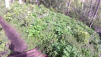
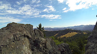
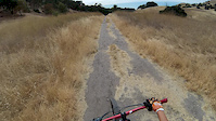
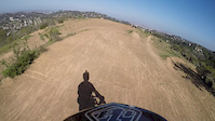
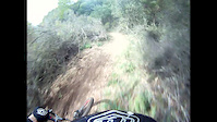
Photos of Cobb Mountain Bike
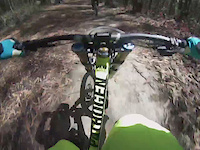
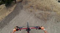
Videos of Cobb Mountain Bike
trail: Big Springs Trail
9:46 |
91 |
May 23, 2015
trail: 200
5:18 |
456 |
Sep 5, 2014
trail: Scout Trail
0:27 |
516 |
Aug 30, 2014
trail: Creek Trail
0:35 |
320 |
Jun 14, 2014
trail: Creek Trail
3:03 |
290 |
Jun 14, 2014

trail: 100
3:42 |
467 |
May 14, 2014
trail: 100
2:16 |
776 |
Mar 25, 2014
trail: 100
2:01 |
423 |
Mar 8, 2014
Recent Trail Reports
| status | trail | date | condition | info | user |
|---|---|---|---|---|---|
| Gail's Trail | Jan 10, 2026 @ 1:09pm (America/Los_Angeles) Jan 10, 2026 | Variable | cedarnfrens | ||
| Nates Cutoff | Jan 10, 2026 @ 1:09pm (America/Los_Angeles) Jan 10, 2026 | Variable | cedarnfrens | ||
| Boggs Peak Trail | Jan 10, 2026 @ 1:09pm (America/Los_Angeles) Jan 10, 2026 | Variable | cedarnfrens | ||
| High Point Trail | Jan 10, 2026 @ 1:09pm (America/Los_Angeles) Jan 10, 2026 | Variable | cedarnfrens | ||
| Bear Bones Trail | Jan 10, 2026 @ 1:09pm (America/Los_Angeles) Jan 10, 2026 | Variable | cedarnfrens | ||
| Crew Trail | Jan 10, 2026 @ 1:09pm (America/Los_Angeles) Jan 10, 2026 | Variable | cedarnfrens | ||
| Berry Trail | Jan 10, 2026 @ 1:09pm (America/Los_Angeles) Jan 10, 2026 | Variable | cedarnfrens | ||
| Scout Trail | Jan 10, 2026 @ 1:09pm (America/Los_Angeles) Jan 10, 2026 | Variable | cedarnfrens | ||
| Karen's Trail | Jan 10, 2026 @ 1:09pm (America/Los_Angeles) Jan 10, 2026 | Variable | cedarnfrens | ||
| Hoberg's Loop | Jan 10, 2026 @ 1:09pm (America/Los_Angeles) Jan 10, 2026 | Variable | cedarnfrens |
Activity Feed
| username | action | type | title | date |
|---|---|---|---|---|
| trailforks | add | video | activity #97539671 | Jun 21, 2026 @ 8:00pm 2 hours |
| trailforks | add | video | activity #97196482 | Jun 17, 2026 @ 11:00am Jun 17, 2026 |
| trailforks | add | video | activity #96688243 | Jun 10, 2026 @ 12:00pm Jun 10, 2026 |
| trailforks | add | video | activity #96676647 | Jun 10, 2026 @ 9:00am Jun 10, 2026 |
| trailforks | add | video | activity #96543224 | Jun 8, 2026 @ 9:00am Jun 8, 2026 |
Recent Comments
| username | type | title | comment | date |
|---|---|---|---|---|
| trail | Some fun stuff to hop off throughout the upper... | Apr 27, 2026 @ 10:29am Apr 27, 2026 | ||
| trail | Nice easy climb but more fun top to bottom. ... | Dec 15, 2025 @ 10:54am Dec 15, 2025 | ||
| trail | What do you mean? Are the features gone? | Nov 5, 2025 @ 12:50pm Nov 5, 2025 | ||
| trail | Sadly they destroyed all the good work when... | Jul 20, 2025 @ 5:18pm Jul 20, 2025 | ||
| trail | All open. Connects spots, ride it. Hike it.... | Nov 21, 2021 @ 9:53pm Nov 21, 2021 |
Local Badges
-

10 Blue Trails68 awarded -

Epic Ride Climb 2k33 awarded -

Climbing 10k Badge6 awarded -

Climbing 100k Badge1 awarded -

Epic Ride Descent 2k34 awarded -

Descent 10k Badge7 awarded
Activity Type Stats
| activitytype | trails | distance | descent | descent distance | total vertical | rating | global rank | state rank | photos | reports | routes | ridelogs |
|---|---|---|---|---|---|---|---|---|---|---|---|---|
| Mountain Bike | 40 | 51 miles | 6,591 ft | 17 miles | 2,779 ft | #3,319 | #1,139 | 44 | 218 | 4 | 1,592 | |
| Hike | 37 | 51 miles | 6,591 ft | 17 miles | 2,779 ft | #4,855 | #1,714 | 218 | 595 | |||
| Trail Running | 37 | 51 miles | 6,591 ft | 17 miles | 2,779 ft | #4,433 | #1,357 | 218 | 25 |
Frequently Asked Questions About Cobb
▼
What are the best places to ride in Cobb?
Cobb has 1 areas to explore for mountain biking. The top rated areas are:
▼
What are the highest rated mountain biking trails in Cobb?
The highest rated mountain biking trails in Cobb are:
- Jethros Trail (4.2/5)
- Gail's Trail (4/5)
- Game Trail (4/5)
- Bear Bones Trail (4/5)
- High Point Trail (4/5)
▼
What is the best time of the year to ride in Cobb?
Based on ride log data, the most popular months to ride in Cobb are:
- May (16 activities)
- July (7 activities)
- September (5 activities)
▼
Where can I park to ride in Cobb?
There are 1 parking locations listed in Cobb. The most popular parking spots are:
Trails
- By TheBikeNerd
 NWTA & contributors
 - Admins: REMBA
- #5770 - 4,559 views
- cobb activity log | embed map of Cobb mountain bike trails | cobb mountain biking points of interest
Downloading of trail gps tracks in kml & gpx formats is enabled for Cobb.
You must login to download files.