close
-
Layers w
- Weather Layers
- Pro
- Pro
- Pro
- Pro
- Pro
- Pro
- More Layers
- Pro
- Pro
- Pro
- Pro
-
Upgrade to

3D
Trail Conditions
- Unknown
- Snow Groomed
- Snow Packed
- Snow Covered
- Snow Cover Partial
- Freeze/thaw Cycle
- Icy
- Prevalent Mud
- Wet
- Variable
- Ideal
- Dry
- Very Dry
Trail Flow (Ridden Direction)
Trailforks scans users ridelogs to determine the most popular direction each trail is ridden. A good flowing trail network will have most trails flowing in a single direction according to their intension.
The colour categories are based on what percentage of riders are riding a trail in its intended direction.
The colour categories are based on what percentage of riders are riding a trail in its intended direction.
- > 96%
- > 90%
- > 80%
- > 70%
- > 50%
- < 50%
- bi-directional trail
- no data
Trail Last Ridden
Trailforks scans ridelogs to determine the last time a trail was ridden.
- < 2 days
- < 1 week
- < 2 weeks
- < 1 month
- < 6 months
- > 6 months
Trail Ridden Direction
The intended direction a trail should be ridden.
- Downhill Only
- Downhill Primary
- Both Directions
- Uphill Primary
- Uphill Only
- One Direction
Contribute Details
Colors indicate trail is missing specified detail.
- Description
- Photos
- Description & Photos
- Videos
Trail Popularity ?
Trailforks scans ridelogs to determine which trails are ridden the most in the last 9 months.
Trails are compared with nearby trails in the same city region with a possible 25 colour shades.
Think of this as a heatmap, more rides = more kinetic energy = warmer colors.
- most popular
- popular
- less popular
- not popular
ATV/ORV/OHV Filter
Max Vehicle Width
inches
US Cell Coverage
Legend

Radar Time
Activity Recordings
Trailforks uses anonymized public activity data.
?
Activity Recordings
Trailforks uses anonymized public activity data.
?
Personal Heatmap
▶
Activity Types
all
/
none
▶
Options
2
Date range
month
–
Winter Trails
Warning
A routing network for winter maps does not exist. Selecting trails using the winter trails layer has been disabled.
Missing Trails
Most Popular
Least Popular
Trails are colored based on popularity. The more popular a trail is, the more red. Less popular trails trend towards green.
Jump Magnitude Heatmap
Heatmap of where riders jump on trails. Zoom in to see individual jumps, click circles to view jump details.
BC Backroad Status
![map legend]()
Service Road Atlas is a free to use, community-driven service for viewing and creating reports on the numerous back-country service roads around B.C. and Alberta.

Slope Aspect
Direction the slope faces
Trails Deemphasized
Trails are shown in grey.
Only show trails with no bike usage.
Suggested Layers
Based on selected activity type
Save the current map location and zoom level as your default home location whenever this page is loaded.
SaveEnd of the Maitai Valley
Primary Trail Type: All-Mountain & Downhill
 google parking directions
 Access Info:
Either Maitai dam or Smiths Ford
Activities Click to view
- Mountain Bike
31 trails
- E-Bike
12 trails
- Hike
16 trails
- Trail Running
14 trails
Region Details
- 8
- 3
- 5
- 7
- 3
Region Status
Open as of Jun 22, 2026Stats
- Avg Trail Rating
- Trails (view details)
- 31
- Trails Mountain Bike
- 31
- Trails E-Bike
- 12
- Trails Hike
- 16
- Trails Trail Running
- 14
- Total Distance
- 21 miles
- Total Descent
- 6,401 ft
- Total Vertical
- 1,115 ft
- Highest Trailhead
- 1,141 ft
- Reports
- 2,225
- Photos
- 249
- Ridden Counter
- 16,260
Popular Koata Park (formerly Maitai-Codgers) Trails
• 100 ★ 3.2 • 2,684 ft • 141 ft • 1,377 •
Trail grade updated 2021. A moderate grade climbing trail from the skid site to the trig point and the start of descent. Seating area and amazing views over Nelson await.
• 90 ★ 4.3 • 2,904 ft • 18 ft • 1,093 •
Flowy Bermed track with optional jumps and alternate lines.
• 90 ★ 3.7 • 3,071 ft • 253 ft • 956 •
(TM2YL) is a hand build single tack climb that links the bottom of the and trails with the start of , and . It also creates a loop that leads back to the top of , and . It is one of the key climbing link trails in Codgers. It is well...
• 95 ★ 4.2 • 5,203 ft • 151 ft • 946 •
Moderate progressive grade downhill flow trail with rollable features. Link into lower at trail end from Jacks Hub. New trail grade in 2021
• 90 ★ 3.5 • 906 ft • 0 ft • 934 •
Link route from 'Middle Road' to 'middle of upper 'Firball', named after a local Nelson mountain biking legend.
• 100 ★ 2.7 • 755 ft • 67 ft • 699 •
Short climbing trail to the top of , and . Has some steep pinches. New trail grade in 2021.
• 90 ★ 4.5 • 3,967 ft • 60 ft • 621 •
Like ? then head up TM2YL and give this gem of a trail a hoon. This single track contains a ton of features including rocks, roots, berms, rollers, drop offs etc. its all here at an entry grade 5 that will leave you grinning from ear to...
Mountain Bike Routes
Maitai-Coppermine-Maitai Featured
★ 5.0 • 19 miles • 3,467 ft • 0 •
Coppermine 'Dun Mountain Trail' from the Maitai Esplanade (Campground) loop via Te Ara Kōpiko. Park at...
8 miles • 1,936 ft • 8 •
The junior course for the NZ Schools MTB Champs October 2025
13 miles • 4,048 ft • 17 •
Ride up fringed hill then down Maitai side, then up Linton Hill track to access Keyboard Warrior
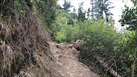
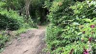
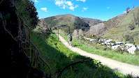
Photos of Koata Park (formerly Maitai-Codgers) Mountain Bike
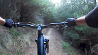
Videos of Koata Park (formerly Maitai-Codgers) Mountain Bike
trail: Turners
0:21 |
254 |
Mar 2, 2020

trail: HotBox
0:33 |
1266 |
Apr 21, 2018
trail: Hulk'n Hogan
0:37 |
2526 |
Oct 16, 2017
trail: HotBox
2:10 |
967 |
Jan 7, 2017

trail: Smasher (Lower)
2:56 |
216 |
Nov 2, 2016
trail: Turners
2:05 |
176 |
Sep 23, 2016

trail: Smasher (Lower)
0:21 |
132 |
Sep 1, 2016

trail: Smasher (Lower)
0:24 |
34276 |
Jun 1, 2016
Recent Trail Reports
| status | trail | date | condition | info | user |
|---|---|---|---|---|---|
| Take Me To Your Leader Extension | Jun 23, 2026 @ 12:27pm (Pacific/Auckland) Jun 22, 2026 | Ideal | ShannonLHiggs | ||
| Deadly Viper Assassination Squad (DiVAS) (Lower) | Jun 21, 2026 @ 1:33pm (Pacific/Auckland) Jun 20, 2026 | Unknown | idxOYd | ||
| Te Ara Rere o Koata ( Koata Rere ) | Jun 20, 2026 @ 4:15am (America/Vancouver) Jun 20, 2026 | Ideal | aceukC8Ti | ||
| Top Dog | Jun 20, 2026 @ 4:12am (America/Vancouver) Jun 20, 2026 | Ideal | aceukC8Ti | ||
| HotBox | Jun 20, 2026 @ 3:55am (America/Vancouver) Jun 20, 2026 | Ideal | aceukC8Ti | ||
| Deadly Viper Assassination Squad (DiVAS) (Upper) | Jun 14, 2026 @ 2:28pm (Pacific/Auckland) Jun 13, 2026 | Ideal | stevecopley WGTV | ||
| Take Me To Your Leader | Jun 14, 2026 @ 2:28pm (Pacific/Auckland) Jun 13, 2026 | Ideal | stevecopley WGTV | ||
| Turners | Jun 14, 2026 @ 2:28pm (Pacific/Auckland) Jun 13, 2026 | Variable | stevecopley WGTV | ||
| Turners Access track | Jun 14, 2026 @ 2:28pm (Pacific/Auckland) Jun 13, 2026 | Ideal | stevecopley WGTV | ||
| IV Line | Jun 8, 2026 @ 6:19pm (Pacific/Auckland) Jun 7, 2026 | Unknown | Raitrails23 |
Activity Feed
| username | action | type | title | date |
|---|---|---|---|---|
| OllieMTBSILVANMCGAZZA | add | photo | activity #98223630 | Jul 1, 2026 @ 1:34pm 1 day |
| NMTBC | update | trail | activity #98043384 | Jun 28, 2026 @ 8:58pm Jun 28, 2026 |
| aceukC8Ti | checkin | trail | activity #97977496 | Jun 28, 2026 @ 4:42am Jun 28, 2026 |
| ShannonLHiggs | add | report | activity #97594284 | Jun 22, 2026 @ 5:27pm Jun 22, 2026 |
| idxOYd | add | report | activity #97448391 | Jun 20, 2026 @ 6:33pm Jun 20, 2026 |
Recent Comments
| username | type | title | comment | date |
|---|---|---|---|---|
| trail | Still putting the finishing touches on it ,... | May 14, 2026 @ 3:23pm May 14, 2026 | ||
| report | To | Apr 10, 2026 @ 8:01pm Apr 10, 2026 | ||
| report | Both good suggestions. I rode it today for my... | Feb 24, 2026 @ 5:57pm Feb 24, 2026 | ||
| trail | Tree down near top | Jan 31, 2026 @ 8:57am Jan 31, 2026 | ||
| trail | Tree down near the top | Jan 3, 2026 @ 5:15pm Jan 3, 2026 |
Nearby Areas
| name | distance | ||||
|---|---|---|---|---|---|
| Codgers | 4 | 0.4 km | |||
| The Grampians | 1 | 3 | 1.8 km | ||
| Fringed Hill Nelson | 4 | 9 | 1.9 km | ||
| Coppermine | 2 | 2 km | |||
| Waitarake/Sharlands | 2 | 7 | 4 | 2.1 km |
Local Badges
-

Completionist3 awarded
Bike & Skill Parks
| name | type | city | rating |
|---|---|---|---|
| Branford Jumps | skill park | Nelson | |
| Codgers Skills Park | skill park | Nelson |
Activity Type Stats
| activitytype | trails | distance | descent | descent distance | total vertical | rating | global rank | state rank | photos | reports | routes | ridelogs |
|---|---|---|---|---|---|---|---|---|---|---|---|---|
| Mountain Bike | 31 | 21 miles | 6,401 ft | 10 miles | 1,115 ft | #846 | #30 | 247 | 2,223 | 12 | 10,019 | |
| E-Bike | 12 | 11 miles | 2,595 ft | 5 miles | 1,089 ft | #2,664 | #69 | 879 | 1,466 | |||
| Hike | 16 | 14 miles | 978 ft | 4 miles | 1,115 ft | #5,513 | #104 | 1 | 1,918 | 51 | ||
| Trail Running | 14 | 13 miles | 938 ft | 3 miles | 988 ft | #4,300 | 1 | 1,900 | 1,159 |
Frequently Asked Questions About Koata Park (formerly Maitai-Codgers)
▼
What are the highest rated mountain biking trails in Koata Park (formerly Maitai-Codgers)?
The highest rated mountain biking trails in Koata Park (formerly Maitai-Codgers) are:
- Smasher (Lower) (4.5/5)
- Top Dog (4.4/5)
- Te Ara Rere o Koata ( Koata Rere ) (4.3/5)
- Lollipop (4.3/5)
- HotBox (4.3/5)
▼
What is the best time of the year to ride in Koata Park (formerly Maitai-Codgers)?
Based on ride log data, the most popular months to ride in Koata Park (formerly Maitai-Codgers) are:
- December (34 activities)
- March (34 activities)
- November (29 activities)
▼
Where can I park to ride in Koata Park (formerly Maitai-Codgers)?
There are 3 parking locations listed in Koata Park (formerly Maitai-Codgers). The most popular parking spots are: View all parking and trailhead locations on the map to plan your visit.
▼
What is the longest trail in Koata Park (formerly Maitai-Codgers)?
The longest trail in Koata Park (formerly Maitai-Codgers) is Hulk'n Hogan at 5,203 ft. View all trails sorted by distance.
Activities
Trails
- Hard trails in Koata Park (formerly Maitai-Codgers)
- Easy trails in Koata Park (formerly Maitai-Codgers)
- Favorite trails in Koata Park (formerly Maitai-Codgers)
- Most ridden trails in Koata Park (formerly Maitai-Codgers)
- Singletrack in Koata Park (formerly Maitai-Codgers)
- Viewpoint trails in Koata Park (formerly Maitai-Codgers)
- Trails with technical features in Koata Park (formerly Maitai-Codgers)
- Race routes in Koata Park (formerly Maitai-Codgers)
- By bradical9 & contributors
- Admins: Aorere-Enduro, NelsonCouncil, NMTBC, tamallama, easy-trail
- #6654 - 16,896 views
- koata park (formerly maitai-codgers) activity log | embed map of Koata Park (formerly Maitai-Codgers) mountain bike trails | koata park (formerly maitai-codgers) mountain biking points of interest polygons
Downloading of trail gps tracks in kml & gpx formats is enabled for Koata Park (formerly Maitai-Codgers).
You must login to download files.