


more stats
3,829 ft
Distance
5 ft
Climb
-441 ft
Descent
00:06:56
Avg time
-437 ft
Altitude change
523 ft
Altitude min
960 ft
Altitude max
960 ft
Altitude start
525 ft
Altitude end
-11.4%
Grade
-44.3%
Grade max
2.5%
Grade min
39 ft
Distance climb
3,632 ft
Distance down
118 ft
Distance flat
00:06:56
Avg time

IV Line Details

  • Activities
    • Mountain Bike
    • E-Bike
  • Riding Area
  • Difficulty Rating
  • Voted Difficulty
    Advanced (1 vote)
  • Local Popularity
    80 in Mountain Biking [+]
    • 75 in E-Biking
  • Global Ranking
    #92880 in Mountain Biking [+]
    • #33589 in E-Biking
  • National Ranking
    #2,087 in Mountain Biking · New Zealand [+]
    • #796 in E-Biking
  • Trail Type
    Singletrack
  • Bike Type
    AM, XC
  • Season
    All Year
  • Dogs Allowed
    Yes
  • eBike Allowed
    Yes up to Class 1

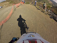
An alternative trail down from the Turners skid site with a few rocky corners and berms. Dries out quickly after rain.
New trail grade in 2021

Access Info

Accessed from the Turners skid site on the right side of the forestry road.

Tags
Berms

Recent Activity on Trail

Past Week
  • 1 rides
  • 10 miles average
6 Months
  • 46 rides
  • 12 miles avg distance
All
  • 280 rides
  • Last: Oct 9, 2026
c1c2c3c4
January
February
March
April
May
June
July
August
September
October
November
December
update trails status or condition

IV Line Trail Reports

statusdatedescription
Sep 2, 2026 @ 10:17am (Pacific/Auckland)
Sep 1, 2026
2 x blocked culverts. Shovel jobs
Jun 8, 2026 @ 6:19pm (Pacific/Auckland)
Jun 7, 2026
tree cleared
Jun 7, 2026 @ 12:44pm (Pacific/Auckland)
Jun 6, 2026
Tree down about half way down trail. About half meter diam. Can walk around but blocking trail
Jun 6, 2026 @ 3:23pm (Pacific/Auckland)
Jun 5, 2026
Tree down over trail about 2/3 down. Walk around possible
Apr 11, 2026 @ 3:27pm (Pacific/Auckland)
Apr 10, 2026
more »
Status:
on Sep 2, 2026
Avg: 3.33 (21 votes)
Your vote: 0

view (2,925)
close
      Directions to iv-line trailhead (-41.285470, 173.311520)

      Photos

      28 more »
      mtb
      131 |
      Dec 17, 2011 @ 2:19am
      Dec 17, 2011
      mtb
      738 |
      Jul 23, 2012 @ 7:59pm
      Jul 23, 2012
      mtb
      316 |
      Apr 11, 2013 @ 2:21am
      Apr 11, 2013
      mtb
      323 |
      Apr 11, 2013 @ 2:22am
      Apr 11, 2013

      Videos

      3 more »
      Nelson Trail Previews: IV Line into Gully on...
      mtb
      7:01 | 410 | Jul 7, 2022 , Nelson
      IV Line
      mtb
      7:01 | 603 | Apr 11, 2013 , Nelson
      Caelab and Doug ride IV line
      mtb
      0:42 | 491 | Jul 29, 2012 , Nelson
      3.2 ★★★★★
      21 Ratings
      5 ★ 10%
      4 ★ 29%
      3 ★ 38%
      2 ★ 14%
      1 ★ 10%

      5 Reviews & Comments

      inge3081
      Love this track, one of my favourite downhills. Nothing tech, fast in places.. Awesome.
      Don't like the fact that people have made shortcuts on the track (to get a better time on Strava?! ????)..

      We hope you've been enjoying Trailforks!

      Create a FREE account to view all trail reviews and much more.

      • By NMTBCTF Pro NMTBC & contributors
      • #36963 - 5,329 views

      Frequently Asked Questions

      ▼ Where is IV Line located?
      IV Line is located in Koata Park (formerly Maitai-Codgers), Nelson, New Zealand. It is part of the Koata Park (formerly Maitai-Codgers) trail network. The trailhead is located at coordinates -41.28547, 173.31152.
      ▼ How hard is IV Line?
      IV Line is rated as Advanced difficulty. The average grade is 11.4%.
      ▼ What is the elevation gain for IV Line?
      IV Line has 5 ft of elevation gain. The trail has 441 ft of elevation descent. The elevation ranges from 523 ft to 960 ft.
      ▼ How long is IV Line?
      IV Line is 3,829 ft long. The trail type is singletrack.
      ▼ Are dogs allowed on IV Line?
      Yes, dogs are allowed on IV Line. Please keep dogs on a leash where required and clean up after them.
      ▼ When is the best time of year to ride IV Line?
      IV Line is best visited during: All Year.
      ▼ How do I access IV Line? Where is the closest parking trailhead?
      The closest parking and trailhead locations to IV Line are: View all parking locations in the area.
      ▼ How long does it take to ride IV Line?
      Based on recorded activities, it takes an average of 7 minutes to ride IV Line. The trail is 3,829 ft long. Actual times will vary based on fitness level, conditions, and pace. View recent activity logs for more details.
      ▼ How busy is IV Line?
      IV Line is a very popular trail. There have been 3,144 recorded activities on this trail. The trail has received 2,925 check-ins. View recent activity on this trail.

      Hit the Trail

      Open in App

      Get this trail on your phone instantly.

      open trail in app

      Download Trail

      Save to wishlist, Garmin & download.
      save the trail

      Find Related Routes

      Find routes and users activities that include this trail.
      find routes for this trail

      You must enter a description before submitting.


