close
-
Layers w
- Weather Layers
- Pro
- Pro
- Pro
- Pro
- Pro
- Pro
- More Layers
- Pro
- Pro
- Pro
- Pro
-
Upgrade to

3D
Trail Conditions
- Unknown
- Snow Groomed
- Snow Packed
- Snow Covered
- Snow Cover Partial
- Freeze/thaw Cycle
- Icy
- Prevalent Mud
- Wet
- Variable
- Ideal
- Dry
- Very Dry
Trail Flow (Ridden Direction)
Trailforks scans users ridelogs to determine the most popular direction each trail is ridden. A good flowing trail network will have most trails flowing in a single direction according to their intension.
The colour categories are based on what percentage of riders are riding a trail in its intended direction.
The colour categories are based on what percentage of riders are riding a trail in its intended direction.
- > 96%
- > 90%
- > 80%
- > 70%
- > 50%
- < 50%
- bi-directional trail
- no data
Trail Last Ridden
Trailforks scans ridelogs to determine the last time a trail was ridden.
- < 2 days
- < 1 week
- < 2 weeks
- < 1 month
- < 6 months
- > 6 months
Trail Ridden Direction
The intended direction a trail should be ridden.
- Downhill Only
- Downhill Primary
- Both Directions
- Uphill Primary
- Uphill Only
- One Direction
Contribute Details
Colors indicate trail is missing specified detail.
- Description
- Photos
- Description & Photos
- Videos
Trail Popularity ?
Trailforks scans ridelogs to determine which trails are ridden the most in the last 9 months.
Trails are compared with nearby trails in the same city region with a possible 25 colour shades.
Think of this as a heatmap, more rides = more kinetic energy = warmer colors.
- most popular
- popular
- less popular
- not popular
ATV/ORV/OHV Filter
Max Vehicle Width
inches
US Cell Coverage
Legend

Radar Time
Activity Recordings
Trailforks uses anonymized public activity data.
?
Activity Recordings
Trailforks uses anonymized public activity data.
?
Personal Heatmap
▶
Activity Types
all
/
none
▶
Options
2
Date range
month
–
Winter Trails
Warning
A routing network for winter maps does not exist. Selecting trails using the winter trails layer has been disabled.
Missing Trails
Most Popular
Least Popular
Trails are colored based on popularity. The more popular a trail is, the more red. Less popular trails trend towards green.
Jump Magnitude Heatmap
Heatmap of where riders jump on trails. Zoom in to see individual jumps, click circles to view jump details.
BC Backroad Status
![map legend]()
Service Road Atlas is a free to use, community-driven service for viewing and creating reports on the numerous back-country service roads around B.C. and Alberta.

Slope Aspect
Direction the slope faces
Trails Deemphasized
Trails are shown in grey.
Only show trails with no bike usage.
Suggested Layers
Based on selected activity type
Save the current map location and zoom level as your default home location whenever this page is loaded.
Save
No description for Combloux has been added yet!
Login or register to submit one.
This region uses the Uk/Euro style trail grading system.
Activities Click to view
- Mountain Bike
20 trails
- E-Bike
15 trails
- Adaptive Bike
0 trails
- Hike
21 trails
- Trail Running
21 trails
- Backcountry Ski
4 trails
Region Details
- 10
- 1
- 6
- 1
Region Status
Caution as of Jul 18, 2025Stats
- Avg Trail Rating
- Trails (view details)
- 18
- Trails Mountain Bike
- 21
- Trails E-Bike
- 15
- Trails Horse
- 1
- Trails Hike
- 21
- Trails Trail Running
- 21
- Trails Backcountry Ski
- 4
- Total Distance
- 9 miles
- Total Descent
- 4,489 ft
- Total Vertical
- 3,874 ft
- Highest Trailhead
- 5,750 ft
- Reports
- 17
- Photos
- 3
- Ridden Counter
- 835
Popular Combloux Mountain Biking Trails
• 25 ★ 5.0 • 3,258 ft • 29 ft • 22 •
Nice single track to down from Combloux to Passy lac.
• 55 ★ 4.0 • 1,985 ft • 0 ft • 20 •
Moderately popular blue difficulty singletrack. This mountain bike primary trail can be used downhill only. Trail visibility is always easy to follow. On average it takes 5 minutes to complete this trail.
• 60 ★ 0.0 • 1,122 ft • 0 ft • 16 •
Moderately popular blue difficulty singletrack. This mountain bike primary trail can be used downhill only and has a moderate overall physical rating. Trail visibility is sometimes hard to follow.
• 45 ★ 5.0 • 1,949 ft • 0 ft • 16 •
Moderately popular blue difficulty singletrack. This multi-use trail can be used downhill only. Trail visibility is always easy to follow. On average it takes 3 minutes to complete this trail.
• 30 ★ 4.0 • 1 mile • 0 ft • 11 •
Descente technique. Beaucoup de racine et de pierre, contrôlez bien votre vitesse, surtout sur la première moitié. Attention il faut traverser un enclot à vache au tout début
• 15 ★ 0.0 • 213 ft • 8 ft • 11 •
The new pump track of combloux. Easy for beginners and fun for good bikers.
• 20 ★ 0.0 • 4,252 ft • 0 ft • 10 •
Nice singletrack full of roots, with some tech and steep uphills. Jolie sentier, plein de racines, pas mal de passages techniques et remontées raides et techniques
Combloux Mountain Bike Routes
24 miles • 8,476 ft • 11 • Loop • Race •
Race route for the UCI Enduro World Cup Haute-Savoie, Combloux
Videos of Combloux Mountain Bike
0:06 |
6 |
Apr 4, 2022
Recent Trail Reports
| status | trail | date | condition | info | user |
|---|---|---|---|---|---|
| La Petite Ravine | Jul 18, 2025 @ 7:38am Jul 18, 2025 | Dry | manikdunc | ||
| Montée Sommet Des Salles | May 29, 2025 @ 1:43pm May 29, 2025 | Ideal | samale | ||
| Mur Des Salles | May 29, 2025 @ 1:43pm May 29, 2025 | Ideal | samale | ||
| Le Jaillet par Beauregard - Part 3 | May 29, 2025 @ 1:43pm May 29, 2025 | Ideal | samale | ||
| Le Jaillet par Beauregard - Part 2 | May 29, 2025 @ 1:43pm May 29, 2025 | Ideal | samale | ||
| Montée De La Fouettaz | May 29, 2025 @ 1:43pm May 29, 2025 | Ideal | samale | ||
| Torrent d'Arbon | Aug 17, 2017 @ 11:38am Aug 17, 2017 | Dry | tigre38 |
Activity Feed
| username | action | type | title | date |
|---|---|---|---|---|
| Tibo74 | wishlist | route | activity #94683298 | May 14, 2026 @ 5:48am May 14, 2026 |
| Tibo74 | ridden | route | activity #94683286 | May 14, 2026 @ 5:47am May 14, 2026 |
| howiearnstad | wishlist | route | activity #87795798 | Jan 25, 2026 @ 8:45am Jan 25, 2026 |
| Rocco774 | wishlist | route | activity #82510867 | Oct 17, 2025 @ 9:53am Oct 17, 2025 |
| Rocco774 | wishlist | region | activity #81660119 | Oct 4, 2025 @ 4:31am Oct 4, 2025 |
Recent Comments
| username | type | title | comment | date |
|---|---|---|---|---|
| trail | Exposed in some parts, steep in others, not... | Aug 1, 2025 @ 9:02am Aug 1, 2025 | ||
| trail | Funny | Aug 1, 2025 @ 8:59am Aug 1, 2025 | ||
| trail | Funny | Aug 1, 2025 @ 8:58am Aug 1, 2025 | ||
| trail | Beware when nearing the canyon. The trail is... | Sep 17, 2024 @ 9:42am Sep 17, 2024 |
Local Badges
-

Epic Mountain Bike Climb 2k1 awarded -

Climbing 10k Badge0 awarded -

Mountain Biking 100k Badge0 awarded -

Epic Ride Descent 2k1 awarded -

Descent 10k Badge0 awarded -

Descent 100k Badge0 awarded
Bike & Skill Parks
| name | type | city | rating |
|---|---|---|---|
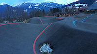
| pumptrack combloux | skill park | Combloux |
Activity Type Stats
| activitytype | trails | distance | descent | descent distance | total vertical | rating | global rank | state rank | photos | reports | routes | ridelogs |
|---|---|---|---|---|---|---|---|---|---|---|---|---|
| Mountain Bike | 20 | 9 miles | 4,488 ft | 5 miles | 3,875 ft | #7,560 | #370 | 3 | 14 | 1 | 912 | |
| E-Bike | 15 | 7 miles | 3,130 ft | 4 miles | 3,547 ft | #4,494 | #269 | 15 | 1 | 62 | ||
| Horse | 1 | 1,949 ft | 430 ft | 1,900 ft | 430 ft | 1 | ||||||
| Hike | 21 | 9 miles | 4,488 ft | 5 miles | 3,875 ft | #6,856 | #253 | 17 | 135 | |||
| Trail Running | 21 | 9 miles | 4,488 ft | 5 miles | 3,875 ft | #6,301 | #234 | 17 | 22 | |||
| Backcountry Ski | 4 | 1,053 ft | 105 ft | #245 | #12 | 3 | 51 |
Frequently Asked Questions About Combloux
▼
What are the highest rated mountain biking trails in Combloux?
The highest rated mountain biking trails in Combloux are:
- Les Grangettes (4.1/5)
- Torrent d'Arbon (4.1/5)
- La Petite Ravine (4.1/5)
- Les Tannes (4/5)
- Descente De La Berth (4/5)
▼
What is the best time of the year to ride in Combloux?
Based on ride log data, the most popular months to ride in Combloux are:
- July (21 activities)
- May (6 activities)
- October (4 activities)
▼
Where can I park to ride in Combloux?
Check the Combloux trail map for trailhead and parking information. Community members regularly update access and parking details for trails in the area.
▼
What is the longest trail in Combloux?
The longest trail in Combloux is Descente De La Berth at 1.8 km. View all trails sorted by distance.
Activities
Trails
Points of Interest
- By sylvainaubry & contributors
- Admins: alltta, freerider48, maxlatourte, Charliedp, Whipperman
- #17925 - 3,561 views
- combloux activity log | embed map of Combloux mountain bike trails | combloux mountain biking points of interest
Downloading of trail gps tracks in kml & gpx formats is enabled for Combloux.
You must login to download files.