close
-
Layers w
- Weather Layers
- Pro
- Pro
- Pro
- Pro
- Pro
- Pro
- More Layers
- Pro
- Pro
- Pro
- Pro
-
Upgrade to

3D
Trail Conditions
- Unknown
- Snow Groomed
- Snow Packed
- Snow Covered
- Snow Cover Partial
- Freeze/thaw Cycle
- Icy
- Prevalent Mud
- Wet
- Variable
- Ideal
- Dry
- Very Dry
Trail Flow (Ridden Direction)
Trailforks scans users ridelogs to determine the most popular direction each trail is ridden. A good flowing trail network will have most trails flowing in a single direction according to their intension.
The colour categories are based on what percentage of riders are riding a trail in its intended direction.
The colour categories are based on what percentage of riders are riding a trail in its intended direction.
- > 96%
- > 90%
- > 80%
- > 70%
- > 50%
- < 50%
- bi-directional trail
- no data
Trail Last Ridden
Trailforks scans ridelogs to determine the last time a trail was ridden.
- < 2 days
- < 1 week
- < 2 weeks
- < 1 month
- < 6 months
- > 6 months
Trail Ridden Direction
The intended direction a trail should be ridden.
- Downhill Only
- Downhill Primary
- Both Directions
- Uphill Primary
- Uphill Only
- One Direction
Contribute Details
Colors indicate trail is missing specified detail.
- Description
- Photos
- Description & Photos
- Videos
Trail Popularity ?
Trailforks scans ridelogs to determine which trails are ridden the most in the last 9 months.
Trails are compared with nearby trails in the same city region with a possible 25 colour shades.
Think of this as a heatmap, more rides = more kinetic energy = warmer colors.
- most popular
- popular
- less popular
- not popular
ATV/ORV/OHV Filter
Max Vehicle Width
inches
US Cell Coverage
Legend

Radar Time
Activity Recordings
Trailforks uses anonymized public activity data.
?
Activity Recordings
Trailforks uses anonymized public activity data.
?
Personal Heatmap
▶
Activity Types
all
/
none
▶
Options
2
Date range
month
–
Winter Trails
Warning
A routing network for winter maps does not exist. Selecting trails using the winter trails layer has been disabled.
Missing Trails
Most Popular
Least Popular
Trails are colored based on popularity. The more popular a trail is, the more red. Less popular trails trend towards green.
Jump Magnitude Heatmap
Heatmap of where riders jump on trails. Zoom in to see individual jumps, click circles to view jump details.
BC Backroad Status
![map legend]()
Service Road Atlas is a free to use, community-driven service for viewing and creating reports on the numerous back-country service roads around B.C. and Alberta.

Slope Aspect
Direction the slope faces
Trails Deemphasized
Trails are shown in grey.
Only show trails with no bike usage.
Suggested Layers
Based on selected activity type
Save the current map location and zoom level as your default home location whenever this page is loaded.
Save
No description for Concord has been added yet!
Login or register to submit one.
Links
Activities Click to view
- Mountain Bike
80 trails
- Gravel Bike
4 trails
- Adaptive Bike
0 trails
- Winter Fat Bike
0 trails
- Horse
6 trails
- Hike
93 trails
- Trail Running
93 trails
- Snowshoe
27 trails
- Nordic Ski
24 trails
Region Details
- 5
- 38
- 28
- 8
Region Status
Open as of 2 daysStats
- Avg Trail Rating
- Trails (view details)
- 115
- Trails Mountain Bike
- 80
- Trails Gravel Bike
- 4
- Trails Horse
- 6
- Trails Hike
- 93
- Trails Trail Running
- 93
- Trails Snowshoe
- 27
- Trails Backcountry Ski
- 1
- Trails Nordic Ski
- 24
- Total Distance
- 59 miles
- Total Descent
- 5,486 ft
- Total Vertical
- 551 ft
- Highest Trailhead
- 791 ft
- Reports
- 163
- Photos
- 68
- Ridden Counter
- 8,621
Sub Regions
-
Broken Ground
- 12
- 4
-
Hospital/Winant Park
- 4
- 14
- 7
-
Lehtinen Park & Mast Yard
-
Marjorie Swope
- 7
-
Quarry Trails
-
Spear's Park Trails
- 6
-
St. Paul's School
- 14
- 1
Popular Concord Mountain Biking Trails
• 95 ★ 5.0 • 3,268 ft • 27 ft • 271 •
Popular blue difficulty singletrack. This multi-use trail can be used downhill primary. On average it takes 5 minutes to complete this trail.
• 100 ★ 4.4 • 1,811 ft • 24 ft • 262 •
Short alternate route on the orange blazed marsh loop, avoids a lot of the climbing you would otherwise do underneath the powerlines. Really fun, smooth section of trail through the woods.
• 95 ★ 4.4 • 2,749 ft • 38 ft • 257 •
Popular green difficulty mixed. This mountain bike primary trail. On average it takes 4 minutes to complete this trail.
• 95 ★ 4.0 • 1 mile • 133 ft • 245 •
Popular blue difficulty family friendly mixed. This multi-use trail can be used both directions and has a moderate overall physical rating with a 133 ft blue climb. It features bridge. On average it takes 13 minutes to complete this trail.
• 100 ★ 5.0 • 3,159 ft • 79 ft • 237 •
Popular green difficulty singletrack. This mountain bike primary trail. On average it takes 8 minutes to complete this trail.
• 95 ★ 4.0 • 1,985 ft • 18 ft • 226 •
Popular green difficulty singletrack. This multi-use trail can be used both directions and has a easy overall physical rating with a 18 ft blue climb. On average it takes 1 minutes to complete this trail.
• 90 ★ 5.0 • 853 ft • 28 ft • 206 •
The trails: Hiking travel time: about 2 hours Distance: about 2.5 miles for the trail system. The Batchelder Mill Road trail system is the byproduct of logging that occurred some years ago. The trails were made when logs were dragged...
Concord Mountain Bike Routes
★ 2.0 • 6 miles • 650 ft • 7 •
This is a good sampling of the trails in the Winant Part area. Overall the riding in this area is...
8 miles • 675 ft • 6 •
Hospital up to Winant summit, down to Fisk, back up into Three Bridges and , through , back to Winant and
• 6 miles • 926 ft • 6 •
• 2 miles • 257 ft • 2 •
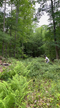
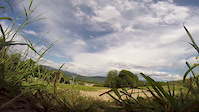
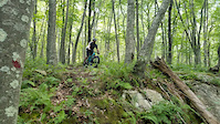
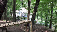
Photos of Concord Mountain Bike
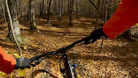
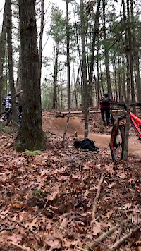
Videos of Concord Mountain Bike

trail: Ghost Pipe
0:20 |
2 |
Jul 19, 2026

trail: Ry's Way
0:09 |
16 |
Jul 7, 2026
trail: Ghost Pipe
0:11 |
13 |
Jul 4, 2026
trail: Ry's Way
0:00 |
210 |
Jul 29, 2020
trail: OTB
0:11 |
258 |
Dec 3, 2019
trail: OTB
0:12 |
174 |
Nov 11, 2019
trail: OTB
0:08 |
121 |
Oct 19, 2019
trail: OTB
0:24 |
443 |
Feb 27, 2019
Recent Trail Reports
| status | trail | date | condition | info | user |
|---|---|---|---|---|---|
| Marsh Trail - Orange Loop | Jul 19, 2026 @ 11:44am (America/New_York) 2 days | Ideal | grampy-jojo | ||
| Ry's Way | May 31, 2026 @ 10:44am (America/New_York) May 31, 2026 | Unknown | DarrenUgyWbi | ||
| Ghost Pipe | Apr 25, 2026 @ 1:39pm (America/New_York) Apr 25, 2026 | Ideal | grampy-jojo | ||
| Howard C. Nowell Trail Blue Loop | Oct 28, 2025 @ 5:00pm (America/New_York) Oct 28, 2025 | Ideal | Oldbikersam | ||
| Pond Trail - Yellow Loop | Oct 28, 2025 @ 5:00pm (America/New_York) Oct 28, 2025 | Ideal | Oldbikersam | ||
| Marsh Loop Alternate | Oct 28, 2025 @ 5:00pm (America/New_York) Oct 28, 2025 | Ideal | Oldbikersam | ||
| Cliff's trail | Jul 4, 2025 @ 11:08am Jul 4, 2025 | Ideal | ColePadulaetm | ||
| Prickerbush Switchback (from Sheeperder's Trail to Winant summit) | Jun 13, 2025 @ 4:51pm Jun 13, 2025 | Ideal | Oldbikersam | ||
| Joan Winant Trail (Blue Trail) | Jun 13, 2025 @ 4:51pm Jun 13, 2025 | Variable | Oldbikersam | ||
| Red Trail | Jun 13, 2025 @ 4:51pm Jun 13, 2025 | Ideal | Oldbikersam |
Activity Feed
| username | action | type | title | date |
|---|---|---|---|---|
| 5herb9 | ridden | trail | activity #99602023 | Jul 20, 2026 @ 6:09am 2 days |
| 5herb9 | ridden | trail | activity #99601927 and 4 more | Jul 20, 2026 @ 6:07am 2 days |
| WarrenY0O2VE | wishlist | region | activity #99556221 | Jul 19, 2026 @ 11:43am 2 days |
| grampy-jojo | add | report | activity #99542923 | Jul 19, 2026 @ 9:41am 2 days |
| grampy-jojo | add | photo | activity #98434956 | Jul 4, 2026 @ 10:45am Jul 4, 2026 |
Recent Comments
| username | type | title | comment | date |
|---|---|---|---|---|
| report | Big Tree in the middle of the trail | May 31, 2026 @ 12:03pm May 31, 2026 | ||
| trail | Why is someone 'planting' rocks in the... | Nov 4, 2025 @ 4:28pm Nov 4, 2025 | ||
| trail | This trail changes every time I ride it and a... | Nov 4, 2025 @ 4:26pm Nov 4, 2025 | ||
| trail | Following an overnight shower the trail... | Oct 13, 2025 @ 9:29am Oct 13, 2025 | ||
| trail | We gat some rain/showers overnight leaving one... | Oct 13, 2025 @ 9:27am Oct 13, 2025 |
Local Badges
-

10 Green Trails137 awarded -

10 Blue Trails143 awarded -

Epic Ride Climb 2k4 awarded -

Climbing 10k Badge37 awarded -

Climbing 100k Badge2 awarded -

Epic Ride Descent 2k4 awarded
Local Products
Activity Type Stats
| activitytype | trails | distance | descent | descent distance | total vertical | rating | global rank | state rank | photos | reports | routes | ridelogs |
|---|---|---|---|---|---|---|---|---|---|---|---|---|
| Mountain Bike | 80 | 42 miles | 4,508 ft | 17 miles | 531 ft | #1,851 | #682 | 67 | 158 | 3 | 11,414 | |
| Gravel Bike | 4 | 3 miles | 210 ft | 4,797 ft | 308 ft | #680 | #1,107 | 6 | 146 | |||
| Horse | 6 | 2 miles | 226 ft | 2,867 ft | 82 ft | #2,967 | #1,668 | 11 | 5 | |||
| Hike | 93 | 50 miles | 5,335 ft | 22 miles | 551 ft | #3,770 | #1,337 | 158 | 458 | |||
| Trail Running | 93 | 50 miles | 5,335 ft | 22 miles | 551 ft | #3,512 | #1,045 | 158 | 1,413 | |||
| Snowshoe | 27 | 20 miles | 1,778 ft | 8 miles | 518 ft | #702 | #297 | 11 | 49 | |||
| Backcountry Ski | 1 | 5,187 ft | 167 ft | 3,215 ft | 148 ft | 11 | 11 | |||||
| Nordic Ski | 24 | 10 miles | 318 ft | 3 miles | 262 ft | #729 | #267 | 1 | 11 | 378 |
Frequently Asked Questions About Concord
▼
What are the best places to ride in Concord?
Concord has 12 areas to explore for mountain biking. The top rated areas are:
▼
What are the highest rated mountain biking trails in Concord?
The highest rated mountain biking trails in Concord are:
- Ry's Way (4.4/5)
- Howard C. Nowell Trail Blue Loop (4.2/5)
- Batchelder Mills Trail (Blue) (4.2/5)
- Batchelder Mills Trail (Red) (4.2/5)
- SST (4.2/5)
▼
What is the best time of the year to ride in Concord?
Based on ride log data, the most popular months to ride in Concord are:
- June (162 activities)
- July (148 activities)
- May (125 activities)
▼
Where can I park to ride in Concord?
There are 12 parking locations listed in Concord. The most popular parking spots are:
- Parking
- Concord Hospital parking lot to Langley Park extension
- Parking
- Parking
- Marjorie Swope Parking Area
Activities
Trails
Points of Interest
- By Radioface
 & contributors
 - Admins: SNH NEMBA, UWV
- #9994 - 10,747 views
- concord activity log | embed map of Concord mountain bike trails | concord mountain biking points of interest
Downloading of trail gps tracks in kml & gpx formats is enabled for Concord.
You must login to download files.