
close
3D
Trail Conditions
- Unknown
- Snow Groomed
- Snow Packed
- Snow Covered
- Snow Cover Partial
- Freeze/thaw Cycle
- Icy
- Prevalent Mud
- Wet
- Variable
- Ideal
- Dry
- Very Dry
Trail Flow (Ridden Direction)
Trailforks scans users activity logs to determine the most popular direction each trail is ridden. A good flowing trail network will have most trails flowing in a single direction according to their intension.
The colour categories are based on what percentage of users are riding a trail in its intended direction.
The colour categories are based on what percentage of users are riding a trail in its intended direction.
- > 96%
- > 90%
- > 80%
- > 70%
- > 50%
- < 50%
- bi-directional trail
- no data
Trail Last Used
Trailforks scans activity logs to determine the last time a trail was ridden.
- < 2 days
- < 1 week
- < 2 weeks
- < 1 month
- < 6 months
- > 6 months
Trail Ridden Direction
The intended direction a trail should be ridden.
- Downhill Only
- Downhill Primary
- Both Directions
- Uphill Primary
- Uphill Only
- One Direction
Contribute Details
Colors indicate trail is missing specified detail.
- Description
- Photos
- Description & Photos
- Videos
Trail Popularity ?
Trailforks scans activity logs to determine which trails are ridden the most in the last 9 months.
Trails are compared with nearby trails in the same city region with a possible 25 colour shades.
Think of this as a heatmap, more activities = more kinetic energy = warmer colors.
- most popular
- popular
- less popular
- not popular
ATV/ORV/OHV Filter
Max Vehicle Width
inches
US Cell Coverage
Legend

Radar Time
Activity Recordings
Trailforks uses anonymized public activity data.
?
Activity Recordings
Trailforks uses anonymized public activity data.
?
Winter Trails
Warning
A routing network for winter maps does not exist. Selecting trails using the winter trails layer has been disabled.
Missing Trails
Most Popular
Least Popular
Trails are colored based on popularity. The more popular a trail is, the more red. Less popular trails trend towards green.
Jump Magnitude Heatmap
Heatmap of where users jump on trails. Zoom in to see individual jumps, click circles to view jump details.
BC Backroad Status
![map legend]()
Service Road Atlas is a free to use, community-driven service for viewing and creating reports on the numerous back-country service roads around B.C. and Alberta.

Slope Aspect
Direction the slope faces
Trails Deemphasized
Trails are shown in grey.
Only show trails with no bike usage.
Suggested Layers
Based on selected activity type
Save the current map location and zoom level as your default home location whenever this page is loaded.
SaveDanmarks Tag ved Ry ligger i det kuperede Søhøjland vest for Himmelbjerget og er kendt som et af Danmarks mere tekniske mountainbikeområder. Stisystemet udnytter det stejle, istidsformede terræn med korte, stejle stigninger og hurtige nedkørsler, som er usædvanlige i dansk sammenhæng. Området består af naturlig singletrack kombineret med retningsbestemte nedkørsler og forbindelsesstier, hvilket skaber et varieret netværk af flow, tekniske sektioner og gentagne rundemuligheder. Officiel turismeinformation beskriver området som teknisk og udfordrende og anbefaler det primært til øvede ryttere. Dele af stisystemet ligger på eller op ad skovområder tilhørende FDF Outdoor Center Sletten, et stort frilufts- og lejrcenter ved Julsø, hvor lokale trailbyggere arbejder i samarbejde med lodsejere om adgang og udvikling af sporene.
Stierne spænder fra hurtige flow-sektioner til mere tekniske spor med rødder, berms, små drops, hop, skarpe sving og stejle passager. Flere lokalt kendte spor – herunder Død Ko, Sort Guld, Smeden og Ålen – giver området et tydeligt gravity-præg, selv om terrænet fortsat er naturligt skovterræn frem for en egentlig bike park. Der findes både retningsbestemte nedkørsler og forbindelsesstier, og flere spor har optionelle sorte linjer eller mere tekniske features. Selvom der findes lettere forbindelsesstier, vil nyere ryttere sandsynligvis opleve store dele af området som udfordrende, især i våde forhold.
Danmarks Tag near Ry is set within the rugged Søhøjlandet hills west of Himmelbjerget and is widely regarded as one of Denmark’s more technical mountain bike destinations. The trail network makes extensive use of the steep glacial terrain, offering short punchy climbs and fast descents that are uncommon in much of Denmark. The system combines natural singletrack with directional descending trails and connecting routes, creating a varied mix of flow, technical riding, and repeat lap opportunities. Official tourism information describes the area as technical and demanding and recommends it primarily for experienced riders. Portions of the trail area lie on or adjacent to forest land associated with FDF Outdoor Center Sletten, a major outdoor education and camp center near Julsø, where local trail builders have publicly acknowledged cooperation with landowners for trail access and development.
The trails range from fast flow sections to more technical riding featuring roots, berms, small drops, jumps, tight turns, and steep pitches. Several locally known trails—including Død Ko (Dead Cow), Sort Guld (Black Gold), Smeden, and Ålen—give the network a distinctly gravity-oriented feel while remaining rooted in natural forest terrain rather than a formal bike park. The system includes directional descending trails, climbing connectors, and optional black-line features in several areas. Although easier connecting trails exist, newer riders will likely find much of the terrain challenging, particularly in wet conditions.
Stierne spænder fra hurtige flow-sektioner til mere tekniske spor med rødder, berms, små drops, hop, skarpe sving og stejle passager. Flere lokalt kendte spor – herunder Død Ko, Sort Guld, Smeden og Ålen – giver området et tydeligt gravity-præg, selv om terrænet fortsat er naturligt skovterræn frem for en egentlig bike park. Der findes både retningsbestemte nedkørsler og forbindelsesstier, og flere spor har optionelle sorte linjer eller mere tekniske features. Selvom der findes lettere forbindelsesstier, vil nyere ryttere sandsynligvis opleve store dele af området som udfordrende, især i våde forhold.
Danmarks Tag near Ry is set within the rugged Søhøjlandet hills west of Himmelbjerget and is widely regarded as one of Denmark’s more technical mountain bike destinations. The trail network makes extensive use of the steep glacial terrain, offering short punchy climbs and fast descents that are uncommon in much of Denmark. The system combines natural singletrack with directional descending trails and connecting routes, creating a varied mix of flow, technical riding, and repeat lap opportunities. Official tourism information describes the area as technical and demanding and recommends it primarily for experienced riders. Portions of the trail area lie on or adjacent to forest land associated with FDF Outdoor Center Sletten, a major outdoor education and camp center near Julsø, where local trail builders have publicly acknowledged cooperation with landowners for trail access and development.
The trails range from fast flow sections to more technical riding featuring roots, berms, small drops, jumps, tight turns, and steep pitches. Several locally known trails—including Død Ko (Dead Cow), Sort Guld (Black Gold), Smeden, and Ålen—give the network a distinctly gravity-oriented feel while remaining rooted in natural forest terrain rather than a formal bike park. The system includes directional descending trails, climbing connectors, and optional black-line features in several areas. Although easier connecting trails exist, newer riders will likely find much of the terrain challenging, particularly in wet conditions.
Primary Trail Type: All-Mountain & Downhill
eBikes Allowed:
Yes
AKA: Danmarks Tag
Land Status: Private Property
 google parking directions plan a road trip here
 Access Info:
Det primære startpunkt for Danmarks Tag er P5-parkeringspladsen på Bøgedalsvej, vest for Ry og tæt ved Himmelbjerget samt FDF Outdoor Center Sletten. Herfra er der direkte adgang til det afmærkede stinet via grusveje og skiltede indgange. P5 fungerer som det vigtigste mødested og udgangspunkt for de fleste ryttere, og området er den mest anvendte adgang til stisystemet. Søg efter “P5 Bøgedalsvej, 8680 Ry” for navigation.
The primary trailhead for Danmarks Tag is the P5 parking area on Bøgedalsvej, west of Ry and close to Himmelbjerget and FDF Outdoor Center Sletten. From here, riders have direct access to the signed trail network via gravel roads and marked entrances. P5 serves as the principal gathering point and starting location for most riders and is the most commonly used access point for the system. Search for “P5 Bøgedalsvej, 8680 Ry” for navigation.
The primary trailhead for Danmarks Tag is the P5 parking area on Bøgedalsvej, west of Ry and close to Himmelbjerget and FDF Outdoor Center Sletten. From here, riders have direct access to the signed trail network via gravel roads and marked entrances. P5 serves as the principal gathering point and starting location for most riders and is the most commonly used access point for the system. Search for “P5 Bøgedalsvej, 8680 Ry” for navigation.
Disclaimer:
Der kræves efter offentligt tilgængelig information ingen tilladelse, medlemskab eller dagskort for at benytte Danmarks Tag-sporene. Ryttere bør følge skiltning og eventuelle retningsbestemmelser på nedkørsler samt blive på de etablerede MTB-spor. Da området ligger i aktiv skov og delvist omkring aktiviteter ved FDF Outdoor Center Sletten, kan ryttere møde gående, lejrgrupper og andre rekreative brugere nær adgangsveje og forbindelsesstier. Midlertidige lukninger eller omlægninger kan forekomme som følge af vejrforhold, arrangementer eller skovarbejde.
Based on publicly available information, no permit, membership, or day pass is required to ride the Danmarks Tag trails. Riders should follow posted signage and any directional trail designations and remain on established MTB routes. Because the network lies within an active forest landscape and partly around activities associated with FDF Outdoor Center Sletten, riders may encounter hikers, camp groups, and other recreational users near access roads and connecting sections. Temporary closures or reroutes may occasionally occur due to weather conditions, events, or forestry operations.
Based on publicly available information, no permit, membership, or day pass is required to ride the Danmarks Tag trails. Riders should follow posted signage and any directional trail designations and remain on established MTB routes. Because the network lies within an active forest landscape and partly around activities associated with FDF Outdoor Center Sletten, riders may encounter hikers, camp groups, and other recreational users near access roads and connecting sections. Temporary closures or reroutes may occasionally occur due to weather conditions, events, or forestry operations.
This region uses the Uk/Euro style trail grading system.
Trail info last updated
Activities Click to view
- Mountain Bike
26 trails
- E-Bike
26 trails
- Hike
2 trails
- Trail Running
2 trails
Region Details
- 5
- 14
- 7
Region Status
Open as of Aug 6, 2026Stats
- Avg Trail Rating
- Trails (view details)
- 26
- Trails Mountain Bike
- 26
- Trails E-Bike
- 26
- Trails Gravel Bike
- 2
- Trails Hike
- 2
- Trails Trail Running
- 2
- Total Distance
- 8 miles
- Total Descent Distance
- 3 miles
- Total Descent
- 1,724 ft
- Total Vertical
- 435 ft
- Highest Trailhead
- 512 ft
- Reports
- 1,154
- Photos
- 8
- Completed Counter
- 3,677
Popular Danmarks Tag Mountain Biking Trails
• 100 ★ 5.0 • 761 ft • 0 ft • 184 •
Popular red difficulty singletrack. This multi-use trail can be used one direction. It features berm, drop and jump. On average it takes 1 minutes to complete this trail.
• 75 ★ 4.0 • 1,509 ft • 17 ft • 169 •
Popular red difficulty singletrack. This multi-use trail can be used one direction. It features berm, drop, jump and rock garden. Adaptive MTB rating: amtb black. On average it takes 3 minutes to complete this trail.
• 95 ★ 0.0 • 722 ft • 0 ft • 167 •
Popular black difficulty singletrack. This multi-use trail can be used one direction and has a moderate overall physical rating. It features berm, drop, jump and rock garden. On average it takes 1 minutes to complete this trail.
• 85 ★ 5.0 • 564 ft • 8 ft • 166 •
Popular red difficulty singletrack. This multi-use trail can be used one direction. It features berm, drop and jump. On average it takes minutes to complete this trail.
• 50 ★ 0.0 • 2,818 ft • 53 ft • 162 •
Moderately popular blue difficulty singletrack. This multi-use trail and has a easy overall physical rating. It features berm and jump. Trail visibility is always easy to follow. On average it takes 4 minutes to complete this trail.
• 60 ★ 0.0 • 3,264 ft • 242 ft • 156 •
Moderately popular red difficulty doubletrack. This multi-use trail can be used one direction. It features berm. On average it takes 6 minutes to complete this trail.
• 40 ★ 0.0 • 3,219 ft • 147 ft • 153 •
Moderately popular red difficulty singletrack. This multi-use trail can be used one direction. It features berm, drop and jump. On average it takes 9 minutes to complete this trail.
• 95 ★ 0.0 • 784 ft • 37 ft • 151 •
Popular red difficulty singletrack. This multi-use trail can be used one direction. On average it takes 1 minutes to complete this trail.
Danmarks Tag Mountain Bike Routes
1 mile • 191 ft • 2 • Out & Back •
The idea of Denmark's Tag has basically been to utilize the many elevation meters that are in the area to...
4 miles • 639 ft • 16 • Loop •
The idea of Denmark's Tag has basically been to utilize the many elevation meters that are in the area to...
5 miles • 824 ft • 18 • Loop •
The idea of Denmark's Tag has basically been to utilize the many elevation meters that are in the area to...
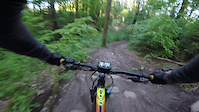
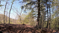
Photos of Danmarks Tag Mountain Bike
Videos of Danmarks Tag Mountain Bike

Recent Trail Reports
| status | trail | date | condition | info | user |
|---|---|---|---|---|---|
| Ålen | Aug 6, 2026 @ 1:27am (Pacific/Midway) Aug 6, 2026 | Ideal | Basdemeijer | ||
| Ålekvabben | Aug 6, 2026 @ 1:27am (Pacific/Midway) Aug 6, 2026 | Ideal | Basdemeijer | ||
| Op til smeden | Aug 6, 2026 @ 1:27am (Pacific/Midway) Aug 6, 2026 | Ideal | Basdemeijer | ||
| Bob & Leth | Aug 6, 2026 @ 1:27am (Pacific/Midway) Aug 6, 2026 | Ideal | Basdemeijer | ||
| Op til alt det sjove | Aug 6, 2026 @ 1:27am (Pacific/Midway) Aug 6, 2026 | Ideal | Basdemeijer | ||
| Villa | Aug 6, 2026 @ 1:27am (Pacific/Midway) Aug 6, 2026 | Ideal | Basdemeijer | ||
| Honey | Aug 6, 2026 @ 1:27am (Pacific/Midway) Aug 6, 2026 | Ideal | Basdemeijer | ||
| Shortcut | Aug 6, 2026 @ 1:27am (Pacific/Midway) Aug 6, 2026 | Ideal | Basdemeijer | ||
| Ned til P7 | Aug 4, 2026 @ 1:22am (Pacific/Midway) Aug 4, 2026 | Ideal | Basdemeijer | ||
| Knøsbakken | Aug 4, 2026 @ 1:22am (Pacific/Midway) Aug 4, 2026 | Ideal | Basdemeijer |
Activity Feed
| username | action | type | title | date |
|---|---|---|---|---|
| jabbajawa | ridden | route | activity #103548648 | Sep 11, 2026 @ 9:15am Sep 11, 2026 |
| jabbajawa | wishlist | route | activity #102319968 | Aug 25, 2026 @ 12:48pm Aug 25, 2026 |
| martinhoegh | update | trail | activity #101762554 | Aug 18, 2026 @ 6:17am Aug 18, 2026 |
| Basdemeijer | add | report | activity #100855829 and 7 more | Aug 6, 2026 @ 5:05am Aug 6, 2026 |
| Basdemeijer | add | report | activity #100717092 and 22 more | Aug 4, 2026 @ 6:56am Aug 4, 2026 |
Recent Comments
| username | type | title | comment | date |
|---|---|---|---|---|
| trail | Permanently closed! Blocked with trees | Jun 23, 2025 @ 8:21am Jun 23, 2025 |
Nearby Areas
| name | distance | ||||
|---|---|---|---|---|---|
| Østerskov | 1 | 1 | 3.4 km | ||
| Søhøjlandet | 4 | 3 | 3.5 km | ||
| Nordskoven | 18 | 4 km | |||
| Vesterskoven | 21 | 5.2 km | |||
| Gjessø skov, Rustrup Skov, Thorsø og Bødskovgård | 1 | 2 | 5.9 km |
Local Badges
-

Completionist2 awarded
Activity Type Stats
| activitytype | trails | distance | descent | descent distance | total vertical | rating | global rank | state rank | photos | reports | routes | activity logs |
|---|---|---|---|---|---|---|---|---|---|---|---|---|
| Mountain Bike | 26 | 8 miles | 1,722 ft | 3 miles | 436 ft | #2,550 | #8 | 8 | 1,154 | 3 | 523 | |
| E-Bike | 26 | 8 miles | 1,722 ft | 3 miles | 436 ft | #1,080 | #19 | 1,150 | 3 | 119 | ||
| Gravel Bike | 2 | 5,115 ft | 85 ft | 1,273 ft | 243 ft | #3,589 | #9 | 2 | 37 | |||
| Hike | 2 | 1,814 ft | 115 ft | 1,234 ft | 377 ft | #2,754 | #33 | 1,149 | 19 | |||
| Trail Running | 2 | 1,814 ft | 115 ft | 1,234 ft | 377 ft | #2,001 | #33 | 1,149 | 7 |
Frequently Asked Questions
▼
What are the highest rated mountain biking trails in Danmarks Tag?
The highest rated mountain biking trails in Danmarks Tag are:
- Ålekvabben (4.1/5)
- Bob & Leth (4.1/5)
- Smeden (4.1/5)
- Min Ven Simon (4.1/5)
- Villa (4.1/5)
▼
Where can I park to ride in Danmarks Tag?
There are 4 parking locations listed in Danmarks Tag. The most popular parking spots are: View all parking and trailhead locations on the map to plan your visit.
▼
What is the longest trail in Danmarks Tag?
The longest trail in Danmarks Tag is Den Blå Runde at 1.3 miles. View all trails sorted by distance.
▼
How many trails are in Danmarks Tag?
Danmarks Tag has a total of 26 trails. Browse top mountain biking trails in Danmarks Tag to find detailed information including difficulty ratings, distances, and trail conditions.
▼
Which trail has the most elevation gain in Danmarks Tag?
The trail with the most elevation gain in Danmarks Tag is Knøsbakken with 242 ft of elevation gain. View all trails sorted by elevation gain.
▼
Which trail has the most elevation descent in Danmarks Tag?
The trail with the most elevation descent in Danmarks Tag is Sort Guld with 181 ft of elevation descent. View all trails sorted by elevation descent.
▼
What activities are most popular in Danmarks Tag?
Danmarks Tag supports the following activities: Mountain Biking, E-Biking, Hiking, Trail Running.
▼
What are the steepest mountain biking trails in Danmarks Tag?
The steepest mountain biking trail in Danmarks Tag is Knøsbakken with an average grade of 7.4%. View all trails sorted by grade.
▼
What trails have the biggest jumps in Danmarks Tag?
The trails with the biggest jumps in Danmarks Tag are: Browse all mountain bike trails to find trails with jumps and technical features.
▼
Are the trails open in Danmarks Tag?
The overall region status for Danmarks Tag is Clear / Green. Out of 29 trails:
- Clear / Green: 28
- Minor Issue / Yellow: 1
▼
Can I ride an ebike in Danmarks Tag?
Yes, Danmarks Tag supports e-bike riding. There are 33 trails in Danmarks Tag that allow e-bikes. Check the e-bike trails listing for specific trail access details and any local regulations.
▼
What are the most popular mountain biking routes in Danmarks Tag?
The most popular mountain biking routes in Danmarks Tag are: View all mountain biking routes in Danmarks Tag.
▼
What are the most popular Strava Segments in Danmarks Tag?
The most popular Strava segments in Danmarks Tag are:
- Hestefold - period (6,159 athletes)
- Nice drops and burms (5,049 athletes)
- Ålekvabben (4,977 athletes)
▼
What are the most popular mountain biking trails in Danmarks Tag?
The most popular mountain biking trails in Danmarks Tag are: View all mountain biking trails sorted by popularity.
- By markholloway
 Trailforks Map Team & contributors
 - Admins: Hoegh Temp
- #28487 - 8,288 views
- danmarks tag activity log | embed map of Danmarks Tag mountain bike trails | danmarks tag mountain biking points of interest
Downloading of trail gps tracks in kml & gpx formats is enabled for Danmarks Tag.
You must login to download files.