
close
3D
Trail Conditions
- Unknown
- Snow Groomed
- Snow Packed
- Snow Covered
- Snow Cover Partial
- Freeze/thaw Cycle
- Icy
- Prevalent Mud
- Wet
- Variable
- Ideal
- Dry
- Very Dry
Trail Flow (Ridden Direction)
Trailforks scans users activity logs to determine the most popular direction each trail is ridden. A good flowing trail network will have most trails flowing in a single direction according to their intension.
The colour categories are based on what percentage of users are riding a trail in its intended direction.
The colour categories are based on what percentage of users are riding a trail in its intended direction.
- > 96%
- > 90%
- > 80%
- > 70%
- > 50%
- < 50%
- bi-directional trail
- no data
Trail Last Used
Trailforks scans activity logs to determine the last time a trail was ridden.
- < 2 days
- < 1 week
- < 2 weeks
- < 1 month
- < 6 months
- > 6 months
Trail Ridden Direction
The intended direction a trail should be ridden.
- Downhill Only
- Downhill Primary
- Both Directions
- Uphill Primary
- Uphill Only
- One Direction
Contribute Details
Colors indicate trail is missing specified detail.
- Description
- Photos
- Description & Photos
- Videos
Trail Popularity ?
Trailforks scans activity logs to determine which trails are ridden the most in the last 9 months.
Trails are compared with nearby trails in the same city region with a possible 25 colour shades.
Think of this as a heatmap, more activities = more kinetic energy = warmer colors.
- most popular
- popular
- less popular
- not popular
ATV/ORV/OHV Filter
Max Vehicle Width
inches
US Cell Coverage
Legend

Radar Time
Activity Recordings
Trailforks uses anonymized public activity data.
?
Activity Recordings
Trailforks uses anonymized public activity data.
?
Winter Trails
Warning
A routing network for winter maps does not exist. Selecting trails using the winter trails layer has been disabled.
Missing Trails
Most Popular
Least Popular
Trails are colored based on popularity. The more popular a trail is, the more red. Less popular trails trend towards green.
Jump Magnitude Heatmap
Heatmap of where users jump on trails. Zoom in to see individual jumps, click circles to view jump details.
BC Backroad Status
![map legend]()
Service Road Atlas is a free to use, community-driven service for viewing and creating reports on the numerous back-country service roads around B.C. and Alberta.

Slope Aspect
Direction the slope faces
Trails Deemphasized
Trails are shown in grey.
Only show trails with no bike usage.
Suggested Layers
Based on selected activity type
Save the current map location and zoom level as your default home location whenever this page is loaded.
SaveFull of all kinds of trails with hiking and biking and even horse trails. Camping and cabins are available the park
Primary Trail Type: Cross-Country
Land Status: State Park
Land Manager: Arkansas State Parks
 google parking directions plan a road trip here
Access Info:
Most people start in campground A. That is were the main trail head starts. There is good parking and restrooms.
Links
Trail info last updated
Region Supporters & Maintainers

Activities Click to view
- Mountain Bike
4 trails
- Hike
12 trails
- Trail Running
12 trails
Region Details
- 4
Region Status
Caution as of Nov 14, 2026
Stats
- Avg Trail Rating
- Trails (view details)
- 12
- Trails Mountain Bike
- 4
- Trails E-Bike
- 4
- Trails Hike
- 12
- Trails Trail Running
- 12
- Total Distance
- 26 miles
- Total Descent
- 3,455 ft
- Total Vertical
- 861 ft
- Highest Trailhead
- 1,773 ft
- Reports
- 291
- Photos
- 122
- Completed Counter
- 8,922
Popular Devils Den State Park - Monument Trails Trails
• 100 ★ 4.0 • 1 mile • 132 ft • 961 •
Loops off Fossil Flats and meets back up at the northern Lee Creek crossing. This singletrack experience connects with Fossil Flats and opens up options for a western side ride.
• 95 ★ 3.3 • 971 ft • 74 ft • 943 •
A short trail that connects Fossil Flats near the Fossil Flats trailhead to Devil's Racetrack.
• 85 ★ 4.3 • 3,999 ft • 141 ft • 895 •
Links off Sawmill to Racers’ Hill along the bluff line at a steady clip, winding through trees and along bedrock formations.
• 75 ★ 4.9 • 2 miles • 262 ft • 849 •
A bluff line experience that traverses the eastern side of the park, winding through rock formations and along creek crossings providing beautiful views of the iconic Lee Creek.
• 45 ★ 3.6 • 2 miles • 241 ft • 527 •
The flat exposed rock in the creek bed lends this trail its name. Many fossils are visible in the exposed creek bed. Along the trail you will see evidence of the CCC and early settlers, creek views, and big rock formations. This trail...
• 70 ★ 4.8 • 3 miles • 566 ft • 454 •
This trail travels almost the length of the park from the southernmost area to eventually link up with the Historic Fossil Flats Trail. The trail follows bluff lines taking riders and hikers under and behind waterfalls, through...
Mountain Bike Routes
15 miles • 1,812 ft • 6 • Loop •
A compilation route of the majority of the trails. Helpful if you are just driving in for the day or...
• 13 miles • 1,550 ft • 3 •
• 30 miles • 4,155 ft • 8 •
• 7 miles • 883 ft • 3 •
• 8 miles • 1,359 ft • 6 •
So incredibly scenic with really fun trails. This planet is pretty rad
Photos of Devils Den State Park - Monument Trails Mountain Bike
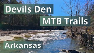
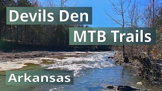
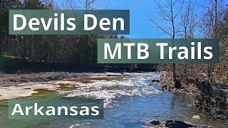
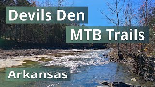
Videos of Devils Den State Park - Monument Trails Mountain Bike


Current Trail Warnings
| status | trail | date | condition | user | info |
|---|---|---|---|---|---|
| Devils Racetrack | Oct 24, 2026 @ 8:46am (America/Indiana/Vincennes) Oct 24, 2026 | Ideal | thomcerny NGMBA | Large tree down on southern section |
Recent Trail Reports
| status | trail | date | condition | info | user |
|---|---|---|---|---|---|
| Fossil Flats Trail | Nov 14, 2026 @ 6:30am (America/Indiana/Vincennes) Nov 14, 2026 | Ideal | robbiethetrailtroll OORC | ||
| Sawmill Loop | Nov 14, 2026 @ 6:30am (America/Indiana/Vincennes) Nov 14, 2026 | Ideal | robbiethetrailtroll OORC | ||
| All You Can Eat | Nov 14, 2026 @ 6:30am (America/Indiana/Vincennes) Nov 14, 2026 | Ideal | robbiethetrailtroll OORC | ||
| Sparky | Oct 24, 2026 @ 8:46am (America/Indiana/Vincennes) Oct 24, 2026 | Ideal | thomcerny NGMBA | ||
| We Can Take It | Oct 24, 2026 @ 8:46am (America/Indiana/Vincennes) Oct 24, 2026 | Ideal | thomcerny NGMBA | ||
| Dollar a Day | Oct 24, 2026 @ 8:46am (America/Indiana/Vincennes) Oct 24, 2026 | Ideal | thomcerny NGMBA | ||
| Goldbrick | Oct 24, 2026 @ 8:46am (America/Indiana/Vincennes) Oct 24, 2026 | Ideal | thomcerny NGMBA | ||
| Racers Hill | Oct 18, 2026 @ 10:31am (America/Chicago) Oct 18, 2026 | Ideal | robbiethetrailtroll OORC | ||
| Orville | Jan 13, 2026 @ 11:21am (America/Chicago) Jan 13, 2026 | Ideal | decoydude | ||
| Sparky to Orville Connector | Nov 9, 2025 @ 4:44pm (America/Chicago) Nov 9, 2025 | Ideal | DaleOliver |
Activity Feed
| username | action | type | title | date |
|---|---|---|---|---|
| robbiethetrailtroll | add | report | activity #107880867 and 2 more | Nov 16, 2026 @ 4:20am Nov 16, 2026 |
| jkdarton | wishlist | route | activity #107761407 | Nov 14, 2026 @ 7:18am Nov 14, 2026 |
| MS95 | wishlist | route | activity #107555507 | Nov 10, 2026 @ 12:34pm Nov 10, 2026 |
| KarenOxaU4r | ridden | trail | activity #107394233 and 6 more | Nov 7, 2026 @ 6:09pm Nov 7, 2026 |
| cleask | wishlist | route | activity #107390131 | Nov 7, 2026 @ 4:29pm Nov 7, 2026 |
Recent Comments
| username | type | title | comment | date |
|---|---|---|---|---|
| report | (35.7928413, -94.2390744) | Sep 25, 2026 @ 2:19pm Sep 25, 2026 | ||
| trail | Ridden downhill (north to south) it is a... | Nov 6, 2025 @ 5:05pm Nov 6, 2025 | ||
| trail | Needs to be green and renamed outlaw. | Oct 2, 2025 @ 11:44am Oct 2, 2025 | ||
| trail | One of the best trails I’ve rode. Best way... | Sep 14, 2025 @ 2:11pm Sep 14, 2025 | ||
| trail | For the most part, trails are in good shape. ... | Aug 23, 2025 @ 9:38am Aug 23, 2025 |
Nearby Areas
| name | distance | ||||
|---|---|---|---|---|---|
| Lake Fort Smith State Park | 3 | 2 | 9.8 km | ||
| Mt Kessler | 7 | 8 | 11 | 2 | 16 km |
| Lincoln Lake | 7 | 1 | 17.1 km | ||
| Ramay JH School Trails | 2 | 1 | 18.3 km | ||
| Centennial Park at Millsap Mountain | 7 | 8 | 14 | 18.4 km |
Activity Type Stats
| activitytype | trails | distance | descent | descent distance | total vertical | rating | global rank | state rank | photos | reports | routes | activity logs |
|---|---|---|---|---|---|---|---|---|---|---|---|---|
| Mountain Bike | 4 | 6 miles | 623 ft | 3 miles | 269 ft | #4,508 | #24 | 122 | 289 | 1 | 2,929 | |
| E-Bike | 4 | 6 miles | 623 ft | 3 miles | 269 ft | 287 | 458 | |||||
| Hike | 12 | 26 miles | 3,455 ft | 10 miles | 860 ft | #7,014 | #19 | 279 | 668 | |||
| Trail Running | 12 | 26 miles | 3,455 ft | 10 miles | 860 ft | #7,377 | #18 | 273 | 81 |
Frequently Asked Questions
▼
What are the highest rated mountain biking trails in Devils Den State Park - Monument Trails?
The highest rated mountain biking trails in Devils Den State Park - Monument Trails are:
- Devils Racetrack (4.5/5)
- We Can Take It (4.4/5)
- Orville (4.3/5)
- Sparky (4.3/5)
- Sawmill Loop (4.2/5)
▼
What is the best time of the year to ride in Devils Den State Park - Monument Trails?
Based on activity log data, the most popular months to ride in Devils Den State Park - Monument Trails are:
- April (82 activities)
- March (70 activities)
- September (57 activities)
▼
Where can I park to ride in Devils Den State Park - Monument Trails?
There are 8 parking locations listed in Devils Den State Park - Monument Trails. The most popular parking spots are: View all parking and trailhead locations on the map to plan your visit.
▼
What is the longest trail in Devils Den State Park - Monument Trails?
The longest trail in Devils Den State Park - Monument Trails is Devils Racetrack at 3.5 miles. View all trails sorted by distance.
▼
What are the best & highest rated hiking trails in Devils Den State Park - Monument Trails?
The best hiking trails in Devils Den State Park - Monument Trails are: View all hiking trails sorted by popularity score.
▼
What are the best & highest rated trail running trails in Devils Den State Park - Monument Trails?
The best trail running trails in Devils Den State Park - Monument Trails are: View all trail running trails sorted by popularity score.
▼
How many trails are in Devils Den State Park - Monument Trails?
Devils Den State Park - Monument Trails has a total of 12 trails. Of those, 4 are designated for mountain biking. Browse top mountain biking trails in Devils Den State Park - Monument Trails to find detailed information including difficulty ratings, distances, and trail conditions.
▼
Which trail has the most elevation gain in Devils Den State Park - Monument Trails?
The trail with the most elevation gain in Devils Den State Park - Monument Trails is Devils Racetrack with 566 ft of elevation gain. View all trails sorted by elevation gain.
▼
Which trail has the most elevation descent in Devils Den State Park - Monument Trails?
The trail with the most elevation descent in Devils Den State Park - Monument Trails is We Can Take It with 442 ft of elevation descent. View all trails sorted by elevation descent.
▼
What activities are most popular in Devils Den State Park - Monument Trails?
Devils Den State Park - Monument Trails supports the following activities: Mountain Biking, Hiking, Trail Running.
▼
What are the steepest mountain biking trails in Devils Den State Park - Monument Trails?
The steepest mountain biking trail in Devils Den State Park - Monument Trails is Goldbrick with an average grade of 7.7%. View all trails sorted by grade.
▼
Are there any trails with scenic viewpoints in Devils Den State Park - Monument Trails?
Yes, there are 1 scenic viewpoints marked along trails in Devils Den State Park - Monument Trails. Some popular viewpoints include: Explore more points of interest to find trails with the best views.
▼
Are there any trails with waterfalls in Devils Den State Park - Monument Trails?
Yes, there are 3 waterfall locations noted along trails in Devils Den State Park - Monument Trails. View the points of interest map to discover trails near waterfalls.
▼
What trails have the biggest jumps in Devils Den State Park - Monument Trails?
The trails with the biggest jumps in Devils Den State Park - Monument Trails are: Browse all mountain bike trails to find trails with jumps and technical features.
▼
Are the trails open in Devils Den State Park - Monument Trails?
The overall region status for Devils Den State Park - Monument Trails is Minor Issue / Yellow. Out of 13 trails:
- Clear / Green: 10
- Minor Issue / Yellow: 1
- Significant Issue / Amber: 2
▼
What are the trail conditions in Devils Den State Park - Monument Trails?
Based on trail reports from the past week in Devils Den State Park - Monument Trails:
- Ideal: 3 trails
▼
Can I ride an ebike in Devils Den State Park - Monument Trails?
There are 11 trails in Devils Den State Park - Monument Trails that allow e-bikes. Check the e-bike trails listing for specific trail access details and any local regulations.
▼
What are the most popular mountain biking routes in Devils Den State Park - Monument Trails?
The most popular mountain biking routes in Devils Den State Park - Monument Trails are: View all mountain biking routes in Devils Den State Park - Monument Trails.
▼
What type of bike is most common in Devils Den State Park - Monument Trails?
Based on activity log data, the most common bike types used in Devils Den State Park - Monument Trails are:
- AM (36 activities)
- XC (12 activities)
- Trials (1 activities)
▼
What are the most popular Strava Segments in Devils Den State Park - Monument Trails?
The most popular Strava segments in Devils Den State Park - Monument Trails are:
- Buckaday (2,880 athletes)
- Takedown! (We Can Take It) (2,445 athletes)
- Racer's Hill (1,549 athletes)
▼
What are some popular technical trail features in Devils Den State Park - Monument Trails?
There are 2 technical trail features (TTFs) in Devils Den State Park - Monument Trails. Some popular features include: View all technical trail features in Devils Den State Park - Monument Trails.
▼
What are the most popular mountain biking trails in Devils Den State Park - Monument Trails?
The most popular mountain biking trails in Devils Den State Park - Monument Trails are: View all mountain biking trails sorted by popularity.
▼
What are the best beginner ride trails in Devils Den State Park - Monument Trails?
The best beginner mountain biking trails in Devils Den State Park - Monument Trails are:
- Goldbrick (3.3/5)
Activities
Trails
- Hard trails in Devils Den State Park - Monument Trails
- Easy trails in Devils Den State Park - Monument Trails
- Favorite trails in Devils Den State Park - Monument Trails
- Most ridden trails in Devils Den State Park - Monument Trails
- Singletrack in Devils Den State Park - Monument Trails
- Viewpoint trails in Devils Den State Park - Monument Trails
- Trails with technical features in Devils Den State Park - Monument Trails
- By Hotrod4989 & contributors
- Admins: OORC
- #10224 - 26,937 views
- devils den state park - monument trails activity log | embed map of Devils Den State Park - Monument Trails mountain bike trails | devils den state park - monument trails mountain biking points of interest
Downloading of trail gps tracks in kml & gpx formats is enabled for Devils Den State Park - Monument Trails.
You must login to download files.
