close
-
Layers w
- Weather Layers
- Pro
- Pro
- Pro
- Pro
- Pro
- Pro
- More Layers
- Pro
- Pro
- Pro
- Pro
-
Upgrade to

3D
Trail Conditions
- Unknown
- Snow Groomed
- Snow Packed
- Snow Covered
- Snow Cover Partial
- Freeze/thaw Cycle
- Icy
- Prevalent Mud
- Wet
- Variable
- Ideal
- Dry
- Very Dry
Trail Flow (Ridden Direction)
Trailforks scans users ridelogs to determine the most popular direction each trail is ridden. A good flowing trail network will have most trails flowing in a single direction according to their intension.
The colour categories are based on what percentage of riders are riding a trail in its intended direction.
The colour categories are based on what percentage of riders are riding a trail in its intended direction.
- > 96%
- > 90%
- > 80%
- > 70%
- > 50%
- < 50%
- bi-directional trail
- no data
Trail Last Ridden
Trailforks scans ridelogs to determine the last time a trail was ridden.
- < 2 days
- < 1 week
- < 2 weeks
- < 1 month
- < 6 months
- > 6 months
Trail Ridden Direction
The intended direction a trail should be ridden.
- Downhill Only
- Downhill Primary
- Both Directions
- Uphill Primary
- Uphill Only
- One Direction
Contribute Details
Colors indicate trail is missing specified detail.
- Description
- Photos
- Description & Photos
- Videos
Trail Popularity ?
Trailforks scans ridelogs to determine which trails are ridden the most in the last 9 months.
Trails are compared with nearby trails in the same city region with a possible 25 colour shades.
Think of this as a heatmap, more rides = more kinetic energy = warmer colors.
- most popular
- popular
- less popular
- not popular
ATV/ORV/OHV Filter
Max Vehicle Width
inches
US Cell Coverage
Legend

Radar Time
Activity Recordings
Trailforks uses anonymized public activity data.
?
Activity Recordings
Trailforks uses anonymized public activity data.
?
Personal Heatmap
▶
Activity Types
all
/
none
▶
Options
2
Date range
month
–
Winter Trails
Warning
A routing network for winter maps does not exist. Selecting trails using the winter trails layer has been disabled.
Missing Trails
Most Popular
Least Popular
Trails are colored based on popularity. The more popular a trail is, the more red. Less popular trails trend towards green.
Jump Magnitude Heatmap
Heatmap of where riders jump on trails. Zoom in to see individual jumps, click circles to view jump details.
BC Backroad Status
![map legend]()
Service Road Atlas is a free to use, community-driven service for viewing and creating reports on the numerous back-country service roads around B.C. and Alberta.

Slope Aspect
Direction the slope faces
Trails Deemphasized
Trails are shown in grey.
Only show trails with no bike usage.
Suggested Layers
Based on selected activity type
Save the current map location and zoom level as your default home location whenever this page is loaded.
Save
No description for Devils - Mission has been added yet!
Login or register to submit one.
 google parking directions
Primary Trail Type: Cross-Country
eBikes Allowed:
No
Shuttleable: YES
Land Status: National Forest
google parking directions Activities Click to view
- Mountain Bike
20 trails
- E-Bike
14 trails
- Horse
7 trails
- Hike
20 trails
- Trail Running
20 trails
- Dirtbike/Moto
13 trails
- ATV/ORV/OHV
2 trails
Region Details
- 3
- 3
- 11
- 3
Region Status
Caution as of Jun 14, 2026Local Trail Association
Stats
- Avg Trail Rating
- Trails (view details)
- 20
- Trails Mountain Bike
- 20
- Trails E-Bike
- 14
- Trails Horse
- 7
- Trails Hike
- 20
- Trails Trail Running
- 20
- Trails Dirtbike/Moto
- 13
- Trails Observed Trials
- 1
- Trails ATV/ORV/OHV
- 2
- Total Distance
- 68 miles
- Total Descent
- 17,664 ft
- Total Vertical
- 5,346 ft
- Highest Trailhead
- 6,855 ft
- Reports
- 372
- Photos
- 227
- Ridden Counter
- 3,569
Popular Devils - Mission Mountain Biking Trails
• 60 ★ 4.5 • 12 miles • 325 ft • 531 •
Multi-use trail primarily used by motorcycles and mountain bikes. One of the premier mountain bike trails in the PNW. Ascending options include riding up Mission Creek Rd to Rd. and then descending or just riding up the trail itself. If...
• 75 ★ 3.0 • 2,593 ft • 105 ft • 348 •
Popular green difficulty singletrack. This multi-use trail can be used downhill primary. On average it takes 5 minutes to complete this trail.
• 65 ★ 4.1 • 4 miles • 327 ft • 318 •
The upper portion is rocky and technical (big loose rocks churned up by motorcycles). Lower portion is more flowy and fast. May 2019 : Large quantity of blowdowns on trail. Avoid this trail until it is cleared.
• 55 ★ 4.5 • 8 miles • 778 ft • 236 •
Mission is a tough climb, mostly due to length. Grade can be steep at times, expect to push a bit if ascending this route.
• 70 ★ 3.2 • 2 miles • 569 ft • 183 •
If you are starting from the Mission Ridge Rd. end, the trail starts off as dirt road it will eventually turn into singletrack. Most locals use this trail to access some of the more popular trails in the area. Short section with minor...
• 55 ★ 3.5 • 2 miles • 530 ft • 162 •
Singletrack, some loose rock, mostly used to access the more popular trails in the area. Traveling downhill is kid friendly
• 55 ★ 4.3 • 5 miles • 1,095 ft • 161 •
Whether you’re a mountain biker or a trail runner, this loop spans nicely graded trails that are well maintained and quite buffed out. The trails dissect beautiful glades of Ponderosa pines and pine grass, traverse ridges with views...
• 65 ★ 3.4 • 3 miles • 531 ft • 154 •
Double track, lots of loose rock, some views of the Wenatchee valley
Devils - Mission Mountain Bike Routes
★ 5.0 • 25 miles • 5,115 ft • 7 • Loop •
Classic figure 8 route for , , and Mission Ridge.
★ 3.0 • 28 miles • 6,870 ft • 6 • Loop •
/ plus DG and MR. A very nice loop with several climbs. CCW is recommended, although all trails are open...
★ 3.0 • 12 miles • 2,048 ft • 8 • Point to Point •
This is one of the better ways to ride . Leaving a vehicle at the bottom of the 5 mile road and shuttling...
3 miles • 596 ft • 4 • Point to Point •
A shorter trail option than the entire , with a focus on those shuttling nearby Mission Ridge and trails....
8 miles • 706 ft • 1 •
This is one of our favorite flow routes in Wenatchee Valley and is featured in Freehub Magazine's North...
Photos of Devils - Mission Mountain Bike
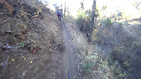
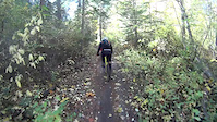
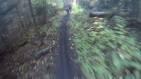
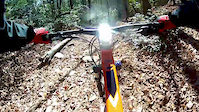
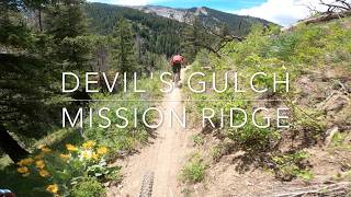
Videos of Devils - Mission Mountain Bike
trail: Devil's Gulch
10:59 |
561 |
Oct 17, 2015
trail: Devil's Gulch
14:14 |
588 |
Oct 17, 2015
trail: Devil's Gulch
8:37 |
453 |
Oct 17, 2015
trail: Beehive
2:26 |
297 |
Feb 6, 2015
trail: Beehive
0:21 |
144 |
Feb 6, 2015
trail: Devil's Gulch
1:12:11 |
125 |
Jul 31, 2025 , Wenatchee

trail: Mission Ridge Trail
0:59 |
612 |
Feb 24, 2011
trail: Mission Ridge Trail
0:59 |
337 |
Feb 24, 2011
Recent Trail Reports
| status | trail | date | condition | info | user |
|---|---|---|---|---|---|
| Upper Mission Ridge | Jun 14, 2026 @ 12:09pm (America/Los_Angeles) Jun 14, 2026 | Unknown | bcatt | ||
| Mission Ridge Trail | Jun 7, 2026 @ 7:05pm (America/Los_Angeles) Jun 7, 2026 | Dry | swilsons | ||
| Devil's Gulch | Jun 4, 2026 @ 7:34pm (America/Los_Angeles) Jun 4, 2026 | Variable | AlanSchmaltzdF | ||
| Red Hill Spur | May 24, 2026 @ 9:33am (America/Los_Angeles) May 24, 2026 | Dry | i-g-o-r | ||
| Red Hill Trail | May 24, 2026 @ 9:31am (America/Los_Angeles) May 24, 2026 | Dry | i-g-o-r | ||
| Red Devil | May 24, 2026 @ 9:31am (America/Los_Angeles) May 24, 2026 | Dry | i-g-o-r | ||
| Magnet Creek Trail #1206 | May 17, 2026 @ 8:17pm (America/Los_Angeles) May 17, 2026 | Unknown | i-g-o-r | ||
| Red Hill (upper) | Sep 25, 2025 @ 9:10am (America/Los_Angeles) Sep 25, 2025 | Ideal | rbwen EMBA-CC | ||
| Beehive | May 24, 2025 @ 3:05pm May 24, 2025 | Very Dry | ckoont | ||
| Devil's Spur | May 24, 2025 @ 3:05pm May 24, 2025 | Dry | ckoont |
Activity Feed
| username | action | type | title | date |
|---|---|---|---|---|
| Dennis3Tht1l | comment | report | activity #97280597 | Jun 18, 2026 @ 3:54pm 2 days |
| bcatt | add | report | activity #96993731 | Jun 14, 2026 @ 12:09pm Jun 14, 2026 |
| bjohnson1 | wishlist | route | activity #96782511 | Jun 11, 2026 @ 8:43pm Jun 11, 2026 |
| BryanId5vwa | wishlist | route | activity #96779422 | Jun 11, 2026 @ 7:35pm Jun 11, 2026 |
| Dennis3Tht1l | comment | report | activity #96627659 | Jun 9, 2026 @ 1:49pm Jun 9, 2026 |
Recent Comments
| username | type | title | comment | date |
|---|---|---|---|---|
| report | I went down upper Mission expecting to finish... | Jun 18, 2026 @ 3:54pm 2 days | ||
| report | We're almost done clearing upper mission... | Jun 9, 2026 @ 1:49pm Jun 9, 2026 | ||
| trail | This trail has some fun and rowdy bits, but it... | Jun 8, 2026 @ 2:19pm Jun 8, 2026 | ||
| trail | Rode on 6/5. Clear of trees - thanks to all... | Jun 6, 2026 @ 10:34am Jun 6, 2026 | ||
| trail | There are a few down trees, otherwise lovely... | May 12, 2026 @ 5:05pm May 12, 2026 |
Nearby Areas
| name | distance | ||||
|---|---|---|---|---|---|
| #2 Canyon | 7 | 11 | 3 | 4.1 km | |
| Table Mountain | 2 | 10 | 15 | 5.1 km | |
| Squilchuck State Park | 5 | 2 | 5.6 km | ||
| Dry Gulch Preserve | 1 | 7.1 km | |||
| Saddle Rock Natural Area | 1 | 9 | 1 | 7.3 km |
Local Badges
-

Completionist0 awarded
Activity Type Stats
| activitytype | trails | distance | descent | descent distance | total vertical | rating | global rank | state rank | photos | reports | routes | ridelogs |
|---|---|---|---|---|---|---|---|---|---|---|---|---|
| Mountain Bike | 20 | 68 miles | 17,664 ft | 33 miles | 5,344 ft | #2,848 | #986 | 206 | 372 | 9 | 2,065 | |
| E-Bike | 14 | 59 miles | 15,230 ft | 29 miles | 5,262 ft | #2,580 | #838 | 328 | 184 | |||
| Horse | 7 | 15 miles | 1,791 ft | 4 miles | 4,751 ft | #1,834 | #965 | 131 | ||||
| Hike | 20 | 68 miles | 17,664 ft | 33 miles | 5,344 ft | #3,590 | #1,245 | 4 | 380 | 371 | ||
| Trail Running | 20 | 68 miles | 17,664 ft | 33 miles | 5,344 ft | #2,860 | #730 | 380 | 141 | |||
| Dirtbike/Moto | 13 | 52 miles | 14,334 ft | 26 miles | 5,262 ft | #161 | #75 | 17 | 239 | 117 | ||
| Observed Trials | 1 | 3 miles | 23 ft | 860 ft | 1,112 ft | 3 | ||||||
| ATV/ORV/OHV | 2 | 5 miles | 23 ft | 860 ft | 3,789 ft | #601 | #266 | 103 | 3 |
Frequently Asked Questions About Devils - Mission
▼
What are the highest rated mountain biking trails in Devils - Mission?
The highest rated mountain biking trails in Devils - Mission are:
- Devil's Gulch (4.4/5)
- Mission Ridge Trail (4.3/5)
- Red Hill Trail (4.2/5)
- Red Devil (4.2/5)
- Upper Mission Ridge (4.2/5)
▼
What is the best time of the year to ride in Devils - Mission?
Based on ride log data, the most popular months to ride in Devils - Mission are:
- June (75 activities)
- July (69 activities)
- August (45 activities)
▼
Where can I park to ride in Devils - Mission?
There are 11 parking locations listed in Devils - Mission. The most popular parking spots are: View all parking and trailhead locations on the map to plan your visit.
▼
What is the longest trail in Devils - Mission?
The longest trail in Devils - Mission is Devil's Gulch at 11.9 miles. View all trails sorted by distance.
Activities
Trails
- By ACree
 & contributors
 - Admins: CDLT, EMBA-CC, EMBA-CC, CDLT, EMBA-CC
- #7595 - 10,969 views
- devils - mission activity log | embed map of Devils - Mission mountain bike trails | devils - mission mountain biking points of interest
Downloading of trail gps tracks in kml & gpx formats is enabled for Devils - Mission.
You must login to download files.