close
-
Layers w
- Weather Layers
- Pro
- Pro
- Pro
- Pro
- Pro
- Pro
- More Layers
- Pro
- Pro
- Pro
- Pro
-
Upgrade to

3D
Trail Conditions
- Unknown
- Snow Groomed
- Snow Packed
- Snow Covered
- Snow Cover Partial
- Freeze/thaw Cycle
- Icy
- Prevalent Mud
- Wet
- Variable
- Ideal
- Dry
- Very Dry
Trail Flow (Ridden Direction)
Trailforks scans users ridelogs to determine the most popular direction each trail is ridden. A good flowing trail network will have most trails flowing in a single direction according to their intension.
The colour categories are based on what percentage of riders are riding a trail in its intended direction.
The colour categories are based on what percentage of riders are riding a trail in its intended direction.
- > 96%
- > 90%
- > 80%
- > 70%
- > 50%
- < 50%
- bi-directional trail
- no data
Trail Last Ridden
Trailforks scans ridelogs to determine the last time a trail was ridden.
- < 2 days
- < 1 week
- < 2 weeks
- < 1 month
- < 6 months
- > 6 months
Trail Ridden Direction
The intended direction a trail should be ridden.
- Downhill Only
- Downhill Primary
- Both Directions
- Uphill Primary
- Uphill Only
- One Direction
Contribute Details
Colors indicate trail is missing specified detail.
- Description
- Photos
- Description & Photos
- Videos
Trail Popularity ?
Trailforks scans ridelogs to determine which trails are ridden the most in the last 9 months.
Trails are compared with nearby trails in the same city region with a possible 25 colour shades.
Think of this as a heatmap, more rides = more kinetic energy = warmer colors.
- most popular
- popular
- less popular
- not popular
ATV/ORV/OHV Filter
Max Vehicle Width
inches
US Cell Coverage
Legend

Radar Time
Activity Recordings
Trailforks uses anonymized public activity data.
?
Activity Recordings
Trailforks uses anonymized public activity data.
?
Personal Heatmap
▶
Activity Types
all
/
none
▶
Options
2
Date range
month
–
Winter Trails
Warning
A routing network for winter maps does not exist. Selecting trails using the winter trails layer has been disabled.
Missing Trails
Most Popular
Least Popular
Trails are colored based on popularity. The more popular a trail is, the more red. Less popular trails trend towards green.
Jump Magnitude Heatmap
Heatmap of where riders jump on trails. Zoom in to see individual jumps, click circles to view jump details.
BC Backroad Status
![map legend]()
Service Road Atlas is a free to use, community-driven service for viewing and creating reports on the numerous back-country service roads around B.C. and Alberta.

Slope Aspect
Direction the slope faces
Trails Deemphasized
Trails are shown in grey.
Only show trails with no bike usage.
Suggested Layers
Based on selected activity type
Save the current map location and zoom level as your default home location whenever this page is loaded.
Save
No description for Donau has been added yet!
Login or register to submit one.
This region uses the Uk/Euro style trail grading system.
Activities Click to view
- Mountain Bike
67 trails
- E-Bike
67 trails
- Hike
65 trails
- Trail Running
65 trails
Region Details
- 5
- 36
- 15
- 2
- 1
Region Status
Open as of May 24, 2026Stats
- Avg Trail Rating
- Trails (view details)
- 59
- Trails Mountain Bike
- 67
- Trails E-Bike
- 67
- Trails Hike
- 65
- Trails Trail Running
- 65
- Total Distance
- 33 miles
- Total Descent
- 7,217 ft
- Total Vertical
- 565 ft
- Highest Trailhead
- 1,690 ft
- Reports
- 126
- Photos
- 125
- Ridden Counter
- 2,095
Popular Donau Mountain Biking Trails
• 90 ★ 4.5 • 2,156 ft • 0 ft • 117 •
Wird zum Ende hin schwieriger. Der letzte Teil vom ersten Abschnitt bis zum Forstweg hat noch Kicker und Pumptrack und kann als Fortsetzung der Hop-Line oder der Kicker-Line gefahren werden. Im ganzen Wald und auch hier sind recht viele...
• 90 ★ 4.7 • 2,402 ft • 6 ft • 94 •
Highly rated popular blue difficulty singletrack. This mountain bike primary trail can be used downhill primary and has a moderate overall physical rating with a 6 ft black diamond climb. On average it takes 4 minutes to complete this trail.
• 95 ★ 4.5 • 4,347 ft • 28 ft • 94 •
Anfangs leider ein Stückchen bergauf, danach schlägelt sich der Weg recht eng durch den Wald.
• 90 ★ 4.3 • 1,545 ft • 34 ft • 91 •
Popular green difficulty singletrack. This mountain bike primary trail can be used both directions and has a moderate overall physical rating with a 34 ft black diamond climb. It features rock garden. Trail visibility is always easy to follow. On average it takes 9 minutes to complete this trail.
• 75 ★ 3.5 • 4,902 ft • 128 ft • 91 •
In der ersten Häflte mit einigen knackigen Anstiegen über Jura Fels, zum Ende hin steil und durchaus gehoben blau.
• 85 ★ 3.7 • 3,269 ft • 83 ft • 86 •
Popular green difficulty machine groomed. This mountain bike primary trail can be used downhill primary and has a easy overall physical rating with a 83 ft green climb. On average it takes 4 minutes to complete this trail.
• 75 ★ 4.0 • 2,969 ft • 0 ft • 59 •
Eine Variante des Trails, Anfangs links oben fahren, dann gehts kurz durch den Wald mit kleinem Gully, aber am Ende bevor es ganz steil runter geht links halten durch den großen Gully. Ausstieg ist der gleiche.
• 65 ★ 3.4 • 4,298 ft • 64 ft • 52 •
Moderately popular green difficulty mixed. This mountain bike primary trail can be used downhill primary. On average it takes 5 minutes to complete this trail.
Donau Mountain Bike Routes
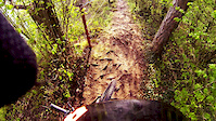
Photos of Donau Mountain Bike
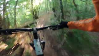
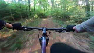
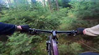
Videos of Donau Mountain Bike
trail: Absturzgefahr
0:49 |
1346 |
Apr 23, 2015
trail: Absturzgefahr
3:29 |
231 |
Oct 10, 2022 , Regensburg
trail: Walba
3:07 |
131 |
Oct 10, 2022 , Regensburg

trail: Mattinger Wiesen
5:04 |
167 |
Oct 10, 2022 , Regensburg
trail: Iradler
2:38 |
128 |
Oct 10, 2022 , Regensburg
Recent Trail Reports
| status | trail | date | condition | info | user |
|---|---|---|---|---|---|
| Sinzing DH | May 24, 2026 @ 12:09pm (America/Vancouver) May 24, 2026 | Ideal | RatisBonanza | ||
| Teugner Connect | May 17, 2026 @ 10:52am (America/Vancouver) May 17, 2026 | Ideal | RatisBonanza | ||
| Abbacher Höhe | May 1, 2026 @ 12:53pm (America/Vancouver) May 1, 2026 | Ideal | RatisBonanza | ||
| Märchenwald | Apr 8, 2026 @ 4:26pm (Europe/Prague) Apr 8, 2026 | Ideal | latehammer | ||
| Cross-Line | Apr 8, 2026 @ 4:26pm (Europe/Prague) Apr 8, 2026 | Ideal | latehammer | ||
| Mattinger Hänge | Mar 6, 2026 @ 7:43pm (Europe/Berlin) Mar 6, 2026 | Variable | Monolito | ||
| Nach Adlersberg | Feb 28, 2026 @ 2:11pm (Europe/Prague) Feb 28, 2026 | Variable | latehammer | ||
| Absturzgefahr | Sep 12, 2025 @ 2:08pm (Europe/Prague) Sep 12, 2025 | Ideal | Radlhans | ||
| Jura Raceway | Sep 12, 2025 @ 2:08pm (Europe/Prague) Sep 12, 2025 | Ideal | Radlhans | ||
| Oberndorf DH | Sep 12, 2025 @ 2:08pm (Europe/Prague) Sep 12, 2025 | Variable | Radlhans |
Activity Feed
| username | action | type | title | date |
|---|---|---|---|---|
| Umh3hU | wishlist | trail | activity #98277332 | Jul 2, 2026 @ 10:11am 2 days |
| RatisBonanza | add | report | activity #95434162 | May 24, 2026 @ 12:09pm May 24, 2026 |
| RatisBonanza | checkin | trail | activity #95432629 and 2 more | May 24, 2026 @ 11:54am May 24, 2026 |
| RatisBonanza | checkin | trail | activity #95303472 | May 23, 2026 @ 4:14am May 23, 2026 |
| RatisBonanza | comment | trail | activity #94921356 | May 17, 2026 @ 10:54am May 17, 2026 |
Recent Comments
| username | type | title | comment | date |
|---|---|---|---|---|
| trail | Das letzte Stück innerhalb des alten... | May 17, 2026 @ 10:54am May 17, 2026 | ||
| trail | Kein Trail mehr erkennbar. Lediglich bei der... | May 6, 2025 @ 1:46pm May 6, 2025 | ||
| trail | War nicht immer leicht dem Trail zu folgen,... | May 3, 2025 @ 5:45am May 3, 2025 | ||
| trail | Schwarz, vor allem die letzte Spitzkehre killt... | Apr 13, 2025 @ 8:51am Apr 13, 2025 | ||
| trail | Trail ganz nach meinem Geschmack. Ist ein... | Nov 26, 2024 @ 1:45am Nov 26, 2024 |
Nearby Areas
| name | distance | ||||
|---|---|---|---|---|---|
| Marienhöhe | 1 | 3.8 km | |||
| Naabdelta | 77 | 34 | 4.6 km | ||
| Laber | 11 | 5 | 4.8 km | ||
| Tegernheim & Co. | 19 | 10 | 6.8 km | ||
| Regen | 16 | 9 | 14.3 km |
Local Badges
-

Completionist0 awarded
Activity Type Stats
| activitytype | trails | distance | descent | descent distance | total vertical | rating | global rank | state rank | photos | reports | routes | ridelogs |
|---|---|---|---|---|---|---|---|---|---|---|---|---|
| Mountain Bike | 67 | 33 miles | 7,218 ft | 18 miles | 564 ft | #1,633 | #18 | 125 | 126 | 2 | 4,307 | |
| E-Bike | 67 | 33 miles | 7,218 ft | 18 miles | 564 ft | #1,154 | #21 | 98 | 1 | 505 | ||
| Hike | 65 | 33 miles | 6,860 ft | 18 miles | 564 ft | #1,663 | #25 | 121 | 53 | |||
| Trail Running | 65 | 33 miles | 6,860 ft | 18 miles | 564 ft | #999 | 121 | 98 |
Frequently Asked Questions About Donau
▼
What are the highest rated mountain biking trails in Donau?
The highest rated mountain biking trails in Donau are:
- Absturzgefahr (4.3/5)
- Nach Adlersberg (4.2/5)
- Union Of The Snake (4.2/5)
- Märchenwald (4.2/5)
- Irre Berms (4.2/5)
▼
What is the best time of the year to ride in Donau?
Based on ride log data, the most popular months to ride in Donau are:
- July (29 activities)
- May (25 activities)
- November (24 activities)
▼
Where can I park to ride in Donau?
Check the Donau trail map for trailhead and parking information. Community members regularly update access and parking details for trails in the area.
▼
What is the longest trail in Donau?
The longest trail in Donau is Mattinger Saupfad at 4.0 km. View all trails sorted by distance.
- By lightlives
 & contributors
 - Admins: apply
- #8305 - 13,376 views
- donau activity log | embed map of Donau mountain bike trails | donau mountain biking points of interest
Downloading of trail gps tracks in kml & gpx formats is enabled for Donau.
You must login to download files.