close
-
Layers w
- Map Content
- More Layers
- Pro
- Pro
- Pro
- Pro
- Pro
- Pro
- Pro
- Pro
-
Upgrade to

3D
Trail Conditions
- Unknown
- Snow Groomed
- Snow Packed
- Snow Covered
- Snow Cover Partial
- Freeze/thaw Cycle
- Icy
- Prevalent Mud
- Wet
- Variable
- Ideal
- Dry
- Very Dry
Trail Flow (Ridden Direction)
Trailforks scans users ridelogs to determine the most popular direction each trail is ridden. A good flowing trail network will have most trails flowing in a single direction according to their intension.
The colour categories are based on what percentage of riders are riding a trail in its intended direction.
The colour categories are based on what percentage of riders are riding a trail in its intended direction.
- > 96%
- > 90%
- > 80%
- > 70%
- > 50%
- < 50%
- bi-directional trail
- no data
Trail Last Ridden
Trailforks scans ridelogs to determine the last time a trail was ridden.
- < 2 days
- < 1 week
- < 2 weeks
- < 1 month
- < 6 months
- > 6 months
Trail Ridden Direction
The intended direction a trail should be ridden.
- Downhill Only
- Downhill Primary
- Both Directions
- Uphill Primary
- Uphill Only
- One Direction
Contribute Details
Colors indicate trail is missing specified detail.
- Description
- Photos
- Description & Photos
- Videos
Trail Popularity ?
Trailforks scans ridelogs to determine which trails are ridden the most in the last 9 months.
Trails are compared with nearby trails in the same city region with a possible 25 colour shades.
Think of this as a heatmap, more rides = more kinetic energy = warmer colors.
- most popular
- popular
- less popular
- not popular
ATV/ORV/OHV Filter
Max Vehicle Width
inches
US Cell Coverage
Legend

Radar Time
x
Activity Recordings
Trailforks users anonymized public ridelogs from the past 6 months.
- mountain biking recent
- mountain biking (>6 month)
- hiking (1 year)
- moto (1 year)
Activity Recordings
Trailforks users anonymized public skilogs from the past 12 months.
- Downhill Ski
- Backcountry Ski
- Nordic Ski
- Snowmobile
Winter Trails
Warning
A routing network for winter maps does not exist. Selecting trails using the winter trails layer has been disabled.
x
Missing Trails
Most Popular
Least Popular
Trails are colored based on popularity. The more popular a trail is, the more red. Less popular trails trend towards green.
Jump Magnitude Heatmap
Heatmap of where riders jump on trails. Zoom in to see individual jumps, click circles to view jump details.
Trails Deemphasized
Trails are shown in grey.
Only show trails with NO bikes.
Save the current map location and zoom level as your default home location whenever this page is loaded.
Save
No description for Eglisau has been added yet!
Login or register to submit one.
This region uses the Uk/Euro style trail grading system.
Activities Click to view
- Mountain Bike
2 trails
- E-Bike
2 trails
- Trail Running
2 trails
Region Details
- 1
- 1
Region Status
Open as of Jan 30, 2024Stats
- Avg Trail Rating
- Trails (view details)
- 2
- Trails Mountain Bike
- 2
- Trails E-Bike
- 2
- Trails Hike
- 2
- Trails Trail Running
- 2
- Total Distance
- 3 miles
- Total Descent Distance
- 1 mile
- Total Descent
- 495 ft
- Total Vertical
- 455 ft
- Highest Trailhead
- 1,856 ft
- Reports
- 11
- Photos
- 2
- Ridden Counter
- 35
Popular Eglisau Mountain Biking Trails
| status | title | difficulty | rating |
|---|---|---|---|
| Steil aber geil | |||
| Rhinsberg Access Road |
Photos of Eglisau Mountain Bike
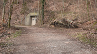
trail: Bike Brechi
32 |
May 30, 2020 @ 7:08am
May 30, 2020Videos of Eglisau Mountain Bike
trail: Steil aber geil
102 |
Mar 12, 2021

trail: Transfer
0:15 |
2152 |
May 9, 2016
Recent Trail Reports
| status | trail | date | condition | info | user |
|---|---|---|---|---|---|
| Tössegg Trail | Jan 30, 2024 @ 5:17am Jan 30, 2024 | Variable | srocky | ||
| Transfer | Aug 22, 2022 @ 10:48pm Aug 22, 2022 | Variable | lh0n | ||
| Steil aber geil | Mar 23, 2021 @ 2:30pm Mar 23, 2021 | Ideal | Traveller66 |
Activity Feed
| username | action | type | title | date |
|---|---|---|---|---|
| droni12 | ridden | trail | activity #50078071 | Mar 16, 2024 @ 6:46am Mar 16, 2024 |
| srocky | add | report | activity #48698194 | Jan 30, 2024 @ 10:56am Jan 30, 2024 |
| svlinch | ridden | trail | activity #44558351 | Sep 26, 2023 @ 7:52am Sep 26, 2023 |
| jurasick | update | trail | activity #44527372 | Sep 25, 2023 @ 1:41pm Sep 25, 2023 |
| svlinch | wishlist | trail | activity #44460279 | Sep 24, 2023 @ 12:43am Sep 24, 2023 |
Recent Comments
| username | type | title | comment | date |
|---|---|---|---|---|
| trail | Really short. Some tree logs making it hard to... | Aug 23, 2022 @ 12:06pm Aug 23, 2022 |
Activity Type Stats
| activitytype | trails | distance | descent | descent distance | total vertical | rating | global rank | state rank | photos | reports | routes | ridelogs |
|---|---|---|---|---|---|---|---|---|---|---|---|---|
| Mountain Bike | 2 | 3 miles | 495 ft | 1 mile | 456 ft | #6,514 | #323 | 2 | 11 | 197 | ||
| E-Bike | 2 | 3 miles | 495 ft | 1 mile | 456 ft | #2,661 | #226 | 11 | 43 | |||
| Hike | 2 | 3 miles | 495 ft | 1 mile | 456 ft | 9 | 2 | |||||
| Trail Running | 2 | 3 miles | 495 ft | 1 mile | 456 ft | #5,221 | #268 | 11 | 6 |
- By NickBosshard
 bike bülach & contributors
 - Admins: Zürich
- #29833 - 746 views
- eglisau activity log | embed map of Eglisau mountain bike trails |
Downloading of trail gps tracks in kml & gpx formats is enabled for Eglisau.
You must login to download files.