close
-
Layers w
- Map Content
- More Layers
- Pro
- Pro
- Pro
- Pro
- Pro
- Pro
- Pro
- Pro
-
Upgrade to

3D
Trail Conditions
- Unknown
- Snow Groomed
- Snow Packed
- Snow Covered
- Snow Cover Partial
- Freeze/thaw Cycle
- Icy
- Prevalent Mud
- Wet
- Variable
- Ideal
- Dry
- Very Dry
Trail Flow (Ridden Direction)
Trailforks scans users ridelogs to determine the most popular direction each trail is ridden. A good flowing trail network will have most trails flowing in a single direction according to their intension.
The colour categories are based on what percentage of riders are riding a trail in its intended direction.
The colour categories are based on what percentage of riders are riding a trail in its intended direction.
- > 96%
- > 90%
- > 80%
- > 70%
- > 50%
- < 50%
- bi-directional trail
- no data
Trail Last Ridden
Trailforks scans ridelogs to determine the last time a trail was ridden.
- < 2 days
- < 1 week
- < 2 weeks
- < 1 month
- < 6 months
- > 6 months
Trail Ridden Direction
The intended direction a trail should be ridden.
- Downhill Only
- Downhill Primary
- Both Directions
- Uphill Primary
- Uphill Only
- One Direction
Contribute Details
Colors indicate trail is missing specified detail.
- Description
- Photos
- Description & Photos
- Videos
Trail Popularity ?
Trailforks scans ridelogs to determine which trails are ridden the most in the last 9 months.
Trails are compared with nearby trails in the same city region with a possible 25 colour shades.
Think of this as a heatmap, more rides = more kinetic energy = warmer colors.
- most popular
- popular
- less popular
- not popular
ATV/ORV/OHV Filter
Max Vehicle Width
inches
US Cell Coverage
Legend

Radar Time
x
Activity Recordings
Trailforks users anonymized public ridelogs from the past 6 months.
- mountain biking recent
- mountain biking (>6 month)
- hiking (1 year)
- moto (1 year)
Activity Recordings
Trailforks users anonymized public skilogs from the past 12 months.
- Downhill Ski
- Backcountry Ski
- Nordic Ski
- Snowmobile
Winter Trails
Warning
A routing network for winter maps does not exist. Selecting trails using the winter trails layer has been disabled.
x
Missing Trails
Most Popular
Least Popular
Trails are colored based on popularity. The more popular a trail is, the more red. Less popular trails trend towards green.
Jump Magnitude Heatmap
Heatmap of where riders jump on trails. Zoom in to see individual jumps, click circles to view jump details.
Trails Deemphasized
Trails are shown in grey.
Only show trails with NO bikes.
Save the current map location and zoom level as your default home location whenever this page is loaded.
SaveSuele pedregoso, cubierto por pinos, algunas carrascas y principalmente matorral.10 De la sierra hacia el sur se desarrolla un piedemonte cubierto de olivares, almendros y algún viñedo, que termina en la vega del río Vinalopó, donde se hallan las mejores tierras de cultivo y se asienta la población
Primary Trail Type: All-Mountain & Downhill
AKA: Morron
 google parking directions
This region uses the Uk/Euro style trail grading system.
Activities Click to view
- Mountain Bike
59 trails
- E-Bike
59 trails
- Hike
63 trails
- Trail Running
63 trails
Region Details
- 34
- 1
- 7
- 17
Region Status
Open as of Apr 12, 2024Stats
- Avg Trail Rating
- Trails (view details)
- 63
- Trails Mountain Bike
- 59
- Trails E-Bike
- 59
- Trails Hike
- 63
- Trails Trail Running
- 63
- Trails Dirtbike/Moto
- 1
- Total Distance
- 64 miles
- Total Descent Distance
- 36 miles
- Total Descent
- 13,469 ft
- Total Vertical
- 1,552 ft
- Highest Trailhead
- 3,234 ft
- Reports
- 123
- Photos
- 6
- Ridden Counter
- 182
Popular El Morrón Mountain Biking Trails
El Morrón Mountain Bike Routes
| title | rating | distance |
|---|---|---|
| Gasqué-Jabalí-Sendas Cañada-Polideportivo | 21 miles | |
| Jabalí-Antenas Geodésico Solana. | 9 miles | |
| Gasqué-Jabalí-Rambla-Infierno. | 17 miles |
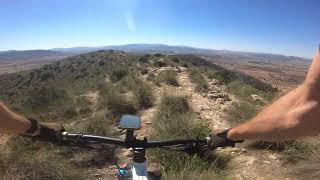
Photos of El Morrón Mountain Bike
trail: Acceso Cresta de la Solana
4 |
Jun 10, 2023 @ 12:58pm
Jun 10, 2023Videos of El Morrón Mountain Bike
trail: Punto Geodésico.
14:34 |
35 |
Oct 1, 2023 , villena
Recent Trail Reports
| status | trail | date | condition | info | user |
|---|---|---|---|---|---|
| Acceso Cresta Solana | Apr 12, 2024 @ 11:18am Apr 12, 2024 | Dry | AMG TFSPAIN | ||
| Cresta de la Solana | Apr 12, 2024 @ 11:18am Apr 12, 2024 | Dry | AMG TFSPAIN | ||
| Jabalí Final | Apr 12, 2024 @ 11:18am Apr 12, 2024 | Dry | AMG TFSPAIN | ||
| Jabalí medio | Apr 12, 2024 @ 11:18am Apr 12, 2024 | Dry | AMG TFSPAIN | ||
| Rambla El Gasqué.º | Apr 12, 2024 @ 11:18am Apr 12, 2024 | Dry | AMG TFSPAIN | ||
| Acceso Jabalí Cañada | Apr 10, 2024 @ 10:59am Apr 10, 2024 | Dry | AMG TFSPAIN | ||
| Jabalí Fácil | Apr 10, 2024 @ 10:59am Apr 10, 2024 | Dry | AMG TFSPAIN | ||
| Jabalí. | Apr 10, 2024 @ 10:59am Apr 10, 2024 | Dry | AMG TFSPAIN | ||
| Geodésico Morron-Jabalí. | Apr 10, 2024 @ 10:59am Apr 10, 2024 | Dry | AMG TFSPAIN | ||
| Acceso Rambla El Gasqué.º | Apr 10, 2024 @ 10:59am Apr 10, 2024 | Dry | AMG TFSPAIN |
Activity Feed
| username | action | type | title | date |
|---|---|---|---|---|
| AMG | add | report | activity #51178299 and 4 more | Apr 14, 2024 @ 12:19pm Apr 14, 2024 |
| AMG | add | report | activity #51038102 and 7 more | Apr 11, 2024 @ 6:31am Apr 11, 2024 |
| AMG | add | route | activity #50741226 | Apr 2, 2024 @ 12:39pm Apr 2, 2024 |
| AMG | update | trail | activity #50711364 and 2 more | Apr 1, 2024 @ 12:51pm Apr 1, 2024 |
| AMG | add | report | activity #50711313 and 10 more | Apr 1, 2024 @ 12:49pm Apr 1, 2024 |
Recent Comments
| username | type | title | comment | date |
|---|---|---|---|---|
| trail | No merece la pena, han tirado muchas piedras... | Dec 16, 2023 @ 2:04pm Dec 16, 2023 | ||
| trail | Trail is rideable. It can be very difficult to... | Oct 1, 2023 @ 10:01am Oct 1, 2023 | ||
| trail | Senda marcada, pero cerrada en algunas partes... | Jul 14, 2023 @ 9:35am Jul 14, 2023 | ||
| trail | Este esta menos cerrado que su continuación,... | Jul 14, 2023 @ 9:28am Jul 14, 2023 | ||
| trail | Tiene senda marcada, pero se ha cerrado mucho... | Jul 14, 2023 @ 9:26am Jul 14, 2023 |
Nearby Areas
| name | distance | ||||
|---|---|---|---|---|---|
| Sierra de la Villa | 7 | 24 | 3.5 km | ||
| Campo de Mirra | 6 | 9 | 3.7 km | ||
| Cabezo Redondo | 11 | 17 | 4.4 km | ||
| Fontanars | 2 | 8 | 5.9 km | ||
| La Replana-Benejama | 2 | 3 | 6.4 km |
Local Badges
-

Completionist0 awarded
Activity Type Stats
| activitytype | trails | distance | descent | descent distance | total vertical | rating | global rank | state rank | photos | reports | routes | ridelogs |
|---|---|---|---|---|---|---|---|---|---|---|---|---|
| Mountain Bike | 59 | 62 miles | 13,041 ft | 36 miles | 1,552 ft | #6,152 | #291 | 2 | 123 | 4 | 98 | |
| E-Bike | 59 | 62 miles | 13,041 ft | 36 miles | 1,552 ft | #2,610 | #254 | 121 | 4 | 40 | ||
| Hike | 63 | 64 miles | 13,468 ft | 36 miles | 1,552 ft | #5,203 | #272 | 4 | 121 | 3 | 10 | |
| Trail Running | 63 | 64 miles | 13,468 ft | 36 miles | 1,552 ft | #5,222 | #270 | 123 | 1 | 1 | ||
| Dirtbike/Moto | 1 | 2 miles | 39 ft | 1,027 ft | 354 ft |
- By AMG
 TFSPAIN & contributors
 - Admins: apply
- #32245 - 664 views
- el morrón activity log | embed map of El Morrón mountain bike trails | el morrón mountain biking points of interest
Downloading of trail gps tracks in kml & gpx formats is enabled for El Morrón.
You must login to download files.