
close
3D
Trail Conditions
- Unknown
- Snow Groomed
- Snow Packed
- Snow Covered
- Snow Cover Partial
- Freeze/thaw Cycle
- Icy
- Prevalent Mud
- Wet
- Variable
- Ideal
- Dry
- Very Dry
Trail Flow (Ridden Direction)
Trailforks scans users activity logs to determine the most popular direction each trail is ridden. A good flowing trail network will have most trails flowing in a single direction according to their intension.
The colour categories are based on what percentage of users are riding a trail in its intended direction.
The colour categories are based on what percentage of users are riding a trail in its intended direction.
- > 96%
- > 90%
- > 80%
- > 70%
- > 50%
- < 50%
- bi-directional trail
- no data
Trail Last Used
Trailforks scans activity logs to determine the last time a trail was ridden.
- < 2 days
- < 1 week
- < 2 weeks
- < 1 month
- < 6 months
- > 6 months
Trail Ridden Direction
The intended direction a trail should be ridden.
- Downhill Only
- Downhill Primary
- Both Directions
- Uphill Primary
- Uphill Only
- One Direction
Contribute Details
Colors indicate trail is missing specified detail.
- Description
- Photos
- Description & Photos
- Videos
Trail Popularity ?
Trailforks scans activity logs to determine which trails are ridden the most in the last 9 months.
Trails are compared with nearby trails in the same city region with a possible 25 colour shades.
Think of this as a heatmap, more activities = more kinetic energy = warmer colors.
- most popular
- popular
- less popular
- not popular
ATV/ORV/OHV Filter
Max Vehicle Width
inches
US Cell Coverage
Legend

Radar Time
Activity Recordings
Trailforks uses anonymized public activity data.
?
Activity Recordings
Trailforks uses anonymized public activity data.
?
Winter Trails
Warning
A routing network for winter maps does not exist. Selecting trails using the winter trails layer has been disabled.
Missing Trails
Most Popular
Least Popular
Trails are colored based on popularity. The more popular a trail is, the more red. Less popular trails trend towards green.
Jump Magnitude Heatmap
Heatmap of where users jump on trails. Zoom in to see individual jumps, click circles to view jump details.
BC Backroad Status
![map legend]()
Service Road Atlas is a free to use, community-driven service for viewing and creating reports on the numerous back-country service roads around B.C. and Alberta.

Slope Aspect
Direction the slope faces
Trails Deemphasized
Trails are shown in grey.
Only show trails with no bike usage.
Suggested Layers
Based on selected activity type
Save the current map location and zoom level as your default home location whenever this page is loaded.
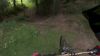
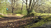
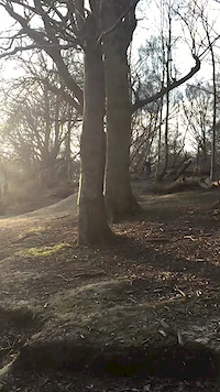
SaveEpping Forest is home to the only real MTB trails right next to London, stretching between Forest Gate in the South and Epping in the North. If you know where to look it contains some of the best singletrack in the South East and London.
Epic mud in the winter and crazy brambles in the summer but lots of fun if you like it twisty and fast. Its very easy to go riding here, if you live in London, Essex or Hertfordshire. There are trains from London Liverpool Street to Chingford, and the Central Line to Snaresbrook, South Woodford, Loughton or Epping giving easy access to the forest.
Epic mud in the winter and crazy brambles in the summer but lots of fun if you like it twisty and fast. Its very easy to go riding here, if you live in London, Essex or Hertfordshire. There are trains from London Liverpool Street to Chingford, and the Central Line to Snaresbrook, South Woodford, Loughton or Epping giving easy access to the forest.
Primary Trail Type: Cross-Country
eBikes Allowed:
Yes
Land Status: City Managed
Land Manager: Corporation of London
 google parking directions plan a road trip here
Links
This region uses the Uk/Euro style trail grading system.
Trail info last updated
Activities Click to view
- Mountain Bike
228 trails
- E-Bike
228 trails
- Horse
60 trails
- Hike
238 trails
- Trail Running
238 trails
Region Details
- 41
- 94
- 88
- 5
Region Status
Open as of Sep 13, 2026Stats
- Avg Trail Rating
- Trails (view details)
- 238
- Trails Mountain Bike
- 228
- Trails E-Bike
- 228
- Trails Gravel Bike
- 127
- Trails Adaptive Bike
- 20
- Trails Winter Fat Bike
- 114
- Trails Horse
- 60
- Trails Hike
- 238
- Trails Trail Running
- 238
- Total Distance
- 103 miles
- Total Descent
- 11,445 ft
- Total Vertical
- 397 ft
- Highest Trailhead
- 414 ft
- Reports
- 1,852
- Photos
- 317
- Completed Counter
- 27,114
Popular Epping Forest Mountain Biking Trails
• 100 ★ 0.0 • 669 ft • 0 ft • 395 •
Popular green difficulty family friendly doubletrack. This multi-use trail can be used both directions and has a easy overall physical rating. On average it takes minutes to complete this trail.
• 95 ★ 0.0 • 732 ft • 5 ft • 350 •
Popular green difficulty singletrack. This multi-use trail can be used both directions and has a easy overall physical rating. On average it takes minutes to complete this trail.
• 90 ★ 3.0 • 920 ft • 0 ft • 274 •
A short undulating run that follows runs along the side of the road. Dick Turpins cave is rumoured to be located near the end of this trail in the front garden of Turpin House on Rats Lane.
• 95 ★ 2.0 • 2,734 ft • 87 ft • 256 •
Popular green difficulty doubletrack. This multi-use trail can be used both directions and has a easy overall physical rating. On average it takes 2 minutes to complete this trail.
• 95 ★ 3.5 • 1,882 ft • 63 ft • 247 •
Rooty and often muddy, links up with Downhill Rush.
• 100 ★ 1.0 • 4,337 ft • 47 ft • 241 •
This Section of trail starts off by crossing the golf course early on, so have your wits about you and be glad your wearing your helmet. Some easy undulations to ride on an otherwise quite simple bit of mixed single and doubletrack
Epping Forest Mountain Bike Routes
32 miles • 2,086 ft • 35 • Loop •
Roughly 50K loop from Buckhurst Hill taking in the River Roding (can get overgrown in places), Wanstead...
27 miles • 2,364 ft • 127 • Loop •
Decent length route from Epping taking in most decent trails down through Theydon, Loughton, Chingford,...
★ 3.0 • 17 miles • 1,174 ft • 9 • Loop •
Larger 28K/17M Loop than smaller Loop 1
10 miles • 903 ft • 13 •
Nice Epping route, starting at Pole Hill, ending on the road back to Walthamstow
Photos of Epping Forest Mountain Bike
Videos of Epping Forest Mountain Bike




Recent Trail Reports
| status | trail | date | condition | info | user |
|---|---|---|---|---|---|
| Over The Top | Sep 13, 2026 @ 7:24pm (Europe/London) Sep 13, 2026 | Ideal | joeg885 | ||
| Off Camber To Cannonball | Sep 13, 2026 @ 7:24pm (Europe/London) Sep 13, 2026 | Ideal | joeg885 | ||
| Dick Turpin | Sep 13, 2026 @ 7:23pm (Europe/London) Sep 13, 2026 | Ideal | joeg885 | ||
| Curly Wurly | Sep 13, 2026 @ 7:23pm (Europe/London) Sep 13, 2026 | Variable | joeg885 | ||
| Singled Out | Sep 13, 2026 @ 7:22pm (Europe/London) Sep 13, 2026 | Variable | joeg885 | ||
| Honeysuckle Valley | Sep 13, 2026 @ 7:21pm (Europe/London) Sep 13, 2026 | Ideal | joeg885 | ||
| The Phantom Menace | Sep 13, 2026 @ 7:19pm (Europe/London) Sep 13, 2026 | Variable | joeg885 | ||
| Grassy Grind | Sep 13, 2026 @ 7:18pm (Europe/London) Sep 13, 2026 | Ideal | joeg885 | ||
| Road Crossing | Sep 13, 2026 @ 7:18pm (Europe/London) Sep 13, 2026 | Variable | joeg885 | ||
| Debden Green to Keepers Lodge (Goldings Hill) | Jul 31, 2026 @ 4:49pm (Europe/London) Jul 31, 2026 | Very Dry | williamjwitt24 |
Activity Feed
| username | action | type | title | date |
|---|---|---|---|---|
| josh428679 | ridden | trail | activity #105290475 | Oct 5, 2026 @ 12:17pm 2 days |
| sendbusy | vote | trail | activity #105224803 | Oct 4, 2026 @ 12:22pm Oct 4, 2026 |
| Jack2u6F2w | wishlist | trail | activity #105071295 | Oct 2, 2026 @ 4:58pm Oct 2, 2026 |
| bashreds | add | video | activity #105064403 | Oct 2, 2026 @ 3:08pm Oct 2, 2026 |
| beamundy | wishlist | trail | activity #104301854 and 2 more | Sep 21, 2026 @ 11:27am Sep 21, 2026 |
Recent Comments
| username | type | title | comment | date |
|---|---|---|---|---|
| trail | Good | Sep 16, 2025 @ 12:52pm Sep 16, 2025 | ||
| trail | No sign of a trail at all. Barely passable... | Sep 21, 2024 @ 5:23am Sep 21, 2024 | ||
| trail | The High Road end of this trail has been... | Aug 24, 2024 @ 2:55pm Aug 24, 2024 | ||
| trail | Great trail with lots of cool bumps and turns. | Aug 15, 2024 @ 3:51am Aug 15, 2024 | ||
| trail | There is no longer a track here! | Oct 1, 2023 @ 9:03am Oct 1, 2023 |
Nearby Areas
| name | distance | ||||
|---|---|---|---|---|---|
| Hainault Forest | 9 | 2 | 4.5 km | ||
| Redbridge Cycling Centre (Hog Hill) | 3 | 3 | 5.3 km | ||
| Broxbourne Woods | 30 | 8 | 8 km | ||
| Grovelands Park | 12 | 8.2 km | |||
| Trent Park | 62 | 1 | 8.9 km |
Local Badges
-

Completionist0 awarded


Activity Type Stats
| activitytype | trails | distance | descent | descent distance | total vertical | rating | global rank | state rank | photos | reports | routes | activity logs |
|---|---|---|---|---|---|---|---|---|---|---|---|---|
| Mountain Bike | 228 | 99 miles | 11,325 ft | 45 miles | 397 ft | #316 | #11 | 315 | 1,852 | 6 | 17,183 | |
| E-Bike | 228 | 99 miles | 11,325 ft | 45 miles | 397 ft | #152 | #24 | 1,825 | 1 | 969 | ||
| Gravel Bike | 127 | 62 miles | 5,190 ft | 25 miles | 397 ft | #326 | #15 | 432 | 1 | 61 | ||
| Adaptive Bike | 20 | 11 miles | 879 ft | 4 miles | 381 ft | #326 | #15 | 124 | ||||
| Winter Fat Bike | 114 | 54 miles | 4,938 ft | 23 miles | 397 ft | #326 | #15 | 64 | 1 | |||
| Horse | 60 | 34 miles | 3,310 ft | 15 miles | 387 ft | #121 | #9 | 378 | 2 | |||
| Hike | 238 | 103 miles | 11,444 ft | 46 miles | 397 ft | #538 | #14 | 1,846 | 1 | 805 | ||
| Trail Running | 238 | 103 miles | 11,444 ft | 46 miles | 397 ft | #252 | #13 | 1,843 | 2 | 2,912 |
Frequently Asked Questions
▼
What are the highest rated mountain biking trails in Epping Forest?
The highest rated mountain biking trails in Epping Forest are:
- High Beach to Claypit Hill (4.2/5)
- Return of the Jedi (4.2/5)
- Collarbone (4.2/5)
- Earl's Round & Down (4.1/5)
- Fairmead Single Track (4.1/5)
▼
Where can I park to ride in Epping Forest?
There are 22 parking locations listed in Epping Forest. The most popular parking spots are:
- Lincols Lane Car Park
- Jack's Hill Car Park
- Claypit Hill Car Park
- Earl's Path Car Park
- Long Running Car Park
▼
What is the longest trail in Epping Forest?
The longest trail in Epping Forest is Rundell Loop at 1.6 miles. View all trails sorted by distance.
▼
What are the best & highest rated hiking trails in Epping Forest?
The best hiking trails in Epping Forest are: View all hiking trails sorted by popularity score.
▼
What are the best & highest rated trail running trails in Epping Forest?
The best trail running trails in Epping Forest are: View all trail running trails sorted by popularity score.
▼
How many trails are in Epping Forest?
Epping Forest has a total of 238 trails. Of those, 228 are designated for mountain biking. Browse top mountain biking trails in Epping Forest to find detailed information including difficulty ratings, distances, and trail conditions.
▼
Which trail has the most elevation gain in Epping Forest?
The trail with the most elevation gain in Epping Forest is Rundell Loop with 340 ft of elevation gain. View all trails sorted by elevation gain.
▼
Which trail has the most elevation descent in Epping Forest?
The trail with the most elevation descent in Epping Forest is Rundell Loop with 363 ft of elevation descent. View all trails sorted by elevation descent.
▼
What activities are most popular in Epping Forest?
Epping Forest supports the following activities: Mountain Biking, E-Biking, Horseback, Hiking, Trail Running.
▼
What are the steepest mountain biking trails in Epping Forest?
The steepest mountain biking trail in Epping Forest is Steep Grassy Climb with an average grade of 11.2%. View all trails sorted by grade.
▼
Are there any trails with scenic viewpoints in Epping Forest?
Yes, there are 7 scenic viewpoints marked along trails in Epping Forest. Some popular viewpoints include:
- Pole Hill Obelisk
- Viewpoint - Honey Lane Quarters
- Viewpoint - Gardeners Arms Pub (views over London)
- Viewpoint over the forest, reservoirs and London. Worth a look.
- Viewpoints overlooking the Deer Sanctuary and the Forest
▼
What trails have the biggest jumps in Epping Forest?
The trails with the biggest jumps in Epping Forest are: Browse all mountain bike trails to find trails with jumps and technical features.
▼
Are the trails open in Epping Forest?
The overall region status for Epping Forest is Clear / Green. Out of 195 trails:
- Clear / Green: 176
- Minor Issue / Yellow: 16
- Significant Issue / Amber: 3
▼
Can I ride an ebike in Epping Forest?
Yes, Epping Forest supports e-bike riding. There are 229 trails in Epping Forest that allow e-bikes. Check the e-bike trails listing for specific trail access details and any local regulations.
▼
What are the most popular mountain biking routes in Epping Forest?
The most popular mountain biking routes in Epping Forest are: View all mountain biking routes in Epping Forest.
▼
What are the top sights to see in Epping Forest?
There are 3 notable sights in Epping Forest. Some of the top sights include:
- Ambresbury Banks Iron Age Earthworks
- Loughton Camp Iron Age Earthworks
- Queen Elizabeth's Hunting Logde
▼
What are the most popular Strava Segments in Epping Forest?
The most popular Strava segments in Epping Forest are:
- Banners Hospital bounce (52,777 athletes)
- High Beech to Cross Roads Trail (19,333 athletes)
- High Beech carpark sprint to Claypit Hill road (15,496 athletes)
▼
What are the most popular mountain biking trails in Epping Forest?
The most popular mountain biking trails in Epping Forest are: View all mountain biking trails sorted by popularity.
▼
What are the best beginner ride trails in Epping Forest?
The best beginner mountain biking trails in Epping Forest are:
- Honeysuckle Valley (2/5)
- Short single track (2/5)
- Whitehall Road to Rangers Road (2/5)
Activities
Trails
Points of Interest
- Debden House Campsite Camping
- Pole Hill Obelisk Viewpoint
- Viewpoint - Honey Lane Quarters
- Viewpoint - Gardeners Arms Pub (views over London)
- Ambresbury Banks Iron Age Earthworks Sight
- Loughton Camp Iron Age Earthworks Sight
- Viewpoint over the forest, reservoirs and London. Worth a look.
- Viewpoints overlooking the Deer Sanctuary and the Forest
- The Glade Viewpoint
- Connaught Water Viewpoint
- By eppingforestmtb
 & contributors
 - Admins: PabloGT, MathieuC
- #4673 - 86,076 views
- epping forest activity log | embed map of Epping Forest mountain bike trails | epping forest mountain biking points of interest polygons
Downloading of trail gps tracks in kml & gpx formats is enabled for Epping Forest.
You must login to download files.
