close
-
Layers w
- Map Content
- More Layers
- Pro
- Pro
- Pro
- Pro
- Pro
- Pro
- Pro
- Pro
-
Upgrade to

3D
Trail Conditions
- Unknown
- Snow Groomed
- Snow Packed
- Snow Covered
- Snow Cover Partial
- Freeze/thaw Cycle
- Icy
- Prevalent Mud
- Wet
- Variable
- Ideal
- Dry
- Very Dry
Trail Flow (Ridden Direction)
Trailforks scans users ridelogs to determine the most popular direction each trail is ridden. A good flowing trail network will have most trails flowing in a single direction according to their intension.
The colour categories are based on what percentage of riders are riding a trail in its intended direction.
The colour categories are based on what percentage of riders are riding a trail in its intended direction.
- > 96%
- > 90%
- > 80%
- > 70%
- > 50%
- < 50%
- bi-directional trail
- no data
Trail Last Ridden
Trailforks scans ridelogs to determine the last time a trail was ridden.
- < 2 days
- < 1 week
- < 2 weeks
- < 1 month
- < 6 months
- > 6 months
Trail Ridden Direction
The intended direction a trail should be ridden.
- Downhill Only
- Downhill Primary
- Both Directions
- Uphill Primary
- Uphill Only
- One Direction
Contribute Details
Colors indicate trail is missing specified detail.
- Description
- Photos
- Description & Photos
- Videos
Trail Popularity ?
Trailforks scans ridelogs to determine which trails are ridden the most in the last 9 months.
Trails are compared with nearby trails in the same city region with a possible 25 colour shades.
Think of this as a heatmap, more rides = more kinetic energy = warmer colors.
- most popular
- popular
- less popular
- not popular
ATV/ORV/OHV Filter
Max Vehicle Width
inches
US Cell Coverage
Legend

Radar Time
x
Activity Recordings
Trailforks users anonymized public ridelogs from the past 6 months.
- mountain biking recent
- mountain biking (>6 month)
- hiking (1 year)
- moto (1 year)
Activity Recordings
Trailforks users anonymized public skilogs from the past 12 months.
- Downhill Ski
- Backcountry Ski
- Nordic Ski
- Snowmobile
Winter Trails
Warning
A routing network for winter maps does not exist. Selecting trails using the winter trails layer has been disabled.
x
Missing Trails
Most Popular
Least Popular
Trails are colored based on popularity. The more popular a trail is, the more red. Less popular trails trend towards green.
Jump Magnitude Heatmap
Heatmap of where riders jump on trails. Zoom in to see individual jumps, click circles to view jump details.
Trails Deemphasized
Trails are shown in grey.
Only show trails with NO bikes.
Save the current map location and zoom level as your default home location whenever this page is loaded.
Save
No description for Exeter has been added yet!
Login or register to submit one.
Activities Click to view
- Mountain Bike
170 trails
- E-Bike
23 trails
- Hike
159 trails
- Trail Running
158 trails
Region Details
- 19
- 25
- 107
- 14
- 3
- 2
Region Status
Open as of May 11, 2024Stats
- Avg Trail Rating
- Trails (view details)
- 171
- Trails Mountain Bike
- 170
- Trails E-Bike
- 23
- Trails Hike
- 159
- Trails Trail Running
- 158
- Trails Snowmobile
- 10
- Trails Snowshoe
- 156
- Trails Downhill Ski
- 1
- Trails Backcountry Ski
- 4
- Trails Nordic Ski
- 26
- Total Distance
- 51 miles
- Total Descent Distance
- 17 miles
- Total Descent
- 3,412 ft
- Total Vertical
- 205 ft
- Highest Trailhead
- 225 ft
- Reports
- 1,170
- Photos
- 77
- Ridden Counter
- 62,427
Sub Regions
-
Fort Rock
- 10
- 107
- 14
- 3
- 1
-
Kimball Preserve
- 6
-
Phillips Exeter Academy Woodlands Trail Network
- 8
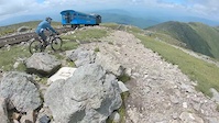
Popular Exeter Mountain Biking Trails
Exeter Mountain Bike Routes
| title | rating | distance |
|---|---|---|
| Watson Lot Fort Rock Sampler | 10 miles | |
| Fort Rock | 8 miles | |
| 6 mi with Olive Branch | 6 miles | |
| FR 20 | 6 miles | |
| Tour De Gnar Fort Rock Part 1 | 16 miles | |
| Watson Lot 6 miler | 6 miles | |
| 15 mile Fort Rock Ride | popular ridelog | 15 miles |
| 12 mile Fort Rock Ride | popular ridelog | 12 miles |
| 17 mile Fort Rock Ride | popular ridelog | 17 miles |
| 7 mile Fort Rock Ride | popular ridelog | 7 miles |
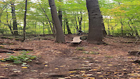
Photos of Exeter Mountain Bike
trail: Qantas Queue
10 |
Apr 20, 2024 @ 6:30pm
Apr 20, 2024
trail: Qantas Queue
12 |
Apr 20, 2024 @ 6:29pm
Apr 20, 2024
trail: Ipa Connector
37 |
Jan 5, 2024 @ 7:34am
Jan 5, 2024
trail: Boulderdash
73 |
Aug 17, 2023 @ 12:00pm
Aug 17, 2023
trail: Boulderdash
55 |
Aug 17, 2023 @ 12:00pm
Aug 17, 2023
trail: Olive Branch
187 |
Apr 20, 2023 @ 11:58am
Apr 20, 2023
trail: Ground On Down
160 |
Nov 23, 2022 @ 6:35am
Nov 23, 2022
trail: Broken Rake
138 |
Nov 23, 2022 @ 6:33am
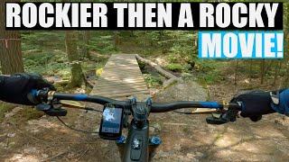
Nov 23, 2022Videos of Exeter Mountain Bike
trail: Shadow's Skinny Log
239 |
Aug 25, 2022
trail: Summit
3:11 |
3086 |
Dec 19, 2019

trail: To Bog
0:12 |
254 |
Apr 1, 2014

trail: IPA
0:57 |
205 |
Oct 14, 2012

trail: Tunnel Down
1:15:15 |
181 |
Aug 23, 2022 , Exeter

trail: neB giB
1:15:15 |
106 |
Aug 23, 2022 , Exeter
trail: Lower Parliament
1:15:15 |
89 |
Aug 23, 2022 , Exeter

trail: Hamburger Hill
1:15:15 |
137 |
Aug 23, 2022 , Exeter
Recent Trail Reports
| status | trail | date | condition | info | user |
|---|---|---|---|---|---|
| Deene's Dream | May 11, 2024 @ 10:13am May 11, 2024 | Ideal | AndrewHally MRR | ||
| 50/50 | May 11, 2024 @ 10:12am May 11, 2024 | Ideal | AndrewHally MRR | ||
| Boulderdash | May 11, 2024 @ 10:10am May 11, 2024 | Ideal | AndrewHally MRR | ||
| X-Trail | May 11, 2024 @ 10:08am May 11, 2024 | Ideal | AndrewHally MRR | ||
| X-Trail (Racer X) | May 11, 2024 @ 10:07am May 11, 2024 | Ideal | AndrewHally MRR | ||
| XLR8 | May 11, 2024 @ 10:06am May 11, 2024 | Prevalent Mud | AndrewHally MRR | ||
| To Bog | May 7, 2024 @ 12:35pm May 7, 2024 | Ideal | Hubbles83 WMNEMBA | ||
| Swamp Planks | Apr 23, 2024 @ 2:02pm Apr 23, 2024 | Wet | Kbaum | ||
| BLT South | Apr 23, 2024 @ 2:02pm Apr 23, 2024 | Ideal | Kbaum | ||
| Enchanted Forest | Apr 23, 2024 @ 2:02pm Apr 23, 2024 | Ideal | Kbaum |
Activity Feed
| username | action | type | title | date |
|---|---|---|---|---|
| Douches | wishlist | region | activity #52705871 | May 16, 2024 @ 6:54pm 3 days |
| csoufleris | wishlist | route | activity #52544740 | May 13, 2024 @ 9:16am May 13, 2024 |
| csoufleris | wishlist | region | activity #52544371 | May 13, 2024 @ 9:09am May 13, 2024 |
| AndrewHally | add | report | activity #52427748 and 6 more | May 11, 2024 @ 10:06am May 11, 2024 |
| AndrewHally | comment | trail | activity #52427735 | May 11, 2024 @ 10:05am May 11, 2024 |
Recent Comments
| username | type | title | comment | date |
|---|---|---|---|---|
| trail | Still muddy | May 11, 2024 @ 10:05am May 11, 2024 | ||
| trail | My comment should say “start at the entrance... | Oct 31, 2023 @ 5:11am Oct 31, 2023 | ||
| trail | Additional note First drop is smooth and th... | Oct 31, 2023 @ 5:07am Oct 31, 2023 | ||
| trail | Fun and twisty. Worth it to do on its own, but... | Oct 31, 2023 @ 5:01am Oct 31, 2023 | ||
| trail | Just a note that I went back and sessions... | Oct 31, 2023 @ 4:59am Oct 31, 2023 |
Local Badges
-

10 Blue Trails43 awarded -

Completionist10 awarded -

Epic Ride 50k159 awarded -

Epic Ride Climb 2k0 awarded -

Epic Ride Descent 2k0 awarded -

Climbing 10k Badge7 awarded
Activity Type Stats
| activitytype | trails | distance | descent | descent distance | total vertical | rating | global rank | state rank | photos | reports | routes | ridelogs |
|---|---|---|---|---|---|---|---|---|---|---|---|---|
| Mountain Bike | 170 | 51 miles | 3,402 ft | 17 miles | 207 ft | #114 | #48 | 76 | 1,165 | 6 | 26,917 | |
| E-Bike | 23 | 7 miles | 604 ft | 3 miles | 161 ft | #468 | #139 | 1,102 | 396 | |||
| Hike | 159 | 49 miles | 3,127 ft | 16 miles | 203 ft | #78 | #41 | 1,161 | 1 | 241 | ||
| Trail Running | 158 | 49 miles | 3,091 ft | 16 miles | 203 ft | #80 | #41 | 1,161 | 1 | 393 | ||
| Snowmobile | 10 | 4 miles | 289 ft | 2 miles | 108 ft | 462 | 6 | |||||
| Snowshoe | 156 | 47 miles | 3,209 ft | 15 miles | 203 ft | 517 | 1 | 50 | ||||
| Downhill Ski | 1 | 246 ft | 69 ft | 7 ft | 12 | 2 | ||||||
| Backcountry Ski | 4 | 4,075 ft | 154 ft | 2,667 ft | 69 ft | 12 | 1 | |||||
| Nordic Ski | 26 | 14 miles | 738 ft | 4 miles | 203 ft | 1 | 480 | 52 |
- By WillieJacobsz
 TRAILFORKS Trailforks Map Team & contributors
 - Admins: SC NEMBA-NH
- #32348 - 5,728 views
- exeter activity log | embed map of Exeter mountain bike trails | exeter mountain biking points of interest
Downloading of trail gps tracks in kml & gpx formats is enabled for Exeter.
You must login to download files.