close
-
Layers w
- Weather Layers
- Pro
- Pro
- Pro
- Pro
- Pro
- Pro
- More Layers
- Pro
- Pro
- Pro
- Pro
-
Upgrade to

3D
Trail Conditions
- Unknown
- Snow Groomed
- Snow Packed
- Snow Covered
- Snow Cover Partial
- Freeze/thaw Cycle
- Icy
- Prevalent Mud
- Wet
- Variable
- Ideal
- Dry
- Very Dry
Trail Flow (Ridden Direction)
Trailforks scans users ridelogs to determine the most popular direction each trail is ridden. A good flowing trail network will have most trails flowing in a single direction according to their intension.
The colour categories are based on what percentage of riders are riding a trail in its intended direction.
The colour categories are based on what percentage of riders are riding a trail in its intended direction.
- > 96%
- > 90%
- > 80%
- > 70%
- > 50%
- < 50%
- bi-directional trail
- no data
Trail Last Ridden
Trailforks scans ridelogs to determine the last time a trail was ridden.
- < 2 days
- < 1 week
- < 2 weeks
- < 1 month
- < 6 months
- > 6 months
Trail Ridden Direction
The intended direction a trail should be ridden.
- Downhill Only
- Downhill Primary
- Both Directions
- Uphill Primary
- Uphill Only
- One Direction
Contribute Details
Colors indicate trail is missing specified detail.
- Description
- Photos
- Description & Photos
- Videos
Trail Popularity ?
Trailforks scans ridelogs to determine which trails are ridden the most in the last 9 months.
Trails are compared with nearby trails in the same city region with a possible 25 colour shades.
Think of this as a heatmap, more rides = more kinetic energy = warmer colors.
- most popular
- popular
- less popular
- not popular
ATV/ORV/OHV Filter
Max Vehicle Width
inches
US Cell Coverage
Legend

Radar Time
Activity Recordings
Trailforks uses anonymized public activity data.
?
Activity Recordings
Trailforks uses anonymized public activity data.
?
Personal Heatmap
▶
Activity Types
all
/
none
▶
Options
2
Date range
month
–
Winter Trails
Warning
A routing network for winter maps does not exist. Selecting trails using the winter trails layer has been disabled.
Missing Trails
Most Popular
Least Popular
Trails are colored based on popularity. The more popular a trail is, the more red. Less popular trails trend towards green.
Jump Magnitude Heatmap
Heatmap of where riders jump on trails. Zoom in to see individual jumps, click circles to view jump details.
BC Backroad Status
![map legend]()
Service Road Atlas is a free to use, community-driven service for viewing and creating reports on the numerous back-country service roads around B.C. and Alberta.

Slope Aspect
Direction the slope faces
Trails Deemphasized
Trails are shown in grey.
Only show trails with no bike usage.
Suggested Layers
Based on selected activity type
Save the current map location and zoom level as your default home location whenever this page is loaded.
Save
No description for Fallston has been added yet!
Login or register to submit one.
Activities Click to view
- Mountain Bike
78 trails
- E-Bike
5 trails
- Gravel Bike
0 trails
- Adaptive Bike
0 trails
- Winter Fat Bike
0 trails
- Hike
81 trails
- Trail Running
81 trails
Region Details
- 3
- 1
- 17
- 50
- 4
Region Status
Open as of Jun 6, 2026Stats
- Avg Trail Rating
- Trails (view details)
- 75
- Trails Mountain Bike
- 81
- Trails E-Bike
- 5
- Trails Horse
- 3
- Trails Hike
- 81
- Trails Trail Running
- 81
- Total Distance
- 53 miles
- Total Descent
- 6,572 ft
- Total Vertical
- 498 ft
- Highest Trailhead
- 535 ft
- Reports
- 7,842
- Photos
- 486
- Ridden Counter
- 29,401
Sub Regions
-
Gunpowder Falls State Park - Little Gunpowder
- 17
- 50
- 4
Popular Fallston Mountain Biking Trails
• 100 ★ 4.5 • 3 miles • 100 ft • 861 •
Relatively flat trail running along the Little Gunpowder River. While rated beginner, it does have stream crossings and some rocks and roots.
• 100 ★ 4.0 • 738 ft • 11 ft • 784 •
High line of the Little Gunpowder Trail that offers a climb/descent opportunity in an otherwise relatively flat region
• 100 ★ 3.0 • 892 ft • 22 ft • 737 •
Single track trail, paralleling and connecting to trail
• 90 ★ 4.5 • 2 miles • 164 ft • 655 •
Extends the climb past the waterfalls, to access a long trail to nowhere. Using the various farm road beds and terraces the trail winds its way over hill and dale, with a nice downhill flow.
• 100 ★ 4.0 • 724 ft • 23 ft • 654 •
Trail paralleling , provides access to the and Rusty Trombone trails
• 85 ★ 4.0 • 1 mile • 71 ft • 640 •
Trail running along the old Ma & Pa Railroad bed on the Harford County side of the river
• 95 ★ 5.0 • 574 ft • 0 ft • 635 •
Single track climb and descent up and over the narrow gauge hill
Fallston Mountain Bike Routes
★ 5.0 • 11 miles • 711 ft • 36 •
A tad bit easier 10 mile route.
★ 4.0 • 7 miles • 845 ft • 34 •
The GUMBO Gut Check Grinder Challenge is a tour of the Guyton section of LGP that is about 6.5 miles long...
★ 4.0 • 11 miles • 1,024 ft • 51 •
Explore the many falling streams and brooks and the historic Ma and Pa Railbed.
11 miles • 762 ft • 10 • Out & Back •
Starting with a short scenic country road "Critical Mass" type ride around Kingsville. After returning to...
15 miles • 1,294 ft • 45 •
Park at Bel Air Rd parking, under the tunnel to Jesse's Trail and beyond. This route has a good climb at...
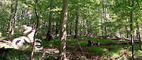
Photos of Fallston Mountain Bike
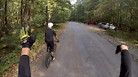
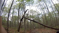
Videos of Fallston Mountain Bike

trail: Tuffy's Tavern
0:56 |
71 |
Sep 28, 2020
trail: The Trombone
0:15 |
612 |
Aug 27, 2016
trail: Blue Trail
0:36 |
162 |
Nov 16, 2015
trail: Blue Trail
0:32 |
153 |
May 9, 2015
trail: 26%
14:53 |
105 |
Dec 29, 2014
trail: 26%
3:01 |
274 |
Dec 26, 2014

trail: 26%
7:24 |
779 |
Jul 31, 2014

trail: 26%
5:10 |
287 |
Dec 6, 2013
Recent Trail Reports
Activity Feed
| username | action | type | title | date |
|---|---|---|---|---|
| Michael2luY8P | wishlist | route | activity #96707331 | Jun 10, 2026 @ 5:44pm 6 hours |
| shinny13 | add | report | activity #96455053 and 2 more | Jun 7, 2026 @ 6:41am Jun 7, 2026 |
| MTBCK | add | report | activity #96189346 and 18 more | Jun 3, 2026 @ 4:39pm Jun 3, 2026 |
| shinny13 | add | report | activity #96115383 and 9 more | Jun 2, 2026 @ 3:58pm Jun 2, 2026 |
| Philliesnine77 | wishlist | region | activity #96011235 | Jun 1, 2026 @ 5:41am Jun 1, 2026 |
Recent Comments
| username | type | title | comment | date |
|---|---|---|---|---|
| trail | Great trail. I just picked up mtb and think... | May 12, 2026 @ 8:23pm May 12, 2026 | ||
| report | Ty | Oct 15, 2025 @ 10:56am Oct 15, 2025 | ||
| trail | This trail is damn near perfect. The rock... | May 24, 2025 @ 6:20pm May 24, 2025 | ||
| report | Tree cleared | Apr 29, 2025 @ 6:51am Apr 29, 2025 | ||
| report | Tree cleared | Apr 29, 2025 @ 6:51am Apr 29, 2025 |
Local Badges
-

Guyton It Done!3 awarded -

10 Green Trails349 awarded -

10 Blue Trails525 awarded -

Epic Ride Climb 2k27 awarded -

Climbing 10k Badge143 awarded -

Climbing 100k Badge19 awarded
Activity Type Stats
| activitytype | trails | distance | descent | descent distance | total vertical | rating | global rank | state rank | photos | reports | routes | ridelogs |
|---|---|---|---|---|---|---|---|---|---|---|---|---|
| Mountain Bike | 78 | 53 miles | 6,572 ft | 22 miles | 499 ft | #374 | #135 | 463 | 7,909 | 17 | 33,002 | |
| E-Bike | 5 | 8 miles | 774 ft | 4 miles | 262 ft | #7,399 | #2,238 | 7,444 | 920 | |||
| Horse | 3 | 2 miles | 249 ft | 4,977 ft | 128 ft | 1,557 | 1 | |||||
| Hike | 81 | 53 miles | 6,572 ft | 22 miles | 499 ft | #2,136 | #883 | 26 | 7,905 | 1,777 | ||
| Trail Running | 81 | 53 miles | 6,572 ft | 22 miles | 499 ft | #3,674 | #1,096 | 1 | 7,905 | 669 |
Frequently Asked Questions About Fallston
▼
What are the best places to ride in Fallston?
Fallston has 2 areas to explore for mountain biking. The top rated areas are:
▼
What are the highest rated mountain biking trails in Fallston?
The highest rated mountain biking trails in Fallston are:
- Jesse's Trail (4.5/5)
- Trestle Ridge (4.3/5)
- GUMBOmanjaro (4.3/5)
- Waterfall Trail (4.3/5)
- Cat and Mouse (4.3/5)
▼
What is the best time of the year to ride in Fallston?
Based on ride log data, the most popular months to ride in Fallston are:
- July (699 activities)
- June (620 activities)
- May (614 activities)
▼
Where can I park to ride in Fallston?
There are 9 parking locations listed in Fallston. The most popular parking spots are:
- Guyton Rd Parking Lot (Hillbilly Beach)
- Laurel Brook Road Parking Area (Laurelbot)
- Harford Rd Parking Lot - BaltCo Side (Har-Bal)
- Guyton Flats Parking
- Pleasantville Rd Parking Area (Small)
Activities
Trails
- By Dennyhamlin1178 MORE-GUMBO & contributors
- Admins: MORE-MD LDRSH, kmihm100, MORE-GUMBO
- #11767 - 5,294 views
- fallston activity log | embed map of Fallston mountain bike trails | fallston mountain biking points of interest
Downloading of trail gps tracks in kml & gpx formats is enabled for Fallston.
You must login to download files.