close
-
Layers w
- Weather Layers
- Pro
- Pro
- Pro
- Pro
- Pro
- Pro
- More Layers
- Pro
- Pro
- Pro
- Pro
-
Upgrade to

3D
Trail Conditions
- Unknown
- Snow Groomed
- Snow Packed
- Snow Covered
- Snow Cover Partial
- Freeze/thaw Cycle
- Icy
- Prevalent Mud
- Wet
- Variable
- Ideal
- Dry
- Very Dry
Trail Flow (Ridden Direction)
Trailforks scans users ridelogs to determine the most popular direction each trail is ridden. A good flowing trail network will have most trails flowing in a single direction according to their intension.
The colour categories are based on what percentage of riders are riding a trail in its intended direction.
The colour categories are based on what percentage of riders are riding a trail in its intended direction.
- > 96%
- > 90%
- > 80%
- > 70%
- > 50%
- < 50%
- bi-directional trail
- no data
Trail Last Ridden
Trailforks scans ridelogs to determine the last time a trail was ridden.
- < 2 days
- < 1 week
- < 2 weeks
- < 1 month
- < 6 months
- > 6 months
Trail Ridden Direction
The intended direction a trail should be ridden.
- Downhill Only
- Downhill Primary
- Both Directions
- Uphill Primary
- Uphill Only
- One Direction
Contribute Details
Colors indicate trail is missing specified detail.
- Description
- Photos
- Description & Photos
- Videos
Trail Popularity ?
Trailforks scans ridelogs to determine which trails are ridden the most in the last 9 months.
Trails are compared with nearby trails in the same city region with a possible 25 colour shades.
Think of this as a heatmap, more rides = more kinetic energy = warmer colors.
- most popular
- popular
- less popular
- not popular
ATV/ORV/OHV Filter
Max Vehicle Width
inches
US Cell Coverage
Legend

Radar Time
Activity Recordings
Trailforks uses anonymized public activity data.
?
Activity Recordings
Trailforks uses anonymized public activity data.
?
Personal Heatmap
▶
Activity Types
all
/
none
▶
Options
2
Date range
month
–
Winter Trails
Warning
A routing network for winter maps does not exist. Selecting trails using the winter trails layer has been disabled.
Missing Trails
Most Popular
Least Popular
Trails are colored based on popularity. The more popular a trail is, the more red. Less popular trails trend towards green.
Jump Magnitude Heatmap
Heatmap of where riders jump on trails. Zoom in to see individual jumps, click circles to view jump details.
BC Backroad Status
![map legend]()
Service Road Atlas is a free to use, community-driven service for viewing and creating reports on the numerous back-country service roads around B.C. and Alberta.

Slope Aspect
Direction the slope faces
Trails Deemphasized
Trails are shown in grey.
Only show trails with no bike usage.
Suggested Layers
Based on selected activity type
Save the current map location and zoom level as your default home location whenever this page is loaded.
Save
No description for Faro has been added yet!
Login or register to submit one.
This region uses the Uk/Euro style trail grading system.
Region Details
- 91
- 3
- 82
- 92
- 44
- 11
Stats
- Avg Trail Rating
- Trails (view details)
- 323
- Trails Mountain Bike
- 328
- Trails E-Bike
- 311
- Trails Horse
- 5
- Trails Hike
- 266
- Trails Trail Running
- 262
- Trails Dirtbike/Moto
- 51
- Total Distance
- 172 miles
- Total Descent
- 41,613 ft
- Total Vertical
- 2,916 ft
- Highest Trailhead
- 2,923 ft
- Reports
- 814
- Photos
- 189
- Ridden Counter
- 4,776
Sub Regions
- Albufeira (27)
- Castro Marim (4)
- Faro (110)
- Algarve Coast (93)
- Sao Miguel BikePark (23)
- Marmelete (22)
- Monchique (16)
- Portimão (31)
- São Brás de Alportel (47)
- Fonte Férrea (44)
- Tavira (59)
- Vila Nova De Cacela (3)
Popular Faro Mountain Biking Trails
• 95 ★ 4.9 • 1 mile • 10 ft • 90 •
Beautiful trail with jumps. Ends at the base od the bikepark.
• 100 ★ 0.0 • 1,946 ft • 0 ft • 76 •
Divertida bajada desde el obelisco de la Atalaia hasta Luz. Sendero con pedroleo y un par de saltos alfinal
• 70 ★ 5.0 • 2 miles • 159 ft • 75 •
Sendero costero bordenado el acantilado sobre la praia do Porto do Mos. Muchas variantes.
• 90 ★ 4.8 • 3,881 ft • 8 ft • 67 •
Very good trail with some bigger jumps and possible to ride variations. Nice burms also. Can be ridden by intermediate riders.
• 100 ★ 4.9 • 5,043 ft • 0 ft • 63 •
Highly rated popular blue difficulty singletrack. This mountain bike primary trail can be used both directions. On average it takes 8 minutes to complete this trail.
• 75 ★ 1.5 • 1 mile • 38 ft • 59 •
Easy singletrack after a more technical upper section of
Faro Mountain Bike Routes
★ 5.0 • 21 miles • 3,956 ft • 17 • Loop •
Track de la carrera de enduro celebrada en el mes de febrero de 2024. Recorre los mejores senderos de la...
17 miles • 4,252 ft • 15 • Loop •
Nueva incursión más allá del Guadiana en busca de terrenos endureros que no encuentro en Huelva, esta...
26 miles • 5,207 ft • 11 • Loop •
La zona de Marmelete es una de las pocas zonas del Algarve bien cartografiada en Trailforks, junto a Fonte...
19 miles • 2,847 ft • 2 • Loop •
Checking out some of the others trails in the area
13 miles • 2,019 ft • 2 • Loop •
Checking out some of the main trails in Fonte Ferrea area
140 miles • 3,713 ft • 0 • Point to Point •
Ecovia do Algarve is a coastal route that links Cape St. Vincent (Sagres) in the west point of Algarve and...
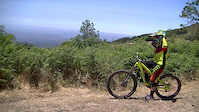
Photos of Faro Mountain Bike
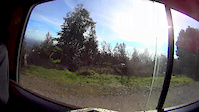
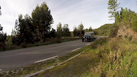
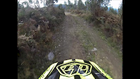
Videos of Faro Mountain Bike

trail: Running Dog
6:38 |
378 |
Jun 16, 2016
trail: Running Dog
6:39 |
1318 |
Jul 16, 2015
trail: Running Dog
2:13 |
164 |
Feb 24, 2015
3:20 |
171 |
Jan 22, 2015
3:59 |
515 |
Dec 31, 2014

trail: Running Dog
5:04 |
273 |
Jun 8, 2014
3:42 |
472 |
May 12, 2014
6:19 |
137 |
May 12, 2014
Recent Trail Reports
Activity Feed
| username | action | type | title | date |
|---|---|---|---|---|
| RafaelThomasI5W6JT | rsvp | event | activity #97519522 | Jun 21, 2026 @ 2:09pm Jun 21, 2026 |
| RicardoaZwMkK | vote | trail | activity #96690779 | Jun 10, 2026 @ 12:43pm Jun 10, 2026 |
| Spectralon | add | report | activity #96597200 and 1 more | Jun 9, 2026 @ 4:53am Jun 9, 2026 |
| Mark1yjaG0 | wishlist | route | activity #96023771 | Jun 1, 2026 @ 9:41am Jun 1, 2026 |
| rovaipa | ridden | trail | activity #95865016 | May 30, 2026 @ 10:08am May 30, 2026 |
Recent Comments
| username | type | title | comment | date |
|---|---|---|---|---|
| trail | A little overgown in places, but rideable,... | Dec 2, 2025 @ 10:48am Dec 2, 2025 | ||
| trail | Please remove as a rideable trail. not... | Nov 19, 2025 @ 6:36am Nov 19, 2025 | ||
| trail | Some up Some down, tricky in places | Nov 18, 2025 @ 11:04am Nov 18, 2025 | ||
| trail | Access PIPELINE from the tarmac road. Hop the... | Nov 18, 2025 @ 10:43am Nov 18, 2025 | ||
| trail | This trail involves a good 20m in a river bed,... | Nov 18, 2025 @ 10:41am Nov 18, 2025 |
Local Badges
-

Big Ride 30k500 awarded -

Completionist0 awarded -
Completionist0 awarded -

Epic Ride 50k148 awarded -
Big Ride 30k251 awarded -

Descent 10k Badge7 awarded
Bike & Skill Parks
| name | type | city | rating |
|---|---|---|---|
| Cortelha MX | skill park | São Brás de Alportel |
Upcoming Local Events
Activity Type Stats
| activitytype | trails | distance | descent | descent distance | total vertical | rating | global rank | state rank | photos | reports | routes | ridelogs |
|---|---|---|---|---|---|---|---|---|---|---|---|---|
| Mountain Bike | 328 | 172 miles | 41,614 ft | 94 miles | 2,917 ft | 179 | 814 | 10 | 24,096 | |||
| E-Bike | 311 | 148 miles | 32,674 ft | 80 miles | 2,917 ft | 9 | 814 | 5 | 1,504 | |||
| Horse | 5 | 2 miles | 190 ft | 1 mile | 748 ft | 10 | ||||||
| Hike | 266 | 139 miles | 33,389 ft | 78 miles | 2,917 ft | 788 | 2,539 | |||||
| Trail Running | 262 | 137 miles | 32,533 ft | 76 miles | 2,917 ft | 786 | 359 | |||||
| Dirtbike/Moto | 51 | 2,238 ft | 7 ft | 344 ft | 92 ft | 54 | 5 |
Activities
Trails
Points of Interest
- By brenthillier
 NSMBA TRAILFORKS & contributors
 - Admins: elyari, AMG, marcossantamaria, krasty1002
- #9880 - 11,029 views
- faro activity log | embed map of Faro mountain bike trails | faro mountain biking points of interest
Downloading of trail gps tracks in kml & gpx formats is enabled for Faro.
You must login to download files.