close
-
Layers w
- Weather Layers
- Pro
- Pro
- Pro
- Pro
- Pro
- Pro
- More Layers
- Pro
- Pro
- Pro
- Pro
-
Upgrade to

3D
Trail Conditions
- Unknown
- Snow Groomed
- Snow Packed
- Snow Covered
- Snow Cover Partial
- Freeze/thaw Cycle
- Icy
- Prevalent Mud
- Wet
- Variable
- Ideal
- Dry
- Very Dry
Trail Flow (Ridden Direction)
Trailforks scans users ridelogs to determine the most popular direction each trail is ridden. A good flowing trail network will have most trails flowing in a single direction according to their intension.
The colour categories are based on what percentage of riders are riding a trail in its intended direction.
The colour categories are based on what percentage of riders are riding a trail in its intended direction.
- > 96%
- > 90%
- > 80%
- > 70%
- > 50%
- < 50%
- bi-directional trail
- no data
Trail Last Ridden
Trailforks scans ridelogs to determine the last time a trail was ridden.
- < 2 days
- < 1 week
- < 2 weeks
- < 1 month
- < 6 months
- > 6 months
Trail Ridden Direction
The intended direction a trail should be ridden.
- Downhill Only
- Downhill Primary
- Both Directions
- Uphill Primary
- Uphill Only
- One Direction
Contribute Details
Colors indicate trail is missing specified detail.
- Description
- Photos
- Description & Photos
- Videos
Trail Popularity ?
Trailforks scans ridelogs to determine which trails are ridden the most in the last 9 months.
Trails are compared with nearby trails in the same city region with a possible 25 colour shades.
Think of this as a heatmap, more rides = more kinetic energy = warmer colors.
- most popular
- popular
- less popular
- not popular
ATV/ORV/OHV Filter
Max Vehicle Width
inches
US Cell Coverage
Legend

Radar Time
Activity Recordings
Trailforks uses anonymized public activity data.
?
Activity Recordings
Trailforks uses anonymized public activity data.
?
Personal Heatmap
▶
Activity Types
all
/
none
▶
Options
2
Date range
month
–
Winter Trails
Warning
A routing network for winter maps does not exist. Selecting trails using the winter trails layer has been disabled.
Missing Trails
Most Popular
Least Popular
Trails are colored based on popularity. The more popular a trail is, the more red. Less popular trails trend towards green.
Jump Magnitude Heatmap
Heatmap of where riders jump on trails. Zoom in to see individual jumps, click circles to view jump details.
BC Backroad Status
![map legend]()
Service Road Atlas is a free to use, community-driven service for viewing and creating reports on the numerous back-country service roads around B.C. and Alberta.

Slope Aspect
Direction the slope faces
Trails Deemphasized
Trails are shown in grey.
Only show trails with no bike usage.
Suggested Layers
Based on selected activity type
Save the current map location and zoom level as your default home location whenever this page is loaded.
Savepequeño y bonito pueblo pirenaico con fuente y restaurante en la entrada al mismo, no hay mucho sitio para aparcar los vehículos en la plaza, mejor en la entrada al pueblo.
Primary Trail Type: All-Mountain & Downhill
eBikes Allowed:
Yes
Land Status: Community Forest
 google parking directions
This region uses the Uk/Euro style trail grading system.
Activities Click to view
- Mountain Bike
122 trails
- E-Bike
122 trails
- Hike
124 trails
- Trail Running
124 trails
Region Details
- 15
- 1
- 41
- 32
- 4
Region Status
Open as of 2 daysStats
- Avg Trail Rating
- Trails (view details)
- 95
- Trails Mountain Bike
- 122
- Trails E-Bike
- 122
- Trails Hike
- 124
- Trails Trail Running
- 124
- Total Distance
- 51 miles
- Total Descent Distance
- 30 miles
- Total Descent
- 19,123 ft
- Total Vertical
- 3,178 ft
- Highest Trailhead
- 5,735 ft
- Reports
- 1,013
- Photos
- 56
- Ridden Counter
- 4,205
Popular FiulleFlow Mountain Biking Trails
• 100 ★ 4.7 • 1 mile • 694 ft • 74 •
Para subir desde Barós a la carretera de Oroel. De subida bastante exigente, yo recomendaría con eléctrica. También se puede hacer de bajada, pero hay descensos mucho mejores. El trail empieza con la anchura de un doubletrack, tiene...
• 100 ★ 4.0 • 745 ft • 0 ft • 67 •
Parte final, varios pasos y escalones rocoso con pendiente, algo erosionado
• 100 ★ 4.4 • 1,237 ft • 114 ft • 62 •
Bonita senda sube y baja de pedaleo a media ladera en un gran bosque, rampas fuertes
• 95 ★ 5.0 • 869 ft • 69 ft • 60 •
Senda de pedaleo enlace a la bajada de Santa Eulalia
• 85 ★ 4.5 • 3,635 ft • 0 ft • 59 •
Senda de bajada muy completa, lo tiene casi todo, curvas, escalones, tramos embarrancados, fuertes pendientes.pero lo general de flow en bosque con un paso guapo final por la cresta de una marga.
• 100 ★ 4.0 • 2,726 ft • 134 ft • 58 •
Senda de subida desde la carretera del Parador. Dura, pero factible con muscular, sin obstáculos reseñables y un piso aceptable. Da acceso a multitud de sendas de bajada: Cerradon, , etc nSe encuentra en la parte alta del Parador por...
• 95 ★ 4.4 • 4,035 ft • 0 ft • 53 •
Se usa de subida, fácil de pedaleo y flow con algún escalón, también de bajada
• 90 ★ 4.8 • 2,989 ft • 0 ft • 52 •
buena bajada umbría en bosque, variada con curvas y flow y algún drop y algún salto, con final mas pedregoso.
FiulleFlow Mountain Bike Routes
12 miles • 3,946 ft • 14 • Loop •
Selección de trails de la zona. Preferible para ebike, por ser subidas duras
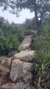
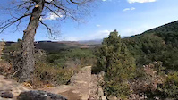
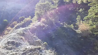
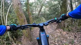
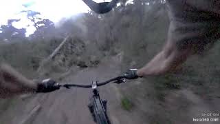
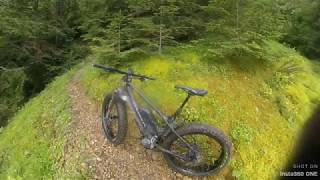
Photos of FiulleFlow Mountain Bike
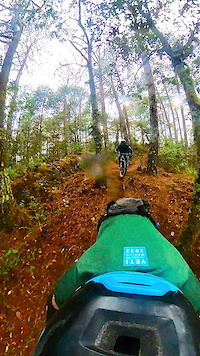
Videos of FiulleFlow Mountain Bike
trail: Bateputia
0:18 |
66 |
Sep 1, 2024
trail: Bateputia
0:07 |
56 |
Aug 21, 2024
trail: Sierra Gorda Queretaro
0:43 |
64 |
Dec 8, 2022
trail: Bolo Inferior
0:17 |
90 |
Oct 14, 2021
trail: Tremoletas
3:46 |
215 |
Apr 1, 2023 , Jaca
trail: Batellasoma
4:11 |
391 |
Jun 3, 2020 , Jaca
trail: Paloto Integral Intermedia
6:32 |
502 |
Jun 3, 2020 , Jaca
Current Trail Warnings
| status | trail | date | condition | user | info |
|---|---|---|---|---|---|
| Muga de Barós | Jul 8, 2026 @ 5:03pm (Europe/Andorra) 2 days | Very Dry | Fiti098 | ||
| Cerecera | Jul 8, 2026 @ 5:03pm (Europe/Andorra) 2 days | Dry | Fiti098 |
Recent Trail Reports
Activity Feed
| username | action | type | title | date |
|---|---|---|---|---|
| Fiti098 | add | report | activity #98732702 and 12 more | Jul 8, 2026 @ 12:41pm 2 days |
| JuanEF | add | report | activity #98628300 and 17 more | Jul 7, 2026 @ 3:04am Jul 7, 2026 |
| Crisjaca | add | poi | activity #98133836 and 1 more | Jun 30, 2026 @ 8:47am Jun 30, 2026 |
| Crisjaca | add | photo | activity #98126263 and 2 more | Jun 30, 2026 @ 6:44am Jun 30, 2026 |
| Crisjaca | add | report | activity #98120590 and 7 more | Jun 30, 2026 @ 4:47am Jun 30, 2026 |
Recent Comments
| username | type | title | comment | date |
|---|---|---|---|---|
| trail | Tiene un punto de paso por marga en ladera,... | Jun 30, 2026 @ 4:47am Jun 30, 2026 | ||
| trail | La subida hasta el primer desvío, con... | Jun 15, 2026 @ 3:07am Jun 15, 2026 | ||
| trail | En las fotos se ve llanito y fácil, pero de... | Jun 15, 2026 @ 2:02am Jun 15, 2026 | ||
| trail | Esta marcado con flechas naranjas, la entrada... | May 20, 2026 @ 9:29am May 20, 2026 | ||
| trail | Con eléctrica es factible, de otra manera veo... | Nov 17, 2025 @ 8:50am Nov 17, 2025 |
Nearby Areas
| name | distance | ||||
|---|---|---|---|---|---|
| Jarlata | 11 | 4 km | |||
| Jaca Pirineos Bikeland.- Centro MTB | 8 | 47 | 4.1 km | ||
| Rapitán | 1 | 16 | 4.6 km | ||
| Monte Sesún | 15 | 5.3 km | |||
| Boalar | 11 | 7 km |
Local Badges
-

Completionist0 awarded
Activity Type Stats
| activitytype | trails | distance | descent | descent distance | total vertical | rating | global rank | state rank | photos | reports | routes | ridelogs |
|---|---|---|---|---|---|---|---|---|---|---|---|---|
| Mountain Bike | 122 | 49 miles | 19,094 ft | 30 miles | 3,179 ft | #2,215 | #170 | 51 | 1,013 | 1 | 801 | |
| E-Bike | 122 | 49 miles | 19,094 ft | 30 miles | 3,179 ft | #299 | #136 | 5 | 1,014 | 2 | 278 | |
| Hike | 124 | 51 miles | 19,124 ft | 30 miles | 3,179 ft | #2,904 | #332 | 1,011 | 114 | |||
| Trail Running | 124 | 51 miles | 19,124 ft | 30 miles | 3,179 ft | #2,253 | #323 | 1,013 | 134 |
Frequently Asked Questions About FiulleFlow
▼
What are the highest rated mountain biking trails in FiulleFlow?
The highest rated mountain biking trails in FiulleFlow are:
- El Fabar (4.4/5)
- Las Mallatas Superior (4.4/5)
- Santa Eulalia Superior (4.4/5)
- Bateputia (4.3/5)
- Picharré Superior (4.3/5)
▼
What is the best time of the year to ride in FiulleFlow?
Based on ride log data, the most popular months to ride in FiulleFlow are:
- July (7 activities)
- August (7 activities)
- October (6 activities)
▼
Where can I park to ride in FiulleFlow?
There are 1 parking locations listed in FiulleFlow. The most popular parking spots are:
▼
What is the longest trail in FiulleFlow?
The longest trail in FiulleFlow is La Picaraza at 2.7 miles. View all trails sorted by distance.
Activities
Trails
Points of Interest
- By ivanntronkos
 & contributors
 - Admins: apply
- #38069 - 3,175 views
- fiulleflow activity log | embed map of FiulleFlow mountain bike trails | fiulleflow mountain biking points of interest
Downloading of trail gps tracks in kml & gpx formats is enabled for FiulleFlow.
You must login to download files.