close
-
Layers w
- Weather Layers
- Pro
- Pro
- Pro
- Pro
- Pro
- Pro
- More Layers
- Pro
- Pro
- Pro
- Pro
-
Upgrade to

3D
Trail Conditions
- Unknown
- Snow Groomed
- Snow Packed
- Snow Covered
- Snow Cover Partial
- Freeze/thaw Cycle
- Icy
- Prevalent Mud
- Wet
- Variable
- Ideal
- Dry
- Very Dry
Trail Flow (Ridden Direction)
Trailforks scans users activity logs to determine the most popular direction each trail is ridden. A good flowing trail network will have most trails flowing in a single direction according to their intension.
The colour categories are based on what percentage of users are riding a trail in its intended direction.
The colour categories are based on what percentage of users are riding a trail in its intended direction.
- > 96%
- > 90%
- > 80%
- > 70%
- > 50%
- < 50%
- bi-directional trail
- no data
Trail Last Ridden
Trailforks scans activity logs to determine the last time a trail was ridden.
- < 2 days
- < 1 week
- < 2 weeks
- < 1 month
- < 6 months
- > 6 months
Trail Ridden Direction
The intended direction a trail should be ridden.
- Downhill Only
- Downhill Primary
- Both Directions
- Uphill Primary
- Uphill Only
- One Direction
Contribute Details
Colors indicate trail is missing specified detail.
- Description
- Photos
- Description & Photos
- Videos
Trail Popularity ?
Trailforks scans activity logs to determine which trails are ridden the most in the last 9 months.
Trails are compared with nearby trails in the same city region with a possible 25 colour shades.
Think of this as a heatmap, more activities = more kinetic energy = warmer colors.
- most popular
- popular
- less popular
- not popular
ATV/ORV/OHV Filter
Max Vehicle Width
inches
US Cell Coverage
Legend

Radar Time
Activity Recordings
Trailforks uses anonymized public activity data.
?
Activity Recordings
Trailforks uses anonymized public activity data.
?
Personal Heatmap
▶
Activity Types
all
/
none
▶
Options
2
Date range
month
–
Winter Trails
Warning
A routing network for winter maps does not exist. Selecting trails using the winter trails layer has been disabled.
Missing Trails
Most Popular
Least Popular
Trails are colored based on popularity. The more popular a trail is, the more red. Less popular trails trend towards green.
Jump Magnitude Heatmap
Heatmap of where users jump on trails. Zoom in to see individual jumps, click circles to view jump details.
BC Backroad Status
![map legend]()
Service Road Atlas is a free to use, community-driven service for viewing and creating reports on the numerous back-country service roads around B.C. and Alberta.

Slope Aspect
Direction the slope faces
Trails Deemphasized
Trails are shown in grey.
Only show trails with no bike usage.
Suggested Layers
Based on selected activity type
Save the current map location and zoom level as your default home location whenever this page is loaded.
Save
No description for Foligno has been added yet!
Login or register to submit one.
This region uses the Uk/Euro style trail grading system.
Activities Click to view
- Mountain Bike
369 trails
- E-Bike
315 trails
- Adaptive Bike
0 trails
- Winter Fat Bike
0 trails
- Horse
72 trails
- Hike
283 trails
- Trail Running
270 trails
- Dirtbike/Moto
68 trails
- ATV/ORV/OHV
14 trails
- Nordic Ski
19 trails
Region Details
- 128
- 3
- 116
- 74
- 1
- 1
- 3
Region Status
Caution as of Jul 25, 2026Stats
- Avg Trail Rating
- Trails (view details)
- 347
- Trails Mountain Bike
- 371
- Trails E-Bike
- 315
- Trails Horse
- 72
- Trails Hike
- 283
- Trails Trail Running
- 270
- Trails Dirtbike/Moto
- 68
- Trails Observed Trials
- 1
- Trails ATV/ORV/OHV
- 14
- Trails Nordic Ski
- 19
- Total Distance
- 254 miles
- Total Descent
- 64,875 ft
- Total Vertical
- 4,282 ft
- Highest Trailhead
- 4,955 ft
- Reports
- 4,445
- Photos
- 39
- Completed Counter
- 15,767
Sub Regions
-
Cupacci-Chiona
- 6
- 5
-
Pale
- 38
- 30
- 1
-
Sassovivo
- 47
- 31
- 1
Popular Foligno Mountain Biking Trails
• 100 ★ 4.5 • 1,519 ft • 0 ft • 125 •
Popular green difficulty singletrack. This mountain bike primary trail can be used downhill primary. It features bridge and jump. On average it takes 1 minutes to complete this trail.
• 100 ★ 3.8 • 2,386 ft • 27 ft • 116 •
Popular blue difficulty singletrack. This mountain bike primary trail can be used downhill primary and has a easy overall physical rating. On average it takes 3 minutes to complete this trail.
• 100 ★ 5.0 • 2,182 ft • 0 ft • 114 •
Popular blue difficulty singletrack. This mountain bike primary trail can be used downhill primary and has a easy overall physical rating. On average it takes 5 minutes to complete this trail.
• 100 ★ 4.6 • 3,806 ft • 3 ft • 106 •
Popular blue difficulty singletrack. This mountain bike primary trail can be used downhill primary and has a moderate overall physical rating with a 3 ft blue climb. On average it takes 5 minutes to complete this trail.
• 100 ★ 4.5 • 3,723 ft • 21 ft • 105 •
Popular blue difficulty singletrack. This mountain bike primary trail can be used downhill primary and has a hard overall physical rating with a 21 ft blue climb. On average it takes 4 minutes to complete this trail.
• 95 ★ 5.0 • 1 mile • 619 ft • 104 •
Popular green difficulty mixed. This mountain bike primary trail can be used uphill primary and has a easy overall physical rating with a 619 ft blue climb. On average it takes 17 minutes to complete this trail.
• 100 ★ 4.0 • 1,480 ft • 0 ft • 101 •
Popular blue difficulty singletrack. This mountain bike primary trail can be used both directions and has a easy overall physical rating with a 0 ft blue climb. On average it takes 2 minutes to complete this trail.
• 95 ★ 4.5 • 2,109 ft • 0 ft • 101 •
Popular blue difficulty singletrack. This mountain bike primary trail can be used downhill primary and has a easy overall physical rating. On average it takes 3 minutes to complete this trail.
Foligno Mountain Bike Routes
★ 5.0 • 13 miles • 3,787 ft • 10 • Loop •
1^ PROVA CAMPIONATO REGIONALE ENDURO - Regionale - Fuoristrada - ENDURO REGIONALE
★ 2.5 • 24 miles • 2,786 ft • 7 • Loop •
Giro ad anello tra Foligno e Spello. Partendo da Foligno, usciti dalla città, ci si dirige verso Spello...
18 miles • 3,379 ft • 15 •
abbazia-pinnuzza-casale-cancelli copiato da wikiloc
23 miles • 1,848 ft • 1 •
Test del percorso che va da Foligno FS a e ritorno cercando di evitare SS e senza fare troppo dislivello
16 miles • 4,037 ft • 11 • Loop •
Con questo giro si possono fare quasi tutte le discese di pale versante capo d,aqua
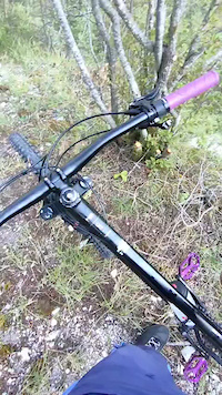
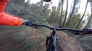
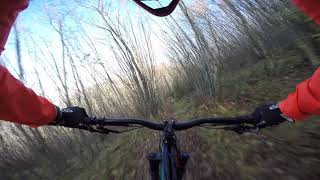
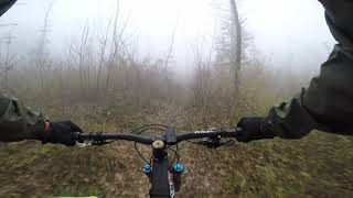
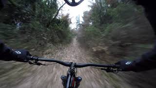
Photos of Foligno Mountain Bike
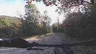
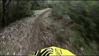
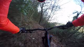
Videos of Foligno Mountain Bike
trail: Link to Andrew Trail
0:08 |
6 |
Aug 30, 2025
trail: Bertini 2nd Stretch
2:38 |
67 |
Dec 27, 2020
trail: Tagliata di Pale
6:47 |
458 |
Apr 8, 2021 , Foligno
trail: Carpineto
0:17 |
388 |
Jan 3, 2019 , Foligno
trail: La Carogna
0:54 |
412 |
Jan 3, 2019 , Foligno
trail: Morte +
5:08 |
845 |
Jan 3, 2019 , Foligno
trail: Mutanne alte
6:23 |
446 |
Dec 28, 2018 , Foligno
trail: Divina Commedia
3:25 |
535 |
Dec 28, 2018 , Foligno
Current Trail Warnings
| status | trail | date | condition | user | info |
|---|---|---|---|---|---|
| Santa Claus | Jul 11, 2026 @ 4:36pm (Europe/Rome) Jul 11, 2026 | Dry | Michelittu FFR | E-Bike |
Recent Trail Reports
Activity Feed
| username | action | type | title | date |
|---|---|---|---|---|
| marcoangeletti | update | trail | activity #100334014 and 1 more | Jul 30, 2026 @ 4:50am 2 days |
| Christian1967 | add | trail | activity #100333949 and 1 more | Jul 30, 2026 @ 4:49am 2 days |
| Alepg88 | add | report | activity #100042213 and 9 more | Jul 26, 2026 @ 4:35am Jul 26, 2026 |
| Michelittu | add | report | activity #99507586 and 7 more | Jul 19, 2026 @ 12:58am Jul 19, 2026 |
| Michelittu | add | report | activity #99507585 and 2 more | Jul 19, 2026 @ 12:58am Jul 19, 2026 |
Recent Comments
| username | type | title | comment | date |
|---|---|---|---|---|
| trail | Il sentiero è chiuso da una recinzione | Jan 30, 2025 @ 8:20am Jan 30, 2025 | ||
| trail | Trail fantastico nel bosco, fondo perfetto,... | Jun 30, 2024 @ 4:46am Jun 30, 2024 | ||
| trail | Trail meraviglioso e molto flow. Tutto nel... | Jun 30, 2024 @ 4:44am Jun 30, 2024 | ||
| trail | Veramente top, bello guidato, divertente,... | Mar 25, 2024 @ 4:57am Mar 25, 2024 | ||
| trail | Si vedono tutti i Sibillini | Jan 7, 2024 @ 1:27am Jan 7, 2024 |
Local Badges
-

Completionist1 awarded -

Big Ride 30k3,931 awarded -

Epic Ride 50k2,021 awarded -

Top 10 Trails9 awarded -
Completionist0 awarded -

10 Black Trails2 awarded
Activity Type Stats
| activitytype | trails | distance | descent | descent distance | total vertical | rating | global rank | state rank | photos | reports | routes | activity logs |
|---|---|---|---|---|---|---|---|---|---|---|---|---|
| Mountain Bike | 369 | 253 miles | 64,875 ft | 114 miles | 4,281 ft | #371 | #5 | 33 | 4,445 | 10 | 10,263 | |
| E-Bike | 315 | 226 miles | 54,685 ft | 100 miles | 4,281 ft | #151 | #15 | 6 | 4,418 | 7 | 2,912 | |
| Horse | 72 | 57 miles | 8,232 ft | 23 miles | 3,241 ft | #724 | #15 | 87 | 4 | |||
| Hike | 283 | 219 miles | 47,848 ft | 91 miles | 4,281 ft | #750 | #16 | 4,392 | 382 | |||
| Trail Running | 270 | 212 miles | 44,895 ft | 87 miles | 4,281 ft | #537 | #14 | 4,393 | 443 | |||
| Dirtbike/Moto | 68 | 56 miles | 7,940 ft | 22 miles | 3,241 ft | #364 | #3 | 89 | 3 | |||
| Observed Trials | 1 | 1 mile | 702 ft | 1 mile | 702 ft | 1 | 2 | |||||
| ATV/ORV/OHV | 14 | 6 miles | 413 ft | 2 miles | 1,358 ft | #482 | #11 | 86 | 1 | |||
| Nordic Ski | 19 | 10 miles | 1,296 ft | 4 miles | 1,893 ft | #283 | #7 | 9 |
Frequently Asked Questions About Foligno
▼
What are the best places to ride in Foligno?
Foligno has 3 areas to explore for mountain biking. The top rated areas are:
▼
What are the highest rated mountain biking trails in Foligno?
The highest rated mountain biking trails in Foligno are:
- Polveriera Down (4.4/5)
- Zoy (4.4/5)
- La Marruca (4.3/5)
- Lu fossu de lu tassu (4.3/5)
- Semiasse (4.2/5)
▼
What is the best time of the year to ride in Foligno?
Based on activity log data, the most popular months to ride in Foligno are:
- December (34 activities)
- November (31 activities)
- May (23 activities)
▼
Where can I park to ride in Foligno?
There are 4 parking locations listed in Foligno. The most popular parking spots are: View all parking and trailhead locations on the map to plan your visit.
Activities
Trails
- By DanyPG89 FFR & contributors
- Admins: magnomagnini, RiccardoPG, MTBio Foligno
- #23399 - 5,839 views
- foligno activity log | embed map of Foligno mountain bike trails | foligno mountain biking points of interest
Downloading of trail gps tracks in kml & gpx formats is enabled for Foligno.
You must login to download files.