close
-
Layers w
- Weather Layers
- Pro
- Pro
- Pro
- Pro
- Pro
- Pro
- More Layers
- Pro
- Pro
- Pro
- Pro
-
Upgrade to

3D
Trail Conditions
- Unknown
- Snow Groomed
- Snow Packed
- Snow Covered
- Snow Cover Partial
- Freeze/thaw Cycle
- Icy
- Prevalent Mud
- Wet
- Variable
- Ideal
- Dry
- Very Dry
Trail Flow (Ridden Direction)
Trailforks scans users ridelogs to determine the most popular direction each trail is ridden. A good flowing trail network will have most trails flowing in a single direction according to their intension.
The colour categories are based on what percentage of riders are riding a trail in its intended direction.
The colour categories are based on what percentage of riders are riding a trail in its intended direction.
- > 96%
- > 90%
- > 80%
- > 70%
- > 50%
- < 50%
- bi-directional trail
- no data
Trail Last Ridden
Trailforks scans ridelogs to determine the last time a trail was ridden.
- < 2 days
- < 1 week
- < 2 weeks
- < 1 month
- < 6 months
- > 6 months
Trail Ridden Direction
The intended direction a trail should be ridden.
- Downhill Only
- Downhill Primary
- Both Directions
- Uphill Primary
- Uphill Only
- One Direction
Contribute Details
Colors indicate trail is missing specified detail.
- Description
- Photos
- Description & Photos
- Videos
Trail Popularity ?
Trailforks scans ridelogs to determine which trails are ridden the most in the last 9 months.
Trails are compared with nearby trails in the same city region with a possible 25 colour shades.
Think of this as a heatmap, more rides = more kinetic energy = warmer colors.
- most popular
- popular
- less popular
- not popular
ATV/ORV/OHV Filter
Max Vehicle Width
inches
US Cell Coverage
Legend

Radar Time
Activity Recordings
Trailforks uses anonymized public activity data.
?
Activity Recordings
Trailforks uses anonymized public activity data.
?
Personal Heatmap
▶
Activity Types
all
/
none
▶
Options
2
Date range
month
–
Winter Trails
Warning
A routing network for winter maps does not exist. Selecting trails using the winter trails layer has been disabled.
Missing Trails
Most Popular
Least Popular
Trails are colored based on popularity. The more popular a trail is, the more red. Less popular trails trend towards green.
Jump Magnitude Heatmap
Heatmap of where riders jump on trails. Zoom in to see individual jumps, click circles to view jump details.
BC Backroad Status
![map legend]()
Service Road Atlas is a free to use, community-driven service for viewing and creating reports on the numerous back-country service roads around B.C. and Alberta.

Slope Aspect
Direction the slope faces
Trails Deemphasized
Trails are shown in grey.
Only show trails with no bike usage.
Suggested Layers
Based on selected activity type
Save the current map location and zoom level as your default home location whenever this page is loaded.
Save
No description for Förberget has been added yet!
Login or register to submit one.
 google parking directions
Primary Trail Type: All-Mountain & Downhill
Shuttleable: YES
google parking directions Access Info:
Continental Inn, Copperhill Mountain Lodge, Ica Björnänge
This region uses the Uk/Euro style trail grading system.
Activities Click to view
- Mountain Bike
7 trails
- E-Bike
0 trails
Region Details
- 4
- 3
Region Status
Caution as of Jul 30, 2025Stats
- Avg Trail Rating
- Global Ranking
- #7,383
- State Ranking
- #283
- Trails (view details)
- 7
- Trails Mountain Bike
- 9
- Trails Hike
- 3
- Trails Trail Running
- 3
- Total Distance
- 6 miles
- Total Descent
- 1,580 ft
- Total Vertical
- 850 ft
- Highest Trailhead
- 2,155 ft
- Reports
- 124
- Photos
- 45
- Ridden Counter
- 1,746
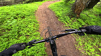
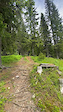
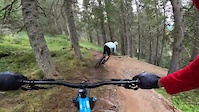
Popular Förberget Mountain Biking Trails
• 90 ★ 4.8 • 2 miles • 29 ft • 480 •
Highly rated popular red difficulty singletrack. This mountain bike primary trail can be used downhill only and has a moderate overall physical rating with a 29 ft blue climb. It features berm, bridge, drop, gap jump, ladder bridge and rock face. Trail visibility is always easy to follow. On average it takes 16 minutes to complete this trail.
• 60 ★ 0.0 • 302 ft • 0 ft • 198 •
Moderately popular blue difficulty singletrack. This mountain bike primary trail can be used uphill primary and has a moderate overall physical rating. It features bridge. On average it takes minutes to complete this trail.
• 60 ★ 2.0 • 1,762 ft • 110 ft • 37 •
Moderately popular red difficulty singletrack. This mountain bike primary trail can be used both directions and has a hard overall physical rating with a 110 ft black diamond climb. On average it takes 6 minutes to complete this trail.
Förberget Mountain Bike Routes
35 miles • 3,399 ft • 3 • Loop •
mix of gravelroads, singletrack, swamp, hard uphills, fast downhill, flat, technical = hell of a mix..
• 2 miles • 34 ft • 1 •
• 6 miles • 1,166 ft • 2 •
• 6 miles • 1,438 ft • 4 •
Photos of Förberget Mountain Bike
Videos of Förberget Mountain Bike


Recent Trail Reports
| status | trail | date | condition | info | user |
|---|---|---|---|---|---|
| Våfflan | Jul 30, 2025 @ 11:31am Jul 30, 2025 | Variable | FridakKgcgt | ||
| El Perro | Jul 22, 2025 @ 11:05pm Jul 22, 2025 | Dry | Axelssonstefan | ||
| Spångest | Jul 26, 2024 @ 5:23am Jul 26, 2024 | Unknown | emilry | ||
| Skotersvett | Jul 21, 2022 @ 6:41am Jul 21, 2022 | Variable | LindaA75 | ||
| Copperhillvägen | Jul 11, 2022 @ 12:51am Jul 11, 2022 | Ideal | Sebastiankarner | ||
| E14 | Aug 21, 2021 @ 5:31am Aug 21, 2021 | Ideal | hagrenaren | ||
| Hårbörsta | May 28, 2020 @ 8:54am May 28, 2020 | Ideal | sxpeter |
Activity Feed
| username | action | type | title | date |
|---|---|---|---|---|
| Kyuss666 | wishlist | trail | activity #95025970 | May 19, 2026 @ 12:57am May 19, 2026 |
| erikblien | wishlist | trail | activity #94668502 | May 13, 2026 @ 8:59pm May 13, 2026 |
| pdfMfq | wishlist | route | activity #94273225 | May 8, 2026 @ 1:09pm May 8, 2026 |
| FridakKgcgt | add | report | activity #77039355 | Jul 30, 2025 @ 11:31am Jul 30, 2025 |
| JanB | add | report | activity #76654032 | Jul 25, 2025 @ 3:28am Jul 25, 2025 |
Recent Comments
| username | type | title | comment | date |
|---|---|---|---|---|
| report | Svårt att göra så mycket åt blötan.... | Jul 22, 2023 @ 9:47am Jul 22, 2023 | ||
| report | Något särskilt ställe på leden som... | Jul 22, 2023 @ 8:15am Jul 22, 2023 | ||
| trail | Flera surhål och många vattenpölar.... | Jul 22, 2023 @ 7:57am Jul 22, 2023 | ||
| report | ”Rotvältan” i sista branten är en... | Jul 4, 2022 @ 10:21am Jul 4, 2022 | ||
| trail | Otroligt fin bana! Extra kul att den ligger... | Sep 25, 2020 @ 12:26pm Sep 25, 2020 |
Nearby Areas
| name | distance | ||||
|---|---|---|---|---|---|
| Åre Bike Park Trail | 5 | 10 | 1.4 km | ||
| Björnen | 2 | 3.6 km | |||
| Åre Bike Park | 3 | 11 | 3.6 km | ||
| Såå/Undersåker | 11 | 4.7 km | |||
| Åreskutan | 2 | 5 | 5.4 km |
Local Badges
-

Våfflan298 awarded
Activity Type Stats
| activitytype | trails | distance | descent | descent distance | total vertical | rating | global rank | state rank | photos | reports | routes | ridelogs |
|---|---|---|---|---|---|---|---|---|---|---|---|---|
| Mountain Bike | 7 | 6 miles | 1,578 ft | 3 miles | 850 ft | #7,383 | #283 | 45 | 126 | 3 | 1,687 | |
| Hike | 3 | 2 miles | 318 ft | 1 mile | 256 ft | 63 | 28 | |||||
| Trail Running | 3 | 2 miles | 318 ft | 1 mile | 256 ft | 63 | 36 |
Frequently Asked Questions About Förberget
▼
What are the highest rated mountain biking trails in Förberget?
The highest rated mountain biking trails in Förberget are:
- Våfflan (4.6/5)
- El Perro (4.2/5)
- Skotersvett (3.7/5)
- Spångest (0/5)
▼
What is the best time of the year to ride in Förberget?
Based on ride log data, the most popular months to ride in Förberget are:
- July (57 activities)
- August (15 activities)
- September (9 activities)
▼
Where can I park to ride in Förberget?
There are 4 parking locations listed in Förberget. The most popular parking spots are: View all parking and trailhead locations on the map to plan your visit.
▼
What is the longest trail in Förberget?
The longest trail in Förberget is Våfflan at 1.5 miles. View all trails sorted by distance.
- By Glisseur
 & contributors
 - Admins: OrjanX
- #10311 - 5,812 views
- förberget activity log | embed map of Förberget mountain bike trails | förberget mountain biking points of interest polygons
Downloading of trail gps tracks in kml & gpx formats is enabled for Förberget.
You must login to download files.