close
-
Layers w
- Map Content
- More Layers
- Pro
- Pro
- Pro
- Pro
- Pro
- Pro
- Pro
- Pro
-
Upgrade to

3D
Trail Conditions
- Unknown
- Snow Groomed
- Snow Packed
- Snow Covered
- Snow Cover Partial
- Freeze/thaw Cycle
- Icy
- Prevalent Mud
- Wet
- Variable
- Ideal
- Dry
- Very Dry
Trail Flow (Ridden Direction)
Trailforks scans users ridelogs to determine the most popular direction each trail is ridden. A good flowing trail network will have most trails flowing in a single direction according to their intension.
The colour categories are based on what percentage of riders are riding a trail in its intended direction.
The colour categories are based on what percentage of riders are riding a trail in its intended direction.
- > 96%
- > 90%
- > 80%
- > 70%
- > 50%
- < 50%
- bi-directional trail
- no data
Trail Last Ridden
Trailforks scans ridelogs to determine the last time a trail was ridden.
- < 2 days
- < 1 week
- < 2 weeks
- < 1 month
- < 6 months
- > 6 months
Trail Ridden Direction
The intended direction a trail should be ridden.
- Downhill Only
- Downhill Primary
- Both Directions
- Uphill Primary
- Uphill Only
- One Direction
Contribute Details
Colors indicate trail is missing specified detail.
- Description
- Photos
- Description & Photos
- Videos
Trail Popularity ?
Trailforks scans ridelogs to determine which trails are ridden the most in the last 9 months.
Trails are compared with nearby trails in the same city region with a possible 25 colour shades.
Think of this as a heatmap, more rides = more kinetic energy = warmer colors.
- most popular
- popular
- less popular
- not popular
ATV/ORV/OHV Filter
Max Vehicle Width
inches
US Cell Coverage
Legend

Radar Time
x
Activity Recordings
Trailforks users anonymized public ridelogs from the past 6 months.
- mountain biking recent
- mountain biking (>6 month)
- hiking (1 year)
- moto (1 year)
Activity Recordings
Trailforks users anonymized public skilogs from the past 12 months.
- Downhill Ski
- Backcountry Ski
- Nordic Ski
- Snowmobile
Winter Trails
Warning
A routing network for winter maps does not exist. Selecting trails using the winter trails layer has been disabled.
x
Missing Trails
Most Popular
Least Popular
Trails are colored based on popularity. The more popular a trail is, the more red. Less popular trails trend towards green.
Jump Magnitude Heatmap
Heatmap of where riders jump on trails. Zoom in to see individual jumps, click circles to view jump details.
Trails Deemphasized
Trails are shown in grey.
Only show trails with NO bikes.
Save the current map location and zoom level as your default home location whenever this page is loaded.
Save
No description for Foz Do Iguaçu has been added yet!
Login or register to submit one.
Region Details
41 mountain bike trails
Region Status
Caution as of May 11, 2024Stats
- Avg Trail Rating
- Trails (view details)
- 37
- Trails Mountain Bike
- 41
- Trails Hike
- 14
- Trails Trail Running
- 12
- Total Distance
- 119 miles
- Total Descent Distance
- 49 miles
- Total Descent
- 8,694 ft
- Total Vertical
- 664 ft
- Highest Trailhead
- 1,036 ft
- Reports
- 42
- Photos
- 36
- Ridden Counter
- 53
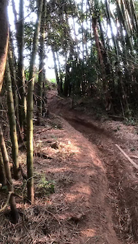
Popular Foz Do Iguaçu Mountain Biking Trails
Photos of Foz Do Iguaçu Mountain Bike
trail: Tinha do Poço Preto
8 |
Feb 8, 2023 @ 3:36am
Feb 8, 2023
trail: Tinha do Poço Preto
7 |
Feb 8, 2023 @ 3:36am
Feb 8, 2023
trail: Trilha da Canafístula
19 |
Oct 23, 2022 @ 6:08pm
Oct 23, 2022
trail: Trilha da Canafístula
23 |
Oct 23, 2022 @ 6:08pm
Oct 23, 2022
trail: Trilha da Canafístula
13 |
Oct 23, 2022 @ 6:08pm
Oct 23, 2022
trail: Trilha da Canafístula
11 |
Oct 23, 2022 @ 6:08pm
Oct 23, 2022
trail: Trilha da Canafístula
8 |
Oct 23, 2022 @ 6:08pm
Oct 23, 2022
trail: Trilha do Rio Almada
20 |
Aug 28, 2021 @ 5:09am
Aug 28, 2021Videos of Foz Do Iguaçu Mountain Bike

trail: Trilha do Cavalo
17 |
Aug 28, 2021
trail: Trilha do Cavalo
13 |
Aug 28, 2021

trail: Trilha do Vietnã
43 |
Jan 7, 2021

trail: Trilha do Vietnã
37 |
Jan 7, 2021
Current Trail Warnings
| status | trail | date | condition | user | info |
|---|---|---|---|---|---|
| Trilha oposta da prainha de Três Lagoas | May 10, 2024 @ 5:41am May 10, 2024 | Unknown | evandrocantu | Com o lago de Itaipu cheio, a trilha fica... |
Recent Trail Reports
| status | trail | date | condition | info | user |
|---|---|---|---|---|---|
| Trilha do Vietnã | May 11, 2024 @ 9:48am May 11, 2024 | Dry | evandrocantu | ||
| Estrada e trilha da Chácara Aliança | May 1, 2024 @ 3:38am May 1, 2024 | Unknown | evandrocantu | ||
| Trilha Vitorassi - Península | May 1, 2024 @ 3:38am May 1, 2024 | Dry | evandrocantu | ||
| Trilha do Leão | Mar 2, 2024 @ 11:45am Mar 2, 2024 | Unknown | evandrocantu | ||
| Trilha da Antiga Base Náutica | Mar 2, 2024 @ 11:43am Mar 2, 2024 | Unknown | evandrocantu | ||
| Trilha Vitorassi: Loop do Laguinho | Feb 11, 2024 @ 2:17am Feb 11, 2024 | Prevalent Mud | evandrocantu | ||
| Trilha Vitorassi: Loop das Bananeiras | Feb 11, 2024 @ 2:17am Feb 11, 2024 | Unknown | evandrocantu | ||
| Trilha Vitorassi: Loop da Ponte | Feb 11, 2024 @ 2:17am Feb 11, 2024 | Prevalent Mud | evandrocantu | ||
| Trilha Vitorassi | Dec 16, 2023 @ 8:48am Dec 16, 2023 | Variable | evandrocantu | ||
| Acesso Trilha Vitorassi - Braço do Lago | Feb 11, 2023 @ 2:13pm Feb 11, 2023 | Unknown | evandrocantu |
Activity Feed
| username | action | type | title | date |
|---|---|---|---|---|
| evandrocantu | add | report | activity #52503193 | May 12, 2024 @ 4:53pm May 12, 2024 |
| evandrocantu | add | report | activity #52364362 | May 10, 2024 @ 5:41am May 10, 2024 |
| evandrocantu | add | report | activity #51947283 and 1 more | May 1, 2024 @ 2:14pm May 1, 2024 |
| evandrocantu | add | report | activity #51732649 | Apr 26, 2024 @ 7:28pm Apr 26, 2024 |
| evandrocantu | add | report | activity #51119339 | Apr 13, 2024 @ 6:42am Apr 13, 2024 |
Recent Comments
| username | type | title | comment | date |
|---|---|---|---|---|
| trail | "Alguem com uma motossera" cortou dezenas de... | Mar 26, 2021 @ 9:54am Mar 26, 2021 |
Activity Type Stats
| activitytype | trails | distance | descent | descent distance | total vertical | rating | global rank | state rank | photos | reports | routes | ridelogs |
|---|---|---|---|---|---|---|---|---|---|---|---|---|
| Mountain Bike | 41 | 119 miles | 8,694 ft | 49 miles | 666 ft | 36 | 42 | 284 | ||||
| Hike | 14 | 37 miles | 3,205 ft | 13 miles | 633 ft | 40 | 63 | |||||
| Trail Running | 12 | 39 miles | 3,396 ft | 14 miles | 633 ft | 38 | 1 |
- By Horta & contributors
- Admins: chpw
- #26668 - 605 views
- foz do iguaçu activity log | embed map of Foz Do Iguaçu mountain bike trails | foz do iguaçu mountain biking points of interest
Downloading of trail gps tracks in kml & gpx formats is enabled for Foz Do Iguaçu.
You must login to download files.