close
-
Layers w
- Weather Layers
- Pro
- Pro
- Pro
- Pro
- Pro
- Pro
- More Layers
- Pro
- Pro
- Pro
- Pro
-
Upgrade to

3D
Trail Conditions
- Unknown
- Snow Groomed
- Snow Packed
- Snow Covered
- Snow Cover Partial
- Freeze/thaw Cycle
- Icy
- Prevalent Mud
- Wet
- Variable
- Ideal
- Dry
- Very Dry
Trail Flow (Ridden Direction)
Trailforks scans users ridelogs to determine the most popular direction each trail is ridden. A good flowing trail network will have most trails flowing in a single direction according to their intension.
The colour categories are based on what percentage of riders are riding a trail in its intended direction.
The colour categories are based on what percentage of riders are riding a trail in its intended direction.
- > 96%
- > 90%
- > 80%
- > 70%
- > 50%
- < 50%
- bi-directional trail
- no data
Trail Last Ridden
Trailforks scans ridelogs to determine the last time a trail was ridden.
- < 2 days
- < 1 week
- < 2 weeks
- < 1 month
- < 6 months
- > 6 months
Trail Ridden Direction
The intended direction a trail should be ridden.
- Downhill Only
- Downhill Primary
- Both Directions
- Uphill Primary
- Uphill Only
- One Direction
Contribute Details
Colors indicate trail is missing specified detail.
- Description
- Photos
- Description & Photos
- Videos
Trail Popularity ?
Trailforks scans ridelogs to determine which trails are ridden the most in the last 9 months.
Trails are compared with nearby trails in the same city region with a possible 25 colour shades.
Think of this as a heatmap, more rides = more kinetic energy = warmer colors.
- most popular
- popular
- less popular
- not popular
ATV/ORV/OHV Filter
Max Vehicle Width
inches
US Cell Coverage
Legend

Radar Time
Activity Recordings
Trailforks uses anonymized public activity data.
?
Activity Recordings
Trailforks uses anonymized public activity data.
?
Personal Heatmap
▶
Activity Types
all
/
none
▶
Options
2
Date range
month
–
Winter Trails
Warning
A routing network for winter maps does not exist. Selecting trails using the winter trails layer has been disabled.
Missing Trails
Most Popular
Least Popular
Trails are colored based on popularity. The more popular a trail is, the more red. Less popular trails trend towards green.
Jump Magnitude Heatmap
Heatmap of where riders jump on trails. Zoom in to see individual jumps, click circles to view jump details.
BC Backroad Status
![map legend]()
Service Road Atlas is a free to use, community-driven service for viewing and creating reports on the numerous back-country service roads around B.C. and Alberta.

Slope Aspect
Direction the slope faces
Trails Deemphasized
Trails are shown in grey.
Only show trails with no bike usage.
Suggested Layers
Based on selected activity type
Save the current map location and zoom level as your default home location whenever this page is loaded.
Save
No description for Frederick has been added yet!
Login or register to submit one.
Activities Click to view
- Mountain Bike
113 trails
- E-Bike
5 trails
- Gravel Bike
0 trails
- Adaptive Bike
0 trails
- Winter Fat Bike
0 trails
- Horse
5 trails
- Hike
112 trails
- Trail Running
112 trails
Region Details
- 12
- 20
- 48
- 15
- 5
Region Status
Open as of Jun 14, 2026Stats
- Avg Trail Rating
- Trails (view details)
- 102
- Trails Mountain Bike
- 119
- Trails E-Bike
- 5
- Trails Horse
- 5
- Trails Hike
- 112
- Trails Trail Running
- 112
- Trails Dirtbike/Moto
- 2
- Trails Backcountry Ski
- 1
- Trails Nordic Ski
- 2
- Total Distance
- 101 miles
- Total Descent
- 22,154 ft
- Total Vertical
- 1,248 ft
- Highest Trailhead
- 1,839 ft
- Reports
- 1,695
- Photos
- 250
- Ridden Counter
- 36,417
Articles
Race Report: 2019 Sheduro Race Report - Frederick Watershed, Maryland
Aug 22, 2019 from pinkbike.com
One of the rockiest trail systems on the East Coast had record attendance during the 2019 Bike Doctor Sheduro
Sub Regions
-
Frederick Watershed
- 10
- 39
- 13
- 5
-
Gambrill State Park
- 10
- 5
- 2
Popular Frederick Mountain Biking Trails
• 100 ★ 4.9 • 2 miles • 681 ft • 1,391 •
Machine built, bike focused, multi-use trail. Bi-directional, Opened for use in Oct. 2019. Part of a Recreation Trails Program grant project. Climbing access from the bottom of the mountain to more gravity focused trails.
• 100 ★ 3.8 • 2,028 ft • 51 ft • 1,261 •
Popular blue difficulty singletrack. This mountain bike primary trail can be used uphill primary. On average it takes 4 minutes to complete this trail.
• 100 ★ 4.7 • 1 mile • 0 ft • 1,200 •
Machine built flow trail with multiple berms, gaps and tables. Part of a Recreation Trails Program grant project. Closed when conditions are soft or wet.
• 95 ★ 4.2 • 1 mile • 121 ft • 899 •
Used to be a more difficult trail before someone cut down some of the trees in the tightest sections (curse you, tree cutter). Not to be confused with 2. Some technical sections and fun rock features. Overall a fun trail and good...
• 100 ★ 4.5 • 4,816 ft • 78 ft • 805 •
Highly rated popular blue difficulty singletrack. This mountain bike primary trail can be used downhill primary and has a moderate overall physical rating with a 78 ft green climb. It features berm and drop. On average it takes 7 minutes to complete this trail.
• 90 ★ 4.1 • 5,036 ft • 100 ft • 773 •
Highly rated popular blue difficulty singletrack. This mountain bike primary trail can be used both directions and has a moderate overall physical rating with a 100 ft blue climb. On average it takes 12 minutes to complete this trail.
• 100 ★ 3.4 • 3,018 ft • 0 ft • 744 •
Not much to say, loose and jenky chunky rocks -- pick your line and speed and blast into a creek ending...if i's hot, jump in.
• 95 ★ 4.5 • 2,005 ft • 5 ft • 732 •
Trail connecting Gambrill Park Road parking lot to the . It is technically easy with a few optional features and minimal elevation change.
Frederick Mountain Bike Routes
★ 5.0 • 7 miles • 864 ft • 2 • Loop •
This loop features the best of Gambrill State Park. And doing it this way as a figure eight maximizes the...
★ 5.0 • 6 miles • 933 ft • 5 • Loop •
This is a loop that will challenge your descending skills on Drops and , and then challenge your cardio...
7 miles • 1,089 ft • 4 •
Meet at Hamburg top lot. Still Shed newbie-friendly, but chunkier & rowdier. Must have bike handling...
7 miles • 790 ft • 7 •
Start: Hamburg Top Lot • 7 miles • 755 ft, Most Casual, must have basic bike handling skills and some...
9 miles • 1,470 ft • 6 •
Meet at Hamburg top lot. Still Shed newbie-friendly, but chunkier & rowdier. Must have bike handling...
★ 3.4 • 5 miles • 550 ft • 1 • Loop •
Short loop that starts at the Hamburg Rd lot. Includes sections of the Blue trail, Huggy Bear,...
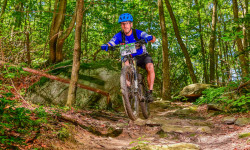
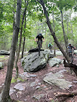
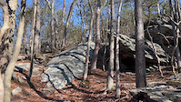
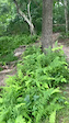
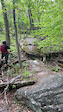
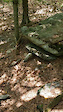
Photos of Frederick Mountain Bike
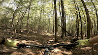
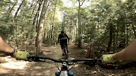
Videos of Frederick Mountain Bike
0:07 |
143 |
Aug 30, 2024
trail: Kubla Khan
0:10 |
276 |
Mar 23, 2024
trail: Lawnmower
0:05 |
224 |
Jul 17, 2023
trail: Evolution
0:08 |
492 |
May 6, 2023
trail: Kubla Khan
0:09 |
487 |
Aug 8, 2021
trail: Catoctin Trail
5:04 |
470 |
Sep 9, 2020
trail: Fun House
4:00 |
519 |
Sep 9, 2020
trail: Three Saws
0:33 |
76 |
Sep 9, 2020
Recent Trail Reports
| status | trail | date | condition | info | user |
|---|---|---|---|---|---|
| Fun House | May 19, 2026 @ 9:07am (America/New_York) May 19, 2026 | Dry | davidjg5 | ||
| Yellow Trail | May 16, 2026 @ 1:37pm (America/New_York) May 16, 2026 | Ideal | Hydroponic99 | ||
| Access Road | May 16, 2026 @ 1:37pm (America/New_York) May 16, 2026 | Ideal | Hydroponic99 | ||
| Yellow Trail | May 16, 2026 @ 1:37pm (America/New_York) May 16, 2026 | Ideal | Hydroponic99 | ||
| Catoctin Trail | May 16, 2026 @ 1:37pm (America/New_York) May 16, 2026 | Ideal | Hydroponic99 | ||
| Yellow Trail | May 16, 2026 @ 1:37pm (America/New_York) May 16, 2026 | Ideal | Hydroponic99 | ||
| Yellow | May 16, 2026 @ 1:37pm (America/New_York) May 16, 2026 | Ideal | Hydroponic99 | ||
| Yellow Trail | May 16, 2026 @ 1:37pm (America/New_York) May 16, 2026 | Ideal | Hydroponic99 | ||
| Yellow Poplar | May 16, 2026 @ 1:37pm (America/New_York) May 16, 2026 | Ideal | Hydroponic99 | ||
| Boundary Line | May 14, 2026 @ 6:49pm (America/New_York) May 14, 2026 | Ideal | basecamp-frederick |
Activity Feed
| username | action | type | title | date |
|---|---|---|---|---|
| trailforks | add | video | activity #97192050 | Jun 17, 2026 @ 10:00am 2 hours |
| trailforks | add | video | activity #97174865 | Jun 17, 2026 @ 5:00am 7 hours |
| flash5twelve | wishlist | region | activity #97111790 | Jun 16, 2026 @ 8:16am 1 day |
| JR514 | wishlist | region | activity #97098749 | Jun 16, 2026 @ 4:11am 1 day |
| malachimills00 | difficultyvote | trail | activity #96967781 | Jun 14, 2026 @ 7:44am Jun 14, 2026 |
Recent Comments
| username | type | title | comment | date |
|---|---|---|---|---|
| trail | What's with all the branches piled up on the... | Oct 4, 2025 @ 4:35pm Oct 4, 2025 | ||
| trail | Tried several trails. All of them just... | Sep 25, 2025 @ 10:58am Sep 25, 2025 | ||
| report | F*"" nightmare. I've cried like a b** several... | Sep 25, 2025 @ 9:49am Sep 25, 2025 | ||
| trail | Most people call it Trail 4 by the signage for it | Sep 9, 2025 @ 12:41pm Sep 9, 2025 | ||
| trail | Just got done riding the new rework. All I... | Jul 31, 2025 @ 5:49am Jul 31, 2025 |
Local Badges
-

10 Green Trails214 awarded -

10 Blue Trails730 awarded -

10 Black Trails209 awarded -

Epic Ride Climb 2k158 awarded -

Climbing 10k Badge209 awarded -

Climbing 100k Badge11 awarded
Activity Type Stats
| activitytype | trails | distance | descent | descent distance | total vertical | rating | global rank | state rank | photos | reports | routes | ridelogs |
|---|---|---|---|---|---|---|---|---|---|---|---|---|
| Mountain Bike | 113 | 88 miles | 19,980 ft | 47 miles | 1,161 ft | #597 | #222 | 252 | 1,703 | 57 | 31,119 | |
| E-Bike | 5 | #8,341 | #2,537 | 1,312 | 3 | 1,451 | ||||||
| Horse | 5 | 22 miles | 2,631 ft | 9 miles | 1,161 ft | #1,692 | #965 | 309 | 5 | |||
| Hike | 112 | 94 miles | 17,037 ft | 47 miles | 1,250 ft | #820 | #374 | 8 | 1,609 | 3 | 1,612 | |
| Trail Running | 112 | 94 miles | 17,037 ft | 47 miles | 1,250 ft | #600 | #225 | 1,609 | 11 | 863 | ||
| Dirtbike/Moto | 2 | 10 miles | 640 ft | 3 miles | 984 ft | 249 | 10 | |||||
| Backcountry Ski | 1 | 2,746 ft | 243 ft | 2,746 ft | 243 ft | |||||||
| Nordic Ski | 2 | 3 miles | 627 ft | 2 miles | 358 ft | 46 | 6 |
Frequently Asked Questions About Frederick
▼
What are the best places to ride in Frederick?
Frederick has 2 areas to explore for mountain biking. The top rated areas are:
▼
What are the highest rated mountain biking trails in Frederick?
The highest rated mountain biking trails in Frederick are:
- Three Saws (4.7/5)
- Boundary Line (4.5/5)
- Kubla Khan (4.5/5)
- Vandal (4.5/5)
- Super Steep (4.4/5)
▼
What is the best time of the year to ride in Frederick?
Based on ride log data, the most popular months to ride in Frederick are:
- July (356 activities)
- August (299 activities)
- May (291 activities)
▼
Where can I park to ride in Frederick?
There are 14 parking locations listed in Frederick. The most popular parking spots are: View all parking and trailhead locations on the map to plan your visit.
Activities
Trails
- By Dcp584
 & contributors
 - Admins: MORE-MD LDRSH, kmihm100, MORE-FC
- #9606 - 10,846 views
- frederick activity log | embed map of Frederick mountain bike trails | frederick mountain biking points of interest
Downloading of trail gps tracks in kml & gpx formats is enabled for Frederick.
You must login to download files.