close
-
Layers w
- Weather Layers
- Pro
- Pro
- Pro
- Pro
- Pro
- Pro
- More Layers
- Pro
- Pro
- Pro
- Pro
-
Upgrade to

3D
Trail Conditions
- Unknown
- Snow Groomed
- Snow Packed
- Snow Covered
- Snow Cover Partial
- Freeze/thaw Cycle
- Icy
- Prevalent Mud
- Wet
- Variable
- Ideal
- Dry
- Very Dry
Trail Flow (Ridden Direction)
Trailforks scans users ridelogs to determine the most popular direction each trail is ridden. A good flowing trail network will have most trails flowing in a single direction according to their intension.
The colour categories are based on what percentage of riders are riding a trail in its intended direction.
The colour categories are based on what percentage of riders are riding a trail in its intended direction.
- > 96%
- > 90%
- > 80%
- > 70%
- > 50%
- < 50%
- bi-directional trail
- no data
Trail Last Ridden
Trailforks scans ridelogs to determine the last time a trail was ridden.
- < 2 days
- < 1 week
- < 2 weeks
- < 1 month
- < 6 months
- > 6 months
Trail Ridden Direction
The intended direction a trail should be ridden.
- Downhill Only
- Downhill Primary
- Both Directions
- Uphill Primary
- Uphill Only
- One Direction
Contribute Details
Colors indicate trail is missing specified detail.
- Description
- Photos
- Description & Photos
- Videos
Trail Popularity ?
Trailforks scans ridelogs to determine which trails are ridden the most in the last 9 months.
Trails are compared with nearby trails in the same city region with a possible 25 colour shades.
Think of this as a heatmap, more rides = more kinetic energy = warmer colors.
- most popular
- popular
- less popular
- not popular
ATV/ORV/OHV Filter
Max Vehicle Width
inches
US Cell Coverage
Legend

Radar Time
Activity Recordings
Trailforks uses anonymized public activity data.
?
Activity Recordings
Trailforks uses anonymized public activity data.
?
Personal Heatmap
▶
Activity Types
all
/
none
▶
Options
2
Date range
month
–
Winter Trails
Warning
A routing network for winter maps does not exist. Selecting trails using the winter trails layer has been disabled.
Missing Trails
Most Popular
Least Popular
Trails are colored based on popularity. The more popular a trail is, the more red. Less popular trails trend towards green.
Jump Magnitude Heatmap
Heatmap of where riders jump on trails. Zoom in to see individual jumps, click circles to view jump details.
BC Backroad Status
![map legend]()
Service Road Atlas is a free to use, community-driven service for viewing and creating reports on the numerous back-country service roads around B.C. and Alberta.

Slope Aspect
Direction the slope faces
Trails Deemphasized
Trails are shown in grey.
Only show trails with no bike usage.
Suggested Layers
Based on selected activity type
Save the current map location and zoom level as your default home location whenever this page is loaded.
Save
No description for Gander has been added yet!
Login or register to submit one.
Activities Click to view
- Mountain Bike
10 trails
- Gravel Bike
0 trails
- Adaptive Bike
0 trails
- Winter Fat Bike
0 trails
- Hike
10 trails
- Trail Running
10 trails
- Nordic Ski
8 trails
Stats
- Avg Trail Rating
- Trails (view details)
- 17
- Trails Mountain Bike
- 10
- Trails E-Bike
- 1
- Trails Horse
- 1
- Trails Hike
- 10
- Trails Trail Running
- 10
- Trails Dirtbike/Moto
- 1
- Trails ATV/ORV/OHV
- 1
- Trails Snowmobile
- 1
- Trails Snowshoe
- 1
- Trails Nordic Ski
- 8
- Total Distance
- 58 miles
- Total Descent
- 2,434 ft
- Total Vertical
- 460 ft
- Highest Trailhead
- 463 ft
- Reports
- 1
- Photos
- 13
- Ridden Counter
- 106
Sub Regions
-
Lake Side
- 2
- 3
-
Old Town site
Popular Gander Mountain Biking Trails
• 95 ★ 2.5 • 1,985 ft • 0 ft • 15 •
Former hiking trail re purposed to a fun little downhill section. Decent flow with a few rocky sections. Fun and fast with some nice turns. First trail of the new network.
• 5 ★ 4.0 • 2,466 ft • 0 ft • 6 •
Reclaimed old trail. Not as tech as the parallel trail to the East (The Trail to be renamed later).
• 5 ★ 0.0 • 2,021 ft • 252 ft • 6 •
Ouff. Steep in places, but this is how you pay for the fun you just had on the way down.
• 5 ★ 0.0 • 2,701 ft • 10 ft • 5 •
The original Short track loop through the old town site of Gander. Some section of the trail were old walking paths that have been worked by cyclists. Other sections were newly made for cycling. The trail is generally very flat with mo...
• 100 ★ 0.0 • 895 ft • 90 ft • 4 •
Wide single track trail connecting The Forgotten to The Trail. Mostly flat trail with some dips and then some climbing as you head East towards the The Trail. Not very technical, but does feature a short climb and two 90 degree turns....
• 5 ★ 0.0 • 47 miles • 756 ft • 4 •
Less popular green difficulty rail trail. This multi-use trail can be used both directions.
• 5 ★ 0.0 • 915 ft • 0 ft • 3 •
The upper section of the Edgar Baird trail. It is accessible via the Thomas Howe trail network. PLEASE avoid cycling the Thomas Howe pea gravel main trail network as it could create tension with other use groups. Just access the less...
• 5 ★ 0.0 • 1 mile • 48 ft • 2 •
Simple trail around the base and great for accessing Thomas Howe from town.
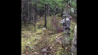
Photos of Gander Mountain Bike
Videos of Gander Mountain Bike
0:23 |
243 |
Oct 30, 2018

0:23 |
123 |
Oct 30, 2018
Recent Trail Reports
| status | trail | date | condition | info | user |
|---|---|---|---|---|---|
| The Trail (To be renamed later) | Jul 20, 2018 @ 6:28am Jul 20, 2018 | Dry | jacobyoung95 |
Activity Feed
| username | action | type | title | date |
|---|---|---|---|---|
| Ed5XGQH6 | wishlist | region | activity #90611557 | Mar 15, 2026 @ 3:15am Mar 15, 2026 |
| td0u | wishlist | region | activity #74960444 | Jul 1, 2025 @ 9:32am Jul 1, 2025 |
| murbike2008 | wishlist | region | activity #55973917 | Jul 21, 2024 @ 4:15am Jul 21, 2024 |
| markholloway | update | trail | activity #46160795 | Nov 10, 2023 @ 10:44am Nov 10, 2023 |
| MEATBICYCLE | ridden | trail | activity #45661833 | Oct 27, 2023 @ 6:16pm Oct 27, 2023 |
Recent Comments
| username | type | title | comment | date |
|---|---|---|---|---|
| trail | Top portion rode very nicely. The final... | May 10, 2021 @ 5:57pm May 10, 2021 | ||
| trail | Took chainsaw and axe down today and cleared... | Nov 1, 2018 @ 1:04pm Nov 1, 2018 |
Local Badges
-

Epic Mountain Bike Climb 2k1 awarded -

Climbing 10k Badge0 awarded -

Mountain Biking 100k Badge0 awarded -

Epic Ride 50k6 awarded -

Epic Ride Descent 2k0 awarded -

Descent 10k Badge0 awarded
Activity Type Stats
| activitytype | trails | distance | descent | descent distance | total vertical | rating | global rank | state rank | photos | reports | routes | ridelogs |
|---|---|---|---|---|---|---|---|---|---|---|---|---|
| Mountain Bike | 10 | 51 miles | 1,909 ft | 24 miles | 459 ft | #6,217 | #9 | 13 | 1 | 367 | ||
| E-Bike | 1 | 47 miles | 1,115 ft | 22 miles | 430 ft | 1 | 1 | |||||
| Horse | 1 | 47 miles | 1,115 ft | 22 miles | 430 ft | 1 | ||||||
| Hike | 10 | 51 miles | 1,909 ft | 24 miles | 459 ft | #5,693 | #15 | 1 | 109 | |||
| Trail Running | 10 | 51 miles | 1,909 ft | 24 miles | 459 ft | #5,131 | #9 | 1 | 9 | |||
| Dirtbike/Moto | 1 | 47 miles | 1,115 ft | 22 miles | 430 ft | 1 | ||||||
| ATV/ORV/OHV | 1 | 47 miles | 1,115 ft | 22 miles | 430 ft | 1 | 3 | |||||
| Snowmobile | 1 | 47 miles | 1,115 ft | 22 miles | 430 ft | |||||||
| Snowshoe | 1 | 47 miles | 1,115 ft | 22 miles | 430 ft | 1 | ||||||
| Nordic Ski | 8 | 54 miles | 1,640 ft | 25 miles | 449 ft | #574 | #7 | 26 |
Frequently Asked Questions About Gander
▼
What are the best places to ride in Gander?
Gander has 2 areas to explore for mountain biking. The top rated areas are:
▼
What are the highest rated mountain biking trails in Gander?
The highest rated mountain biking trails in Gander are:
- The forgotten (4/5)
- The Trail (To be renamed later) (3.6/5)
- OG Short track loop (0/5)
- T'Railway - Gander to Bishop Falls (0/5)
- Upper Edgar Baird (0/5)
▼
What is the best time of the year to ride in Gander?
Based on ride log data, the most popular months to ride in Gander are:
- August (7 activities)
- May (5 activities)
- July (2 activities)
▼
Where can I park to ride in Gander?
There are 2 parking locations listed in Gander. The most popular parking spots are:
Activities
Trails
Points of Interest
- By paolocolletti & contributors
- Admins: adrianricketts, wbruce
- #19177 - 4,828 views
- gander activity log | embed map of Gander mountain bike trails | gander mountain biking points of interest
Downloading of trail gps tracks in kml & gpx formats is enabled for Gander.
You must login to download files.